About this sheet
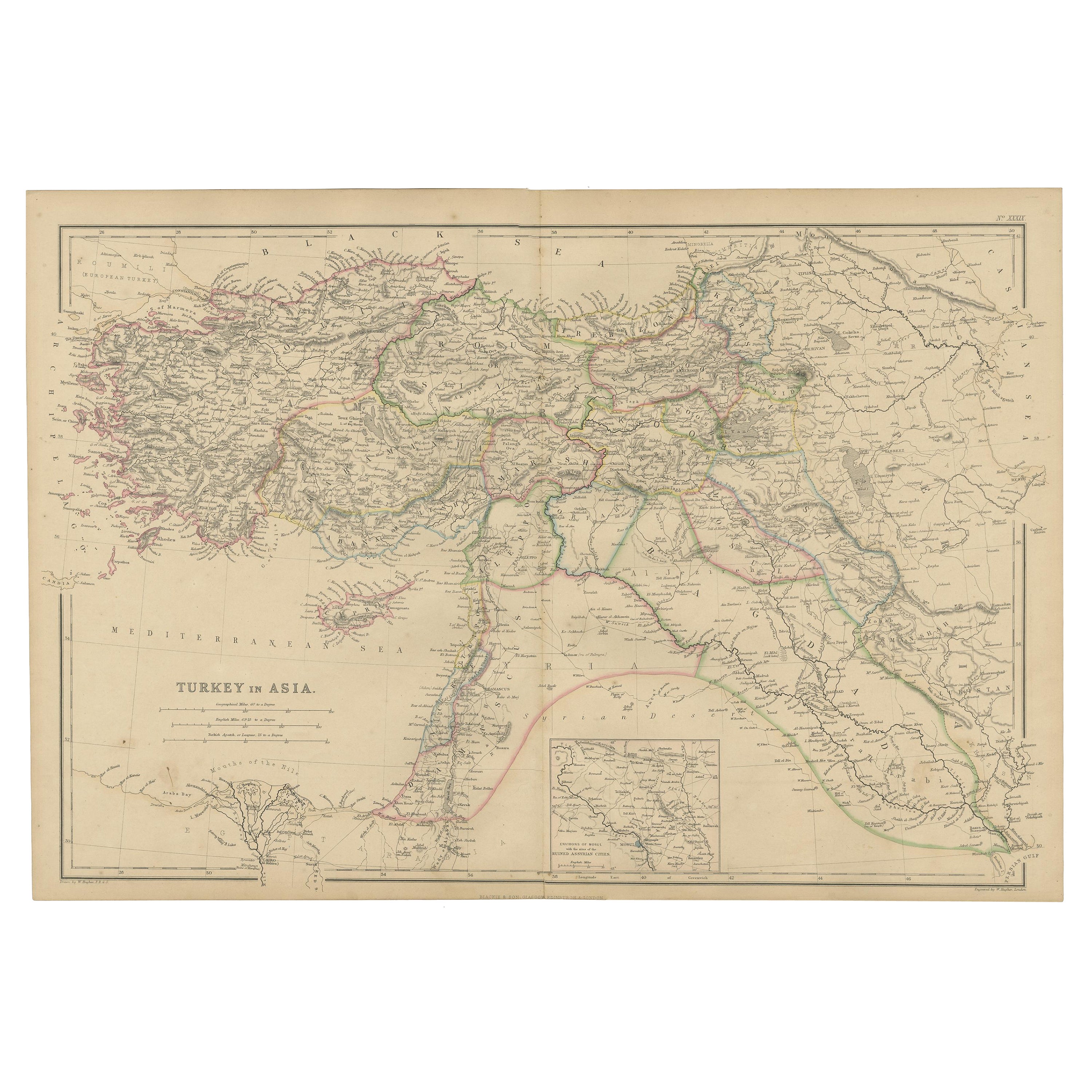
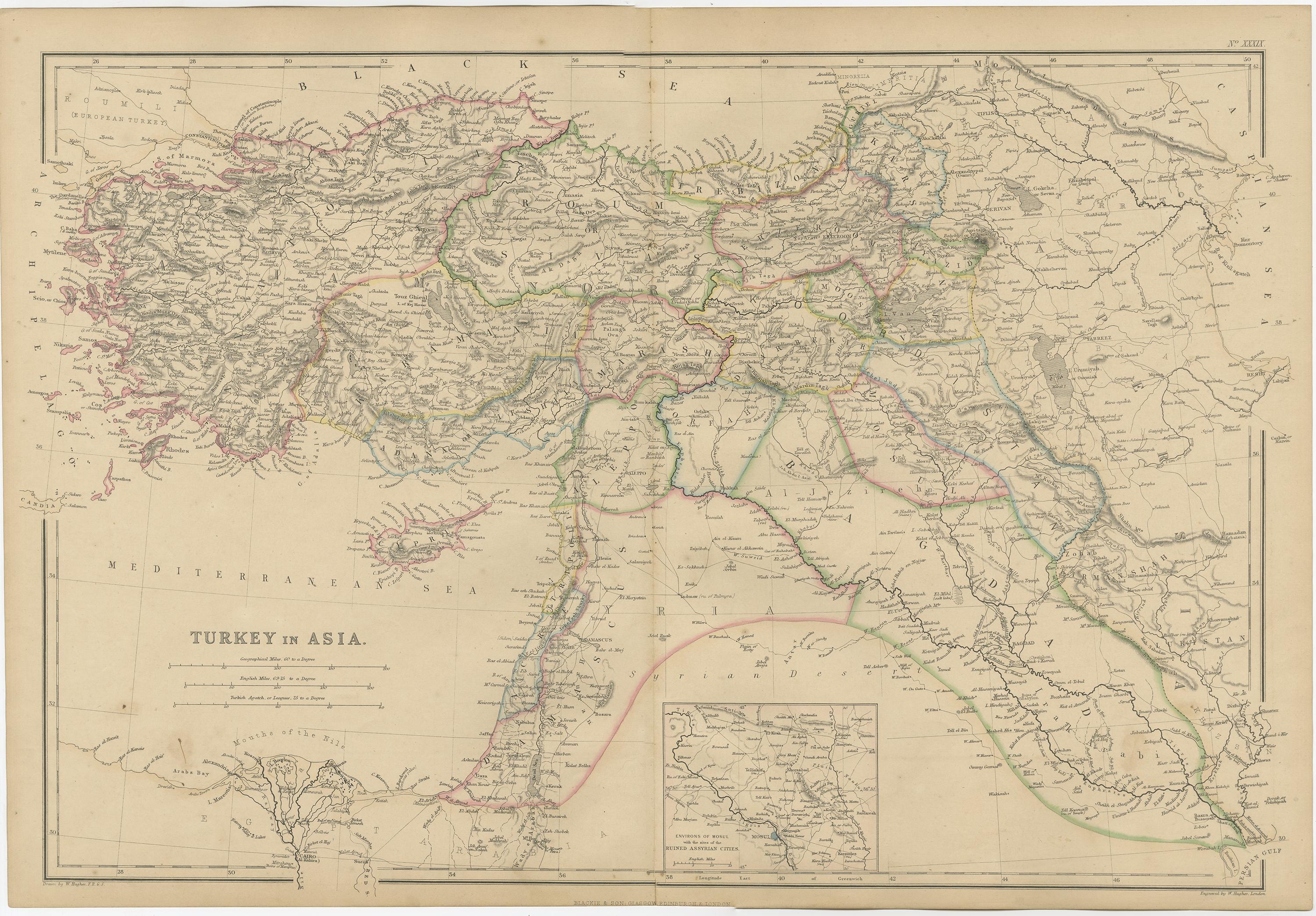
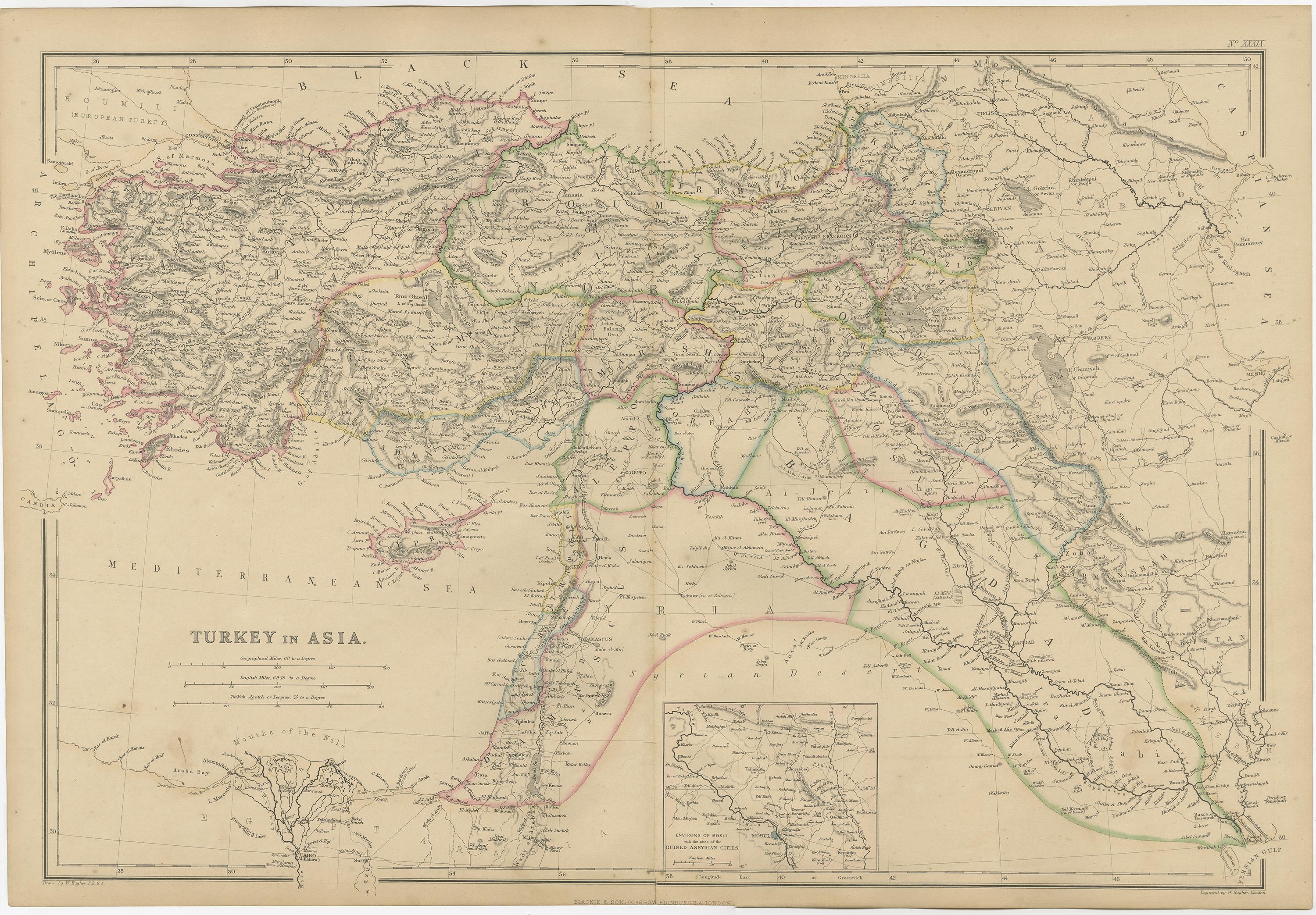
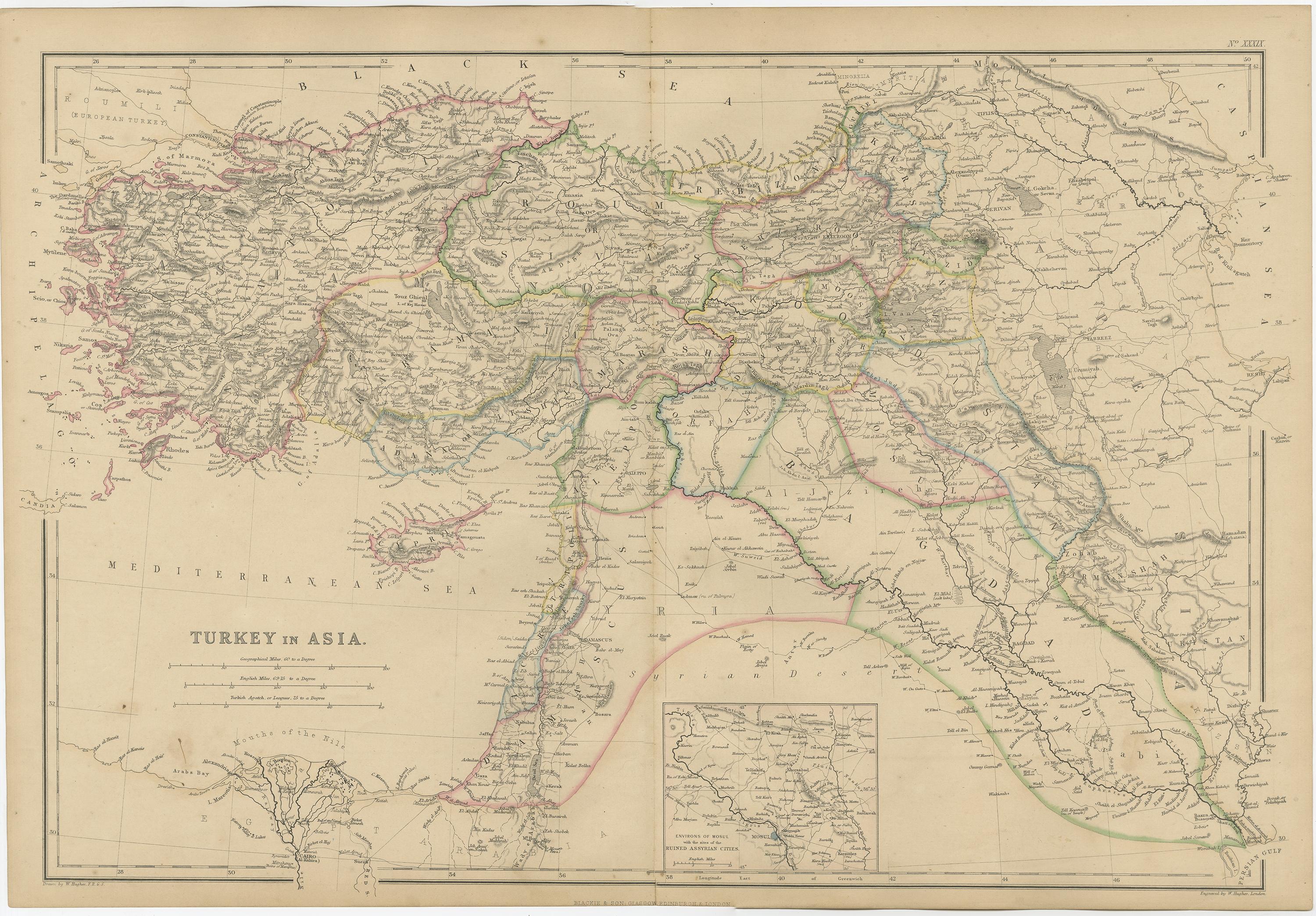
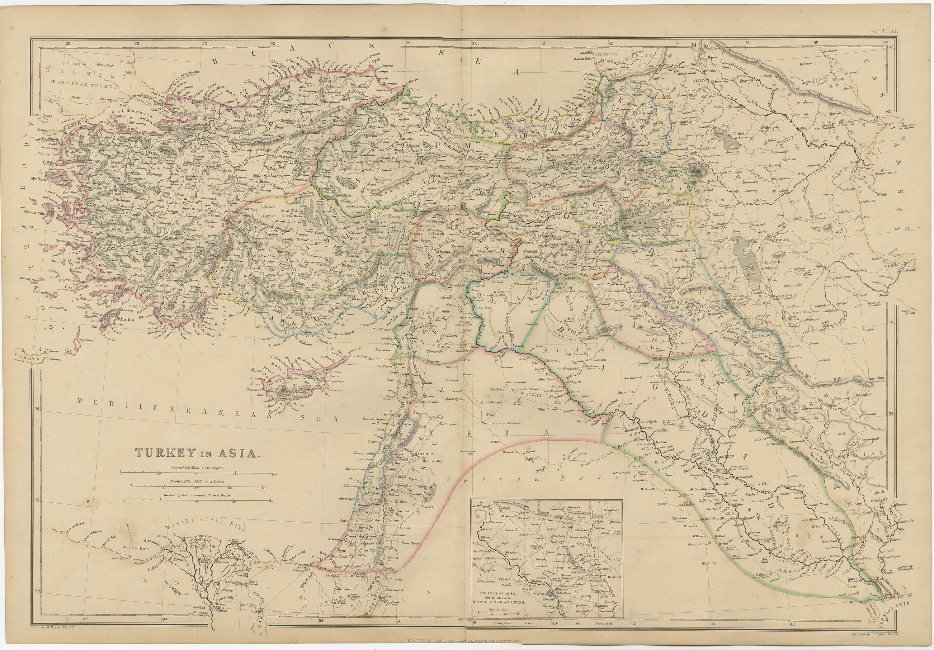
Turkey in Asia – Antique Map by W\.G. Blackie, 1859, with Inset of Assyrian Ruins
This finely detailed antique map titled Turkey in Asia is an original engraving from W\.G. Blackie’s renowned 1859 publication The Imperial Atlas of Modern Geography. Representing the Asian territories of the Ottoman Empire, this map encompasses a broad region from Anatolia to Mesopotamia, including parts of present-day Turkey, Syria, Iraq, Lebanon, and the Arabian Peninsula.
Drawn and engraved with precision, the map highlights the complex geography, provinces, and important cities of the mid-19th-century Ottoman world. Political boundaries are accentuated with delicate hand-coloring, while rivers, mountains, and trade routes are rendered with elegant linework. Major cities such as Aleppo, Damascus, Baghdad, Mosul, and Smyrna are clearly marked, as are less familiar historical towns and provincial centers, making this an informative and attractive map for scholars and collectors alike.
Of special note is the inset map at the lower center, offering a detailed view of the *Environs of Mosul and the Assyrian Ruins*, a region that was drawing renewed archaeological interest in the 19th century following excavations by figures like Austen Henry Layard at Nineveh and Nimrud. The inclusion of this inset reflects the era’s fascination with rediscovered ancient civilizations and the biblical lands.
W\.G. Blackie was a Scottish publisher and geographer whose atlases were prized for their clarity, comprehensiveness, and quality of execution. His *Imperial Atlas* aimed to present up-to-date geographical knowledge of the time, and this map remains an enduring record of a region in flux during the twilight of the Ottoman Empire.
Condition: Very good. Slight age-toning and light wear along the centerfold, consistent with atlas extraction. No tears or significant damage. Original outline color remains strong and clear.
Framing tips: A walnut or rosewood frame with a light ivory or buff mount will highlight the map’s delicate pastel lines and engraved detail. Consider museum-grade glazing for preservation.
Technique: Engraving with original outline color
Maker: W\.G. Blackie, Edinburgh & London, 1859
Key features of this map include:
1. **Geographical Detail**: The map meticulously details the Asian territories of the Ottoman Empire, covering a vast area that includes modern-day Turkey, parts of the Middle East, and extending towards the Caucasus. It displays the region's diverse topography with mountains, rivers, plains, and coastal areas.
2. **Inset Map of Mosul and Assyrian Cities**: A unique feature of this map is the inset detailing the environs of Mosul, a historically significant region in present-day Iraq. This inset likely provides a closer look at the area, including the locations of ancient Assyrian cities and ruins, which are of great archaeological and historical interest.
3. **Political Divisions**: The map shows the administrative divisions of 'Turkey in Asia' as they were recognized in the 1850s, providing insight into the historical political landscape of the region.
4. **Cities and Settlements**: Major cities, towns, and villages are marked, highlighting the key urban centers of the time. This aspect offers a glimpse into the urban and rural settlement patterns in the Ottoman Empire's Asian territories.
5. **Artistic Elements**: In line with the cartographic style of the era, the map likely includes decorative borders, an elegant title script, and possibly other artistic flourishes that add to its aesthetic appeal.
6. **Educational and Historical Value**: As a historical document, this map serves as an invaluable educational tool, offering insights into the geography of 'Turkey in Asia' as perceived in the mid-19th century.
This map is not only a collector’s item for enthusiasts of antique maps but also a significant resource for historians, geographers, and those interested in the Ottoman Empire and Middle Eastern history.