About this sheet
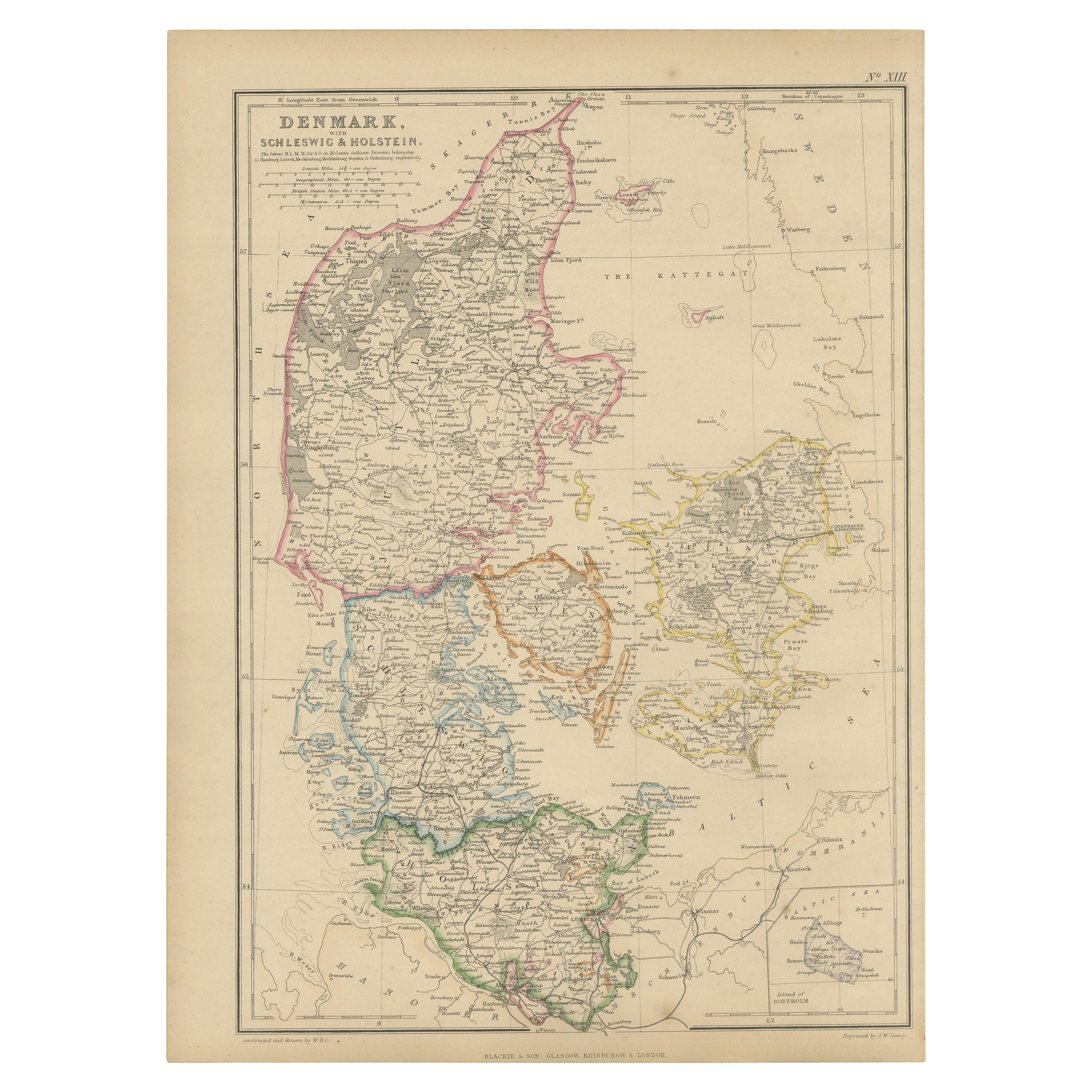
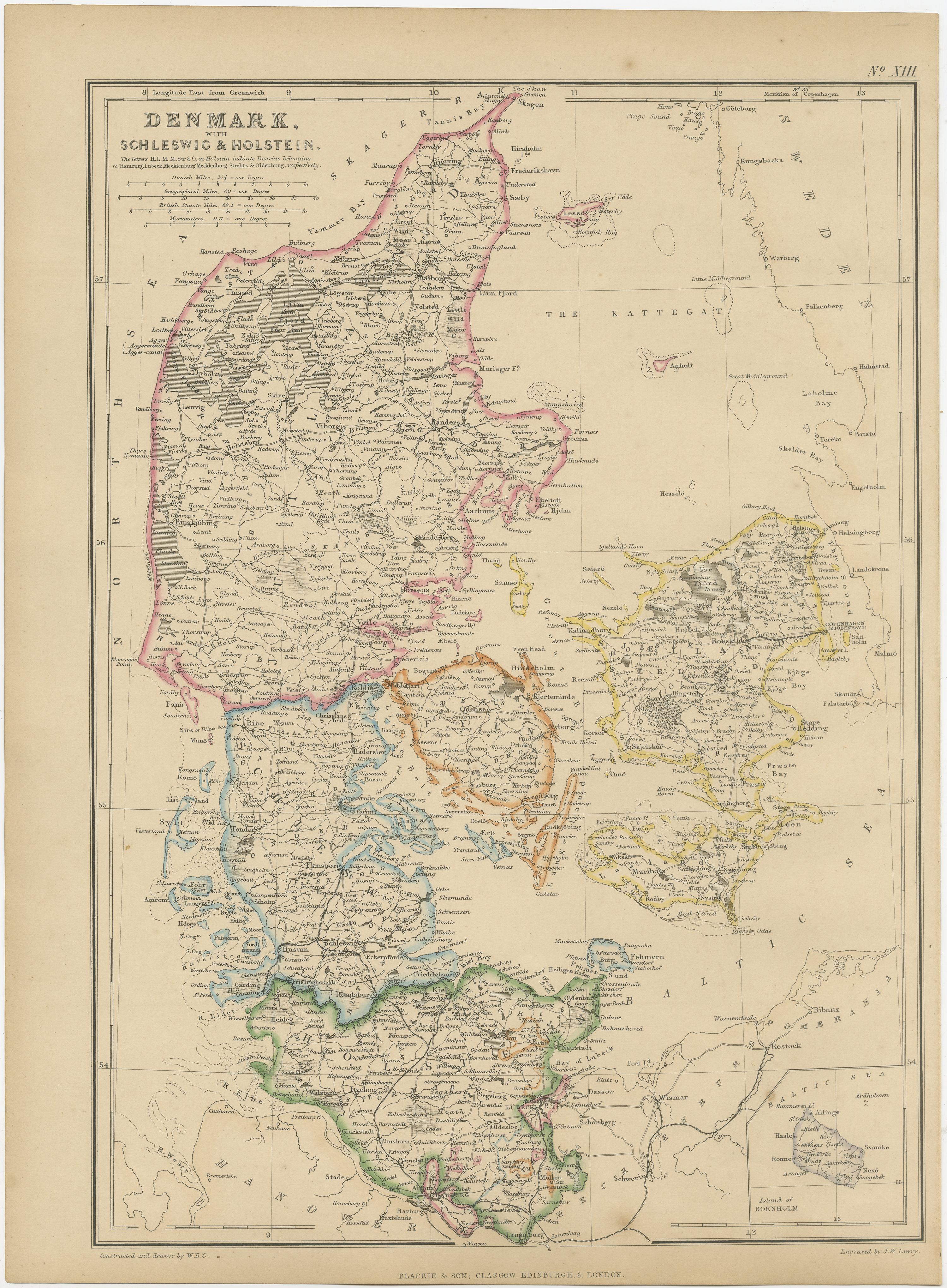
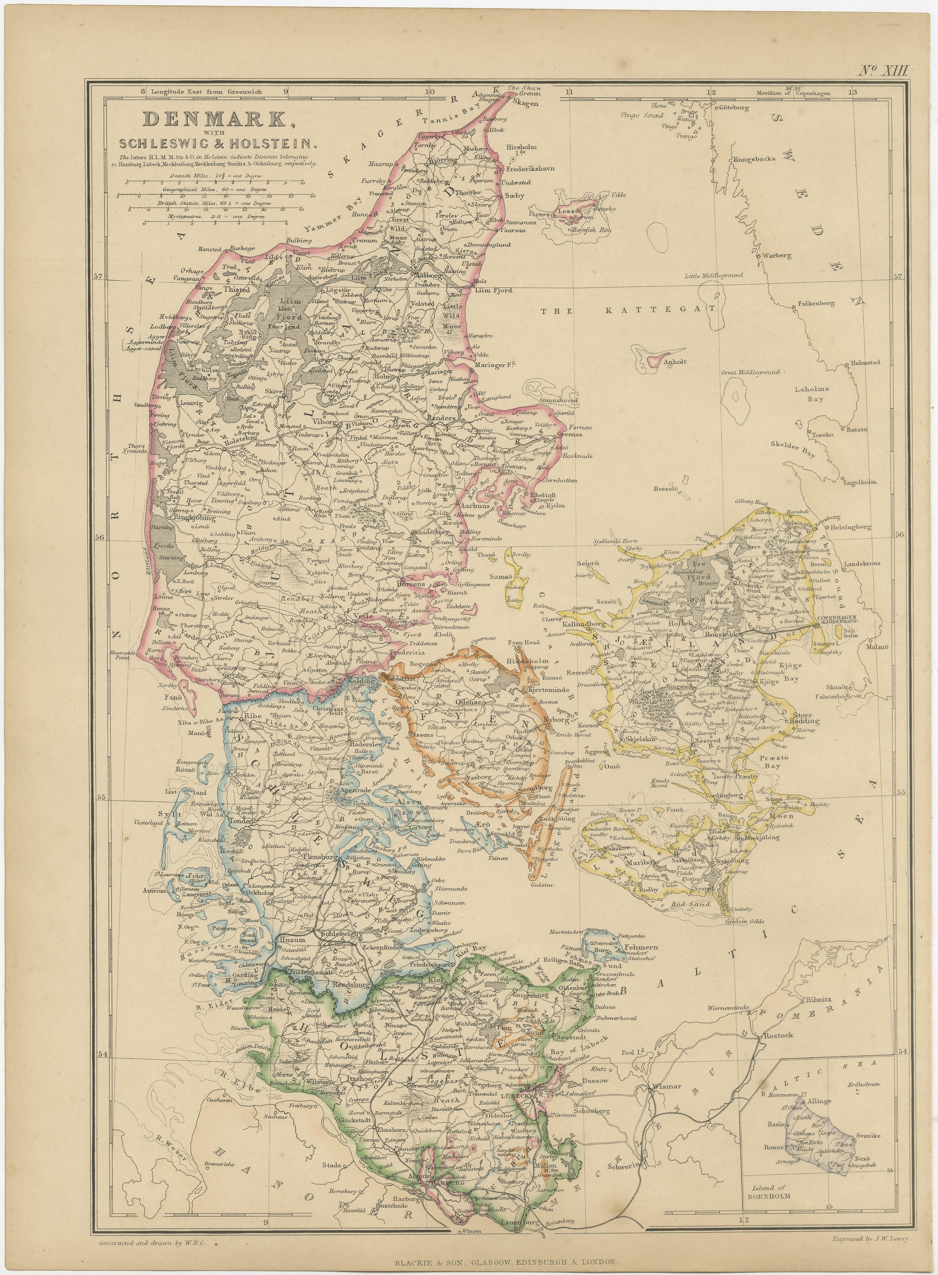
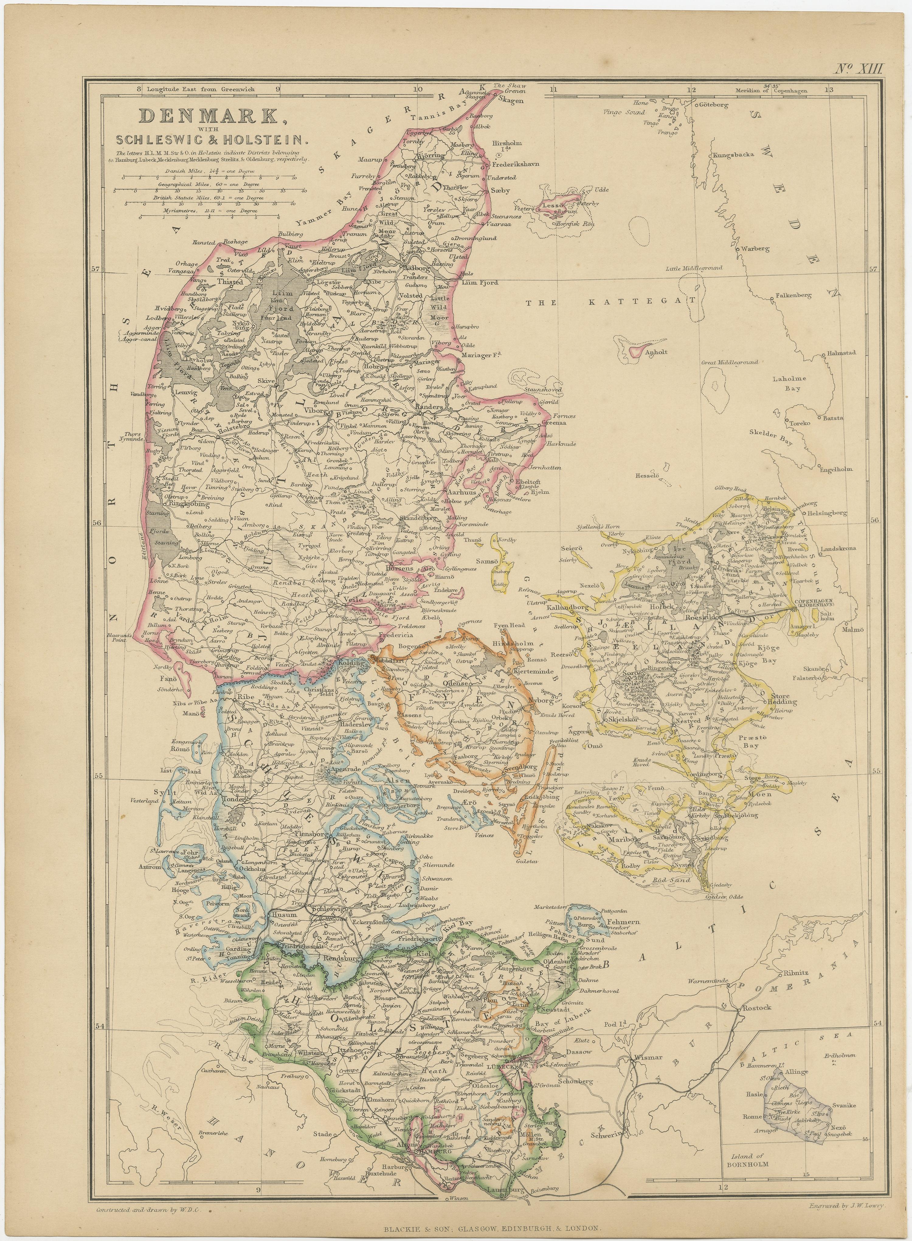
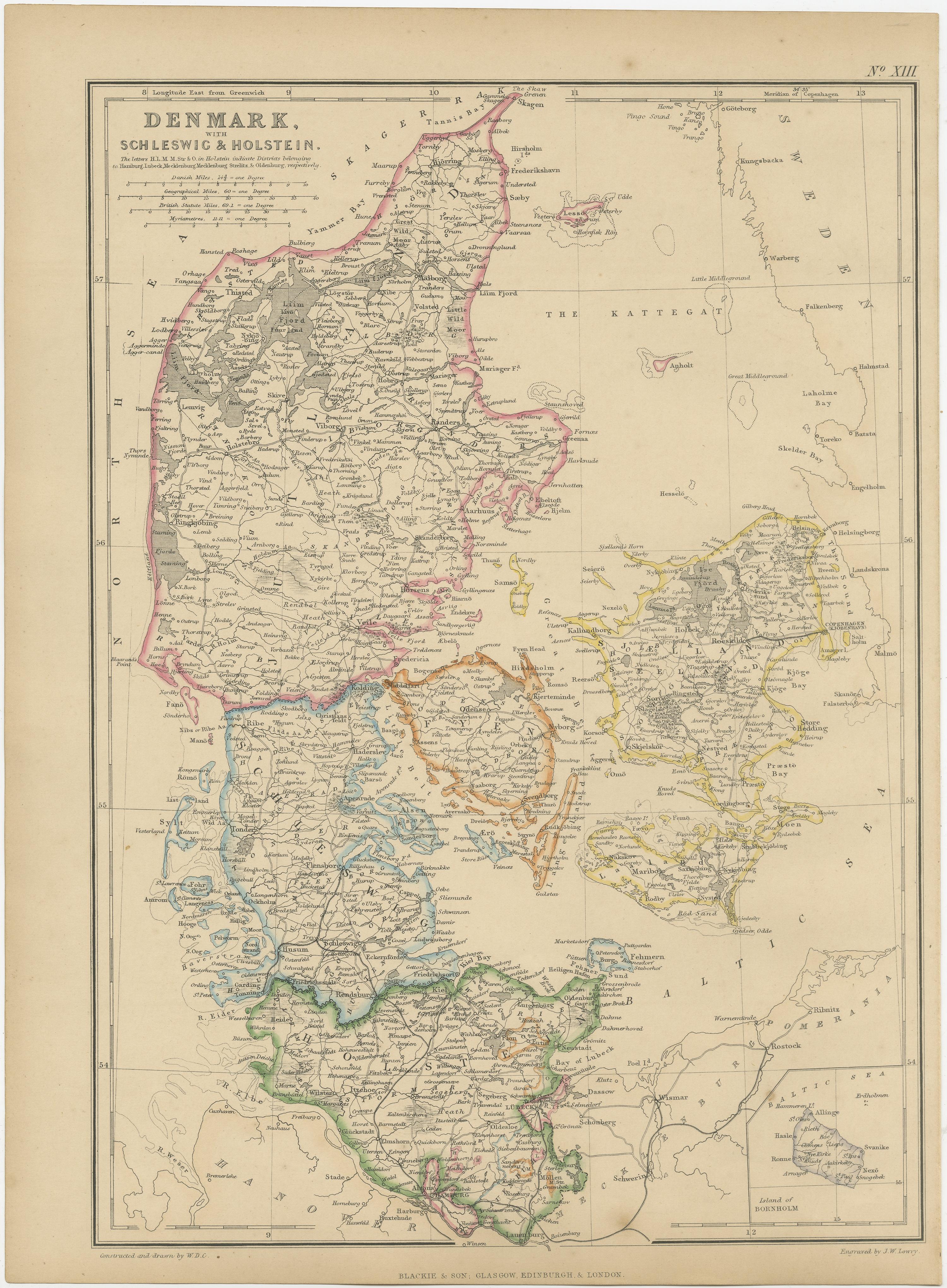
The "Antique Map of Denmark with Schleswig & Holstein" from 'The Imperial Atlas of Modern Geography', published by W. G. Blackie in 1859, is a valuable historical document that provides a detailed view of Denmark along with the regions of Schleswig and Holstein as they were understood in the mid-19th century.
Key Features of the Map:
1. Geographical Coverage: The map encompasses the Kingdom of Denmark and the duchies of Schleswig and Holstein. It illustrates the distinct landscapes of these regions, from the Jutland Peninsula to the numerous Danish islands, and the flat plains of Holstein.
2. Political Boundaries: This period was significant for Denmark and the Schleswig-Holstein region due to the national and political tensions. The map likely delineates the boundaries as they were recognized at the time, offering insight into the complex territorial disputes of the era.
3. Urban and Rural Landscapes: Major cities like Copenhagen, Aarhus, and Kiel, as well as smaller towns and rural villages, are marked. This aspect offers a view of the urban distribution and key population centers in Denmark and the Schleswig-Holstein area.
4. Transportation and Trade Routes: The map may detail the transportation infrastructure, including roads and maritime routes, which were vital for trade and communication in these regions.
5. Natural Features: Significant natural features such as the Danish straits, the North Sea and Baltic Sea coastlines, and important rivers and lakes are likely to be highlighted, showcasing the geographic diversity of the area.
6. Artistic Elements: In line with the cartographic style of the Victorian era, the map probably includes ornate borders, an elegant title script, and possibly other artistic embellishments, adding to its aesthetic value.
7. Educational and Historical Significance: As a historical document, this map serves as an invaluable educational tool, offering a snapshot of the geographical understanding and the political landscape of Denmark and the Schleswig-Holstein region in the mid-19th century.
This antique map is not only a collector’s item for enthusiasts of historical cartography but also an important resource for those interested in the historical geography of Scandinavia and Northern Europe, providing a window into the regional dynamics of the time.