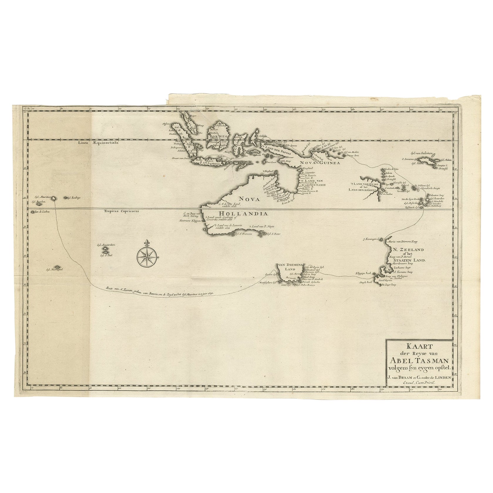
Early Map of Australasia, Marking The Route of Abel Tasman in 1642 'Publ. 1726'
€ 8 500
Original antique · The actual sheet photographed · Certificate of authenticity on request · Sold unframed · Worldwide shipping from € 15 (rates)
Date
1642
Technique
Engraved
Sheet size
32 × 50 cm (12.6 × 19.7 in)
Condition
Good
Reference
BGRN-245
Condition
General age-related toning. Top left margin missing and small worm hole outside image. Please review the images for further condition details.
About this sheet
Antique map titled 'Kaart der Reyse van Abel Tasman volgens syn eygen opstel'. Rare and early map of Australasia, marking the route of Abel Tasman's voyage from Mauritius to Batavia in 1642, on which he discovered Tasmania and New Zealand and proved that Australia was not part of the Great Southern Continent. Despite not showing the route, the map also shows the discoveries in northern Australia made on Tasman's second voyage, 1644. This map originates from 'Oud en Nieuw Oost-Indiën' by F. Valentijn.
Artists and Engravers: François Valentijn (1666-1727), a missionary, worked at Amboina from 1684 to 1694 and 1705 to 1713 and travelled extensively in the VOC's lands.
Condition: Good, general age-related toning. Top left margin missing and small worm hole outside image, please study image carefully.