About this sheet
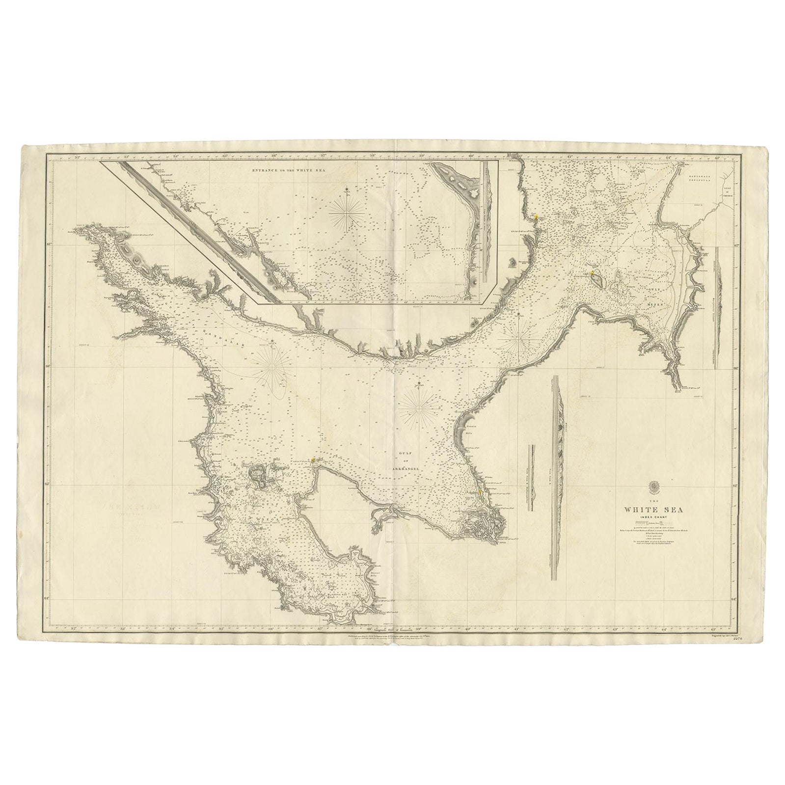
Antique map titled 'The White Sea Index Chart'. Large uncommon map of the White Sea with a smaller inset map of the entrance to the White Sea. The white sea is a southern inlet of the Barents Sea located on the northwest coast of Russia. It is surrounded by Karelia to the west, the Kola Peninsula to the north, and the Kanin Peninsula to the northeast.
The White Sea (Russian: ????? ????, Béloye móre; Karelian and Finnish: Vienanmeri, lit. Dvina Sea; Nenets: ?????? ??', Serako yam) is a southern inlet of the Barents Sea located on the northwest coast of Russia. It is surrounded by Karelia to the west, the Kola Peninsula to the north, and the Kanin Peninsula to the northeast. The whole of the White Sea is under Russian sovereignty and considered to be part of the internal waters of Russia. Administratively, it is divided between Arkhangelsk and Murmansk oblasts and the Republic of Karelia.
The major port of Arkhangelsk is located on the White Sea. For much of Russia's history this was Russia's main centre of international maritime trade, conducted by the Pomors ("seaside settlers") from Kholmogory. In the modern era it became an important Soviet naval and submarine base. The White Sea–Baltic Canal connects the White Sea with the Baltic Sea.
The White Sea is one of the four seas named in English after common colour terms—the others being the Black, Red and Yellow Seas.
Artists and Engravers: Engraved by J. & C. Walker. Published according to Act of Parliament at the Hydrographic Office of the Admiralty. Sold by J. D. Potter.
Condition: Good, general age-related toning. Minor wear, blank verso. Please study image carefully.
Date: 1854
Overall size: 102 x 68 cm
Image size: 94 x 65 cm
We also offer thousands of antique prints covering fields of interest as diverse as architecture, natural history, religion, ethnology and many more.They were the product of engraved, etched or lithographed plates. These plates were handmade out of wood or metal, which required an incredible level of skill, patience and craftsmanship. Whether you have a house with Victorian furniture or more contemporary decor an old engraving can enhance your living space.