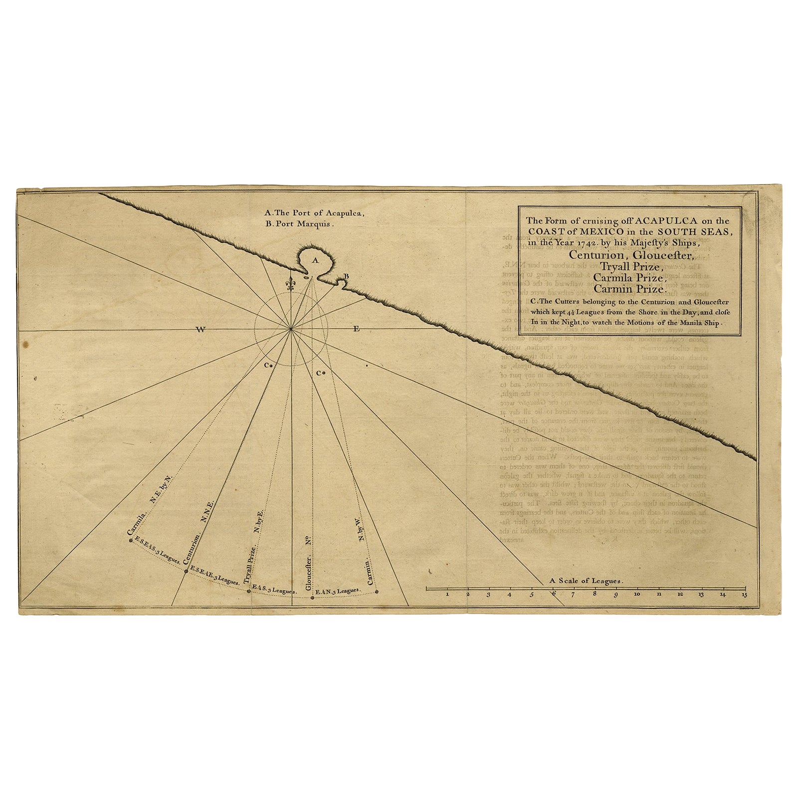
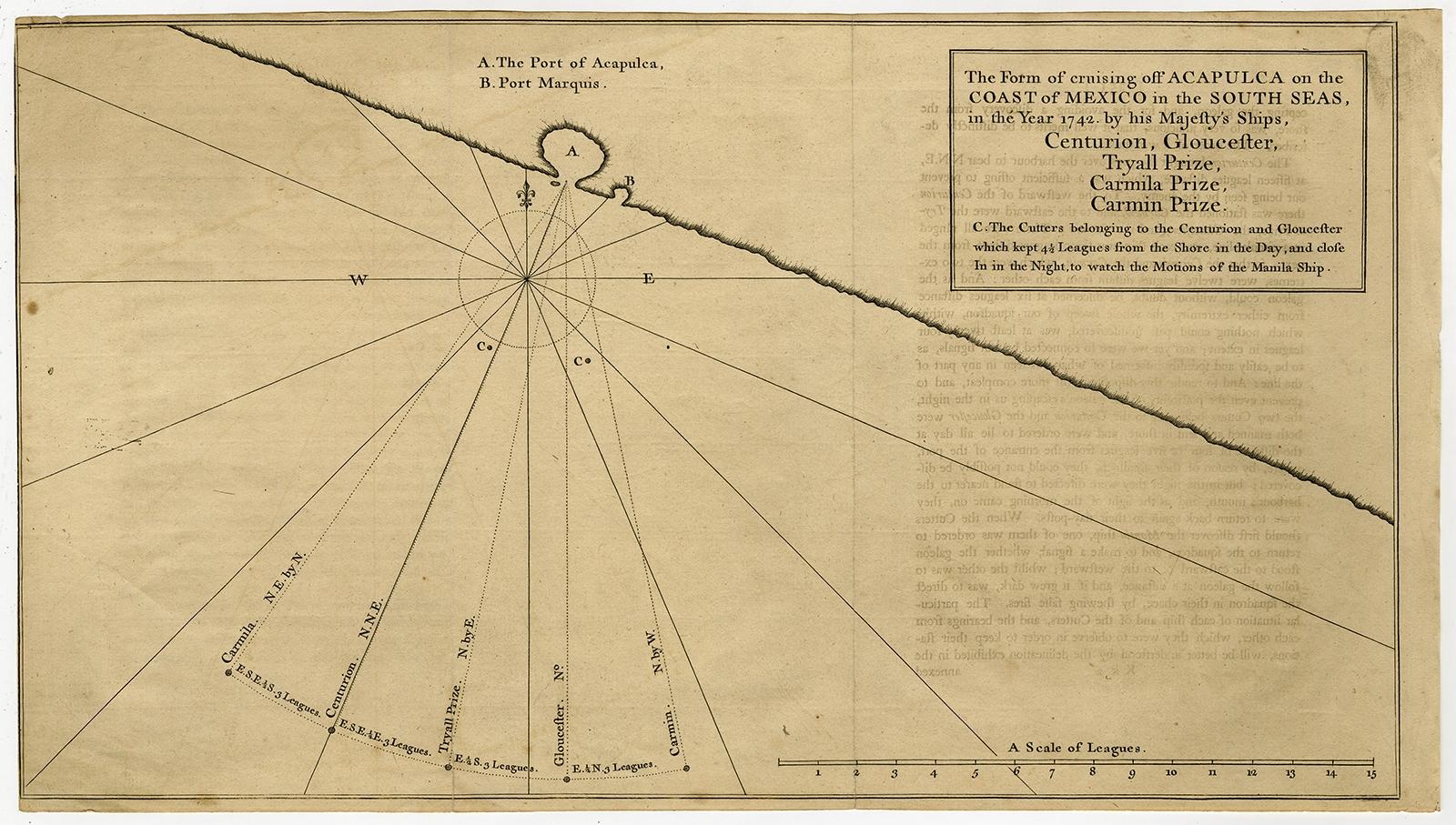
Navigational Chart of Mexico's Coast, with Acapulco and Port Marquis, 1748
€ 140
Original antique · The actual sheet photographed · Certificate of authenticity on request · Sold unframed · Worldwide shipping from € 15 (rates)
Date
1748
Sheet size
24.9 × 44.5 cm (9.8 × 17.5 in)
Condition
Good
Reference
PCT-56789
Condition
Additions or alterations made to the original: Minimal paper separation in the lower edge of the folds (backed with acid-free archival tape). General age-related toning and/or occasional minor defects from handling. Please study scan carefully. Wear consistent with age and use. Original folds, as issued. Offsetting from letterpress text on the opposite page in the book. Small stains in the left edge of the image. Soiling in the top right corner. A faint dampstain in the top left image corner. Creasing in the right margin.
About this sheet
Antique map titled 'The Form of cruising off Acapulca on the Coast of Mexico in the South Seas in the Year 1742. by His Majesty's Ships, Centurion, Gloucester, Tryall Prize, Carmila Prize, Carmin Prize.' -
A navigational chart of the coast of Mexico, with the harbours Acapulco and Port Marquis (Puerto del Marques) indicated. From George Anson's "A Voyage round the world in the years MDCCXL, I, II, II, IV." London: J. and P. Knapton, 1748. Great Britain was at war with Spain in 1740. Admiral of the Fleet George Anson, 1st Baron Anson PC, FRS, RN (1697 -1762) was a British admiral and a wealthy aristocrat, noted for his circumnavigation of the globe and his role overseeing the Royal Navy during the Seven Years' War. Anson commanded the small British squadron sent at the beginning of the war with Spain to harass the Spaniards on the west coast of South America and cut off their supplies of wealth from the Pacific. Disasters and hardships plagued the expedition; most of the ships were lost around Cape Horn, and on the Chilean coast, and of a crew of 960, less than 350 survived. Eventually the Centurion alone was left, but Anson persevered and succeeded in capturing a gold-laden Spanish galleon near Manila. The prize he earned as a result settled his fortune for life. This is the official account of his voyage of circumnavigation, compiled from Anson's journals by Richard Walter, chaplain on board the Centurion, and revised by Benjamin Robins.
Artists and Engravers: Made by 'J. Mason' after 'George Anson'. No engraver given on the map. Some source attribute the maps in this work to J. Mason.
Condition: Good, given age. Original folds, as issued. Offsetting from letterpress text on the opposite page in the book. Small stains in the left edge of the image. Soiling in the top right corner. A faint dampstain in the top left image corner. Creasing in the right margin and lower left corner. Minimal paper separation in the lower edge of the folds (backed with acid-free archival tape). General age-related toning and/or occasional minor defects from handling. Please study scan carefully.