About this sheet
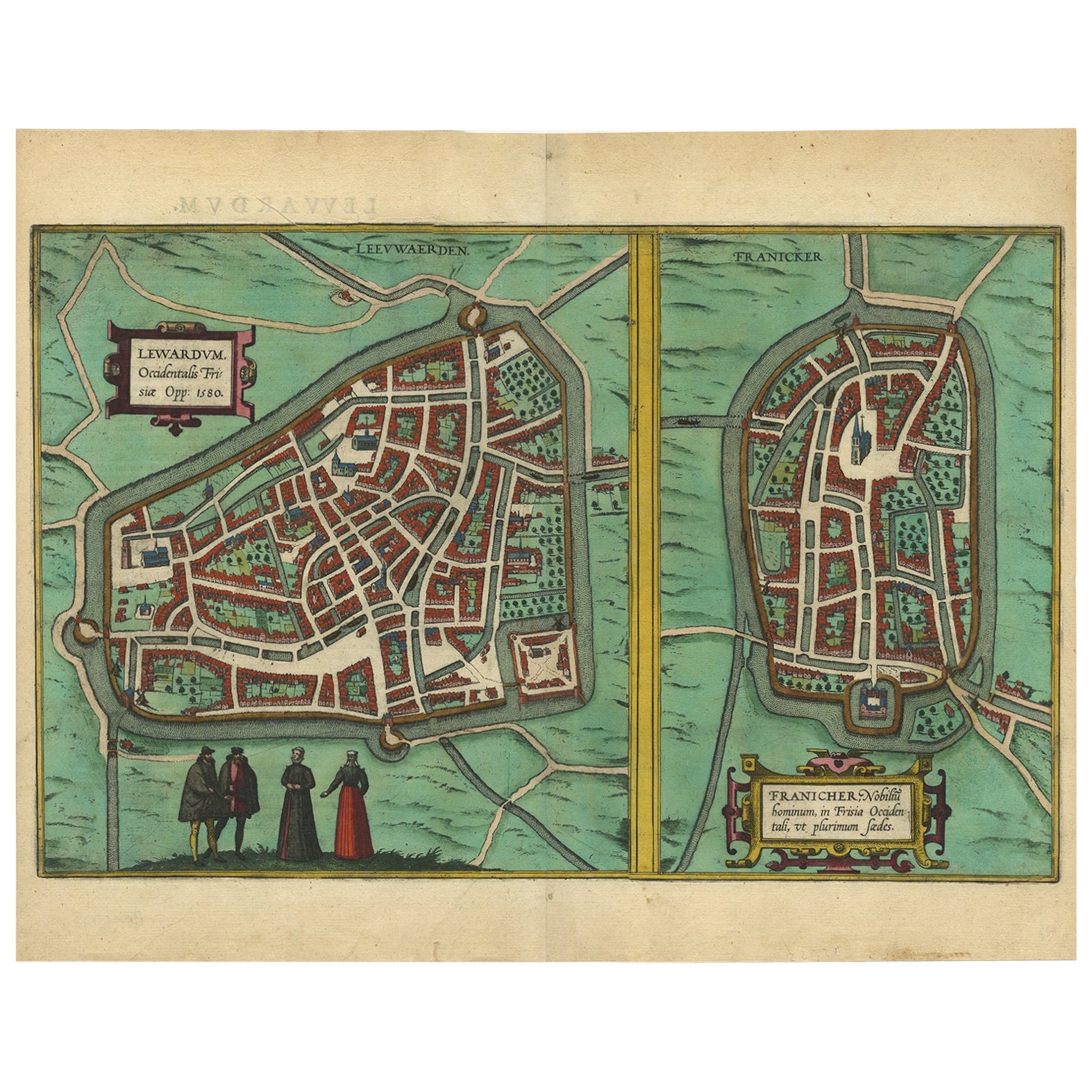
Antique map titled 'Lewardum Occidentlis Frisiae Opp: 1580, Franicher Nobiliu hominum, in Frisia Occidentali, ut plurimum saedes'.
This sheet contains two very detailed bird?s-eye plans of moat surrounded cities. The left-hand view depicts Leeuwarden in 1580, with four costumed figures are shown in the foreground. The right-hand view shows Franeker, situated about 20 kilometres west of Leeuwarden. Latin text on verso.
Artists and Engravers: Georg Braun (1541?1622) was a topo-geographer. From 1572 to 1617, he edited the "Civitates orbis terrarum", which contains 546 prospects, bird's-eye views and maps of cities from all around the world. He was the principal editor of the work, he acquired the tables, hired the artists, and wrote the texts. Frans Hogenberg (1535?1590) was a Flemish and German painter, engraver, and mapmaker. Hogenberg was born in Mechelen, the son of Nicolaas Hogenberg. In 1568 he was banned from Antwerp by the Duke of Alva and travelled to London, where he stayed a few years before emigrating to Cologne. He is known for portraits and topographical views as well as historical allegories. He also produced scenes of contemporary historical events.
Artist: Georg Braun (1541?1622) was a topo-geographer. From 1572 to 1617, he edited the "Civitates orbis terrarum", which contains 546 prospects, bird's-eye views and maps of cities from all around the world. He was the principal editor of the work, he acquired the tables, hired the artists, and wrote the texts. Frans Hogenberg (1535?1590) was a Flemish and German painter, engraver, and mapmaker. Hogenberg was born in Mechelen, the son of Nicolaas Hogenberg. In 1568 he was banned from Antwerp by the Duke of Alva and travelled to London, where he stayed a few years before emigrating to Cologne. He is known for portraits and topographical views as well as historical allegories. He also produced scenes of contemporary historical events.
Condition: Very good. Nice hand-coloring. Please study image carefully.
Date: 1580
Overall size: 50 x 39 cm.
Image size: 48.5 x 30.8 cm.