About this sheet
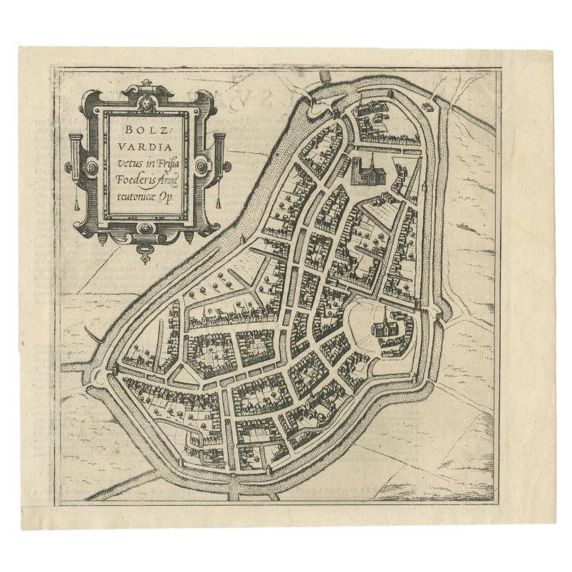
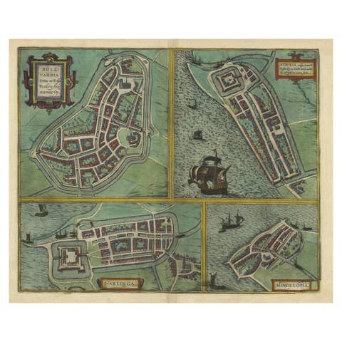
Antique map titled ‘Bolzvardia vetus in Frisia Foederis (..)’. Old map of the city of Bolsward, Friesland. Originally part of a sheet together with the cities of Stavoren, Harlingen and Hindeloopen. This map originates from ‘Urbium praecipuarum totius mundi liber quartus‘. Latin text on verso.
Artists and Engravers: Georg Braun (1542-1622), a German publisher and Frans Hogenberg issued the famous six volume town book "Civitates Orbis Terrarum" between 1572 and 1618. The volumes originally published in Latin, follow by German and French translations. Franz Hogenberg (1533-1588) was the son of a Munich engraver who settled in Malines. He engraved most of the plates for Ortelius' Theatrum and the majority of those in the Civitates, and may have been responsible for originating the project. Worked and died in Cologne/Germany. He was a prolific copper engraver and etching artist of maps and town views. In cooperation with Georg Braun he created the first four volumes of the Civitates Orbis Terrarum in 1572.
Condition: Good, general age-related toning. Trimmed from larger sheet, right margin extended. Latin text on verso. Please study image carefully.
Date: c.1598
Overall size: 27 x 24 cm.
Image size: 22 x 22 cm.
We sell original antique maps to collectors, historians, educators and interior decorators all over the world. Our collection includes a wide range of authentic antique maps from the 16th to the 20th centuries. Buying and collecting antique maps is a tradition that goes back hundreds of years. Antique maps have proved a richly rewarding investment over the past decade, thanks to a growing appreciation of their unique historical appeal. Today the decorative qualities of antique maps are widely recognized by interior designers who appreciate their beauty and design flexibility. Depending on the individual map, presentation, and context, a rare or antique map can be modern, traditional, abstract, figurative, serious or whimsical. We offer a wide range of authentic antique maps for any budget.