
Maps & PrintsBartele Gallery · Langweer
Home / Antique Maps / Sea Charts

Sea Charts

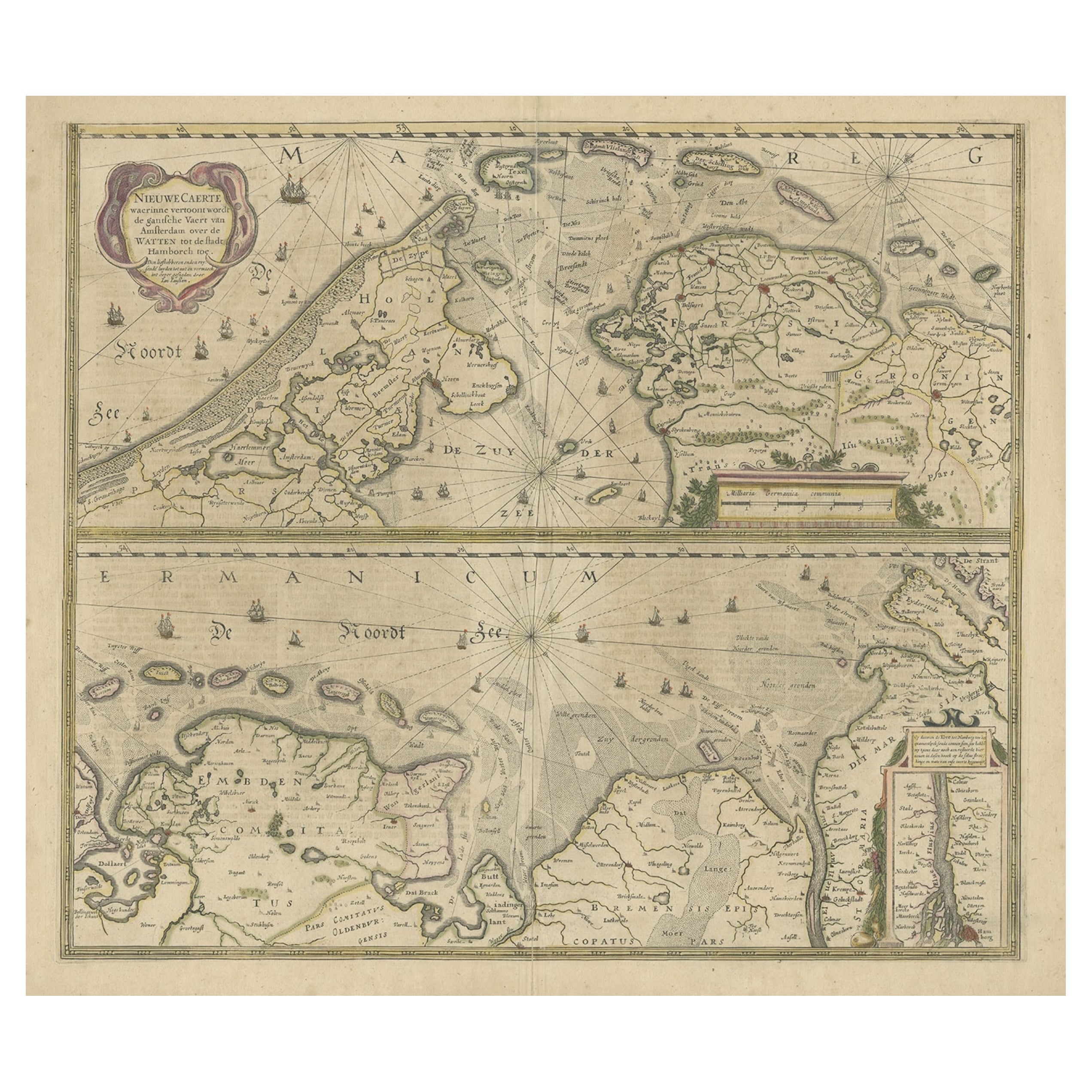
Two Original Antique Engravings with the Dutch and German North Sea Coast, c1650

€ 590

Original antique · The actual sheet photographed · Certificate of authenticity on request · Sold unframed · Worldwide shipping from € 15 (rates)

Sheet size
50 × 59 cm (19.7 × 23.2 in)
Condition
Fair
Reference
BG-11256

Condition

Repaired: archival repair tape used on the back site to strengthen the split.
About this sheet

Antique map titled 'Nieuwe Caerte waerinne vertoont wordt de gantsche Vaert van Amsterdam over de Watten tot de stadt Hamborch toe'.

Two maps with the Dutch and German North Sea coast of Friesland, with West Frisian Islands and below East Frisian Islands with inset map of the Elbe around Hamburg. With title and a scale cartouche.

Artists and Engravers: Johannes Janssonius (Jansson), ( 1588- 1664) Amsterdam was born in Arnhem, the son of Jan Janszoon the Elder,a publisher and bookseller.

Condition: Fair, general age-related toning. Several repairs, split at bottom of the folding line. Original, contemporary hand coloring. Dutch text on verso, please study image carefully.

More from Sea Charts

Ask about this sheet

Two Original Antique Engravings with the Dutch and German North Sea Coast, c1650
Ref. BG-11256 · € 590
We reply by email, usually within one working day.