
Maps & PrintsBartele Gallery · Langweer
Home / Antique Maps / Europe / Western Europe / France

France · 19th century

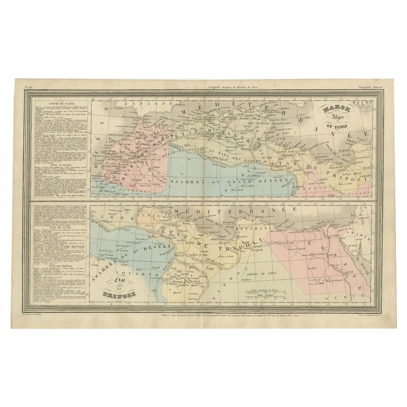
French Antique Map of Northern Africa and Libya, c.1840

€ 92

Original antique · The actual sheet photographed · Certificate of authenticity on request · Sold unframed · Worldwide shipping from € 15 (rates)

Date
1840
Mapmaker / artist
Jules Renouard was a publisher, active at 6 Rue de Tournon, Paris. A line in bottom part informs the reader that Jules Renouard was the editor of "La Géographie
Sheet size
27 × 41 cm (10.6 × 16.1 in)
Condition
Good
Reference
PCT-254

Condition

General age-related toning. Minor wear, original folding line. Blank verso. Please review the images for further condition details.
About this sheet

Antique map titled 'Marok, Alger et Tunis - Etat de Tripoli'. Map of Northern Africa and Libya. This map originates from 'Le globe Atlas classique Universel de géographie ancienne et moderne, pour servir a l'étude de la géographie et de l'histoire dressé par M. A.H.Dufour, Et revu par M.Jomard' by Jules Renouard. Artists and Engravers: Jules Renouard was a publisher, active at 6 Rue de Tournon, Paris. A line in bottom part informs the reader that Jules Renouard was the editor of "La Géographie de Balbi". Afterwards the company was called "Jules Renouard et Cie" and known for his plans and panoramas of Paris. The business was continued by his widow.

Condition: Good, general age-related toning. Minor wear, original folding line. Blank verso, please study image carefully.
Date: c.1840
Overall size: 41 x 27 cm.
Image size: 38.5 x 24 cm.

They were the product of engraved, etched or lithographed plates. These plates were handmade out of wood or metal, which required an incredible level of skill, patience and craftsmanship. Whether you have a house with Victorian furniture or more contemporary decor an old engraving can enhance your living space. We offer a wide range of authentic antique prints for any budget.

More from France

Ask about this sheet

French Antique Map of Northern Africa and Libya, c.1840
1840 · Ref. PCT-254 · € 92
We reply by email, usually within one working day.