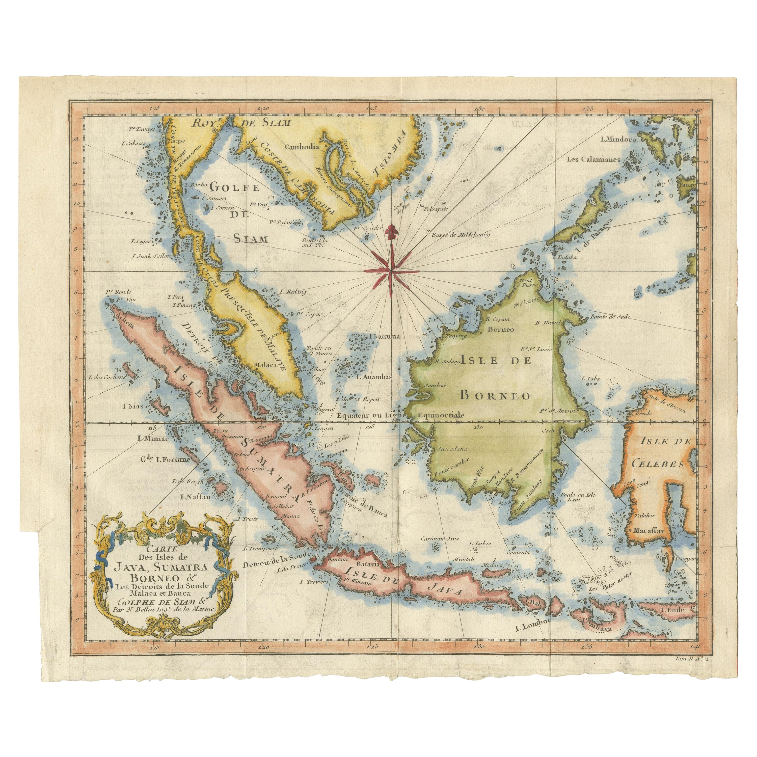
Java, Sumatra & Borneo Map – Bellin & van Schley Decorative Chart, 1750s
€ 650
Original antique · The actual sheet photographed · Certificate of authenticity on request · Sold unframed · Worldwide shipping from € 15 (rates)
Technique
Engraved
Sheet size
26.5 × 32 cm (10.4 × 12.6 in)
Condition
Fair
Reference
BG-13103
What the condition grades mean
Excellent
Bright and clean, with no faults worth mentioning.
Very good
Only light signs of age, such as faint toning.
Good
Normal signs of age for a sheet of this period: toning, some foxing, small marks or neat old repairs.
Fair
Clear faults such as staining, tears or repairs, priced to match.
Every fault we see is written in the condition note, and the whole sheet is shown uncropped in the photos.
Condition
Fine original hand-coloring. Good overall condition. Slightly short lower margin, as published. Vertical folds from the original publication faintly visible. One tear in the right side of the margin, but no repairs. A strong impression-clear colors.
About this sheet
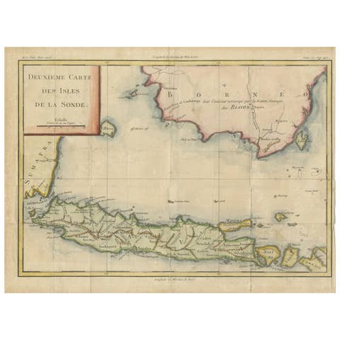
Carte des Isles de Java, Sumatra, Borneo – Decorative Map by Bellin & van Schley, 1750s
This richly detailed and decorative map titled Carte des Isles de Java Sumatra Borneo & les detroits de la sonde Malaca et Banca Golf de Siam covers a vast portion of maritime Southeast Asia. It stretches from the Gulf of Siam and Mindoro in the north to Timor, Java, Sumatra, and Borneo in the south, offering a comprehensive depiction of the region’s islands and straits, including the vital maritime passages of Malacca, Sunda, and Bangka.
Drawn by Jacques Nicolas Bellin, a renowned French hydrographer and member of both the Royal Society of London and the Académie de Marine, the map exemplifies mid-18th-century French cartography, combining geographical accuracy with aesthetic charm. It was published in Antoine François Prévost’s monumental travel collection Histoire générale des voyages, and engraved by Jakob van der Schley, a Dutch draughtsman and engraver known for his refined work after Bellin’s originals.
A large compass rose dominates the center of the composition, elegantly radiating directional lines across the seas. The map’s ornate cartouche, decorated in rococo fashion, adds a graceful embellishment, enhancing its visual appeal and making it especially suitable for framing.
Maps like this were essential not only for navigation but also for the growing European interest in colonial expansion, trade, and exploration during the 18th century. The inclusion of critical waterways such as the Strait of Malacca reflects their strategic importance in global trade routes of the period.
Condition report: Fine original hand-coloring. Good overall condition. Slightly short lower margin, as published. Vertical folds from the original publication faintly visible. One tear in the right side of the margin, but no repairs. A strong impression.
Framing tips: Best suited to a dark wood frame—such as teak or rosewood—with a neutral ivory or parchment-colored mat to complement the aged tones of the map and the vibrant coloring. A gold inner fillet can enhance its historical prestige.