Maps & PrintsBartele Gallery · Langweer
Home / Antique Maps / Sea Charts

Sea Charts · 18th century

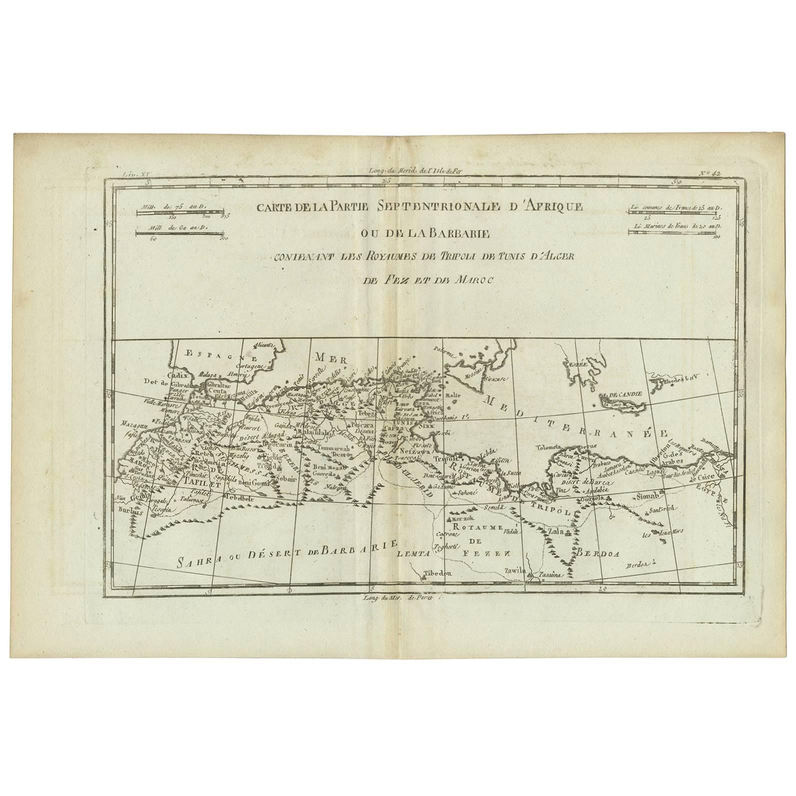
Antique Map of Northern Africa "Barbary Coast" by R. Bonne, circa 1780

€ 129

One of a kind: this is the sheet in the photographs. Ships from Langweer, the Netherlands.

Date
1780
Sheet size
26 × 38.3 cm (10.2 × 15.1 in)
Condition
Good
Reference
BGI-00719

Condition

Minor fading. Please study image carefully.
About this sheet

A fine example of Rigobert Bonne and Guilleme Raynal’s 1780 map of northwestern Africa or the Barbary Coast. Includes the modern day countries of Morocco, Algeria, Tunisia, Libya, and parts of adjacent Spain, Italy and Greece. This map was made in response to European interest in the region due to coastal attacks and incursions by the Barbary Pirates based in Algeria, Tunis, and Morocco. The Barbary Pirates disrupted trade in this region from the Crusades to the early 19th century. Features rivers, some topographical features, and political boundaries. Drawn by R. Bonne for G. Raynal’s Atlas de Toutes les Parties Connues du Globe Terrestre, Dressé pour l'Histoire Philosophique et Politique des Établissemens et du Commerce des Européens dans les Deux Indes.

More from Sea Charts

Ask about this sheet

Antique Map of Northern Africa "Barbary Coast" by R. Bonne, circa 1780
1780 · Ref. BGI-00719 · € 129
We reply by email, usually within one working day.