Maps & PrintsBartele Gallery · Langweer
Home / Antique Maps / Europe / South-East Europe

South-East Europe · 16th century

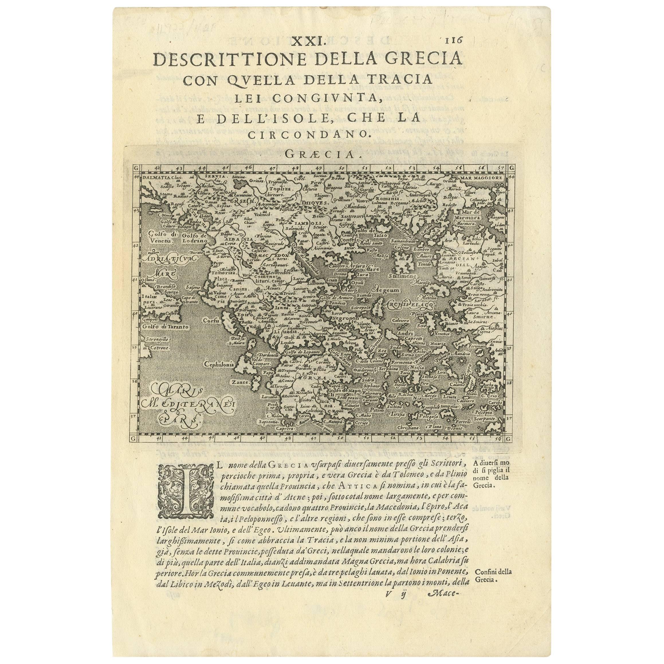
Rare Original 16th Century Antique Map of Greece, 1598

€ 360

One of a kind: this is the sheet in the photographs. Ships from Langweer, the Netherlands.

Date
1598
Sheet size
29.4 × 19.8 cm (11.6 × 7.8 in)
Condition
Good
Reference
BG-09336

Condition

Good, considering age. Please study image carefully.

About this sheet

Beautiful and rare antique map of Greece with Albania, Mecedonia, Romania, Dalmatia and the peninsula of Salento to the Golf of Taranto. Also clearly shown the islands of the Aegaian Sea and the West Coast of Turkey. Published in "Geografia cioe Descrittione Universale della Terra" by G. Porro, 1598. Italian text, also on verso.

More from South-East Europe

Ask about this sheet

Rare Original 16th Century Antique Map of Greece, 1598
1598 · Ref. BG-09336 · € 360
We reply by email, usually within one working day.