About this sheet
Antique Map of Turkey and Constantinople with Views and Figures, Fullarton c.1865
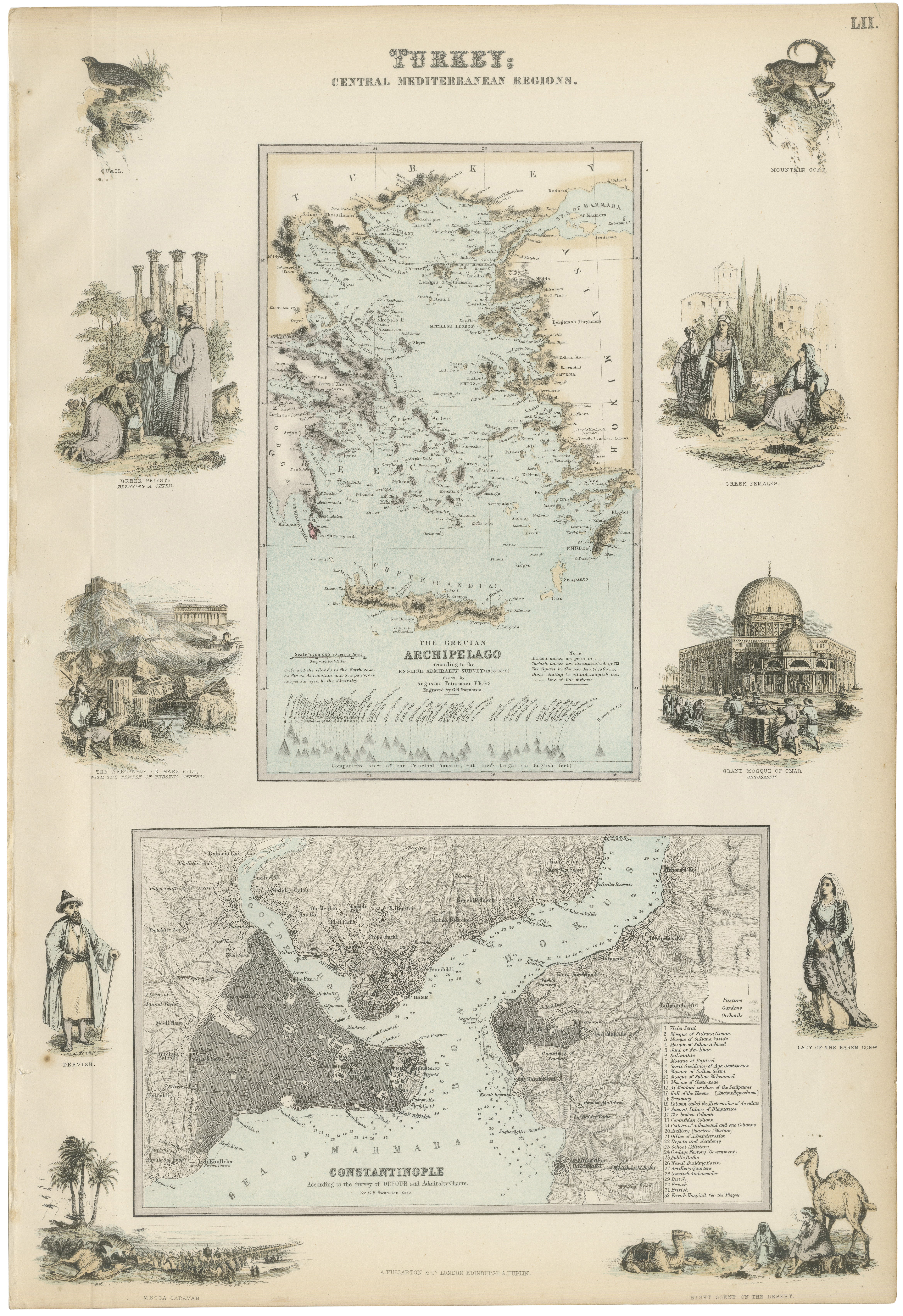
A richly detailed and highly decorative lithographic map titled “Turkey; Central Mediterranean Regions,” published by Archibald Fullarton & Co. in the mid-19th century, circa 1862–1872. This striking composition forms part of *The Royal Illustrated Atlas of Modern Geography* and exemplifies the Victorian fascination with combining cartographic precision and narrative illustration.
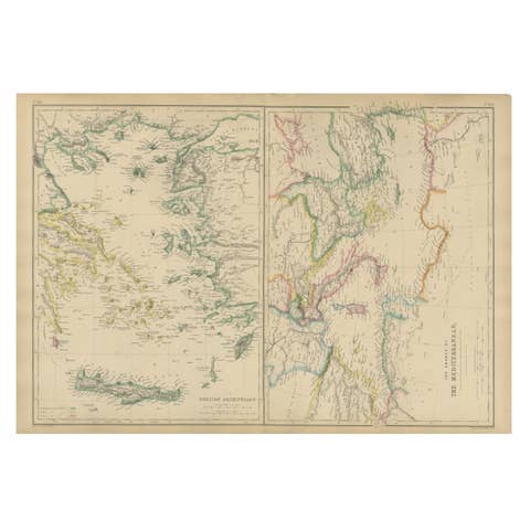
The sheet presents multiple layers of geographic and cultural information. At its center is a finely rendered map of the Grecian Archipelago, based on English Admiralty surveys conducted between 1828 and 1849, drawn by the renowned cartographer Augustus Petermann and engraved by G.H. Swanston. Beneath this, a detailed plan of Constantinople (modern-day Istanbul) provides a close-up view of the Bosphorus, the Golden Horn, and the surrounding urban landscape, reflecting the city's importance as a crossroads between Europe and Asia.
Surrounding the maps is an elaborate series of engraved vignette illustrations that elevate the sheet into a complete visual narrative of the region. These include depictions of classical ruins such as Ephesus, scenes of local life and costume, architectural landmarks like the Mosque of Omar, and studies of regional fauna including camels and birds. These elements were designed not only to inform but to evoke the cultural richness and diversity of the Ottoman world as perceived by 19th-century European audiences.
The combination of cartographic detail, ethnographic imagery, and architectural studies makes this piece particularly desirable. It functions both as a geographical document and as a decorative artwork, offering depth and storytelling rarely found in standard maps of the period.
This is an original 19th-century lithograph, not a reproduction. All items we offer are authentic period works of art over 100 years old. The print is sold unframed; any framed images are shown for presentation and interior inspiration only and not always on scale in the visual presentation.
Condition: Good condition with age-related toning and light surface wear. Vertical fold line (left side) as issued. Minor spotting and handling marks, with margins intact and strong visual contrast throughout the engraving and lithographic elements.
Framing tips: This piece benefits from a substantial frame due to its decorative border and multiple visual elements. A dark walnut or black frame with a wide ivory mat enhances both the central maps and the surrounding vignettes, creating a museum-quality presentation ideal for statement walls.
Technique: Lithograph with original hand color
Maker: Archibald Fullarton & Co., London, circa 1865
Keywords: Turkey Ottoman Empire Constantinople Istanbul Bosphorus Golden Horn Grecian Archipelago Aegean Sea Greece Asia Minor Levant Mediterranean Ephesus Mosque of Omar Jerusalem Petermann Swanston Fullarton Royal Illustrated Atlas geography atlas map lithograph antique map Middle East 19th century decorative map ethnographic figures camel desert ruins Istanbul plan Bosphorus map Victorian atlas