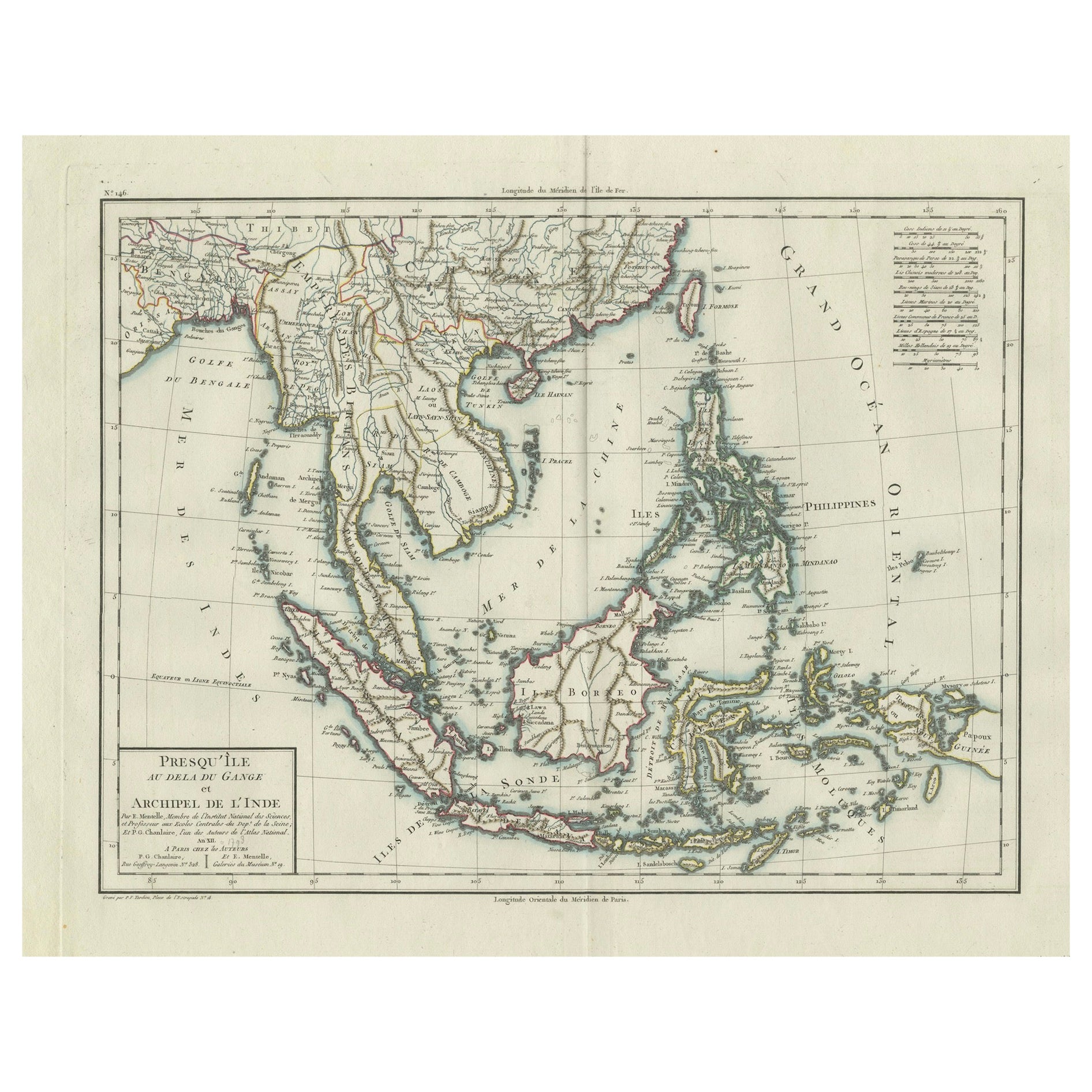
1797 Tardieu Map of Southeast Asia: The Malay Archipelago and Beyond
€ 1 150
Original antique · The actual sheet photographed · Certificate of authenticity on request · Sold unframed · Worldwide shipping from € 15 (rates)
Date
1797
Sheet size
64 × 48.5 cm (25.2 × 19.1 in)
Condition
Good
Reference
BG-13684-1
What the condition grades mean
Excellent
Bright and clean, with no faults worth mentioning.
Very good
Only light signs of age, such as faint toning.
Good
Normal signs of age for a sheet of this period: toning, some foxing, small marks or neat old repairs.
Fair
Clear faults such as staining, tears or repairs, priced to match.
Every fault we see is written in the condition note, and the whole sheet is shown uncropped in the photos.
Condition
Given age. General age-related soiling but mainly outside the image in the margins. Beautiful hand-colored, with some creasing along the centrefold. Latin text on the reverse. Restored tear in outer lower margin; otherwise fine.
About this sheet
An original historical map titled 'Presqu' Île Au Dela Du Gange et Archipel De L'Inde', created by Pierre Francois Tardieu and published in the "Atlas Universel" by Pierre Grégoire Chanlaire & Edmonde Mentelle in Paris, 1797. It depicts the region from Bangladesh to Papua New Guinea, with a central focus on Borneo and the Philippines. Printed on strong hand-pressed paper.
Step back into the age of exploration with this meticulously hand-colored 1797 engraving by the esteemed cartographer Pierre Francois Tardieu. This rare collector's piece, from the Atlas Universel, offers a detailed glimpse into the maritime heart of Southeast Asia, highlighting the 'Presqu' Île Au Dela Du Gange et Archipel De L'Inde'. It is a treasure trove for map enthusiasts and historians alike, featuring the Malay Archipelago with remarkable precision. Borneo and the Philippines are centrally placed, flanked by the intricate web of islands stretching from Bangladesh to the exotic east of Papua New Guinea. Singapore is mentioned already. This decorative and educational map is a must-have for connoisseurs of geographic art and a unique testament to the cartographic achievements of the 18th century."
Such a description would cater to collectors interested in maritime history, cartographic art, and regional maps of Asia, enhancing the allure and perceived value of the map.