About this sheet
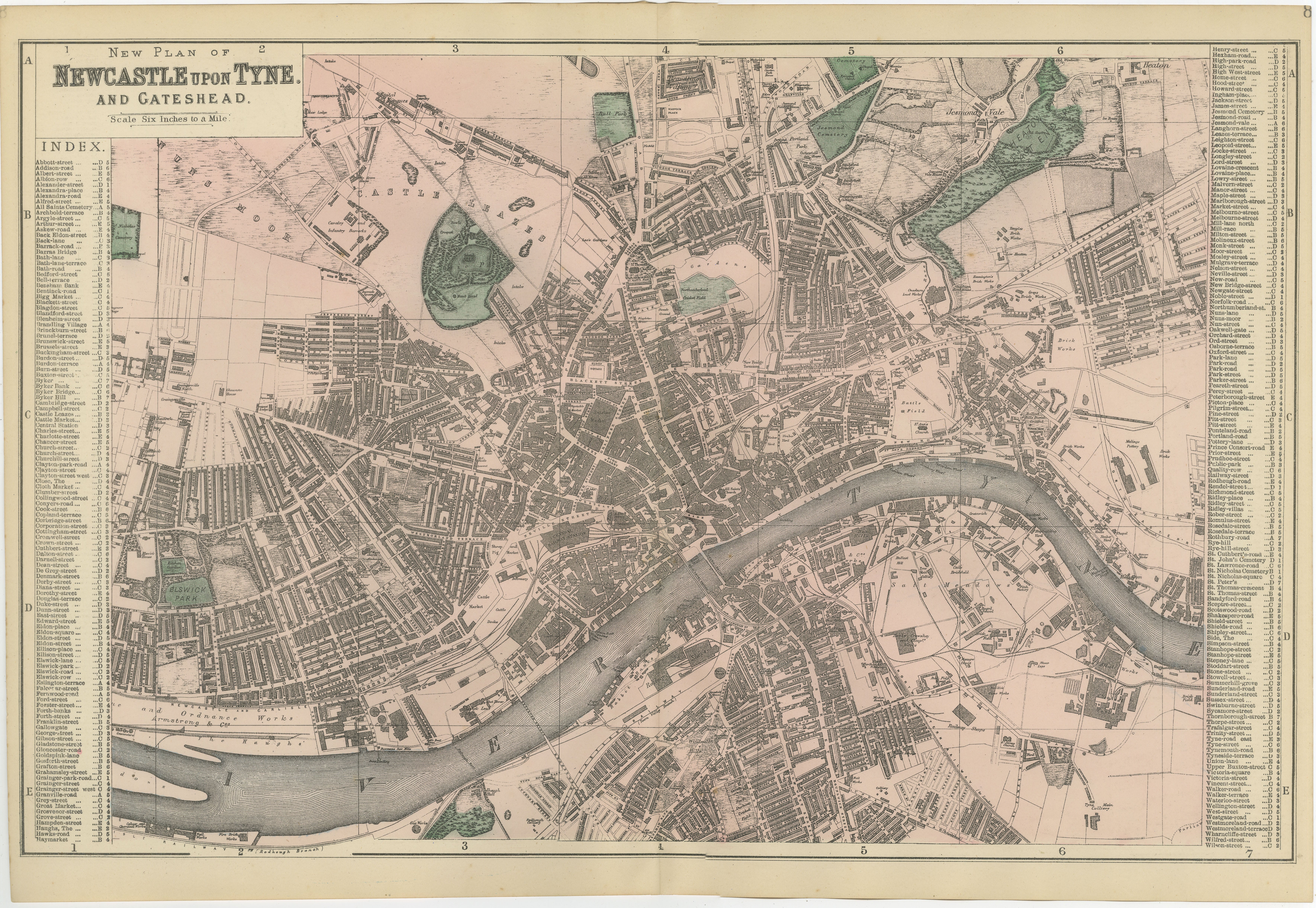
Decorative Map of Newcastle upon Tyne and Gateshead, Victorian City Plan, 1885
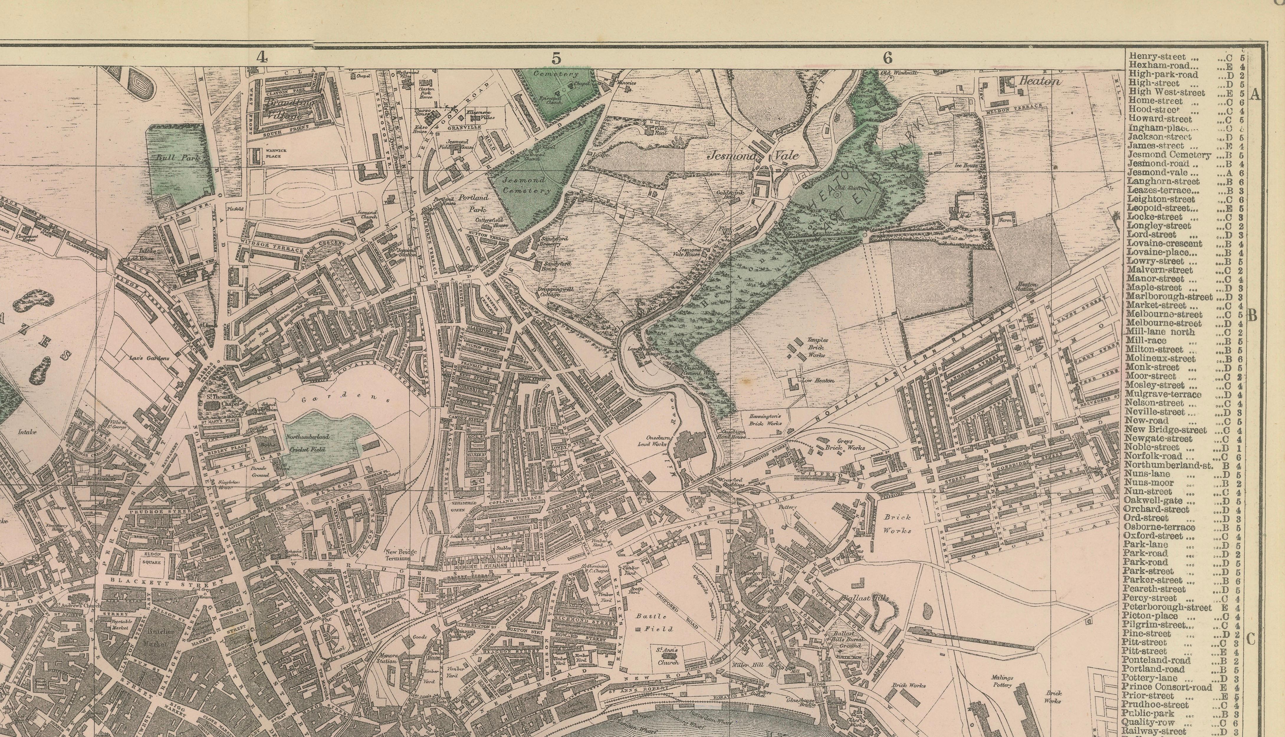
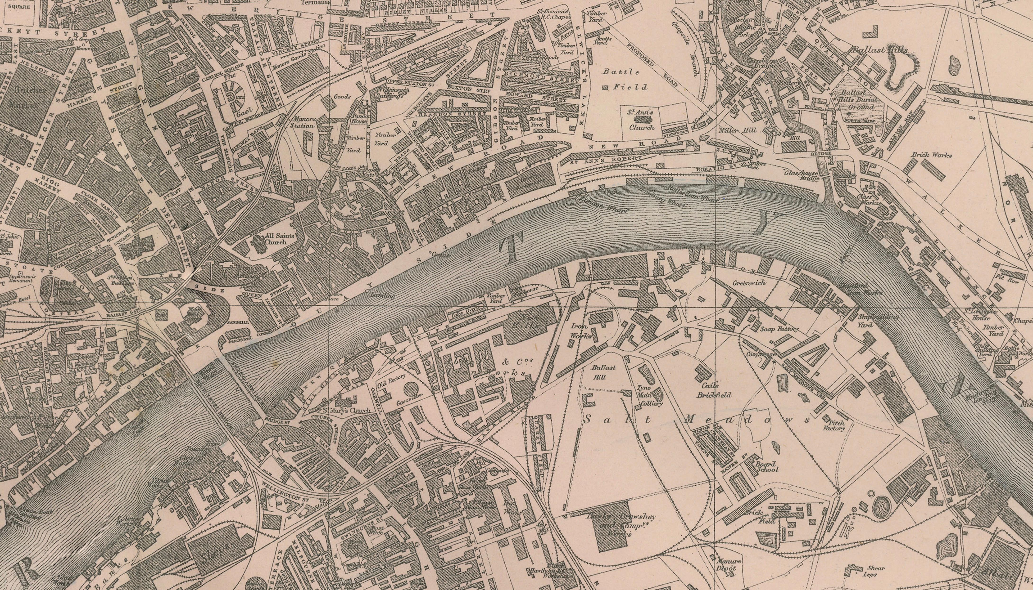
This finely detailed Victorian map titled “New Plan of Newcastle upon Tyne and Gateshead” presents the historic industrial city and its counterpart across the River Tyne during the late nineteenth century. Published in 1885, the map captures Newcastle at a time when it was one of Britain’s most important centers of shipbuilding, coal export, and heavy industry.
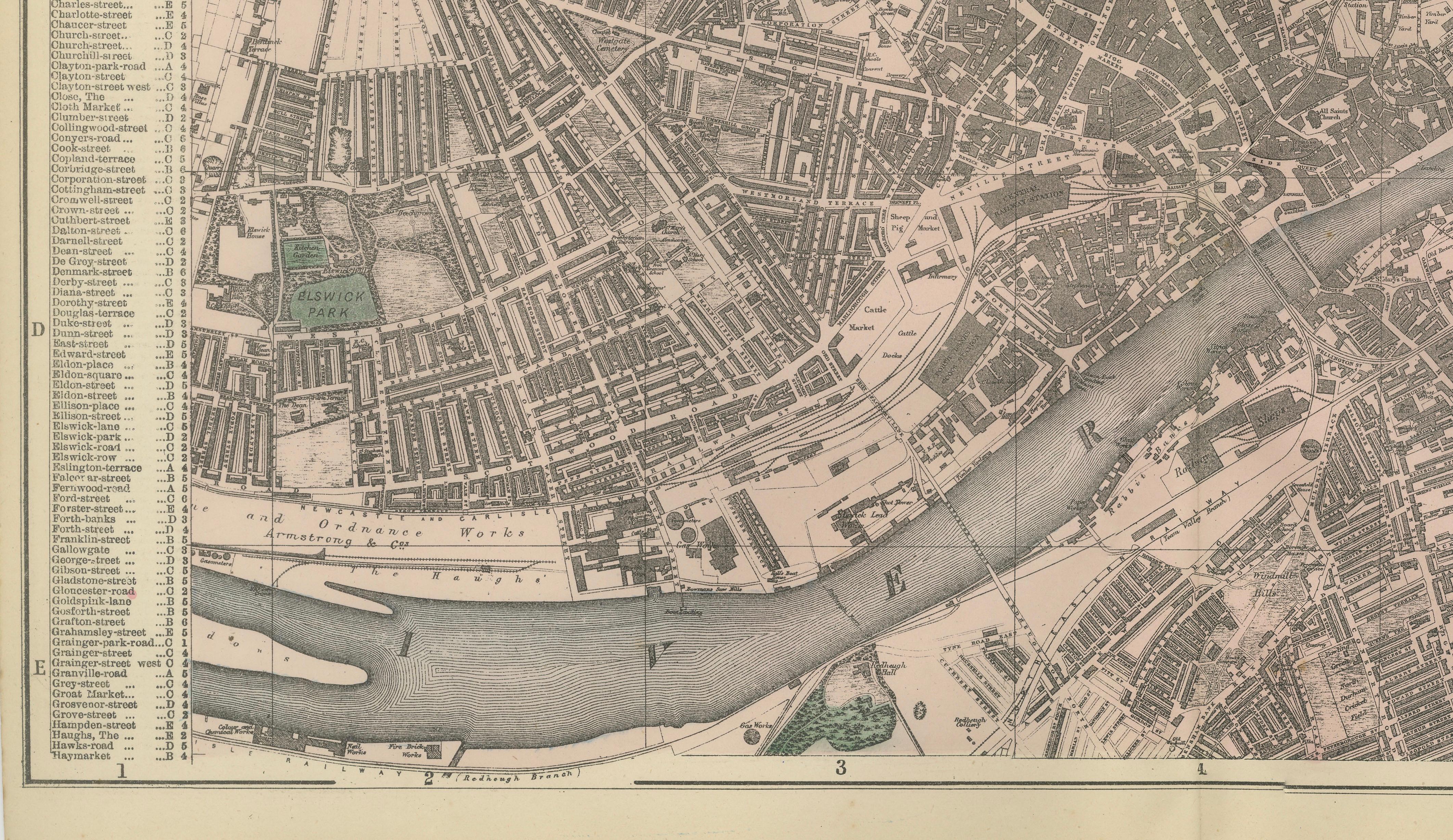
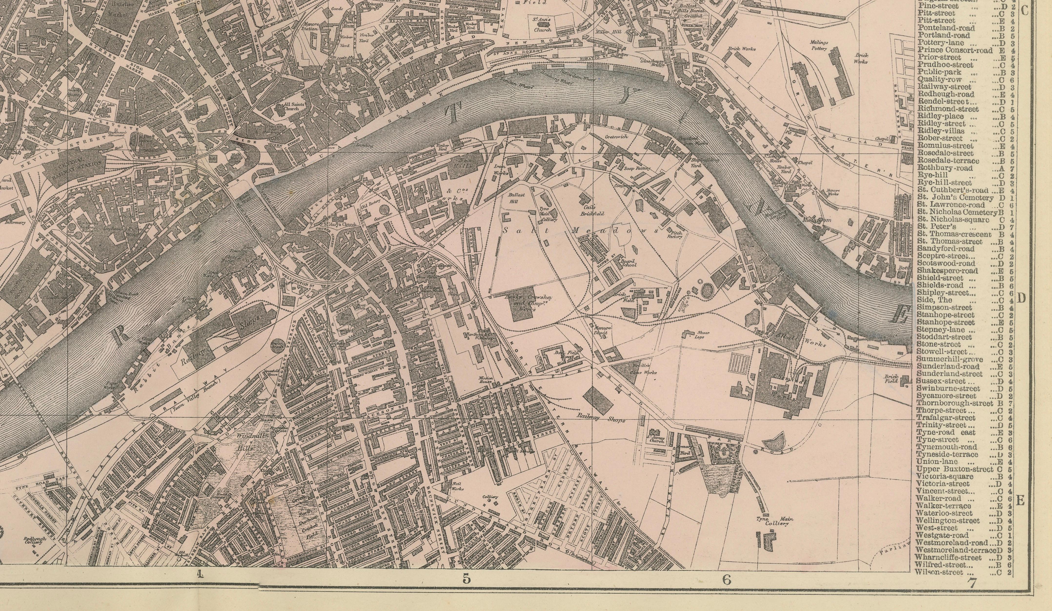
The composition is dominated by the River Tyne, which curves prominently through the center of the map, separating Newcastle from Gateshead. Along its banks appear the dense quays, shipyards, and industrial infrastructure that powered the regional economy. The river crossings—most notably the High Level Bridge and other early bridges—highlight the vital connections between the two urban centers and their role in facilitating trade and movement.
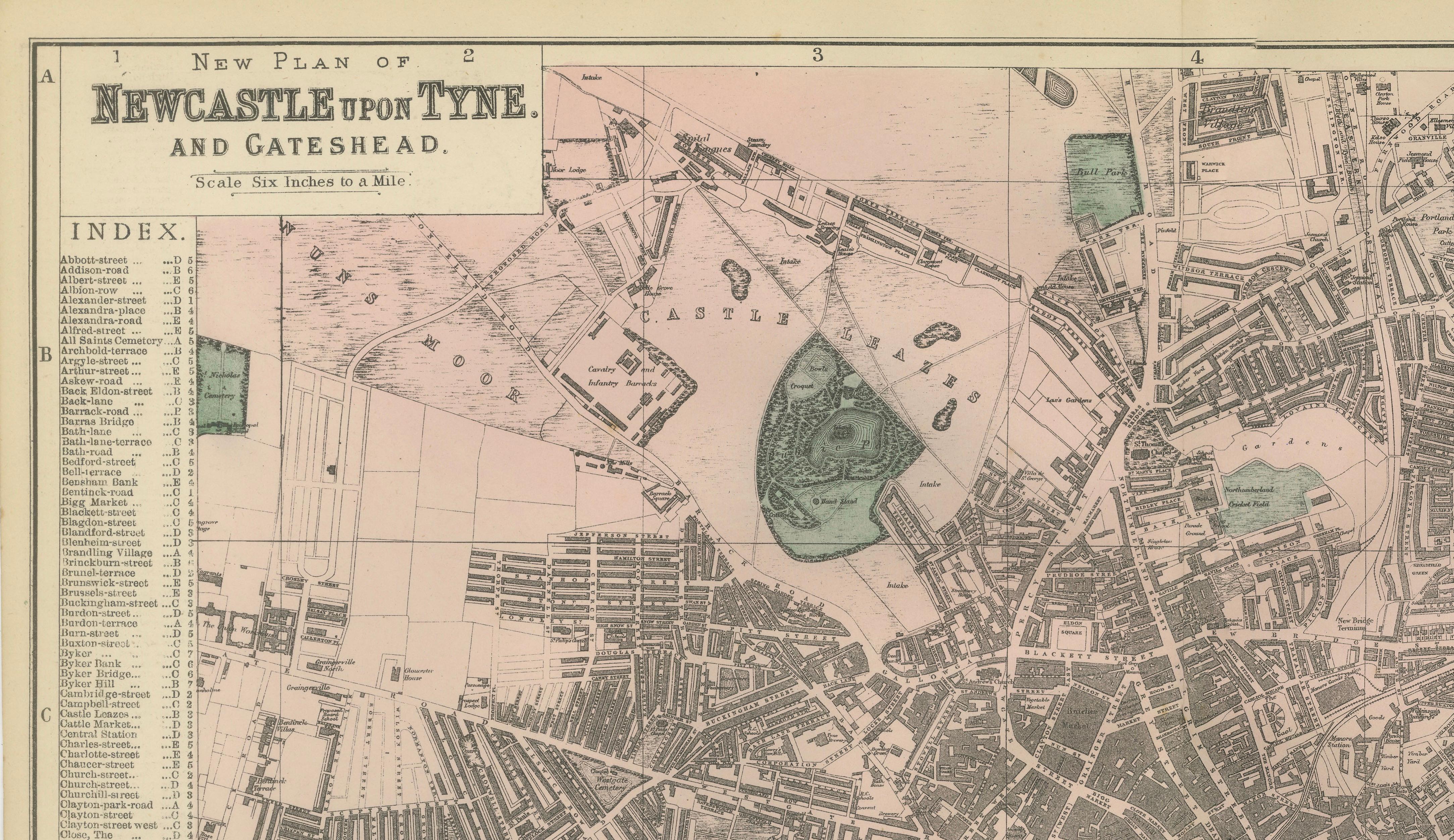
Newcastle itself is shown as a tightly built urban environment, with a complex network of streets radiating from the historic core. Key areas such as Grainger Town, Grey Street, and the vicinity of Grey’s Monument are clearly identifiable, reflecting the city’s nineteenth-century architectural development. Important landmarks including Newcastle Castle and St Nicholas Cathedral anchor the historic identity of the city within the expanding industrial landscape.
Across the river, Gateshead is depicted as an equally active industrial district, with railways, factories, and working-class housing spreading outward from the riverbanks. The surrounding districts—such as Byker, Jesmond, Heaton, Benwell, and Elswick—illustrate the broader urban expansion of Newcastle during the Victorian period, while nearby settlements and transport routes connect the city to the wider region of Northumberland and Durham.
The map is executed with fine lithographic precision, combining detailed linework with subtle hand coloring to distinguish water, parks, and open spaces. An index along the sides provides a comprehensive reference to streets and locations, enhancing both its historical value and practical clarity.
This is an original 19th-century lithograph, not a reproduction. All items we offer are authentic period works of art over 100 years old. The print is sold unframed; any framed images are shown for presentation and interior inspiration only.
Condition
Very good antique condition. Light age-related toning and minor spotting consistent with nineteenth-century paper. Original center fold as issued. Margins remain complete and well preserved.
Framing tips
This map displays beautifully in a wide horizontal format. A dark walnut or black frame with an ivory or warm off-white mat enhances the contrast of the intricate Victorian linework. Ideal for studies, offices, or interiors with an industrial or historical theme.
Technique: Lithograph
Maker: Edward Weller, London, 1885
Keyword Block
antique map, Newcastle upon Tyne map, Gateshead map, Victorian city map, 1885 map, Newcastle city plan, River Tyne map, Tyne bridges, High Level Bridge, Swing Bridge Newcastle, Tyne Bridge Newcastle, Newcastle Quayside, Gateshead Quays, Newcastle docks, Tyne shipyards, industrial Newcastle, Victorian England map, British railway map, Newcastle railway lines, Newcastle Central Station, Grainger Town, Grey Street Newcastle, Grey’s Monument, Newcastle Castle, St Nicholas Cathedral Newcastle, Jesmond, Heaton, Byker, Walker, Wallsend, North Shields, South Shields, Tynemouth, Whitley Bay, Gosforth, Elswick, Scotswood, Benwell, Fenham, Arthur’s Hill, Ouseburn, Sandyford, Shieldfield, Gateshead High Street, Saltwell Park, Low Fell, Felling, Heworth, Jarrow, Hebburn, Sunderland, Durham, Northumberland map, Tyne and Wear, River Tyne industrial, coal export Newcastle, shipbuilding Tyne, Victorian port city, antique lithograph map, 19th century map, decorative wall map, architectural map, urban planning map, historical geography, British Isles map, collector map, interior designer wall art