Maps & PrintsBartele Gallery · Langweer
Home / Antique Maps / Asia / South-East Asia

South-East Asia · 18th century

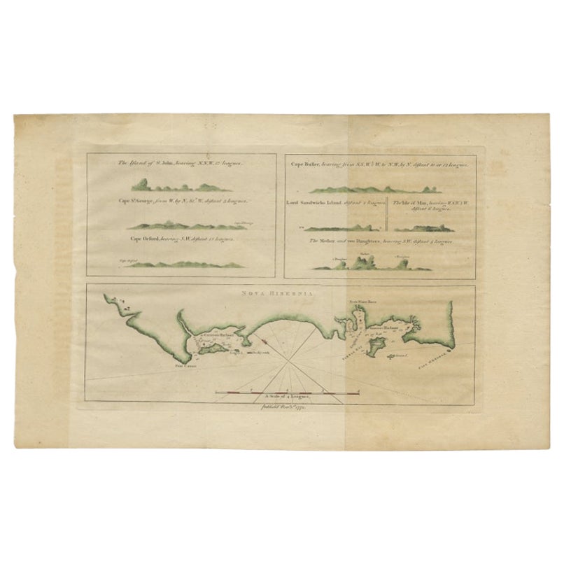
Antique Map of New Ireland Island in the Bismarck Archipelago, New Guinea, 1772

€ 220

Original antique · The actual sheet photographed · Certificate of authenticity on request · Sold unframed · Worldwide shipping from € 15 (rates)

Date
1772
Mapmaker / artist
Philip Carteret: British naval officer and explorer who participated in two of the Royal Navy's circumnavigation expeditions in 1764-66 and 1766-69
Sheet size
44.5 × 28 cm (17.5 × 11.0 in)
Condition
Good
Reference
BG-00824
What the condition grades mean
Excellent
Bright and clean, with no faults worth mentioning.
Very good
Only light signs of age, such as faint toning.
Good
Normal signs of age for a sheet of this period: toning, some foxing, small marks or neat old repairs.
Fair
Clear faults such as staining, tears or repairs, priced to match.

Every fault we see is written in the condition note, and the whole sheet is shown uncropped in the photos.

About this sheet

Antique map titled 'Nova Hibernia'. Antique map of New Ireland, an island in the Bismarck Archipelago, New Guinea. Lying just north of New Britain, from which it is separated by St. George's Channel, it was once believed to be part of one landmass combining New Britain and New Guinea. This theory was disproved in 1767 when Philip Carteret found St. George's Channel and named the island, Nova Hibernia. The other prints depict islands also part of the Bismarck Archipelago. Artists and Engravers: Philip Carteret: British naval officer and explorer who participated in two of the Royal Navy's circumnavigation expeditions in 1764-66 and 1766-69.
Artist: Philip Carteret: British naval officer and explorer who participated in two of the Royal Navy's circumnavigation expeditions in 1764-66 and 1766-69.

Condition: Good, some discoloration. Please study image carefully.
Date: 1772
Overall size: 44.5 x 28 cm.
Image size: 32.5 x 21 cm.

More from South-East Asia

Ask about this sheet

Antique Map of New Ireland Island in the Bismarck Archipelago, New Guinea, 1772
1772 · Ref. BG-00824 · € 220
We reply by email, usually within one working day.

Your favorites

Saved in this browser. Email the list to yourself to keep it on any device.

We use your email to send this list and, only if you tick the box and confirm, for occasional new arrivals. Every email has an unsubscribe link. Bartele Gallery, the Netherlands.