About this sheet
Antique Map of Asia Minor, Egypt & Carthage – Ortelius Theatrum 1572
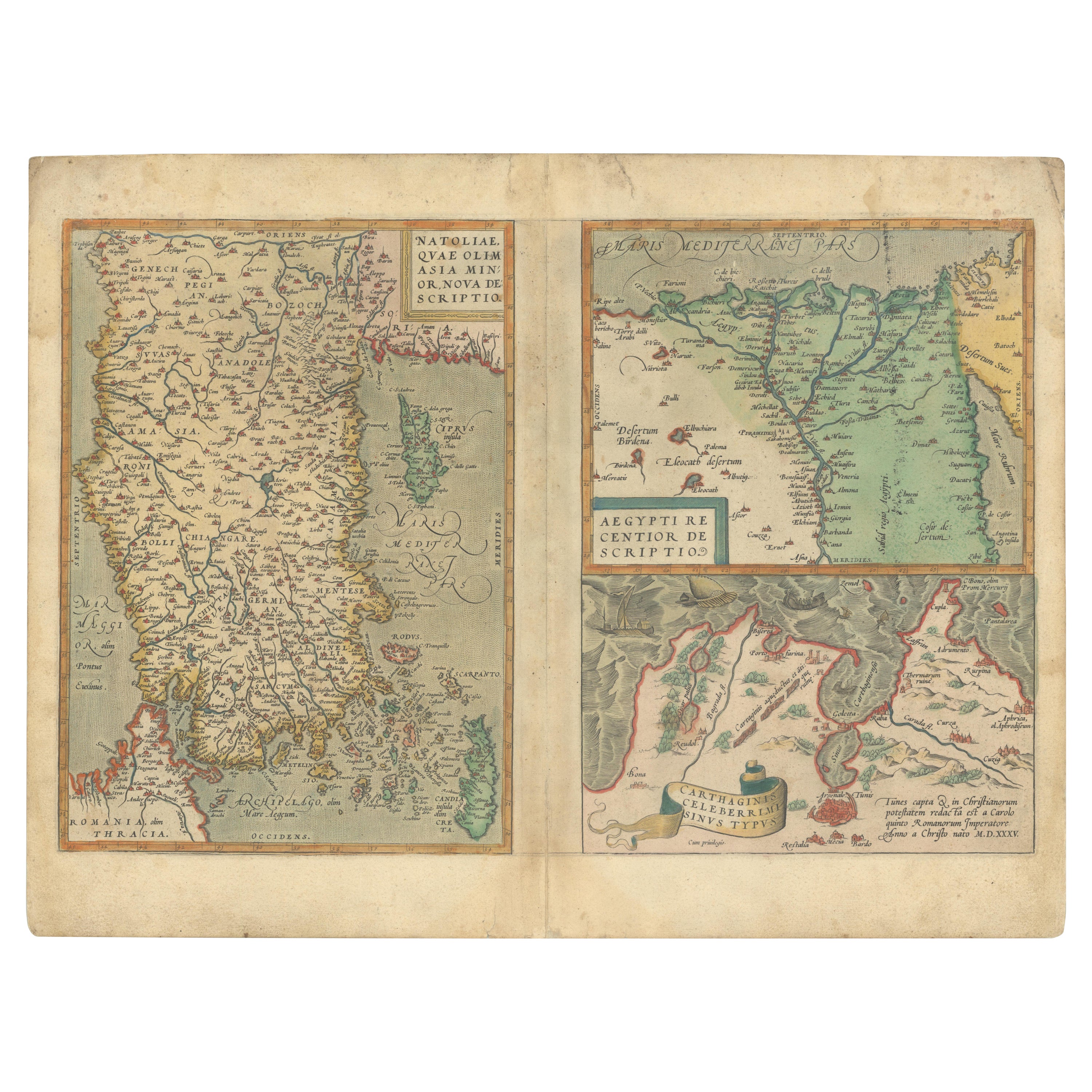
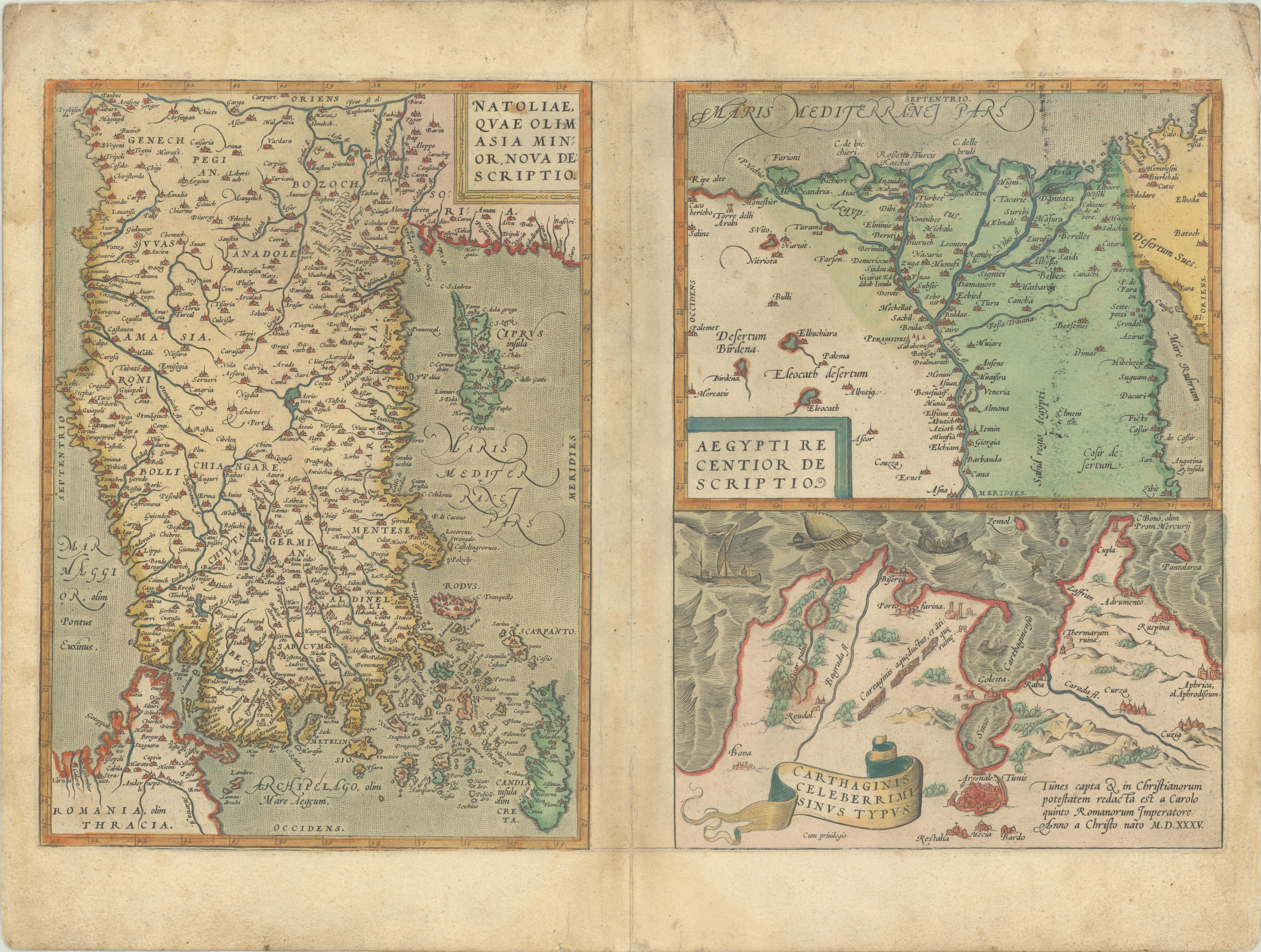
This rare and beautifully hand-colored map sheet originates from Abraham Ortelius’s groundbreaking atlas, Theatrum Orbis Terrarum, first published in 1570 and considered the first true modern atlas. Dated 1572, the sheet features three distinct maps, each reflecting Ortelius’s meticulous effort to bring together the classical world and contemporary cartographic knowledge.
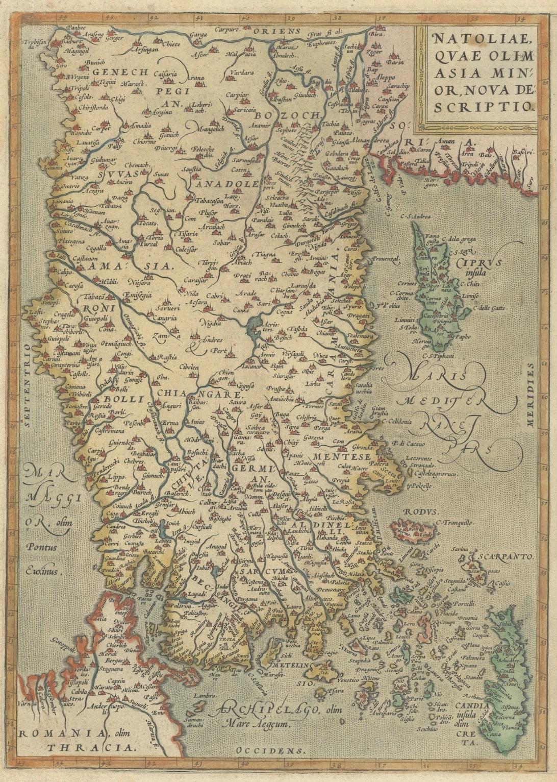
On the left is Natoliae, quae olim Asia Minor, a map of Asia Minor (modern-day Turkey), covering the regions of Lydia, Bithynia, Cappadocia, Cilicia, and surrounding territories. Place names recall both ancient geography and Ortelius’s Renaissance sources, bridging antiquity with the knowledge of his time. Coastal outlines, rivers, and mountain ranges are carefully depicted, with adjacent islands such as Rhodes and Cyprus included.
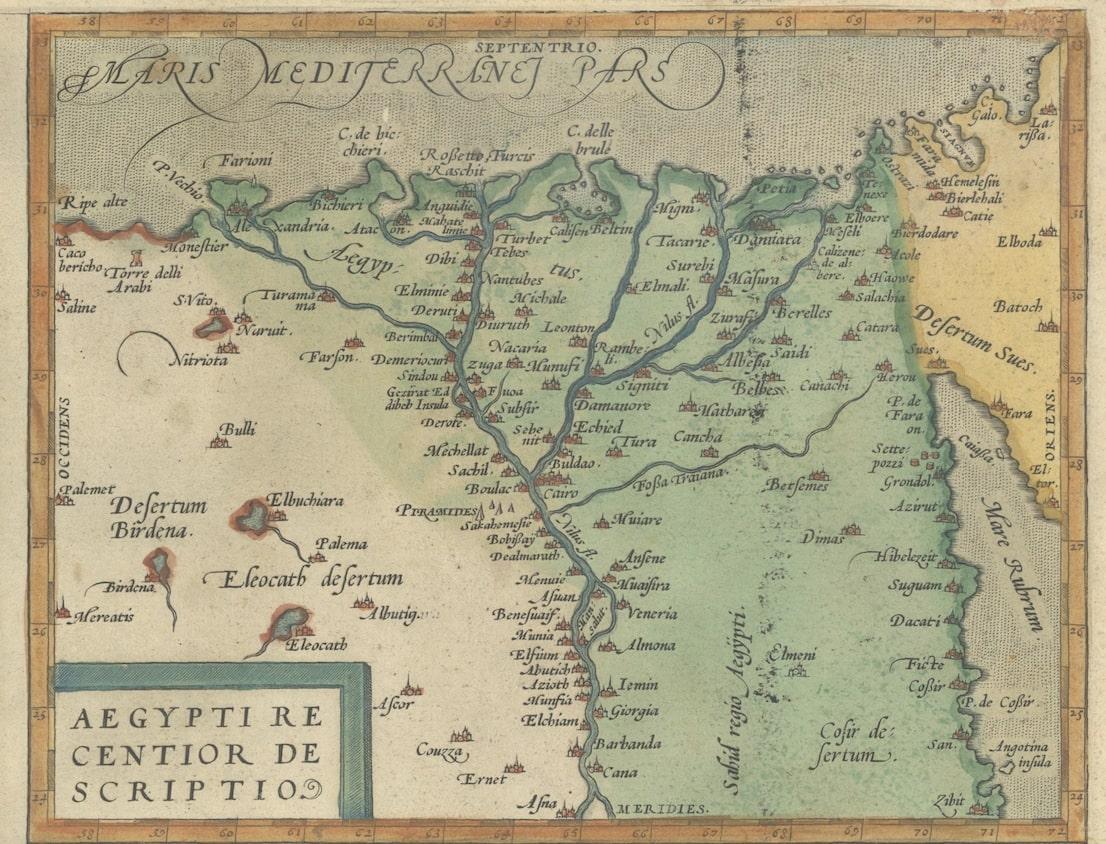
At the top right is Aegypti recentior descriptio, a detailed map of Egypt. The course of the Nile dominates the composition, extending from the Mediterranean coast deep into the interior. Numerous settlements along the river are shown, and the map reflects both classical references and Renaissance interest in the fertile land of the Nile.
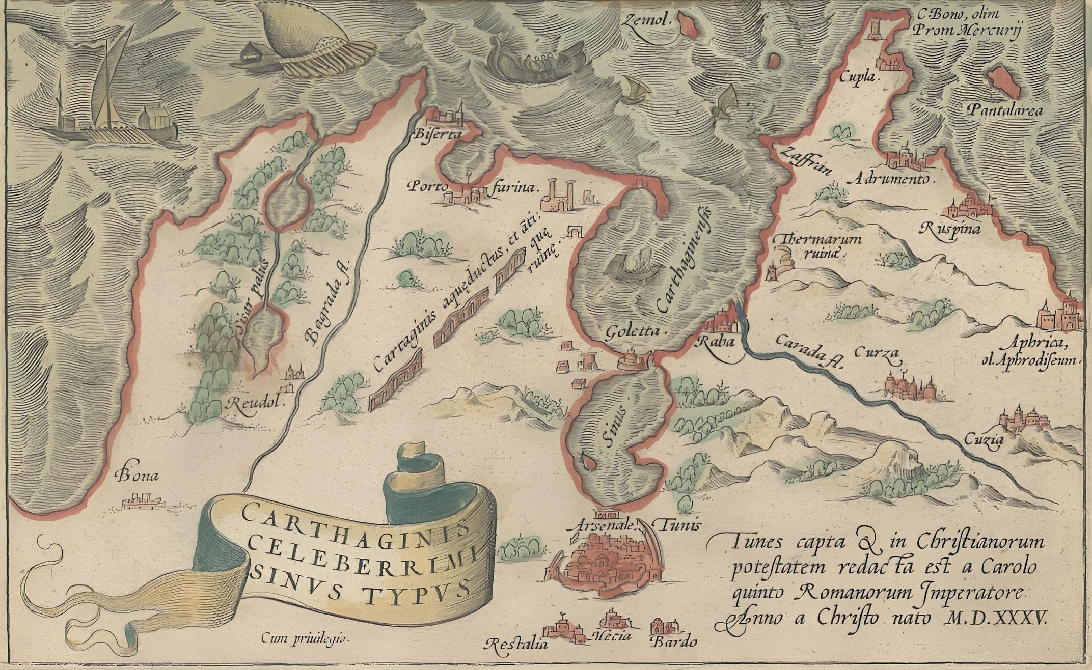
Below Egypt, the sheet includes *Carthaginis celeberrimi sinus typus*, an evocative map of the Bay of Tunis and the remains of ancient Carthage. Here Ortelius pays tribute to one of the most important sites of classical history, illustrating the harbor and surrounding coastal features.
Together, these three maps highlight Ortelius’s humanist approach to geography, where classical heritage and new discoveries met. The sheet was engraved by Frans Hogenberg, Ortelius’s main collaborator, whose crisp engraving and elegant lettering bring clarity and beauty to the maps. Early hand coloring, applied soon after publication, enhances the visual appeal with soft tones of green, ochre, and red.
Condition report: Good and authentic condition for a 16th-century map. Some toning and light foxing consistent with age. Minor centerfold reinforcement visible, as issued. The hand coloring is well-preserved. Wide margins remain intact. Plate marks clearly visible around the maps.
Framing tips: This map sheet would benefit from a dark wood or walnut frame with a cream or light beige mat to balance the warm hand coloring. A double mat with a subtle green inner border would enhance the river and coastal tones, creating a distinguished presentation.
Technique: Copperplate engraving with original hand color
Maker: Abraham Ortelius, Antwerp, 1572