About this sheet
Carte de la Terre de Canaan ou Terre Promise
Cartographer: Le St. Robert
Date of Publication: 1750
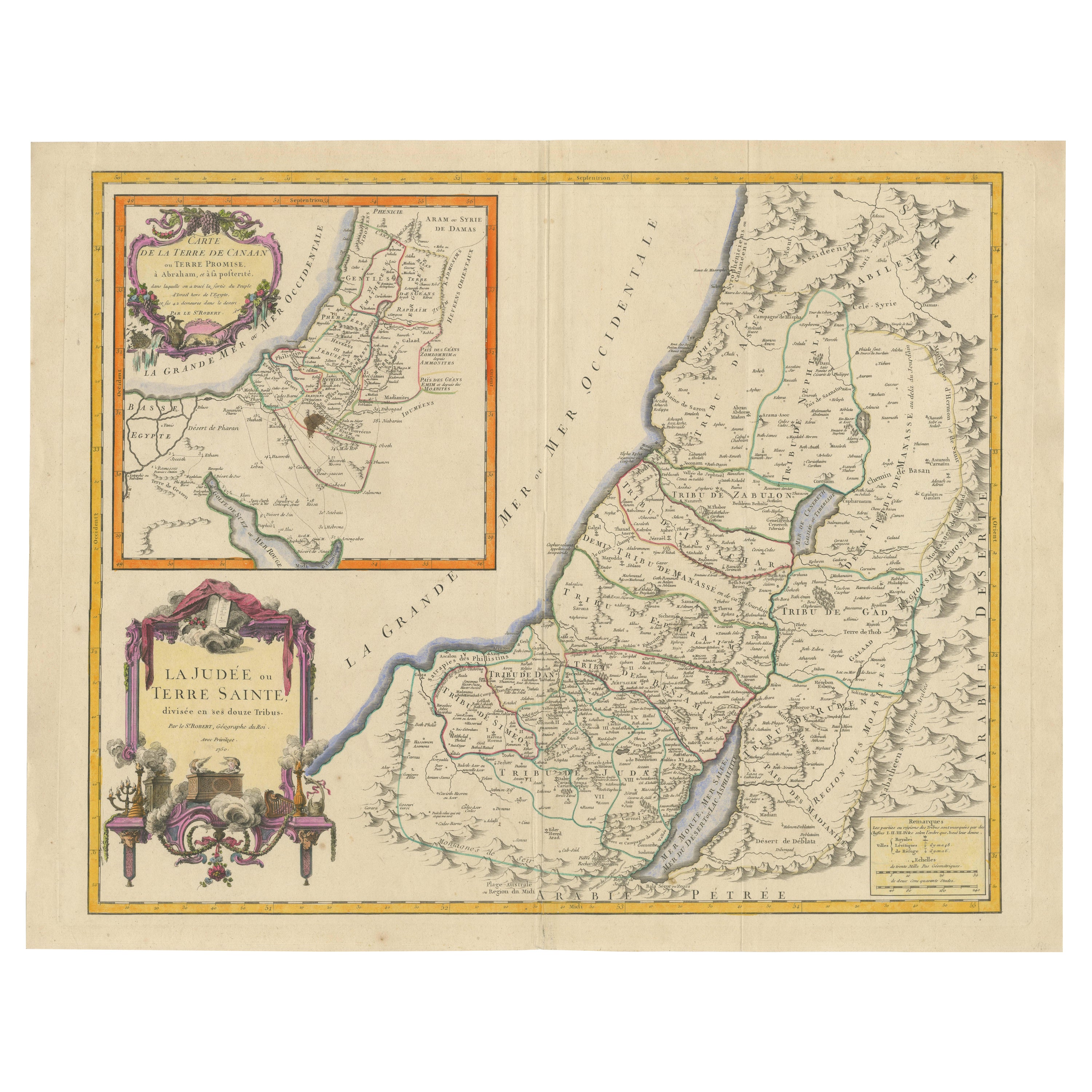
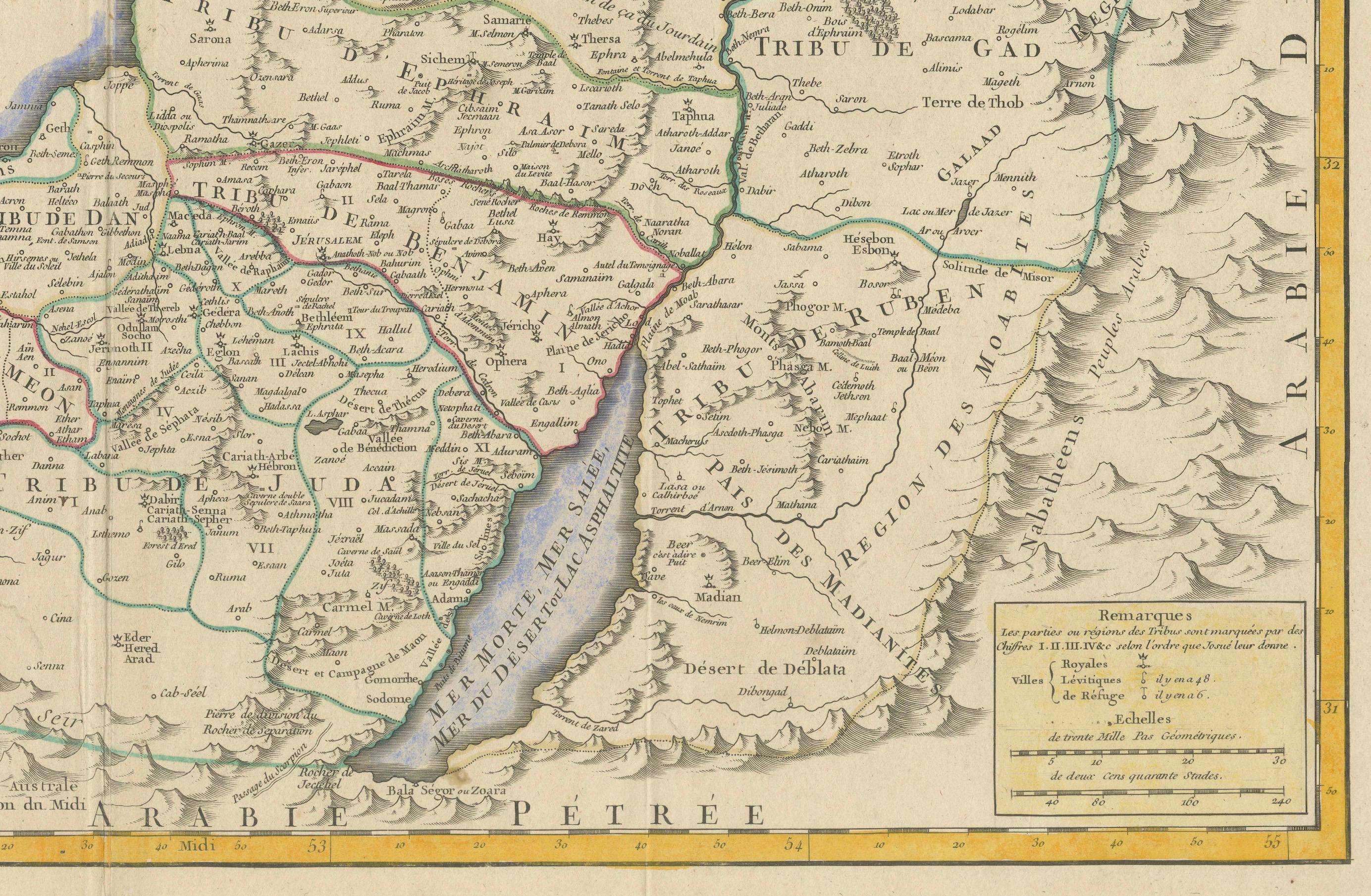
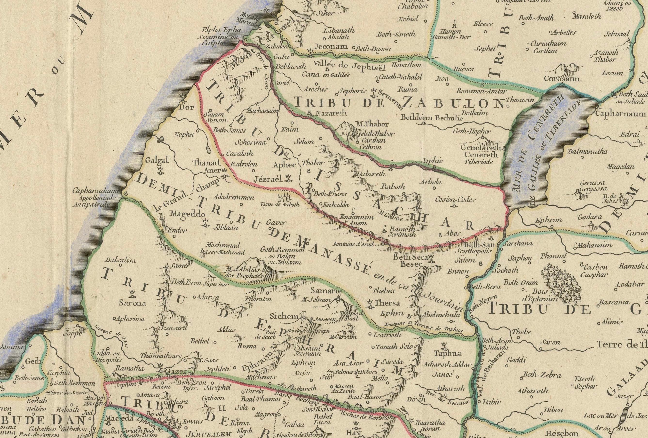
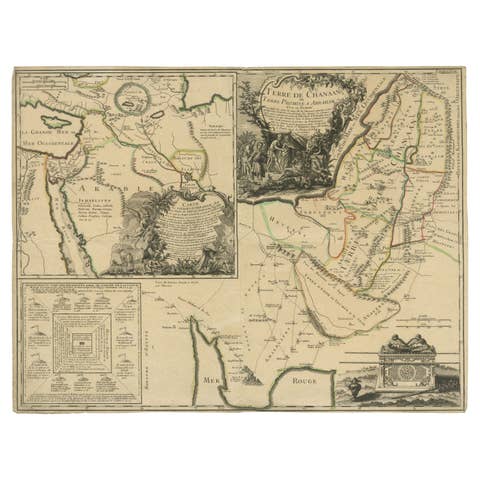
This exquisite 18th-century map, 'Carte de la Terre de Canaan ou Terre Promise', was published by Le St. Robert in 1750 and vividly illustrates the geography of the Holy Land as described in the Bible. The map meticulously outlines the divisions of the Twelve Tribes of Israel, with clear delineations and beautifully colored boundaries. The geographic layout includes the Mediterranean coastline, the Jordan River, the Sea of Galilee, and the Dead Sea, alongside various significant biblical sites.
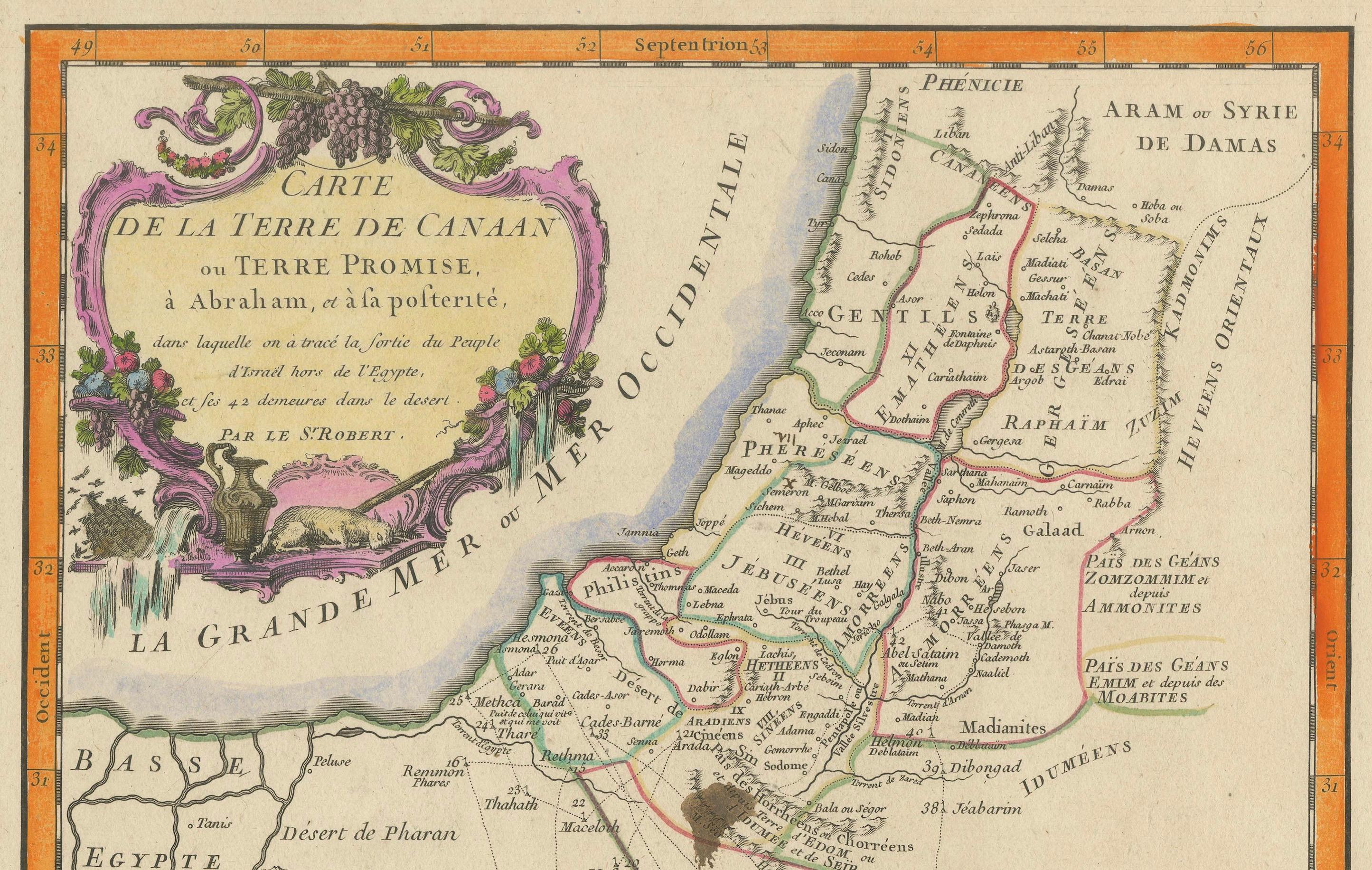
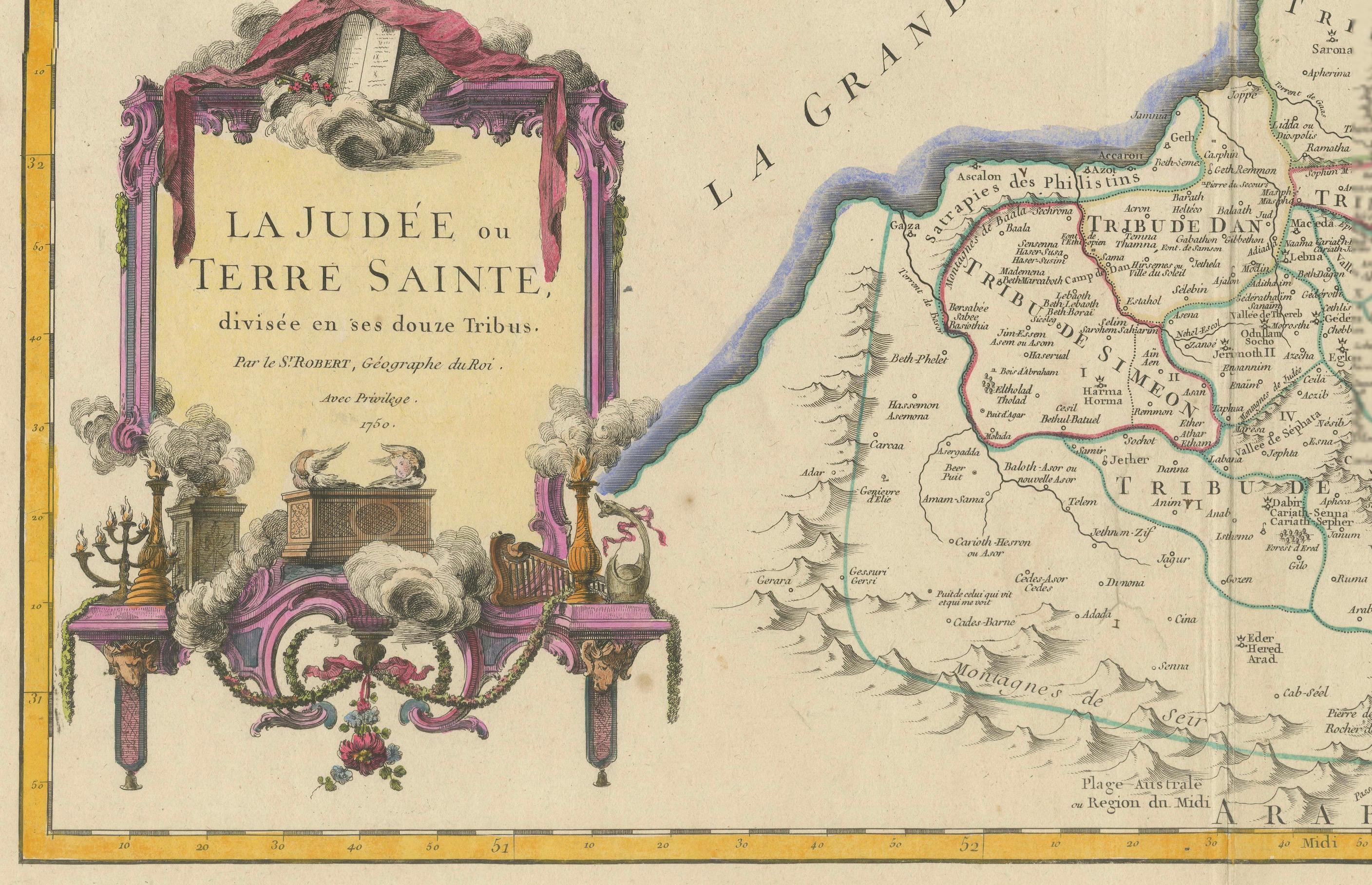
The decorative cartouches are striking features of this map. The title cartouche in the bottom left corner is richly ornamented with religious motifs, including an altar with smoke rising and symbols of Judaic heritage, such as the menorah and Torah scrolls, reflecting the spiritual significance of the region. An inset map in the upper left corner titled 'Carte de la Terre de Canaan ou Terre Proche' provides additional context, showing a wider geographical area, including Egypt and surrounding territories.
Key Features:
- Detailed divisions of the Twelve Tribes of Israel.
- Decorative hand-colored borders highlighting tribal regions.
- Artistic cartouches with Judaic and biblical symbolism.
- Inset map offering a broader regional perspective.
- Text in French, typical of maps from this period.
This map is an excellent addition to any collection of biblical, cartographic, or 18th-century historical artifacts. It offers a unique perspective on how biblical geography was interpreted and represented during the Enlightenment.
---
Analysis/Background Information:
This map is a fine example of 18th-century cartography, where artistic design met geographic accuracy and historical interpretation. During this period, maps of the Holy Land were highly sought after, especially in Christian Europe, due to the deep interest in biblical scholarship and exploration of the Levant.
Le St. Robert’s map reflects the prevailing Enlightenment-era focus on synthesizing biblical narratives with geographic realities. The division of the Twelve Tribes of Israel was a common theme in Holy Land maps, aiming to provide a visual aid to readers and scholars interpreting biblical texts. Such maps were often used in religious and educational contexts, allowing audiences to visualize the geography described in sacred scripture.
The inset map in the top left corner broadens the scope to include Egypt and neighboring regions, underscoring the historical and religious ties between these areas. This addition suggests an awareness of the broader narrative of the Exodus and its importance to biblical geography.
The decorative cartouches are quintessential of 18th-century French maps, where artistic expression played a significant role. The inclusion of Judaic symbols such as the menorah, Torah, and sacrificial altar highlights the cultural and spiritual importance of the region. The map was likely intended for an educated European audience interested in religious history, biblical cartography, or travel.
The French text aligns with the dominance of France in cartography during this era, with French mapmakers like Le St. Robert contributing to the rich tradition of geographical representation. This map not only served as a geographic tool but also as a decorative and intellectual artifact, embodying the cultural fascination with the Holy Land during the 18th century.
Key areas and places:
1. The Twelve Tribes of Israel
The map prominently displays the divisions of the Twelve Tribes, such as Judah, Benjamin, Ephraim, and others, which are essential for biblical and historical significance.
2. Jerusalem
A central and highly significant city in biblical history, Jerusalem is likely highlighted, making it a focal point for collectors.
3. The Jordan River
This iconic river, connecting the Sea of Galilee to the Dead Sea, holds strong religious and geographical importance.
4. The Sea of Galilee
Associated with many events from the New Testament, this lake is a key feature for those interested in biblical geography.
5. The Dead Sea
Known for its unique characteristics and biblical associations, such as the story of Sodom and Gomorrah, the Dead Sea is a major feature on maps of the Holy Land.
6. Famous Biblical Cities
Locations such as Bethlehem, Nazareth, Jericho, and Hebron are commonly featured on maps of the Holy Land and are significant for religious and historical contexts.
7. The Mediterranean Coastline
This includes ancient ports like Jaffa and Tyre, important for trade and mentioned in biblical stories.
8. Mountains and Geographical Features
Key landmarks such as Mount Carmel or Mount Nebo may be illustrated, reflecting their roles in biblical narratives.
9. Neighboring Territories
Areas like Egypt, Edom, and Moab often appear on Holy Land maps, drawing the interest of those studying biblical or regional history.
10...