About this sheet
Antique Map of Western Tartary & Mongolia – Bellin, 1749
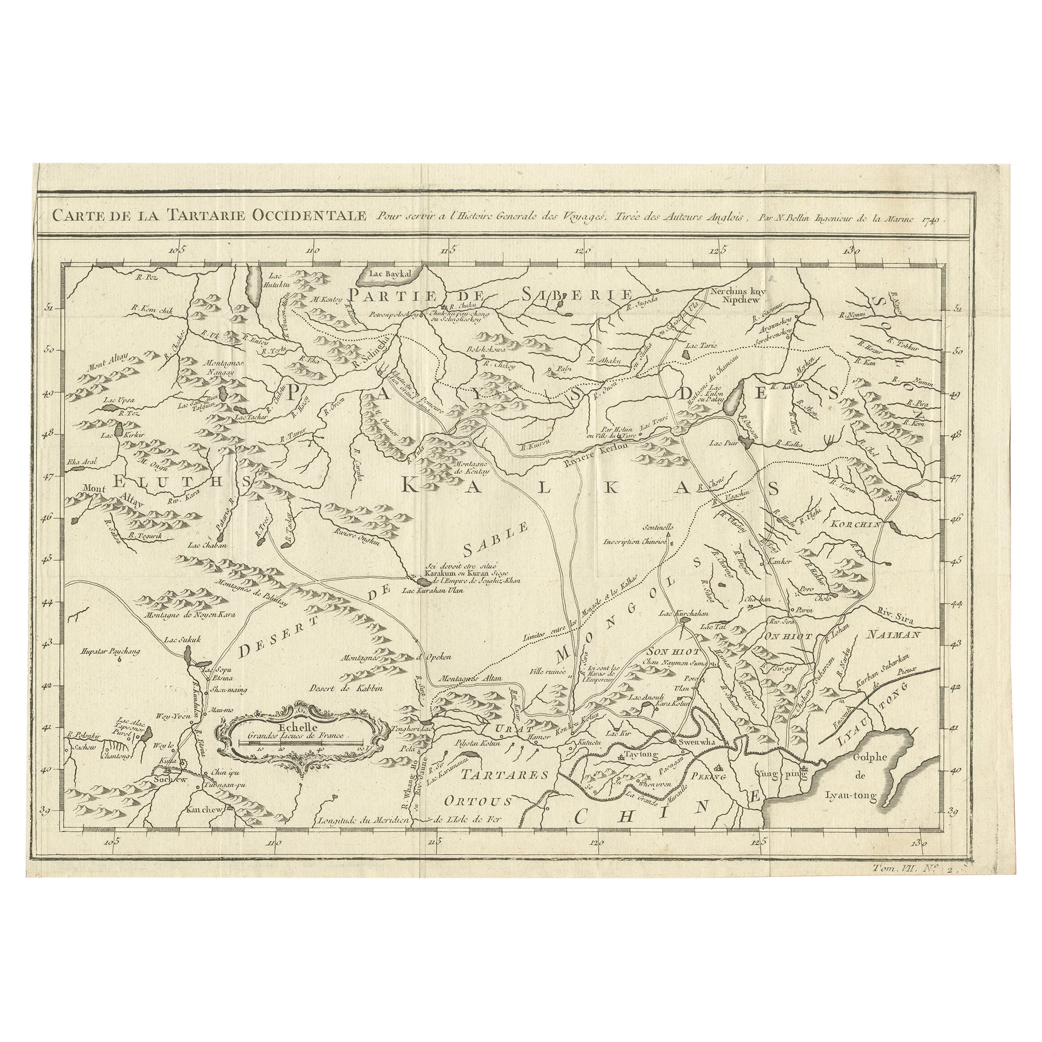
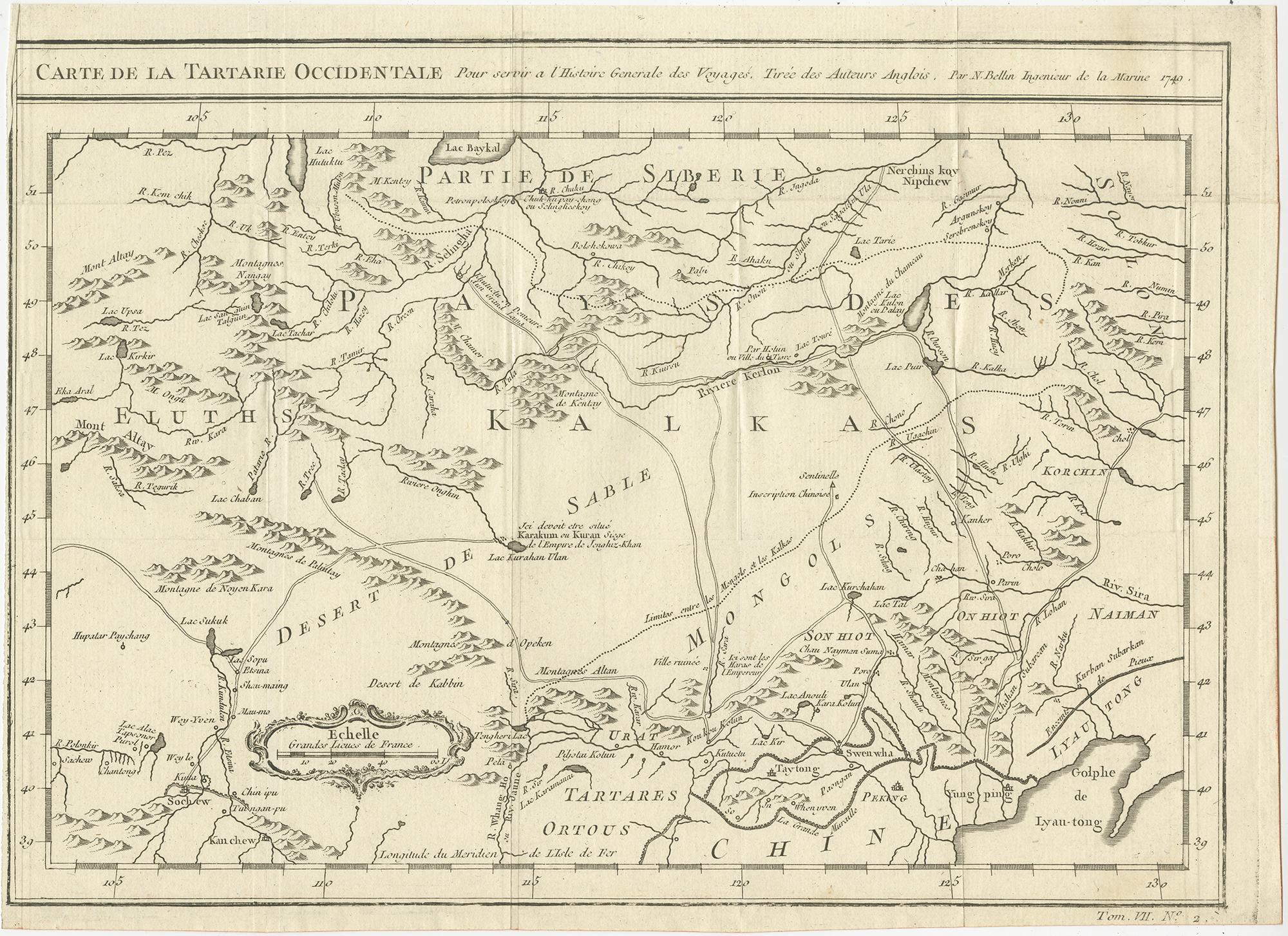
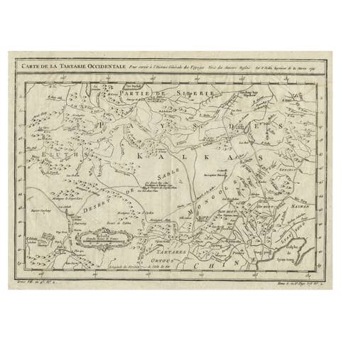
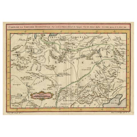
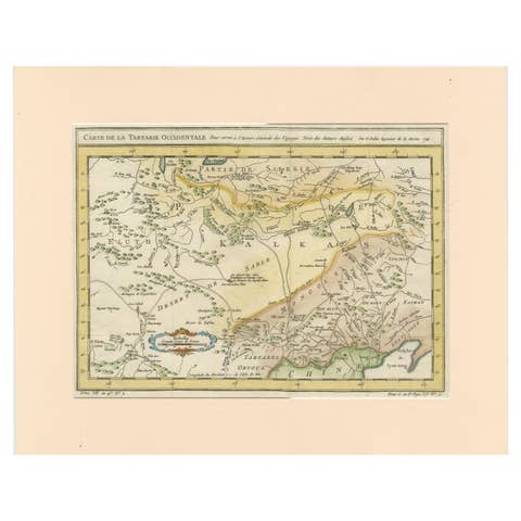
Antique engraved map titled “Carte de la Tartarie Occidentale,” depicting Western Tartary with a strong focus on the regions corresponding largely to present-day Mongolia and adjacent parts of Central and East Asia. The map extends across southern Siberia, Mongolia, northern China, and neighboring territories, presenting a dense network of rivers, mountain ranges, deserts, and regional divisions as understood in the mid-eighteenth century.
A notable feature of this map is its reliance on multiple high-quality sources, including the important surveys of Kyrkov, supplemented by Jesuit missionary reports and English geographic accounts. This synthesis of sources reflects contemporary European efforts to consolidate and verify geographic knowledge of Inner Asia, a region that remained difficult to access and only partially explored by Western travelers.
The map includes detailed indications of roads and routes across Tartary and Mongolia, emphasizing the region’s role as a corridor between China, Siberia, and Central Asia. Sections of the Great Wall of China are clearly shown, underscoring its significance as a political and geographic boundary in European cartographic thought. The careful engraving of terrain and hydrography demonstrates Bellin’s scientific approach and his commitment to clarity and accuracy.
This map was produced by Jacques-Nicolas Bellin, one of the most influential cartographers of the eighteenth century. Bellin served as Hydrographer to the French Navy and later as the first Ingénieur de la Marine at the Dépôt des cartes et plans de la Marine. His maps formed the cartographic foundation of many Enlightenment-era publications and are prized for their precision, restrained design, and scholarly authority.
Published in 1749, this sheet represents an important example of early European mapping of Mongolia and Western Tartary, capturing a moment when geographic knowledge of Inner Asia was rapidly expanding through exploration, diplomacy, and missionary activity.
A historically significant and visually compelling map, well suited to collectors of Asian cartography, Silk Road history, and eighteenth-century French engraving, as well as to interior settings seeking an intellectual and global statement piece.
Condition
Good original condition with light age-related toning and minor handling wear consistent with mid-eighteenth-century engraved maps. Central fold as issued. No later coloring or restoration observed.
Framing tips
This map frames attractively in a dark walnut or ebonized frame with a wide ivory or soft off-white mat. The detailed interior geography benefits from generous margins and museum glass to preserve the fine engraved lines and paper tone.
Technique: Engraving
Maker: Jacques-Nicolas Bellin, France, 1749