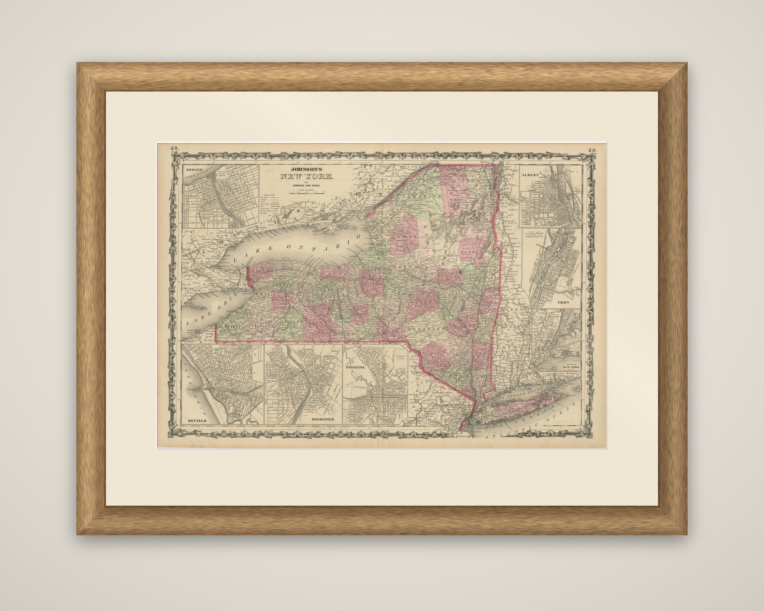
1864 Johnson's Map of New York State with City Insets
€ 280
Original antique · The actual sheet photographed · Certificate of authenticity on request · Sold unframed · Worldwide shipping from € 15 (rates)
Date
1864
Sheet size
43.5 × 68 cm (17.1 × 26.8 in)
Condition
Good
Reference
BG-13952-3
What the condition grades mean
Excellent
Bright and clean, with no faults worth mentioning.
Very good
Only light signs of age, such as faint toning.
Good
Normal signs of age for a sheet of this period: toning, some foxing, small marks or neat old repairs.
Fair
Clear faults such as staining, tears or repairs, priced to match.
Every fault we see is written in the condition note, and the whole sheet is shown uncropped in the photos.
Condition
Good condition, considering age, with some yellowing that is typical of maps from this period. Some soiling and small tears along the edges, due to handling. Study the images carefully.
About this sheet
Johnson's New York, an original steel-engraved map of the state published by Johnson and Ward in 1864 as a plate in Johnson's atlas, with outline and wash color by county. The title block at the upper left reads "Johnson's New York by Johnson and Ward," with the plate numbers 27 and 28 printed in the upper corners.
The sheet shows the whole state from Lake Erie and Lake Ontario to Long Island, with the counties in pink and green, the state boundary in a heavier red line, and railroads and county seats marked throughout. Six city plans are set in the margins: Oswego at the upper left, Albany and Troy at the right, a view of the New York City area at the lower right, and Buffalo, Rochester and Syracuse in a row along the bottom edge. Each is a small street plan that shows the river, canal or lake frontage that shaped the place. The sheet is surrounded by the vine-and-scroll decorative border that marks the Johnson atlas of these years.
The cities chosen for the insets are the main stops along the Erie Canal and the Hudson, the line of towns on which the state's growth depended.