Maps & PrintsBartele Gallery · Langweer
Home / Antique Maps / Europe / Western Europe / Germany

Germany

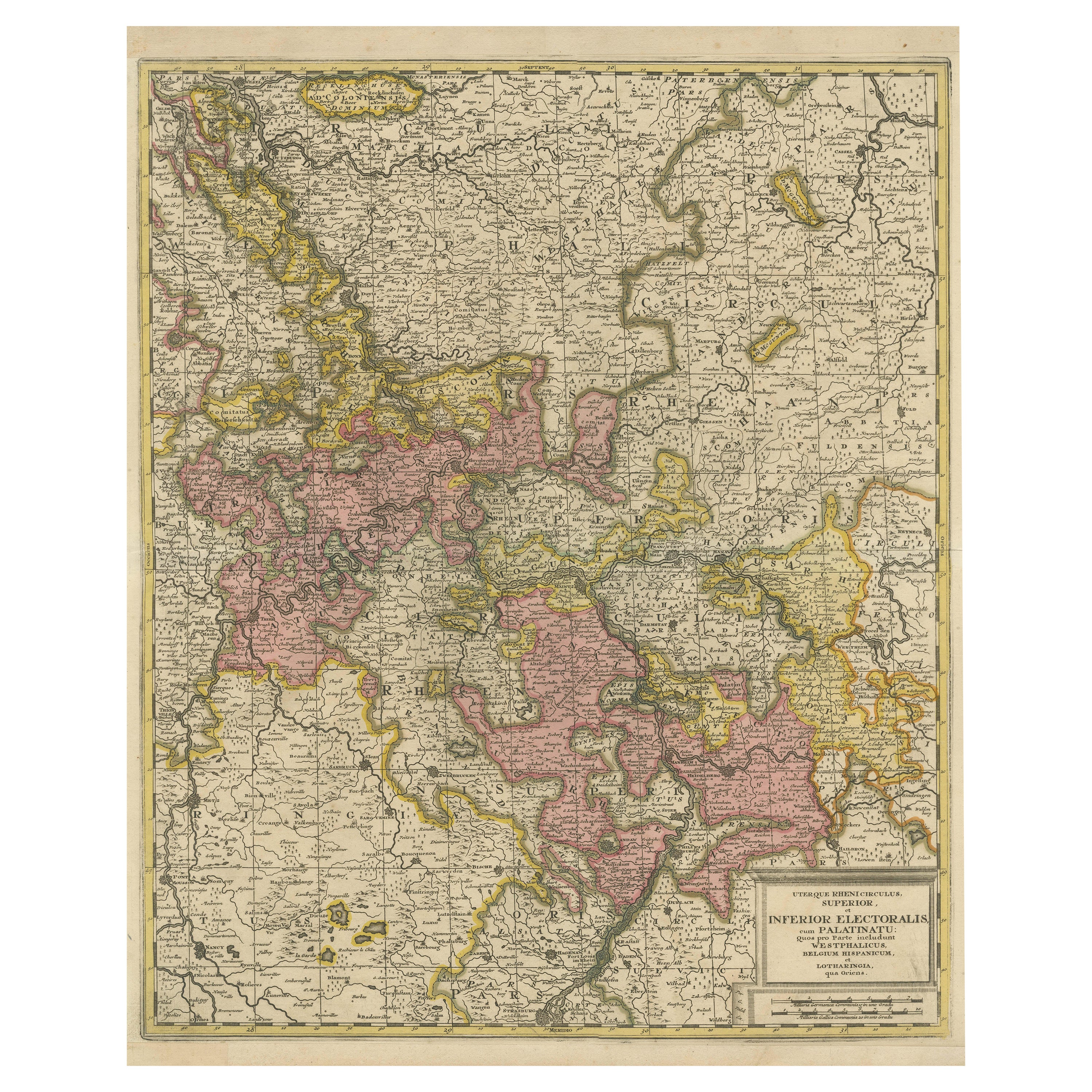

Antique Map of the Area centered on the Rhine River with original coloring

€ 590

One of a kind: this is the sheet in the photographs. Ships from Langweer, the Netherlands.

Sheet size
63 × 51.5 cm (24.8 × 20.3 in)
Condition
Fair
Reference
BG-13442-10

Condition


Repaired: Upper and bottom margin extended. Three closed tears along old outline coloring, nearly invisible. Original/contemporary hand coloring. Original folding line. Upper and bottom margin extended. Three closed tears along old outline coloring, nearly invisible. Blank verso. Please study im


About this sheet

Antique map titled 'Uterque Rheni Circulus Superior (..)'. Fine old color map of the area centered on the Rhine River, from Strassbourg to Wesel and Duisburg, Germany. The map also covers a large stretch of the Moselle River (from Nancy to Coblentz) and the Main River, from Lohr am Main to Mainz.

Published by Gerard Valk, circa 1700. Valk’s maps are known for their high quality engraving and coloring.

More from Germany

Ask about this sheet

Antique Map of the Area centered on the Rhine River with original coloring
Ref. BG-13442-10 · € 590
We reply by email, usually within one working day.





