About this sheet
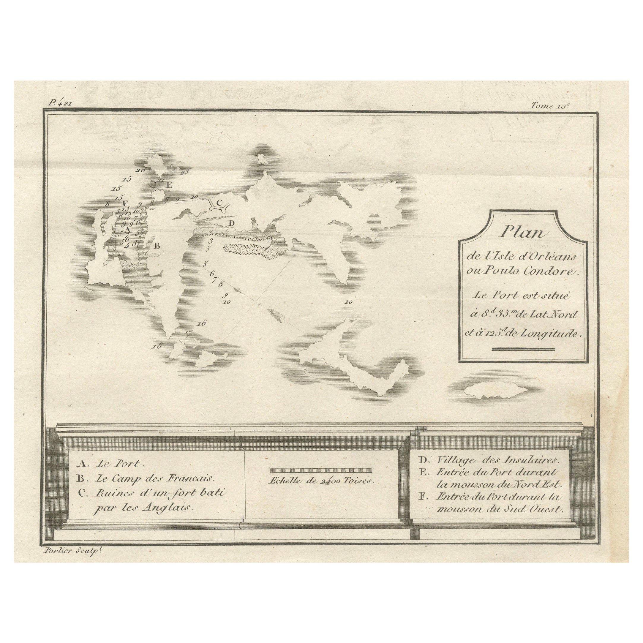
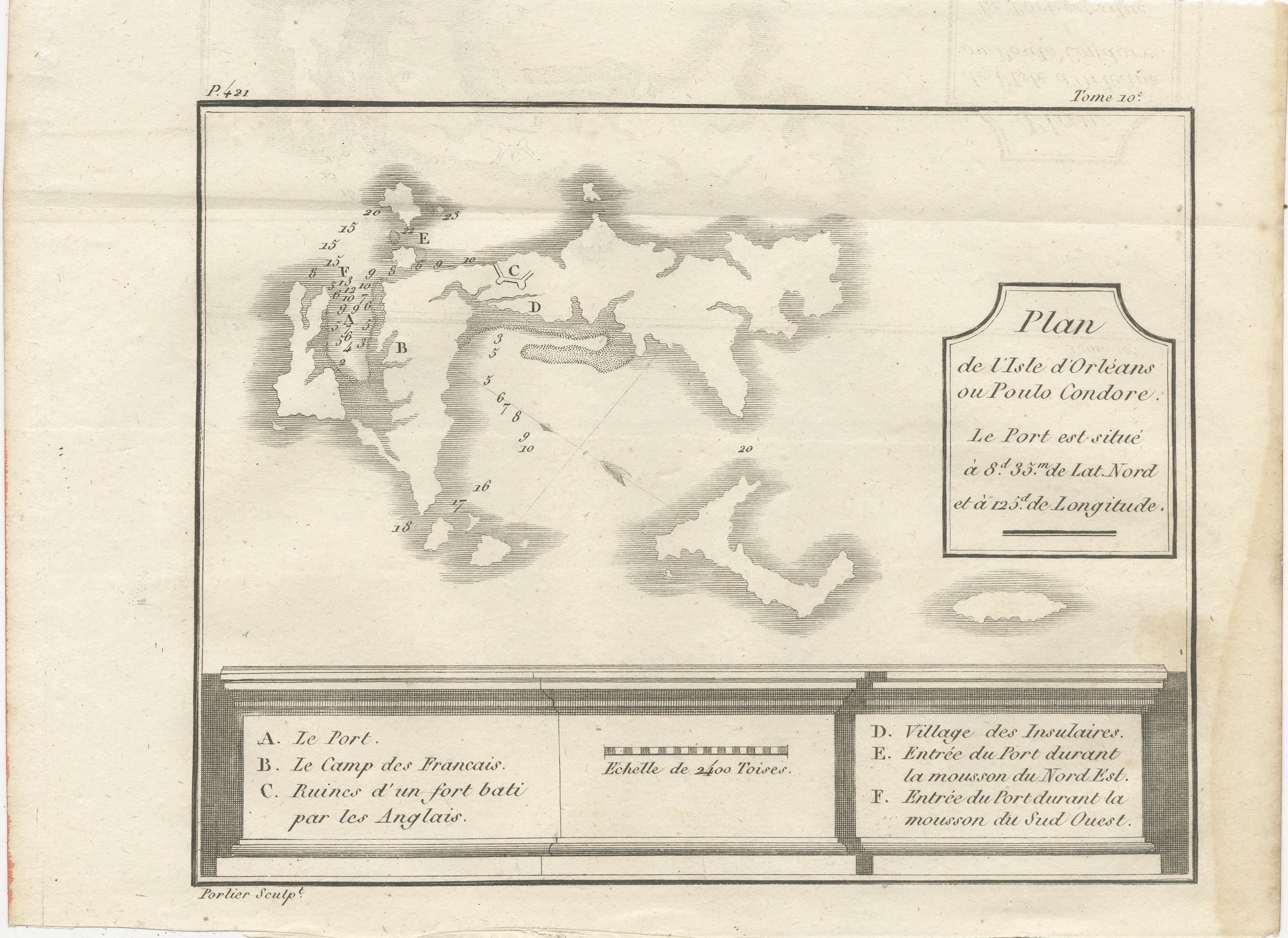
Plan of Poulo Condore (Côn Sơn Island) – Antique French Engraving by Portier, c.1790
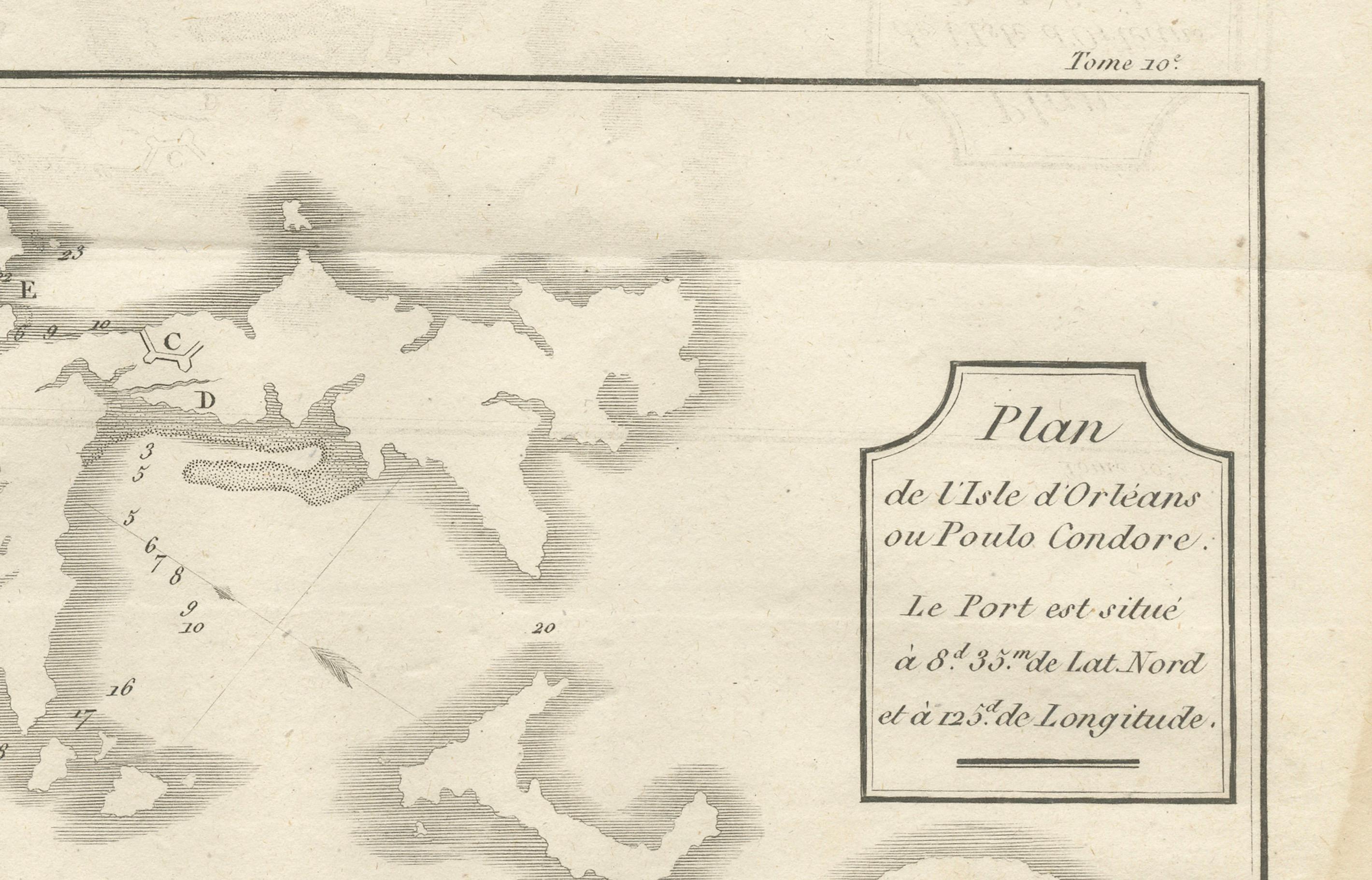
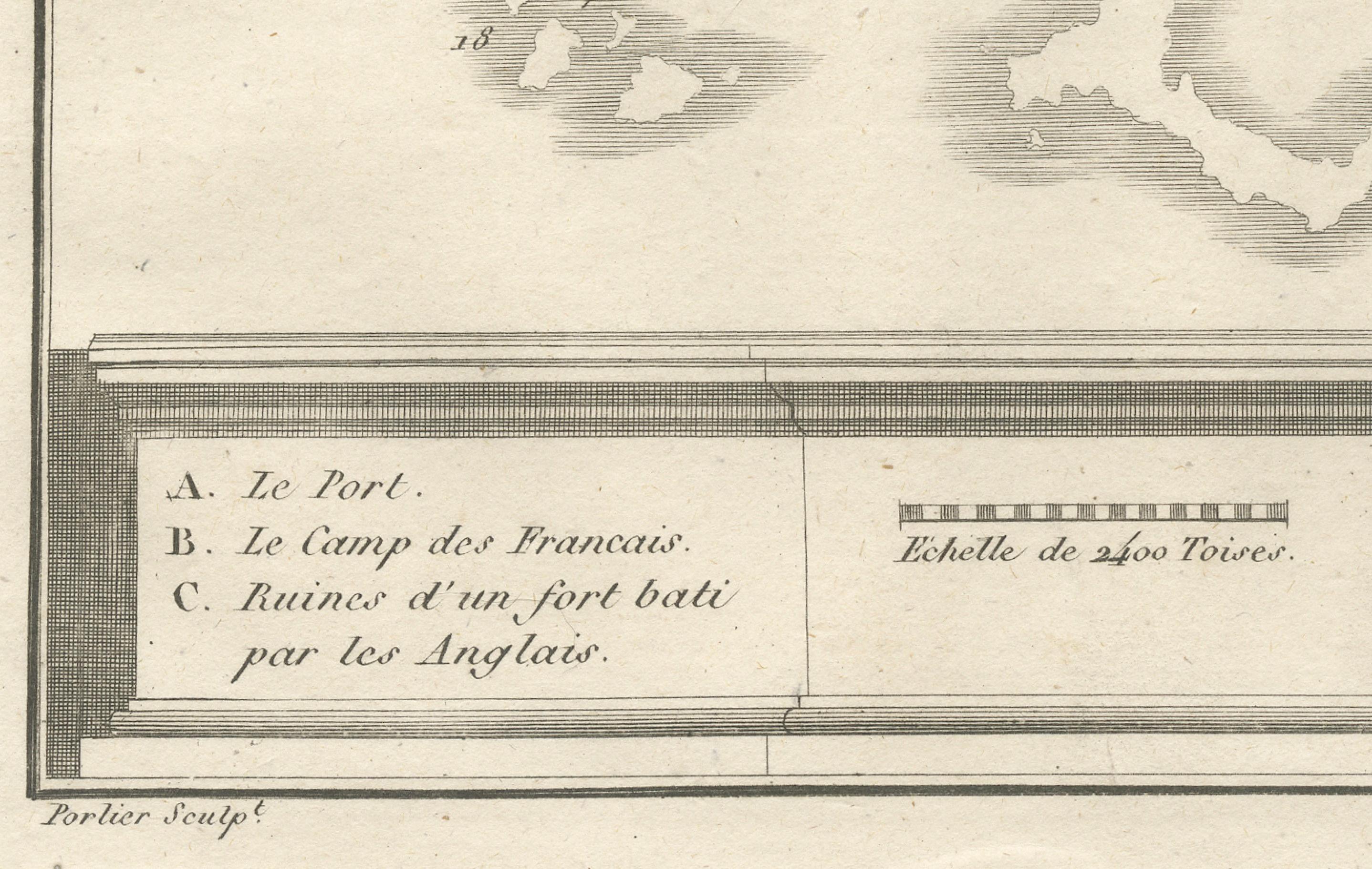
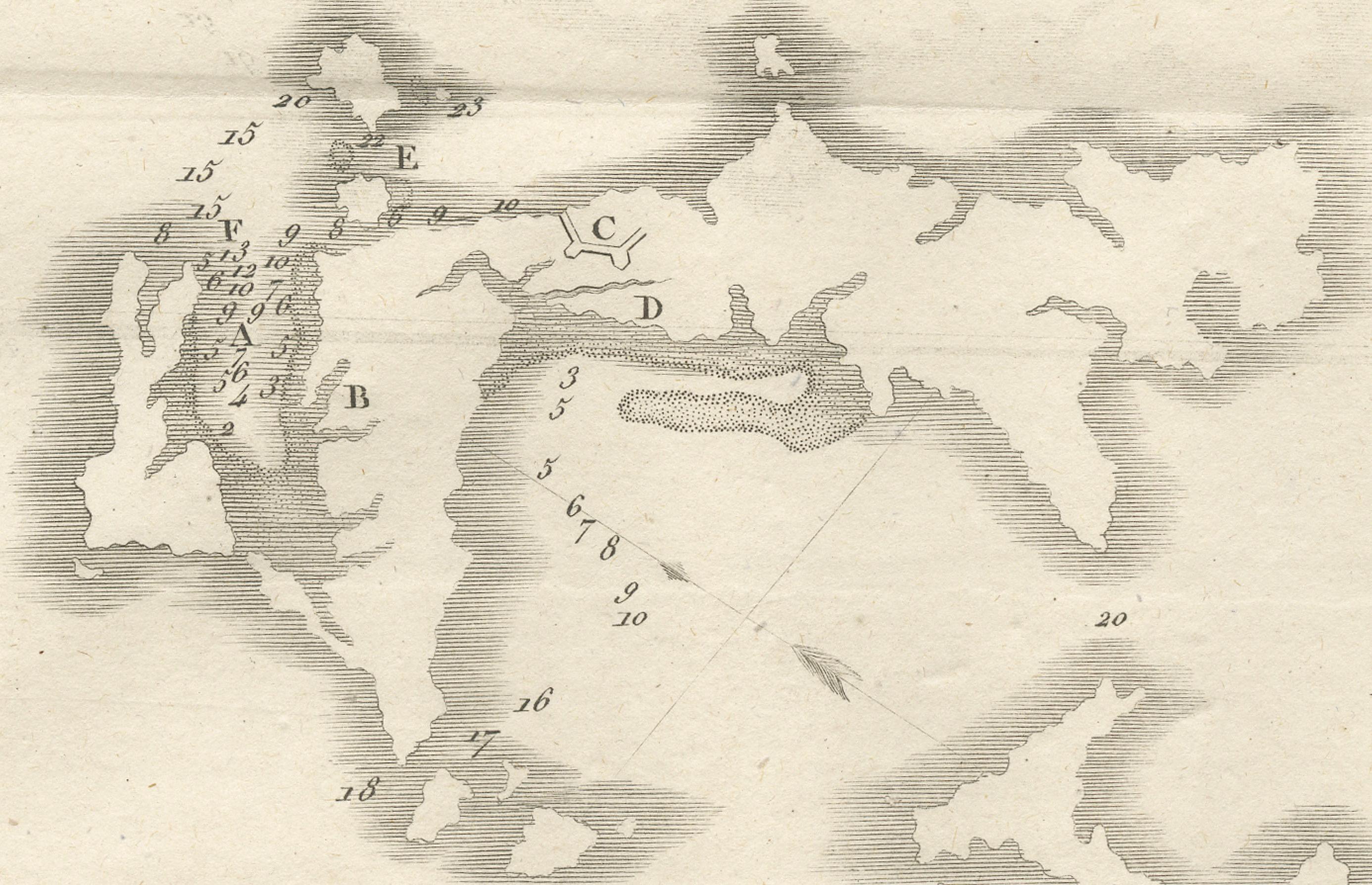
This antique French engraving, created by Portier around 1790, presents a detailed plan of Poulo Condore, now known as Côn Sơn Island in Vietnam’s Côn Đảo archipelago. The title reads “Plan de l’Isle d’Orléans ou Poulo Condore,” and the map specifies the port’s coordinates at 8°43′ N latitude and 13° E longitude (Paris meridian).
The plan includes both natural and man-made features, labeled with letters corresponding to the key at the bottom:
A – The Port
B – The French Camp
C – Ruins of a fort built by the English
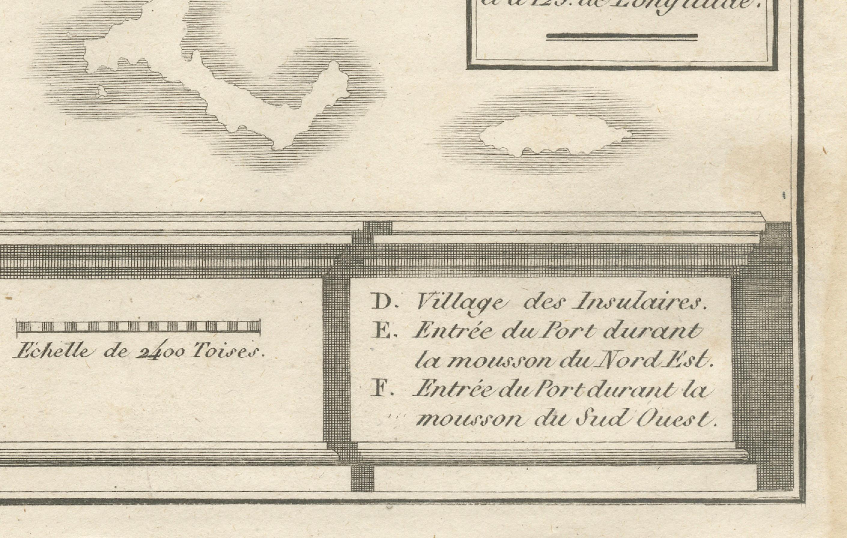
D – Village of the Islanders
E – Port entrance during the northeast monsoon
F – Port entrance during the southwest monsoon
The engraving’s coastal outline is finely rendered, with soundings indicated by numbers in the harbor and approaches. The depiction of seasonal port entrances reflects the island’s strategic maritime role and the navigational challenges presented by monsoonal winds in the South China Sea.
Poulo Condore has a long and complex history as a trading outpost, penal colony, and strategic anchorage. In the 18th century, it attracted European powers, including the French and English, for its position along major sea routes between India, China, and Southeast Asia. The ruined English fort noted here is a reminder of the island’s contested colonial past.
This engraving was likely published in a French geographical or missionary work documenting Asian maritime territories, contributing to Enlightenment-era European knowledge of the region.
Condition report: Very good condition with a clear plate mark and strong impression. Minor toning and faint foxing in the margins. Central fold as issued. Paper is stable and well-preserved.
Framing tips: Best presented in a slim black or dark brown frame with a cream archival mat. A double mat with a fine blue-grey inner line could complement the maritime theme.
Technique: Engraving
Maker: Portier, France, c.1790