Maps & PrintsBartele Gallery · Langweer
Home / Antique Maps / Asia / South-East Asia / East Indies

East Indies · 18th century

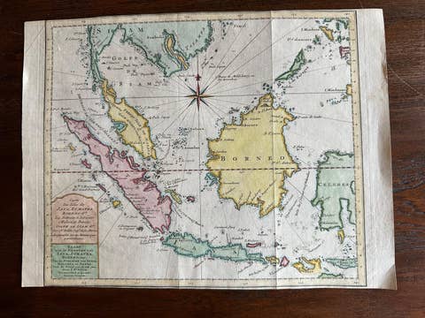
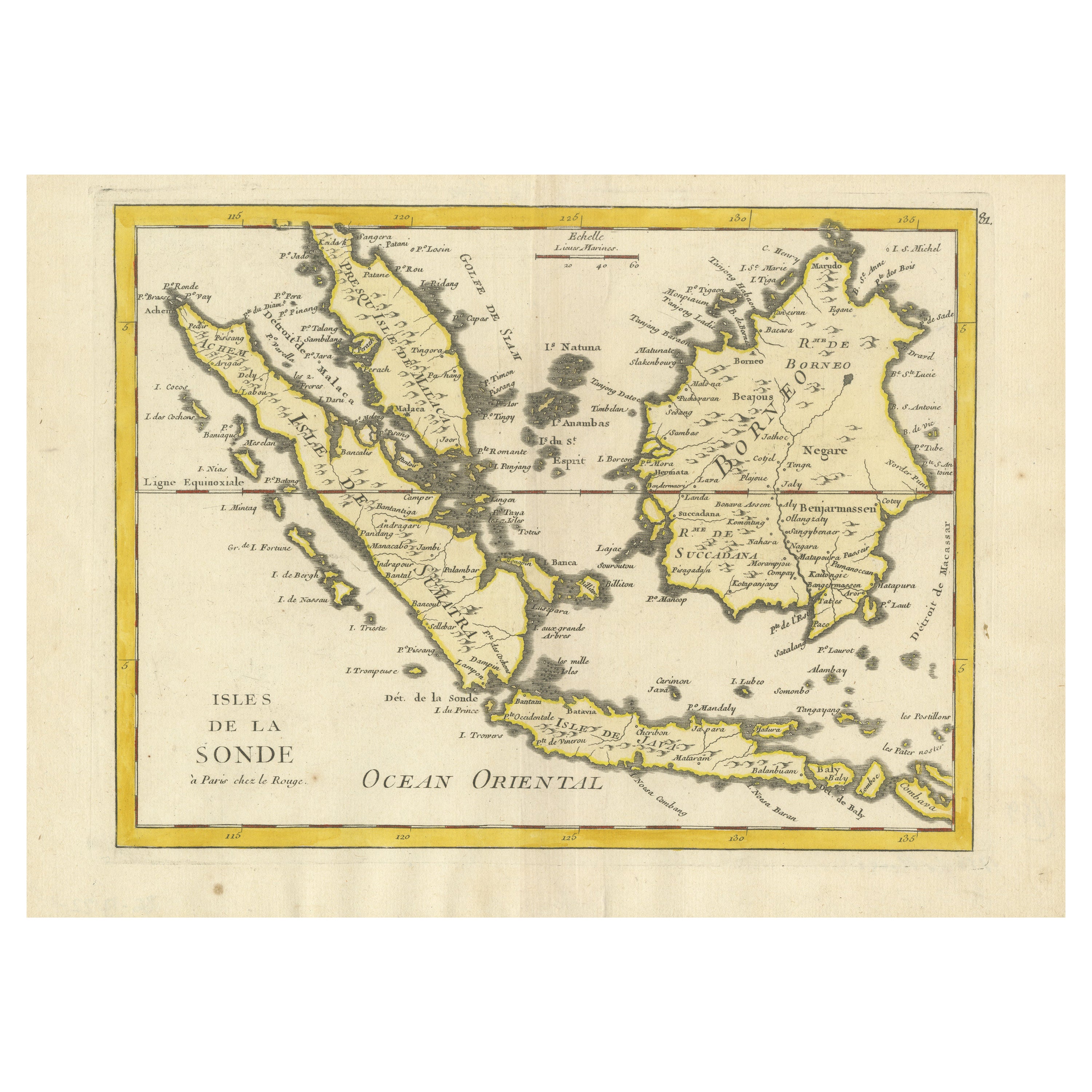
Old Original Antique Map of the Sunda Islands of Indonesia, 1756

€ 550

One of a kind: this is the sheet in the photographs. Ships from Langweer, the Netherlands.

Date
1756
Sheet size
24.5 × 35 cm (9.6 × 13.8 in)
Condition
Excellent
Reference
BG-13122-1

Condition

fine engraving, fold as published, light marginal soiling.
About this sheet

Attractive old decorative map of the Isles de la Sonde, Borneo, Sumatra, Java and Malacca ( Malaysia) with the Straits of Malacca. Penang is spelled as Perach, Johor as Joor. Bali and Lombok are also on it. This map of West Indonesia is from a period when it was colonised by the Dutch, when capital Jakarta was still named Batavia.

Condition: Excellent fine engraving, fold as published, light marginal soiling.
More from East Indies

Ask about this sheet

Old Original Antique Map of the Sunda Islands of Indonesia, 1756
1756 · Ref. BG-13122-1 · € 550
We reply by email, usually within one working day.