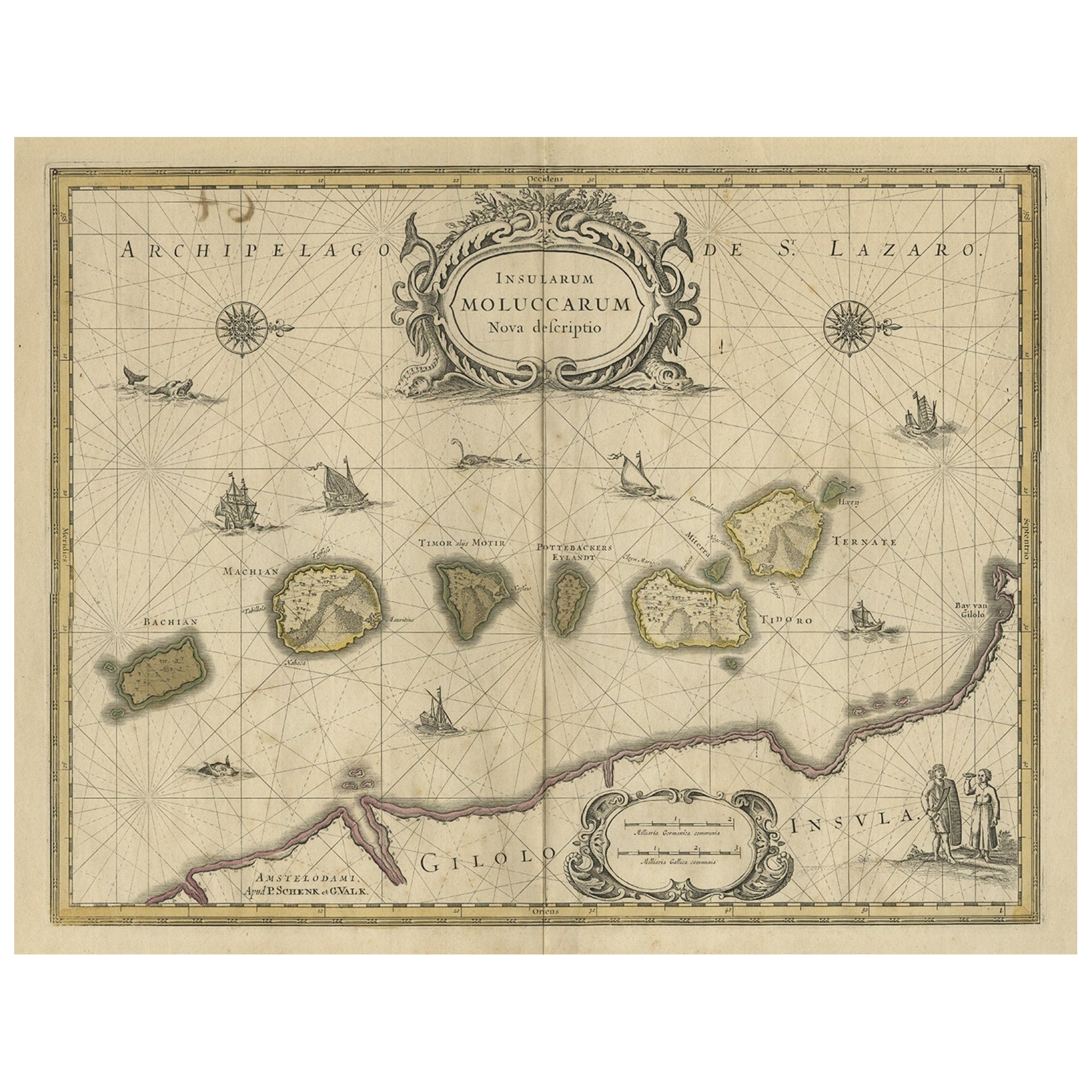
Old Map of the Moluccas, Known as the Famous Spice Islands, Indonesia, ca.1730
€ 690
Original antique · The actual sheet photographed · Certificate of authenticity on request · Sold unframed · Worldwide shipping from € 15 (rates)
Date
1730
Sheet size
44 × 58.4 cm (17.3 × 23.0 in)
Condition
Fair
Reference
PCT-57998
What the condition grades mean
Excellent
Bright and clean, with no faults worth mentioning.
Very good
Only light signs of age, such as faint toning.
Good
Normal signs of age for a sheet of this period: toning, some foxing, small marks or neat old repairs.
Fair
Clear faults such as staining, tears or repairs, priced to match.
Every fault we see is written in the condition note, and the whole sheet is shown uncropped in the photos.
Condition
Given age. Original/contemporaryhand coloring. Small repaired tear bottom margin near middle fold. Edges reinforced with acid free tape on verso. Number written in ink on verso, also visible on recto top left. Paper slightly browned.
About this sheet
Antique map titled 'Insularum Moluccarum Nova Descriptio.'
Old map of the Moluccas. The famous Spice Islands, the cornerstone of the Dutch trading empire in the East Indies throughout the 17th Century, is the focus of this exquisite map. Similar to Blaeu's map, except that it extends further south to include the island of Bachian. The very decorative title cartouche is supported by two sea monsters, and another cartouche contains the scale of miles. It is further embellished with various sailing vessels, sea monsters, two elaborate compass roses with north oriented to the right, and a native couple displaying the costumes and weapons of the region. This map of the was originated by Jan Jansson and here re-issued by Valk and Schenk. This map is similar to Blaeu's map except that it extends further south to include the island of Bachian.
Artists and Engravers: Pieter Schenk / Petrus Schenck ( 1660-1718/19) was born in Germany, but settled in Amsterdam where he first became a pupil of Gerard Valck, the engraver. In 1687 he married Valck's sister and thereafter the Schenk and Valck families were active over a long period with a wide range of interests as print sellers, publishers of books, maps, topographical and architectural drawings and globes. Although they produced some original maps, most of their atlases consisted of printings from revised and re-worked plates originally by Jansson, the Visschers, the Sansons and others.