About this sheet
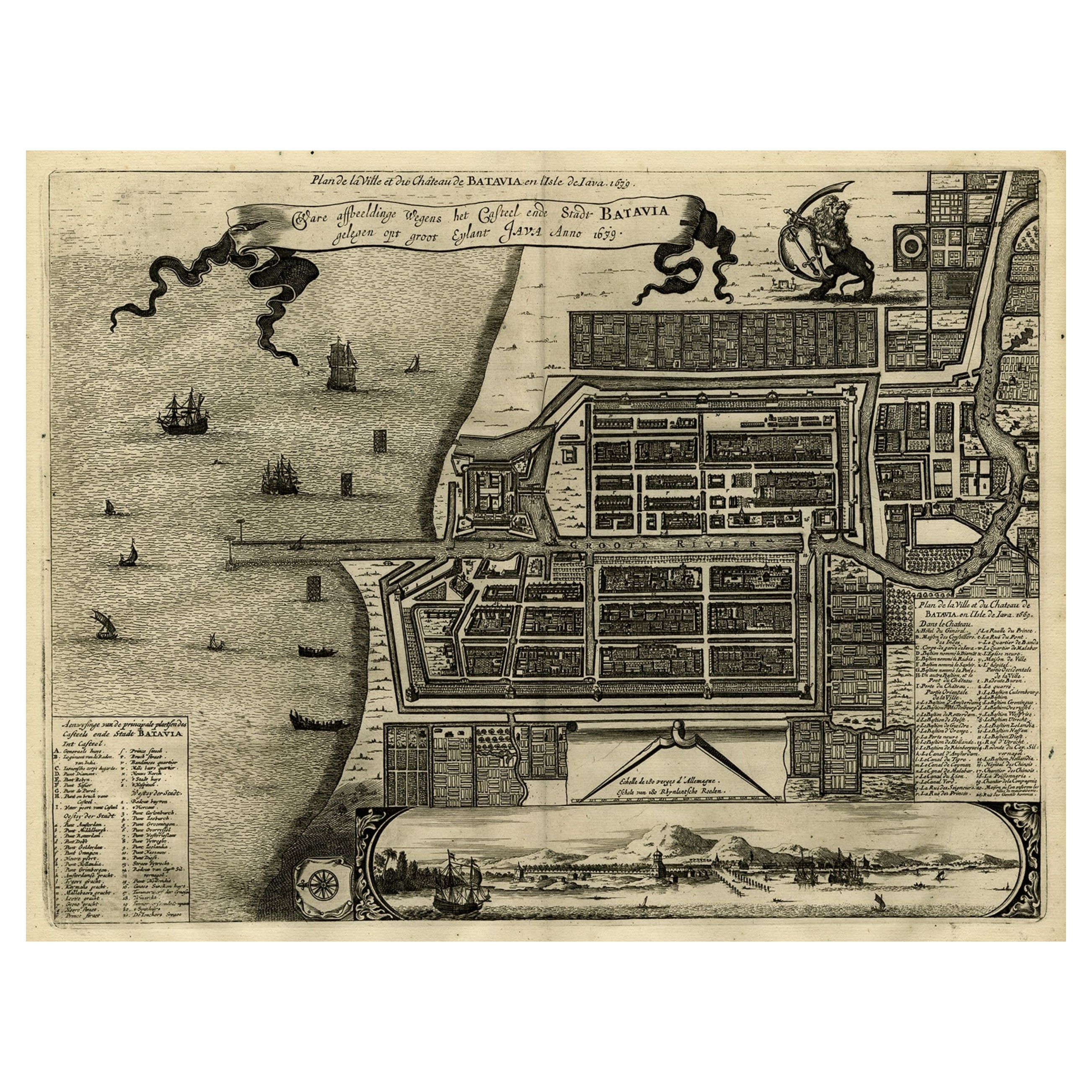
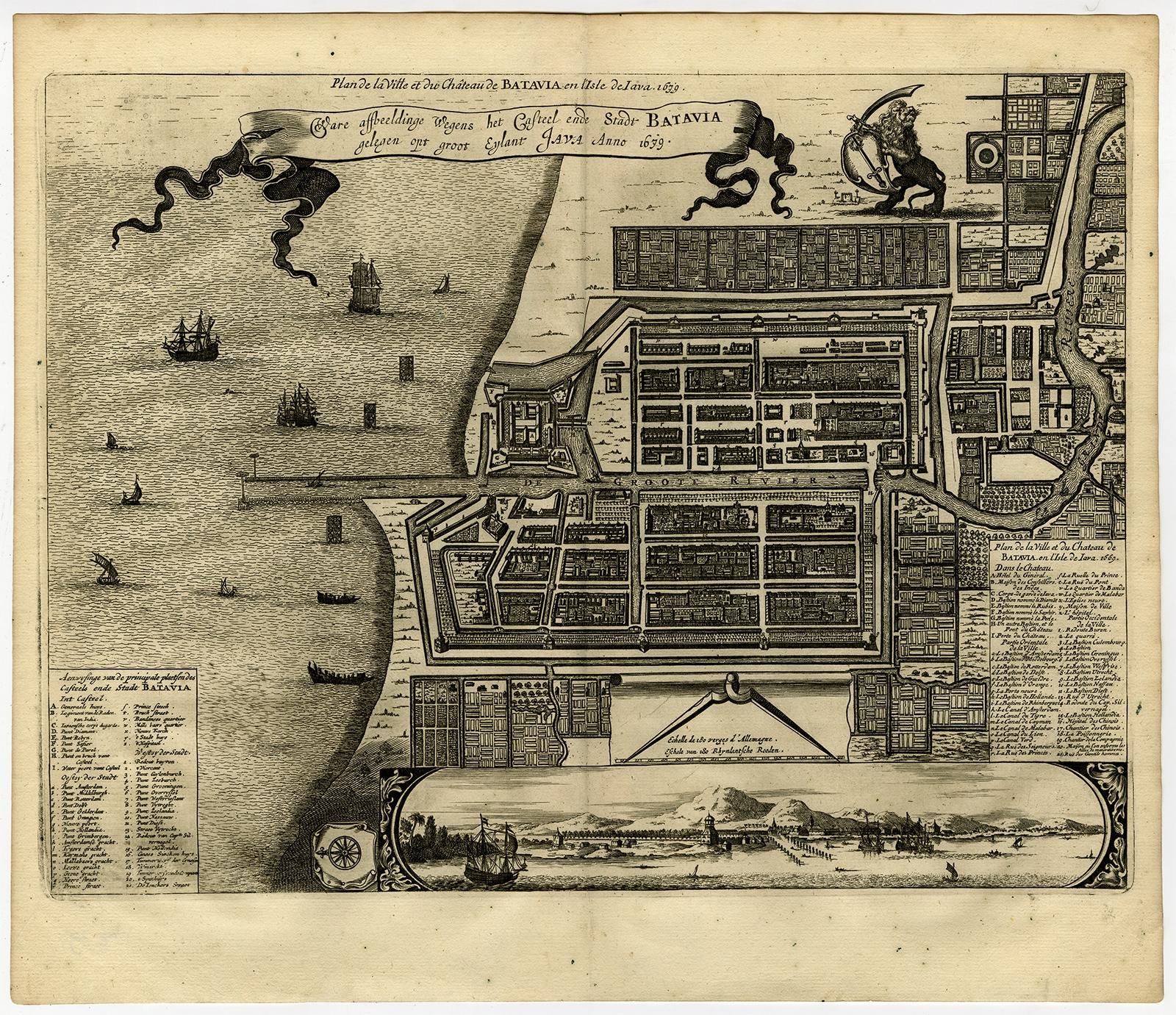
Antique map titled 'Ware afbeeldinge wegens het Casteel ende Stadt Batavia gelegen opt groot Eylant Java Anno 1679. Plan de la Ville et du Chateau de Batavia en l'Isle de Iava. 1679.'
A plan of Batavia, with a bird's eye view from the sea as inset map in the bottom edge. Two indices (French and Dutch) in the lower left and right edges. Arnoldus Montanus' "Gedenkwaerdige Gesantschappen der Oost-Indische Maatschappy in 't Vereenigde Nederland aan de Kaisaren van Japan […]. Amsterdam: Jacob Meurs, 1669.
Artists and Engravers: Made by an anonymous engraver after 'Arnoldus Montanus'.
Condition: Good, given age. Original middle fold, as issued. Some small stains in the margins. General age-related toning and/or occasional minor defects from handling. Please study image carefully.