About this sheet
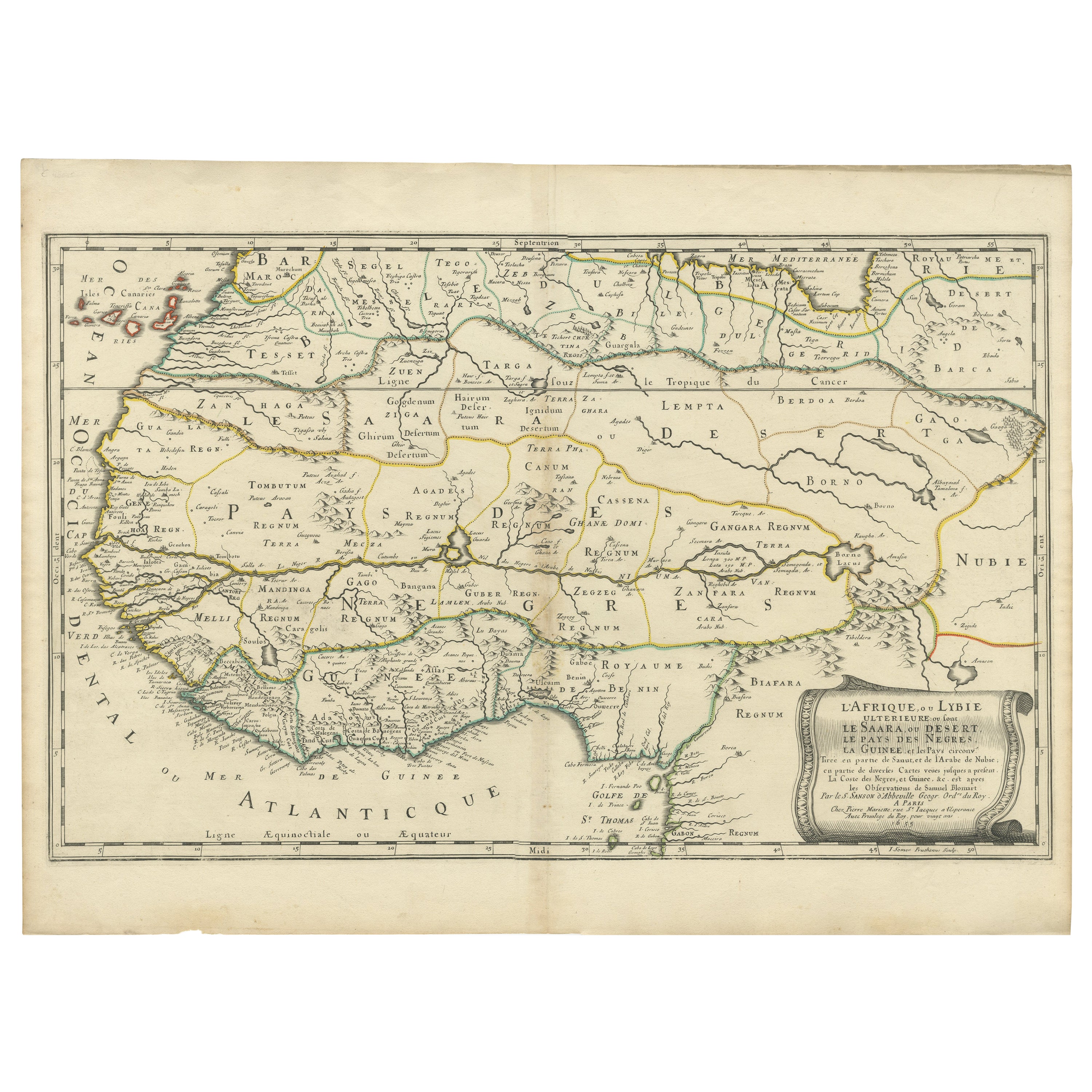
Handsome map of Western Africa filled with information, much of it spurious, in the Sahara Desert, the Niger River and the coast of Guinea. Of particular interest are several incomplete rivers in the desert regions that appear and then disappear. The map is beautifully engraved with a title cartouche fashioned in the form of an oriental carpet.
The map shows a fantastic level of detail near the coastlines, which extends into legend and Ptolemaic myth in the interior of the continent. Detail is particularly extensive in Guinea and the Gold and Ivory Coasts. The Niger River is traced to its Malian lakes. The Mediterranean is barely visible in the northern part of the map. This map incorporates the discoveries made by Samuel Blommaert, who was director of the Dutch West Indies Company, in addition to traveling extensively to Africa and settling the oldest land deed in the state of Delaware. He was also instrumental in the founding of New Sweden. (Source:
Maker/Publisher: N.Sanson (Published in Paris, P.Mariette, 1655)
Conditon: Fine impression with contemporary hand-coloured border colors. Faint toning or foxing along the fold line, but overall good.