About this sheet
1717 Johannes Van Keulen Sea Chart of the Eastern Atlantic - Amsterdam to Gambia

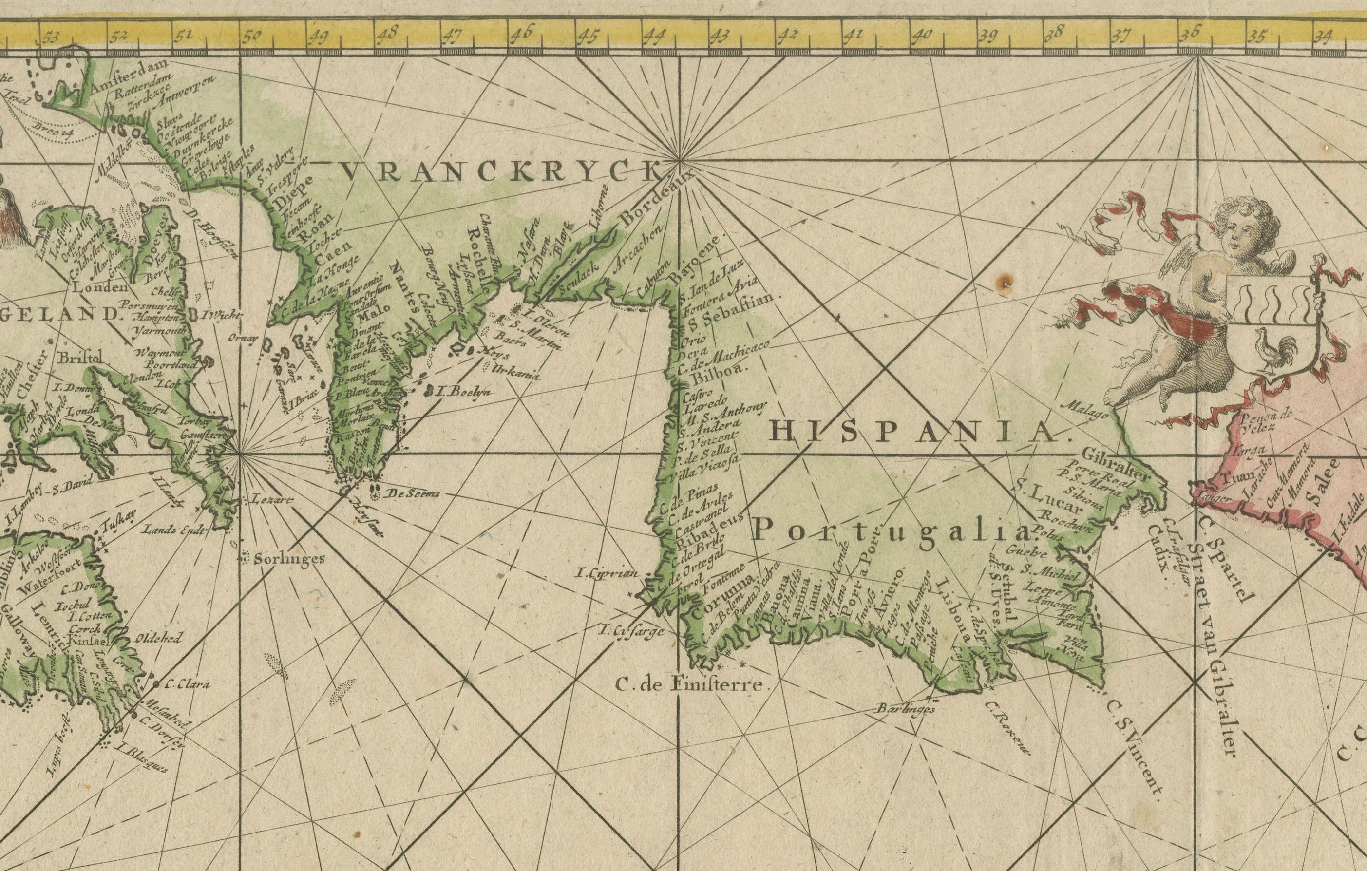
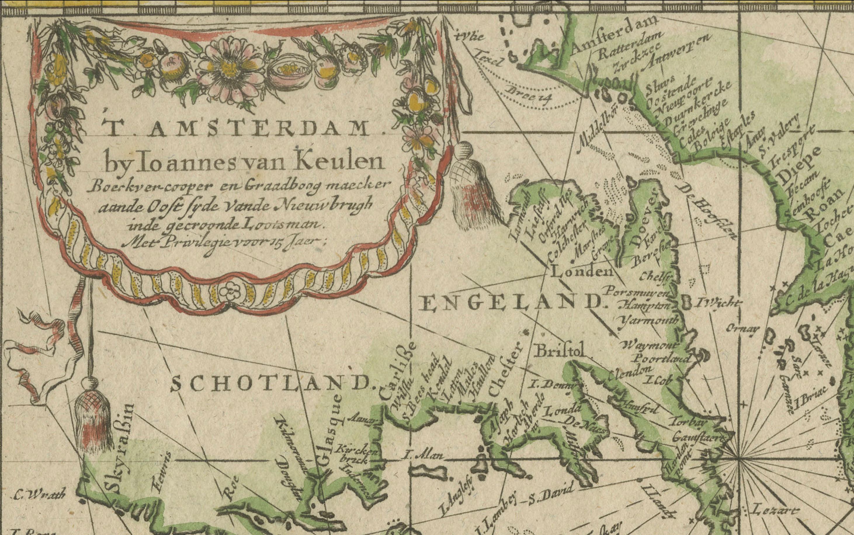
This 1717 sea chart by Johannes Van Keulen, titled "Nieuwe Paskaert vande Gheleele Westersche Scheep-vaert," beautifully illustrates the eastern Atlantic Ocean, extending from Amsterdam and the British Isles in the north to Gambia in the south.
The chart is centered on the Straits of Gibraltar and the Azores, providing detailed coastal information with clear depictions of important ports and geographic features.
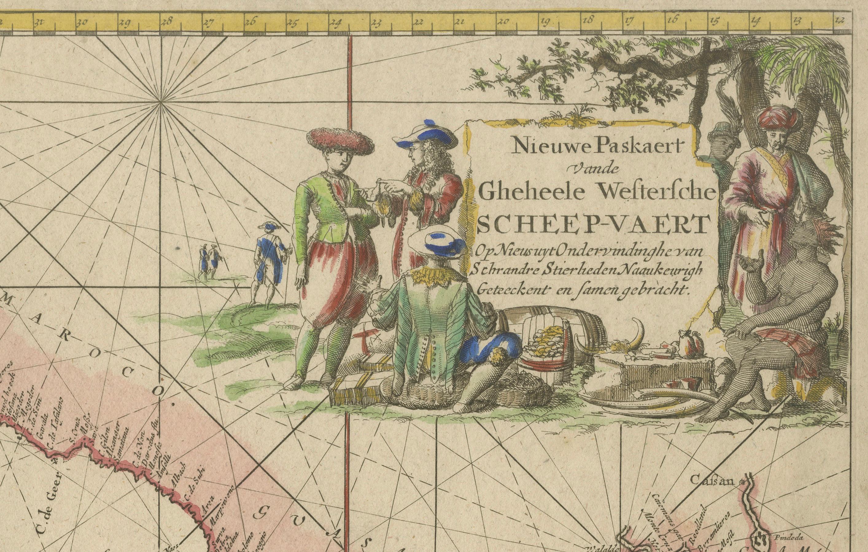
Classic early 18th-century Dutch maritime craftsmanship is evident in the chart's decoration, which includes two compass roses, numerous rhumb lines for navigational plotting, and decorative cartouches illustrating scenes of maritime life. A cherub carrying a coat of arms and two sailing ships embellish the scene, with a sea monster adding an element of mythical intrigue. The map is oriented with east at the top, and the hand coloring is vibrant, accentuating its details.
Johannes Van Keulen was an influential figure in Dutch cartography, founding the firm "In de Gekroonde Lootsman" (In the Crowned Pilot) in 1678, which became one of the most prominent maritime chartmakers of the era. His business flourished through the publication of the "Zee-Atlas" (Sea Atlas) and "Nieuwe Lichtende Zee-Fakkel" (New Shining Sea Torch), securing a reputation for accuracy and artistic quality. After Johannes' death, his son Gerard and later generations continued the family business, even supplying charts to the Dutch East India Company (VOC).
This chart reflects the golden age of Dutch maritime exploration, depicting the navigational routes and coastal details crucial to seafarers in the early 18th century. It serves not only as a navigational tool but also as a testament to the artistry and precision of Dutch cartography during this influential period in maritime history.
The 1717 sea chart by Johannes Van Keulen highlights several key islands and important geographic points in the eastern Atlantic region, extending from Amsterdam to Gambia, focusing on the waters of Western Europe and Africa. Below are the main islands and notable features depicted on the map:
main islands:
1. azores (de azoren)
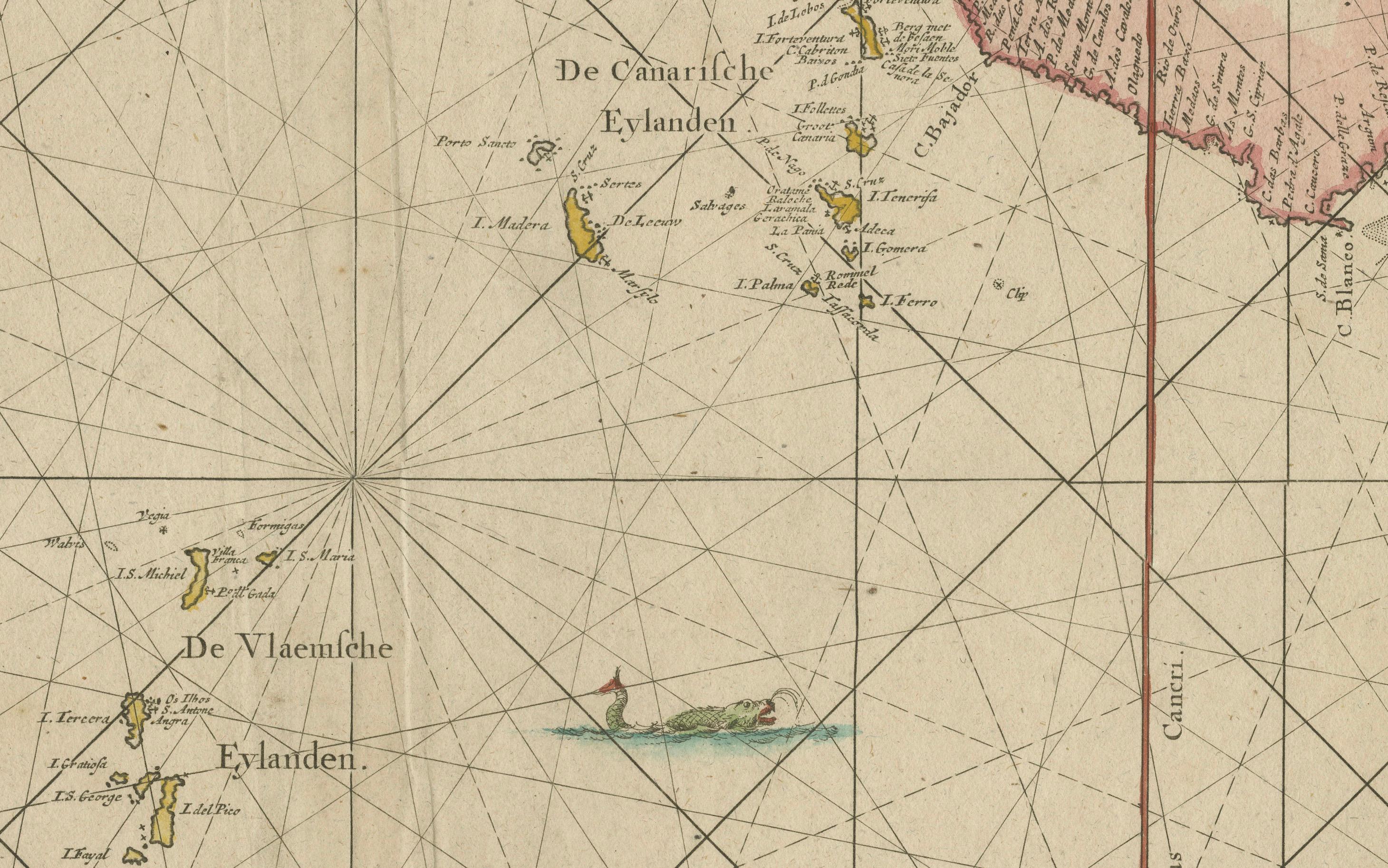
- prominently featured near the center of the map, the azores are a key cluster of islands used as an important stopover for ships crossing the atlantic.
2. canary islands (de canarische eylanden)
- located off the northwest coast of africa, these islands are detailed with individual island names marked. they were significant for navigation and resupply points for ships heading south or west.
3. madeira (madeira)
- madeira is depicted along with porto santo, located further north of the canary islands. this portuguese archipelago was an essential waypoint for atlantic explorers and traders.
4. cape verde islands (de eylanden van caep verde)
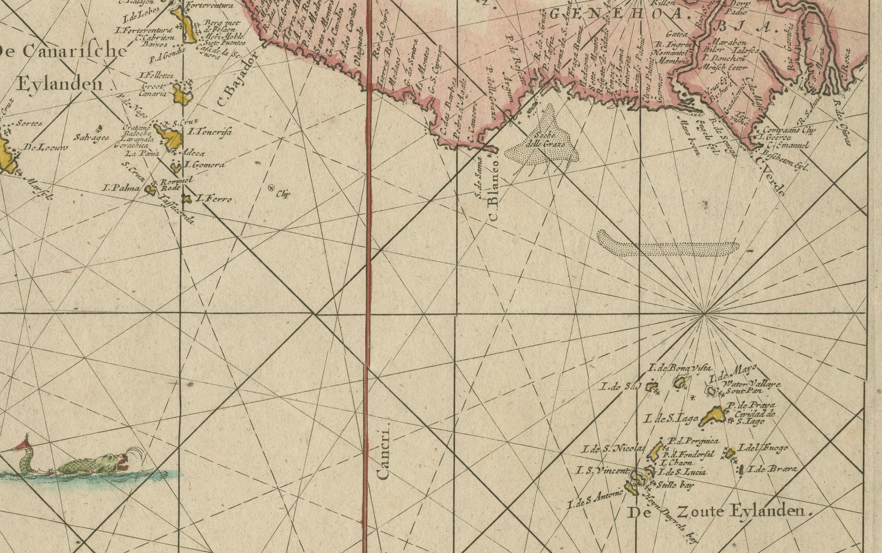
- situated off the coast of senegal, the cape verde islands were crucial for ships traveling between europe, africa, and the americas. each of the islands is depicted and labeled.
other important geographic points:
1. strait of gibraltar
- the map prominently shows the strait of gibraltar, the narrow entrance between the atlantic ocean and the mediterranean sea, an area of critical importance for maritime trade and naval navigation.
2. western european coast
- the coastline of western europe, including parts of spain, portugal, and france, is detailed, highlighting important coastal features, ports, and cities. the detailed rendering of these coastlines was vital for ships navigating nearshore waters.
3. british isles and ireland
- parts of southern england, ireland, and scotland are included, showing major ports and providing a broader view of the navigational context along western europe.
4. west african coast
- the map extends south to gambia on the western coast of africa, covering notable points like the senegal river and coastal trading areas that were significant during the era of european exploration and the slave trade.
decorative elements and cartouches:
1. compass roses and rhumb lines
- there are two compass roses, along with an intricate network of rhumb lines that cover the entire map, allowing navigators to chart their course across the open sea effectively.
2. decorative cartouches
- the decorative cartouches, including one with figures of sailors, natives, and explorers, reflect maritime themes and the exotic allure of the lands explored by dutch seafarers. a cherub carrying a coat of arms above the mediterranean also adds visual flair.
3. sea monsters and ships
- the map features sailing ships and sea monsters, adding both a decorative and navigational reference to help mariners and captivate those interested in maritime myths.
orientation:
- east is at the top
- notably, the map is oriented with east at the top, a unique approach to orientation that was common among sea charts during this time, emphasizing the importance of...