

Black Friday Sale now on: up to 30% off until Monday 30 November →
Orders placed from 15 to 30 November ship from 1 December, in time for Christmas. Our shipping partner: InXpress.
Maps & PrintsBartele Gallery · Langweer
Home / Antique Maps / America / North America

North America

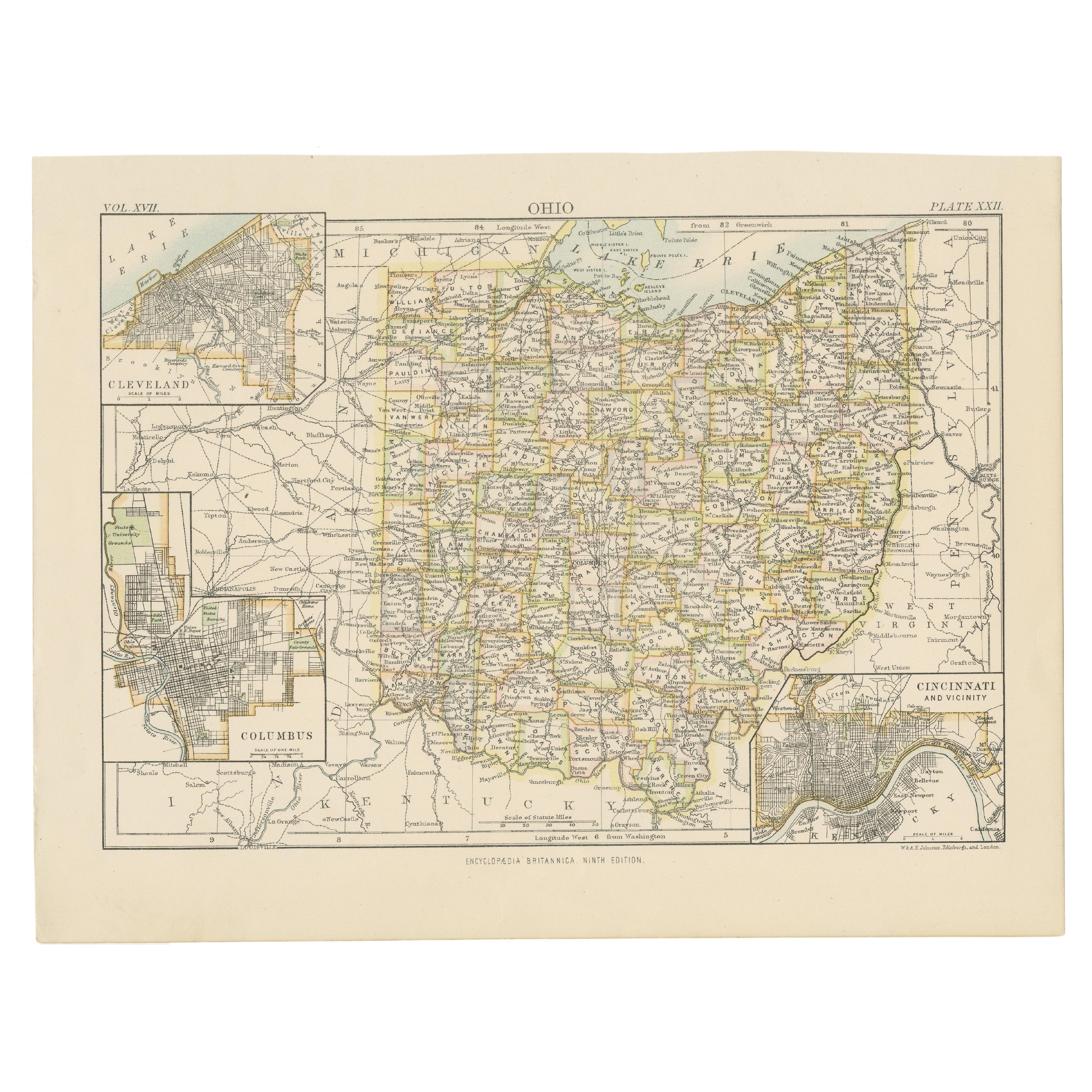
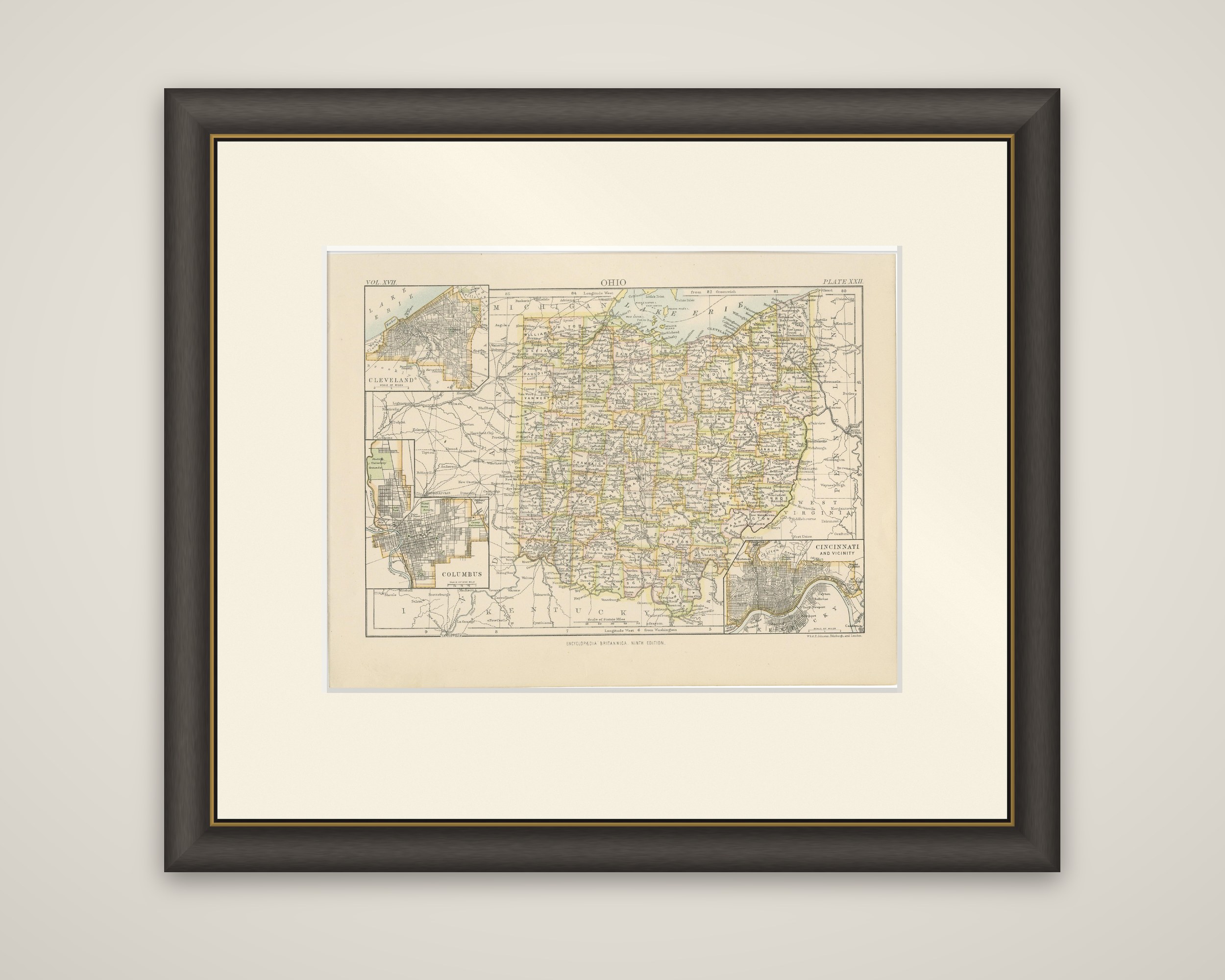
Antique Map of Ohio, with Inset Maps of Cleveland, Columbus and Cincinnati

€ 290€ 20330% off

Buy now at the sale price

Original antique · The actual sheet photographed · Certificate of authenticity on request · Sold unframed · Worldwide shipping from € 15 (rates)

Sheet size
21 × 27 cm (8.3 × 10.6 in)
Condition
Good
Reference
BG-13321-1
What the condition grades mean
Excellent
Bright and clean, with no faults worth mentioning.
Very good
Only light signs of age, such as faint toning.
Good
Normal signs of age for a sheet of this period: toning, some foxing, small marks or neat old repairs.
Fair
Clear faults such as staining, tears or repairs, priced to match.

Every fault we see is written in the condition note, and the whole sheet is shown uncropped in the photos.

Condition

Wear consistent with age and use. General age-related toning, minor wear. Blank verso. Please review the images for further condition details.
About this sheet

Ohio in a color-printed county map, titled "Ohio", from the Ninth Edition of the Encyclopaedia Britannica, published in 1884. The sheet is engraved in fine lines with counties tinted in yellow, green and pink, and the imprint of W. & A.K. Johnston, Edinburgh and London, is printed at the lower right.

The state is shown with its county boundaries, its towns and its railroads, with Lake Erie along the top and the Ohio River marking the long southern and eastern edge, beyond which lie Kentucky and West Virginia. Michigan and Indiana are named at the margins. Three insets fill the corners of the sheet: a plan of Cleveland on the lake at the upper left, Columbus below it on the left, and Cincinnati and vicinity at the lower right, where the Ohio River bends below the city. The scale of miles is given beneath the main map, and the volume and plate numbers are printed at the top corners.

Ohio's three largest cities of the 1880s are each given a large-scale plan here, which makes the sheet a handy record of the state at the height of its industrial growth after the Civil War.

More from North America

Ask about this sheet

Antique Map of Ohio, with Inset Maps of Cleveland, Columbus and Cincinnati
Ref. BG-13321-1 · € 290
We reply by email, usually within one working day.

Your favorites

Saved in this browser. Email the list to yourself to keep it on any device.

We use your email to send this list and, only if you tick the box and confirm, for occasional new arrivals. Every email has an unsubscribe link. Bartele Gallery, the Netherlands.

Powered by SiteKeys