About this sheet
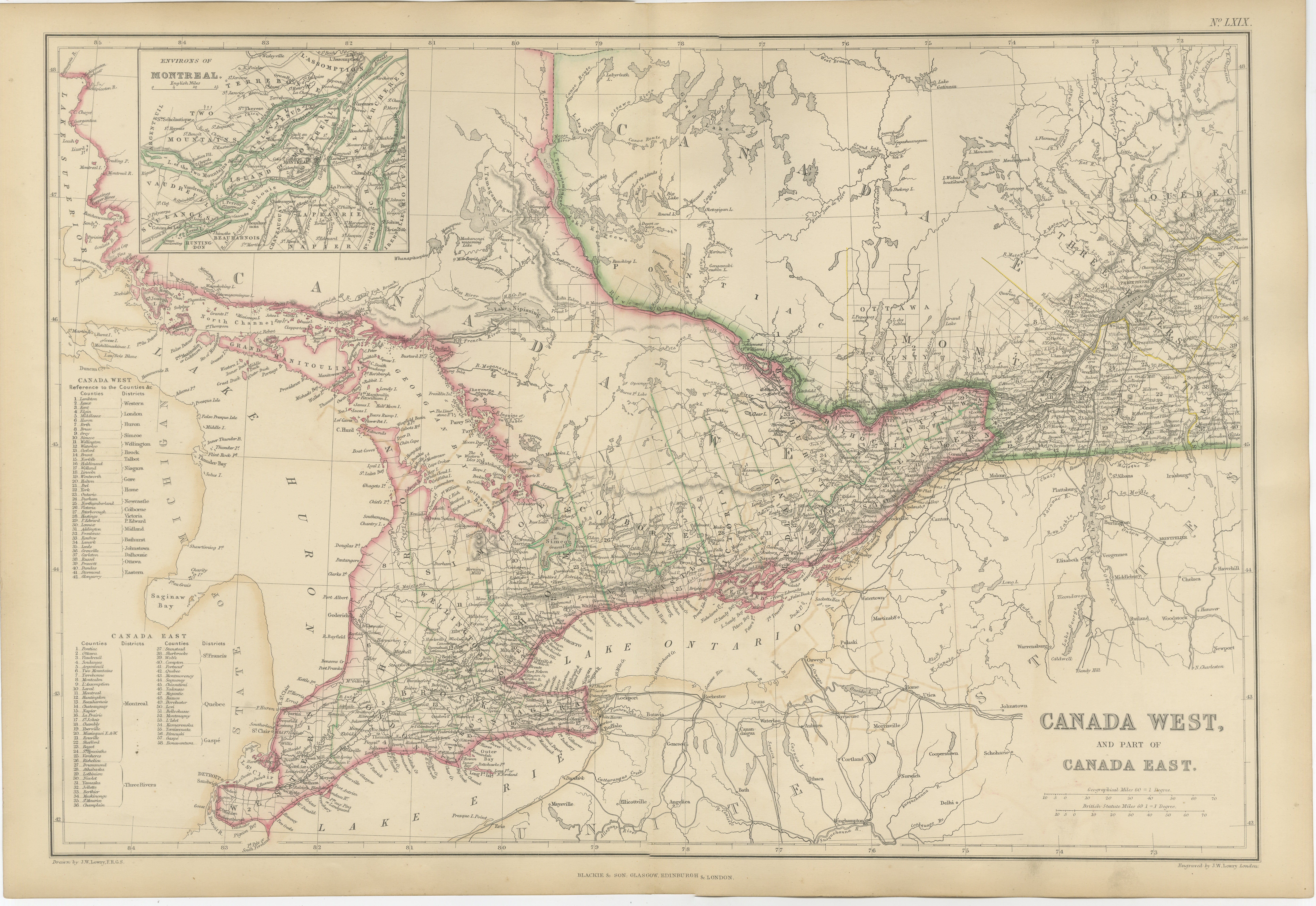
Antique Map of Canada West and Part of Canada East, Ontario & Quebec, 1860
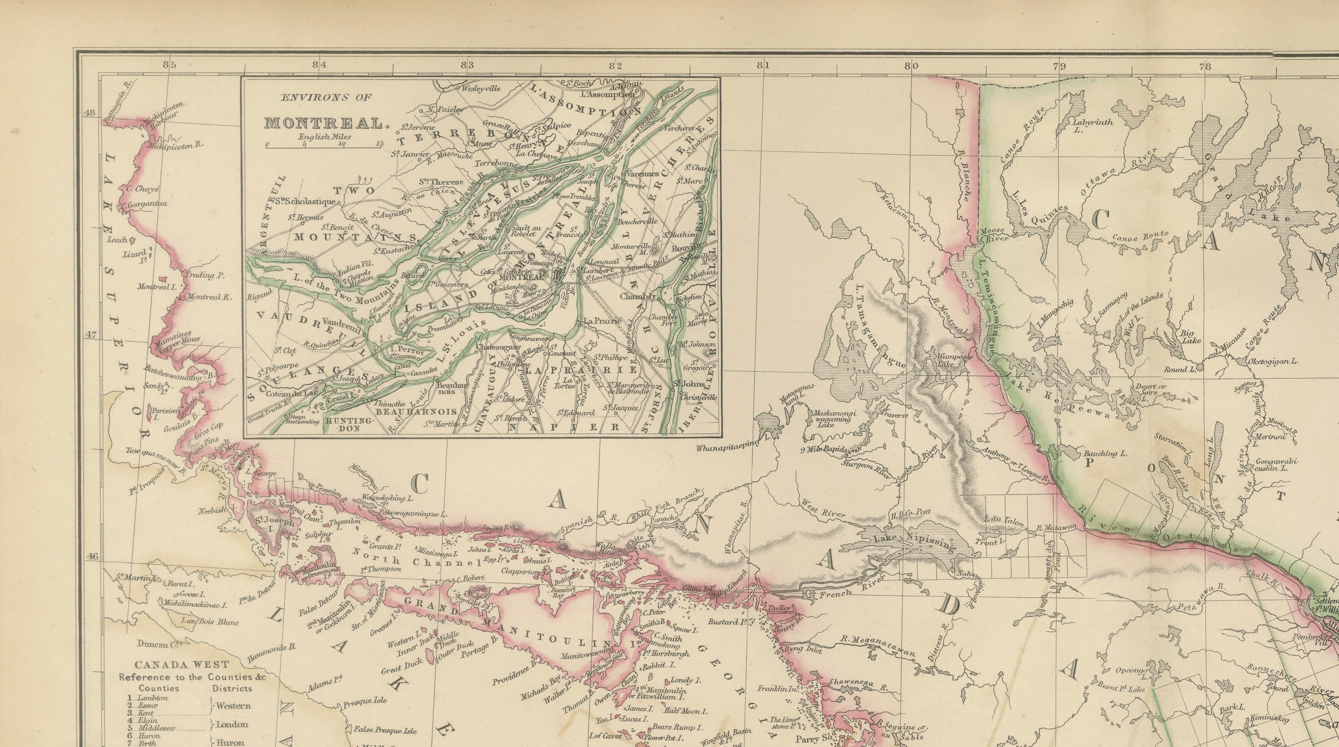
This finely engraved map of central Canada was published by W. G. Blackie of Scotland around 1860 and provides a detailed view of Canada West and part of Canada East during the final years before the formation of the Dominion of Canada in 1867. Covering present-day Ontario and portions of Quebec, the map illustrates one of the most important regions of British North America at a pivotal moment in its political and economic development.
The map extends from the Great Lakes and the Detroit frontier eastward toward Montreal and the St. Lawrence River, showing counties, districts, settlements, waterways, roads, and administrative boundaries in exceptional detail. Original hand coloring distinguishes provincial and county divisions, enhancing both the map's visual appeal and historical usefulness.
A particularly attractive feature is the inset map of the Environs of Montreal, which provides a detailed plan of the region surrounding one of Canada's most important nineteenth-century cities. Throughout the sheet, the Great Lakes system, including Lakes Erie, Ontario, Huron, and Georgian Bay, is carefully depicted, emphasizing the waterways that formed the backbone of trade, transportation, and settlement throughout the region.
The map captures the rapid expansion of agriculture, commerce, and transportation in Upper and Lower Canada during the Victorian era. Numerous towns, villages, rivers, canals, and early transportation routes are shown, reflecting the growing importance of the region as the economic heartland of British North America. The Welland Canal, St. Lawrence River corridor, and the developing settlement networks of southern Ontario are all represented in considerable detail.
Produced using the high-quality engraving techniques for which Blackie's atlas publications became renowned, the map combines geographical accuracy with elegant presentation. Its intricate detail, original hand coloring, and historical significance make it both a valuable research document and an attractive decorative map.
Today, maps of pre-Confederation Canada are highly sought after by collectors of Canadian history, genealogy, settlement studies, transportation history, and antique cartography. This example offers an excellent opportunity to acquire an original Victorian-era map depicting the development of modern Ontario and Quebec.
Condition report: Good antique condition with age-related toning and occasional light spotting consistent with a nineteenth-century map. Original hand coloring remains attractive. Please examine the images carefully for exact condition. A faint central fold, as issued, may be present.
Framing tips: This map displays beautifully in a dark walnut, ebonized, or museum-black frame with a wide warm ivory mat. A thin gilt liner can further enhance the original hand coloring while maintaining a refined historical appearance.
Technique: Copper engraving with original hand coloring
Maker: W. G. Blackie, Scotland, 1860
This is an original 19th-century copperplate engraving, printed at the time. It is not a modern reproduction. Any images showing the print framed are for presentation purposes only. The map is supplied unframed.
Keywords: Canada West, Canada East, Ontario, Quebec, Upper Canada, Lower Canada, Montreal, Toronto, York, Ottawa, Bytown, Kingston, Hamilton, London Ontario, Windsor, Detroit River, Niagara, Niagara Falls, St Catharines, Welland Canal, Peterborough, Belleville, Brockville, Cornwall, Guelph, Brantford, Stratford, Barrie, Simcoe, Georgian Bay, Lake Huron, Lake Erie, Lake Ontario, St Lawrence River, Thousand Islands, Rideau Canal, Ottawa River, Kingston Peninsula, Prince Edward County, Lake Simcoe, Muskoka, Montreal District, Quebec City, Trois-Rivieres, Champlain, Great Lakes, British North America, Canadian Confederation Era, Colonial Canada, Victorian Canada, Settlement History, Transportation History, Genealogy, Antique Map, Hand-Colored Map, Copperplate Engraving, Blackie Atlas, Scottish Cartography.