

Maps & PrintsBartele Gallery · Langweer
Home / Antique Maps / Asia / East Asia / Japan

Japan

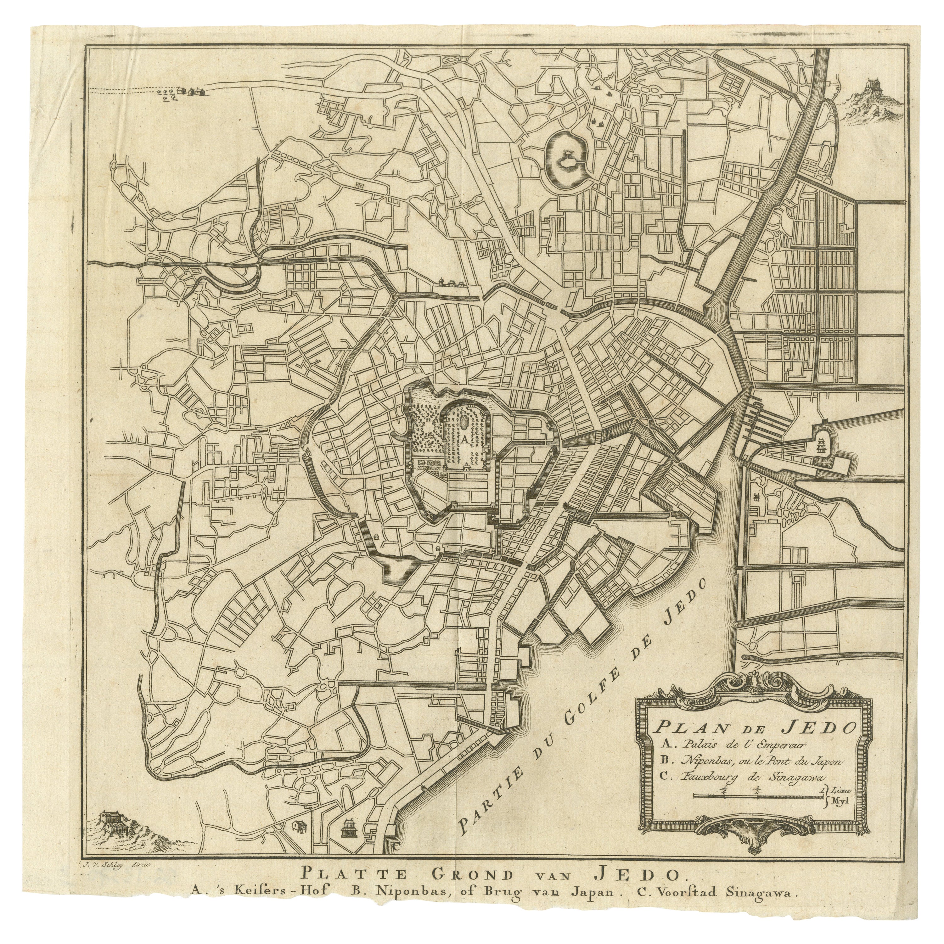
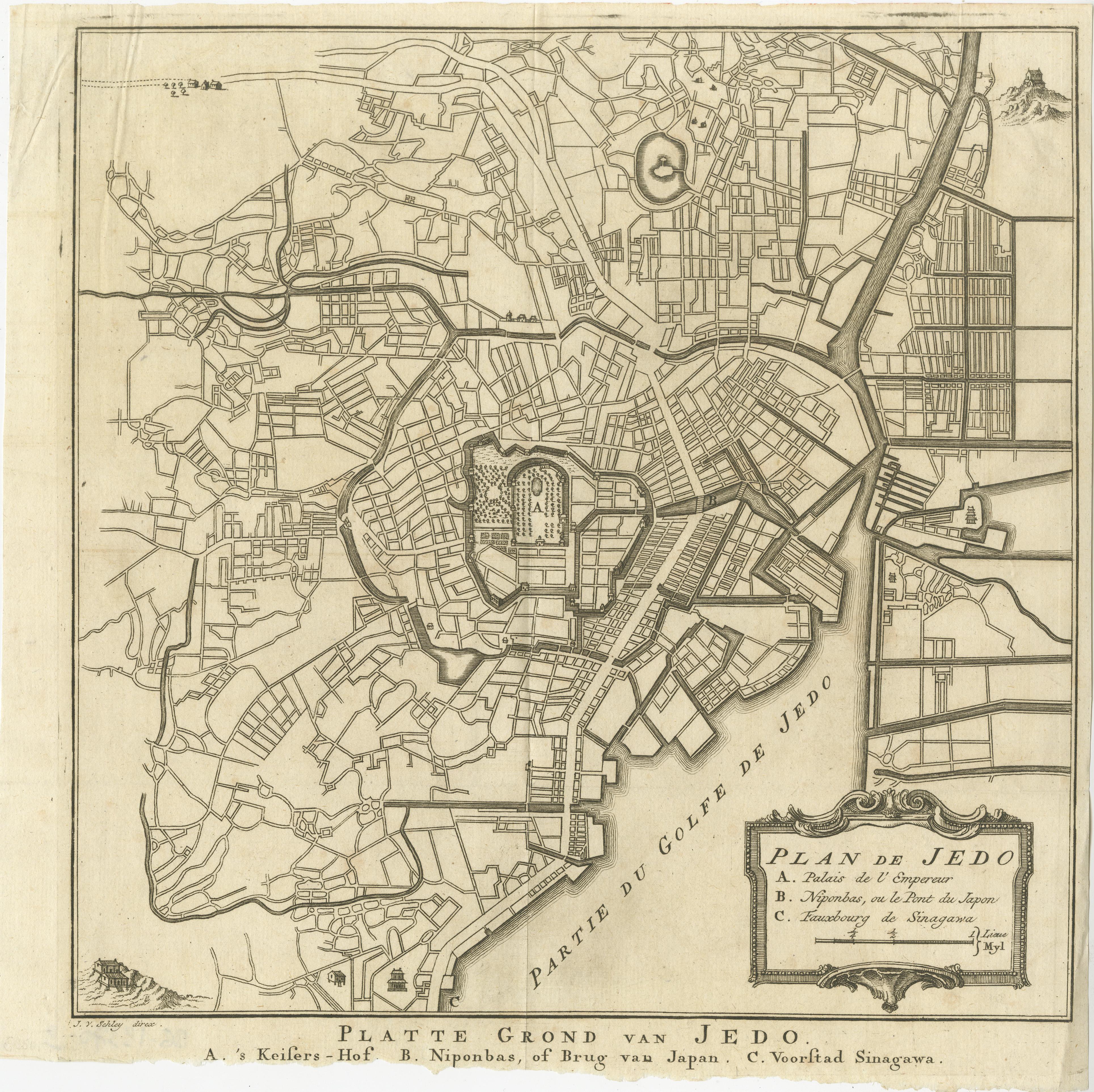
Antique Street Map of the City of Edo 'Modern Tokyo' in Japan

€ 290

One of a kind: this is the sheet in the photographs. Ships from Langweer, the Netherlands.

Sheet size
26.7 × 27 cm (10.5 × 10.6 in)
Condition
Fair
Reference
BG-13370-3

Condition

General age-related toning, original folding lines. Shows some wear, sl. affecting image. Bottom margin trimmed, narrow margins. Blank verso. Please study image carefully.

About this sheet

Antique map titled 'Plan de Jedo - Platte Grond van Jedo'. A detailed street map of the city of Edo (modern Tokyo) in Japan, originally engraved by Bellin and Schley and reissued for Dutch editions of Prévost's monumental 'l'Histoire Géneral des Voyages. The map shows the city as it would have been during the Tokugawa Shogunate, also known as the Edo period. The map centres on the sprawling Edo Castle, here referrred to as the 'Palais de l'Empereur' and shown improbably with a French-style garden in parterre. The only other features of the city to be labelled are two of the early stages of the famous Tokaido road between Tokyo and Kyoto, these being the Nihonbashi Bridge and post town of Shinagawa. The rest of the city is mainly shown as a network of streets, though a number of pagodas, temples, and fortifications are also shown. Published circa 1750.

More from Japan

Ask about this sheet

Antique Street Map of the City of Edo 'Modern Tokyo' in Japan
Ref. BG-13370-3 · € 290
We reply by email, usually within one working day.