About this sheet
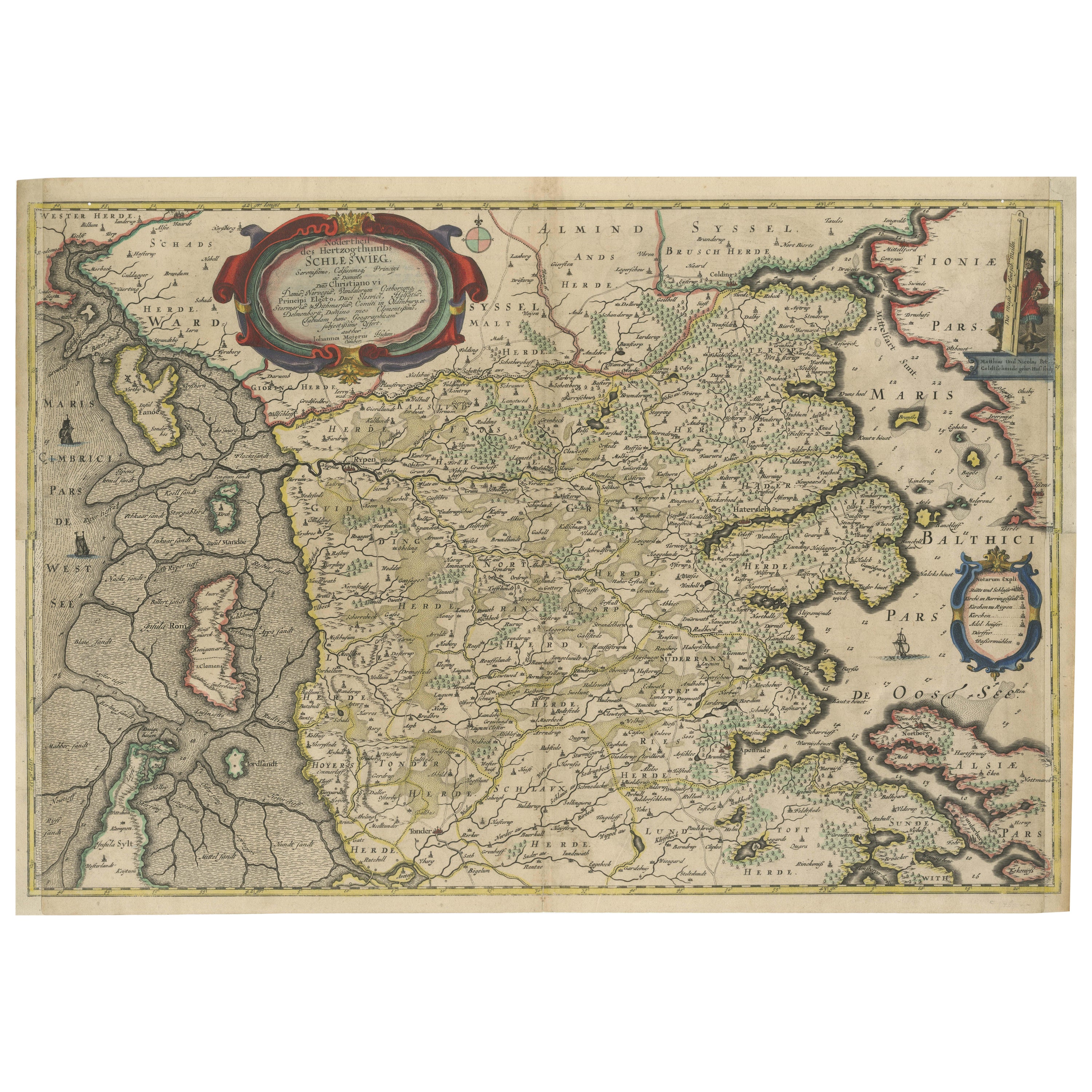
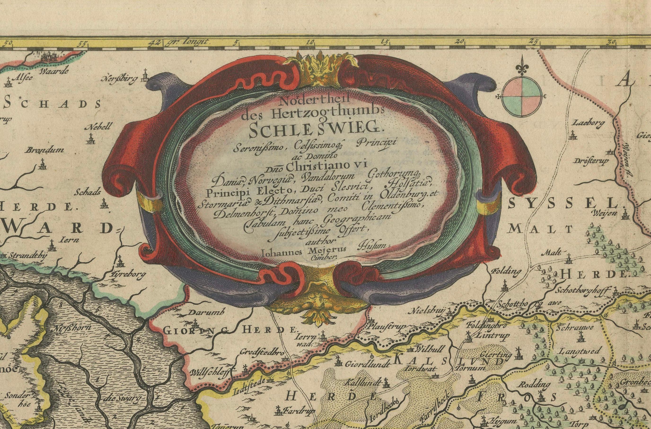
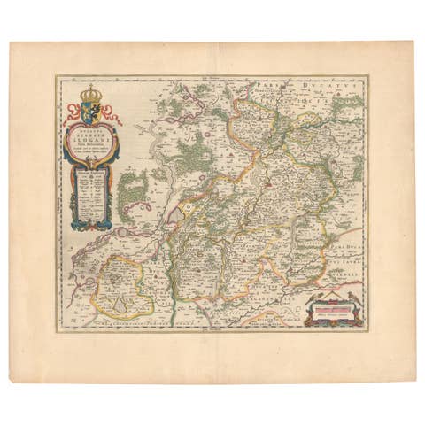
The map shows the Duchy of Schleswig, which spans the area between the North Sea coast, Kolding, and Flensburg. The maps were originally published by Johannes Mejer in the regional atlas of Schleswig-Holstein, compiled by Caspar Danckwerth. Later, these maps were included in a revised edition by Joan Blaeu, one of the leading Dutch cartographers of the 17th century. This collaboration brought the maps to a wider European audience.
The translated Latin text within the cartouche reads as follows:
"Northern part of the Duchy of Schleswig
Dedicated to the Most Serene and Most Exalted Prince and Lord,
Lord Christian VI,
King of Denmark, Norway, the Vandals, and the Goths,
Elected Prince, Duke of Schleswig, Holstein, Stormarn, and Dithmarschen,
Count of Oldenburg and Delmenhorst, my most gracious Lord,
To whom this geographic presentation is humbly offered by its author,
Johannes Mejerus, a native of Husum (Cimbricus)."
This cartouche serves as a dedication to King Christian VI of Denmark and Norway, honoring him with his full royal titles and presenting the map as a humble offering by Johannes Mejerus, who created this map.
This map is a beautifully detailed 17th-century representation of the northern parts of the Duchy of Schleswig and eastern parts of the Haderslev region, created by Johannes Mejer and published by the famous Dutch cartographer Johannes Blaeu in Amsterdam in 1662. The map is part of a larger collection of regional maps, known for its artistic and cartographic excellence, typical of the golden age of Dutch map-making.
Key Features of the Map:
1. Geographical Coverage:
- The map covers the eastern part of Haderslev, stretching from Kolding to the coastal areas around Haderslev, and the northern part of Schleswig. It includes regions along the North Sea coast, spanning from Kolding to Flensburg, showing important towns, cities, rivers, and key features of the landscape.
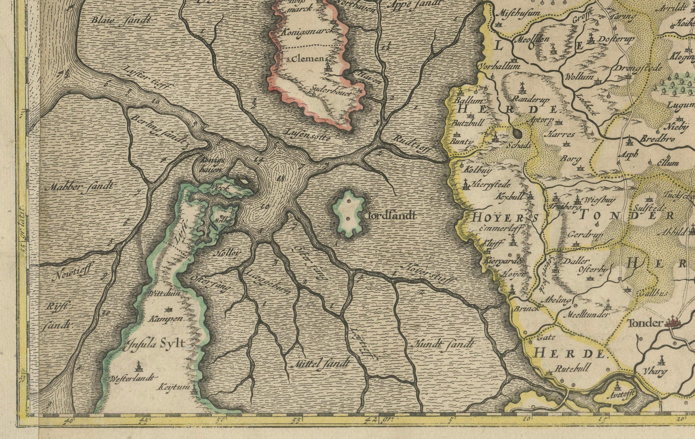
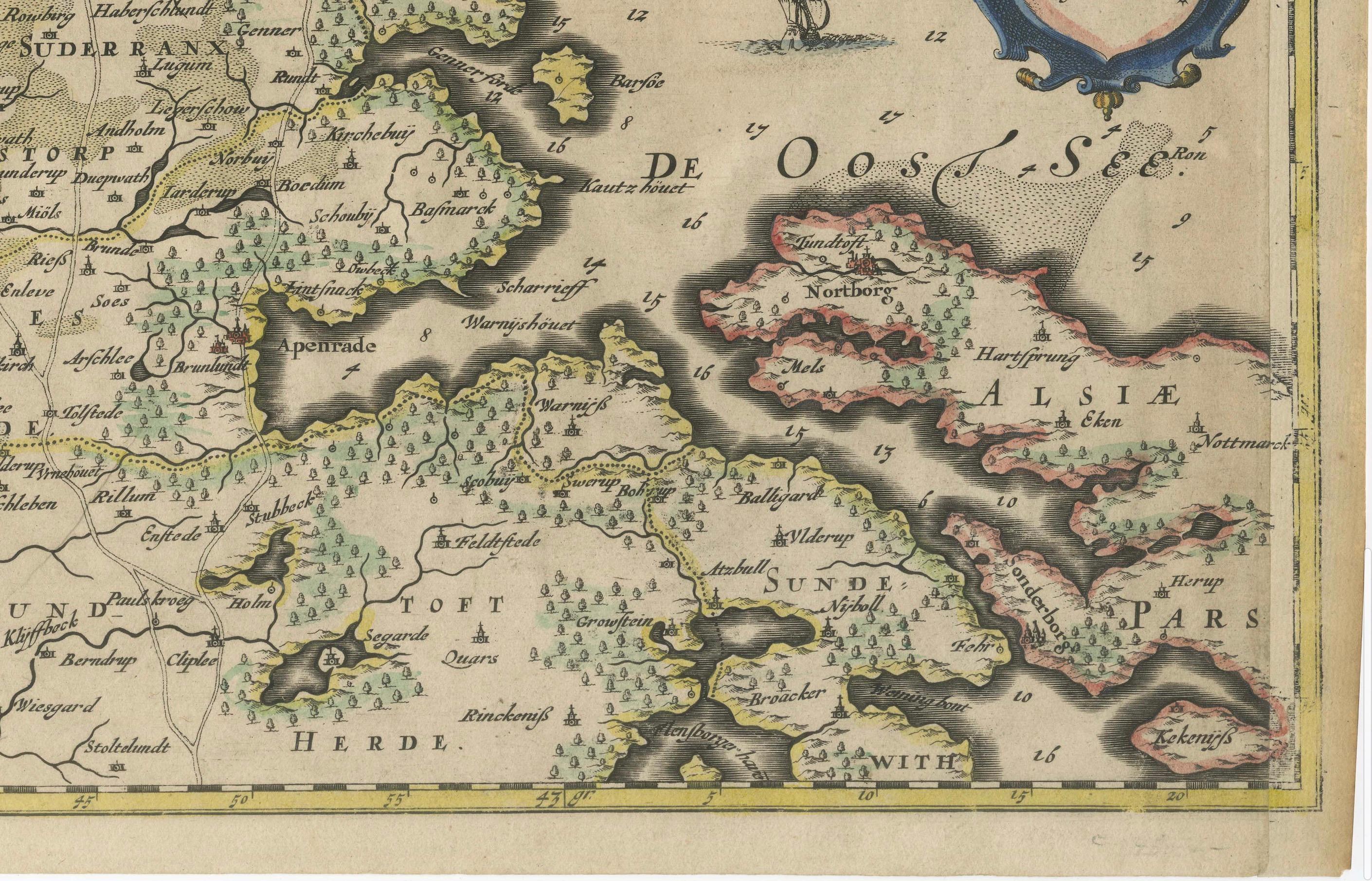
- The Baltic Sea is marked as the "Baltici Pars" on the eastern side of the map, and "De Oostersee" (Eastern Sea) appears near the sea coast. Coastal features and some islands, like Romø (Röm) and Sylt (Sild), are also visible.
2. Historical and Political Context:
- Schleswig and Holstein were duchies located in the region now known as Schleswig-Holstein, a region historically contested by Denmark and Germany.
- The map shows administrative divisions (e.g., "Herde") and place names relevant to the time period, such as cities like Flensburg, Tondern (Tønder), and Schleswig. It reflects a high level of detail in both geography and the political borders of the time.
3. Decorative Elements:
- Cartouches: The map has several decorative cartouches, ornate frames typically used to enclose titles or legends. The main cartouche, located at the top center, contains a dedication to King Christian VI of Denmark, including his royal titles. The rich ornamentation and scrollwork surrounding it are typical of the baroque style of the era.
- Maritime Embellishments: Ships and possibly sea creatures are depicted in the maritime areas, reflecting both the artistic style and the significance of the region’s coastal trade routes.
- Compass Rose: Near the cartouche, there is a decorative compass rose, aiding in the orientation of the map, a common feature in navigation maps of the time.
4. Topographical Details:
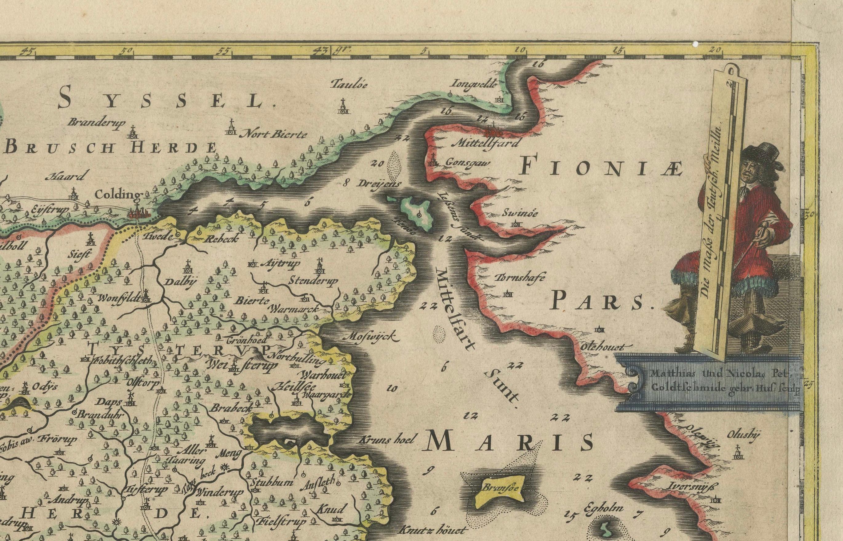
- The map includes extensive topographical features, such as rivers, forests, hills, and fields, marked with great detail. Small illustrations of settlements, fortifications, and churches are also scattered throughout the landscape.
- Towns and villages are labeled with varying text sizes to indicate their relative importance. The North Sea and the Baltic Sea coasts are drawn with waves and show important sea routes and coastal features.
5. Scale and Orientation:
- The map includes a latitude scale at the top, indicating the degree lines for navigation and positioning.
- It is oriented with north at the top, a standard convention in European maps during this period.
Artistic and Historical Importance:
This map not only serves as a practical geographical reference but also as a work of art. Created by Johannes Mejer, a prominent German cartographer, and published by Blaeu, one of the most esteemed mapmakers in history, it exemplifies the cartographic and artistic achievements of the 17th century. The decorative features, such as the cartouches and maritime illustrations, elevate it beyond a mere functional map to a collectible piece reflecting the political and cultural context of its time.
This map would have been part of a larger atlas, potentially used by scholars, nobility, or wealthy merchants, providing insight into the political divisions and geography of Northern Europe during the mid-17th century.