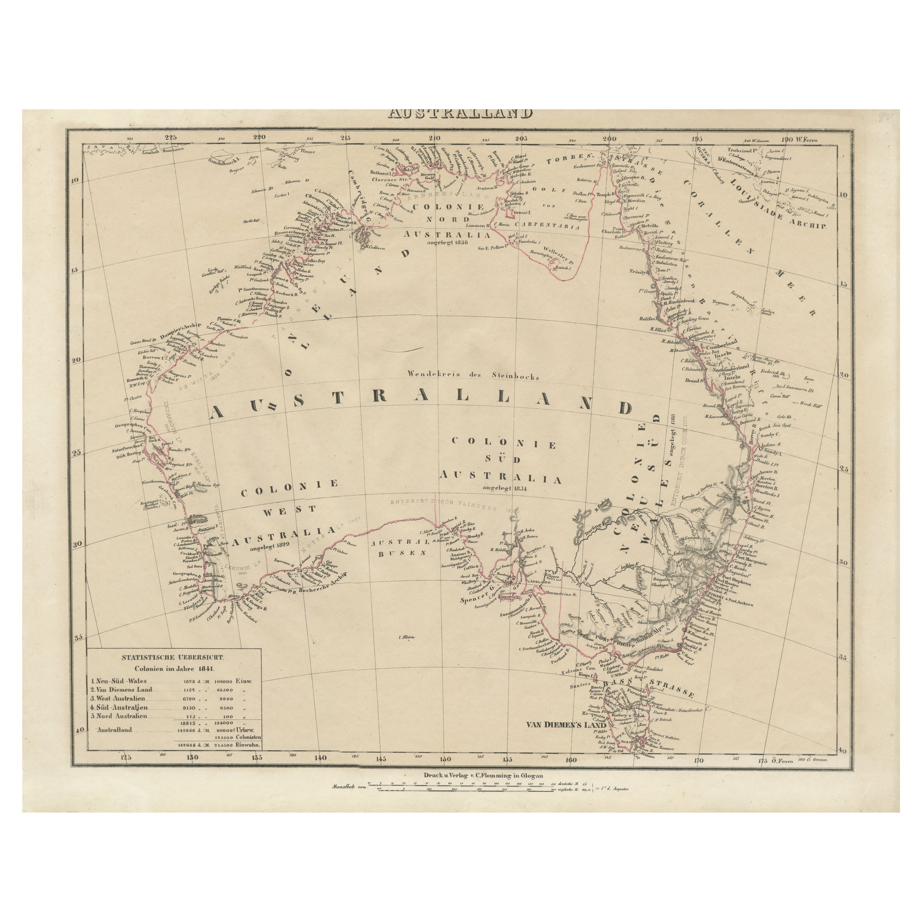
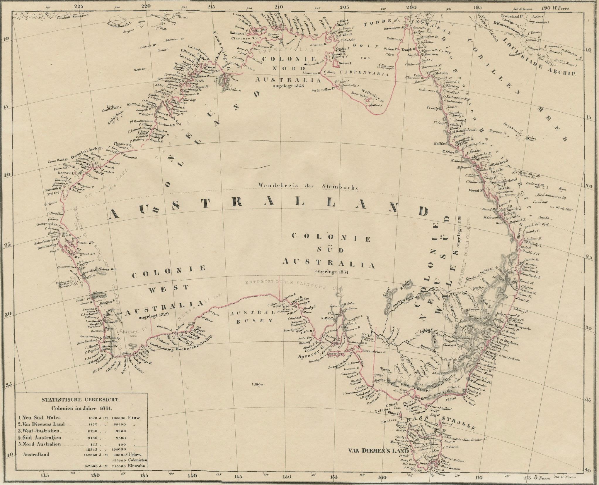
Detailed German Map of Australia Including Statistics of 1841, Published in 1854
€ 200
One of a kind: this is the sheet in the photographs. Ships from Langweer, the Netherlands.
Date
1841
Sheet size
35.7 × 44.5 cm (14.1 × 17.5 in)
Condition
Good
Reference
BG-13700-1
Condition
Good. Paper slightly browned or discoloured. General age-related toning and/or occasional minor defects from handling. Light creasing overal. Title 'Australland' is cut short by scan, not on the original. Please study scan carefully.
About this sheet
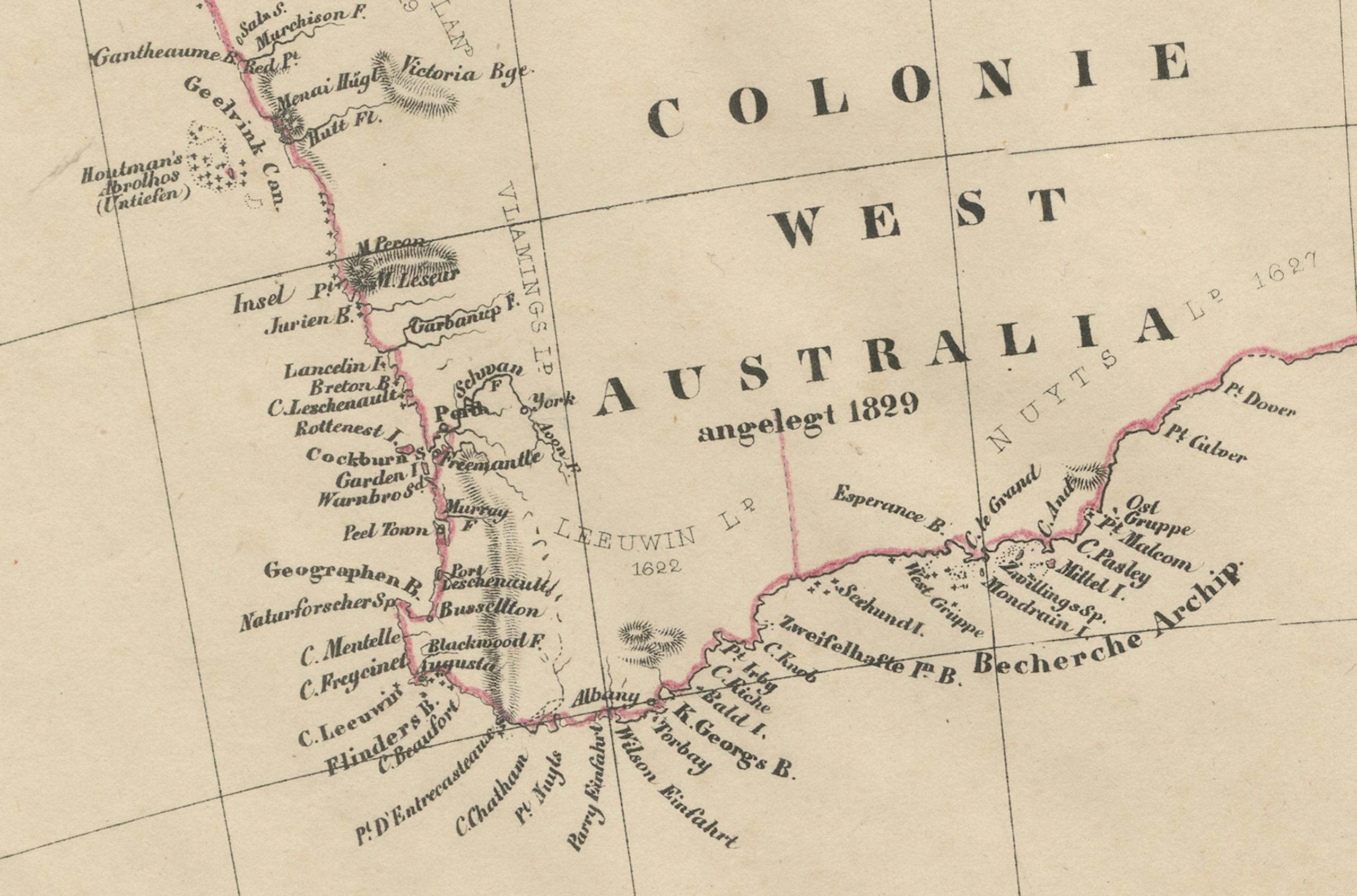
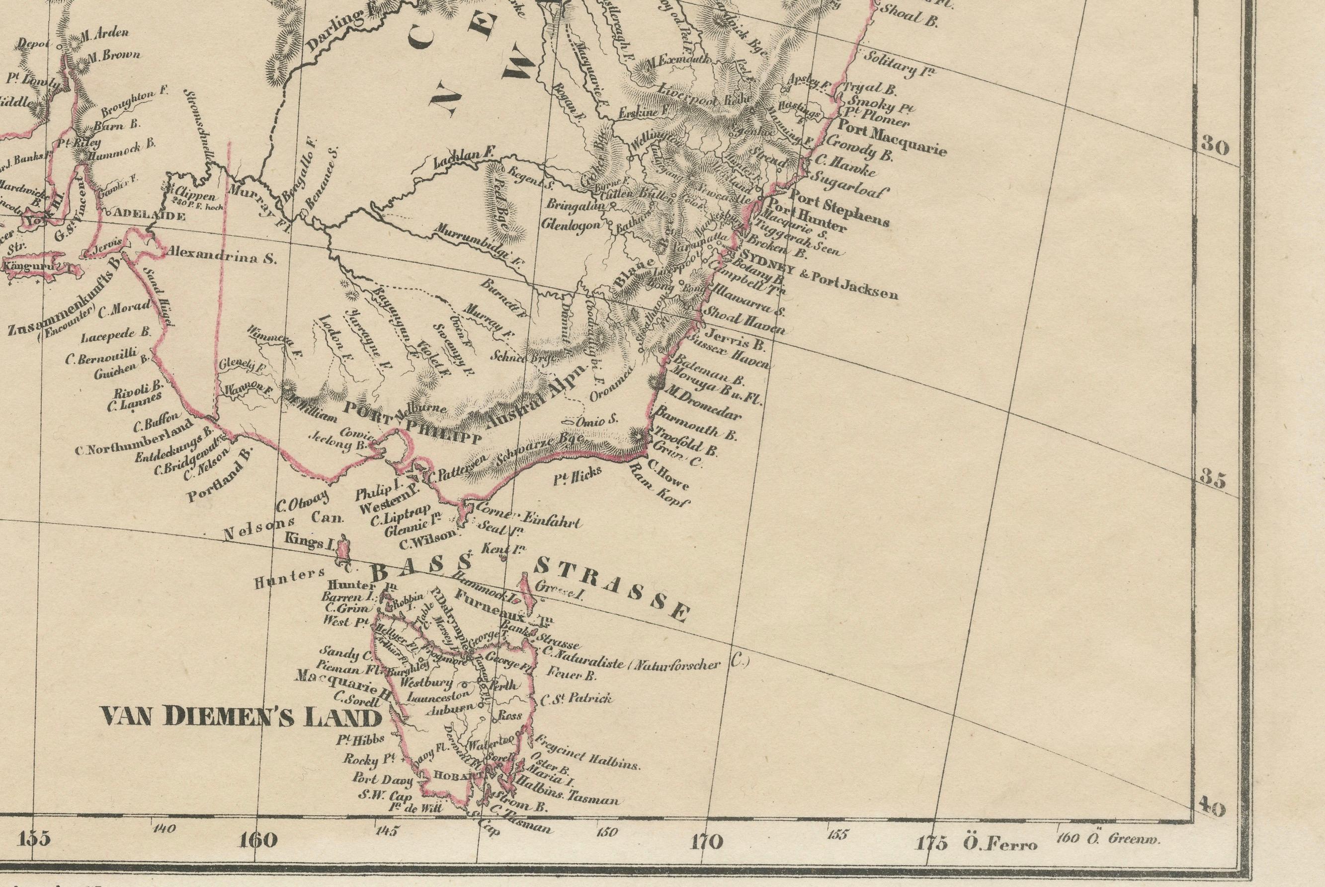
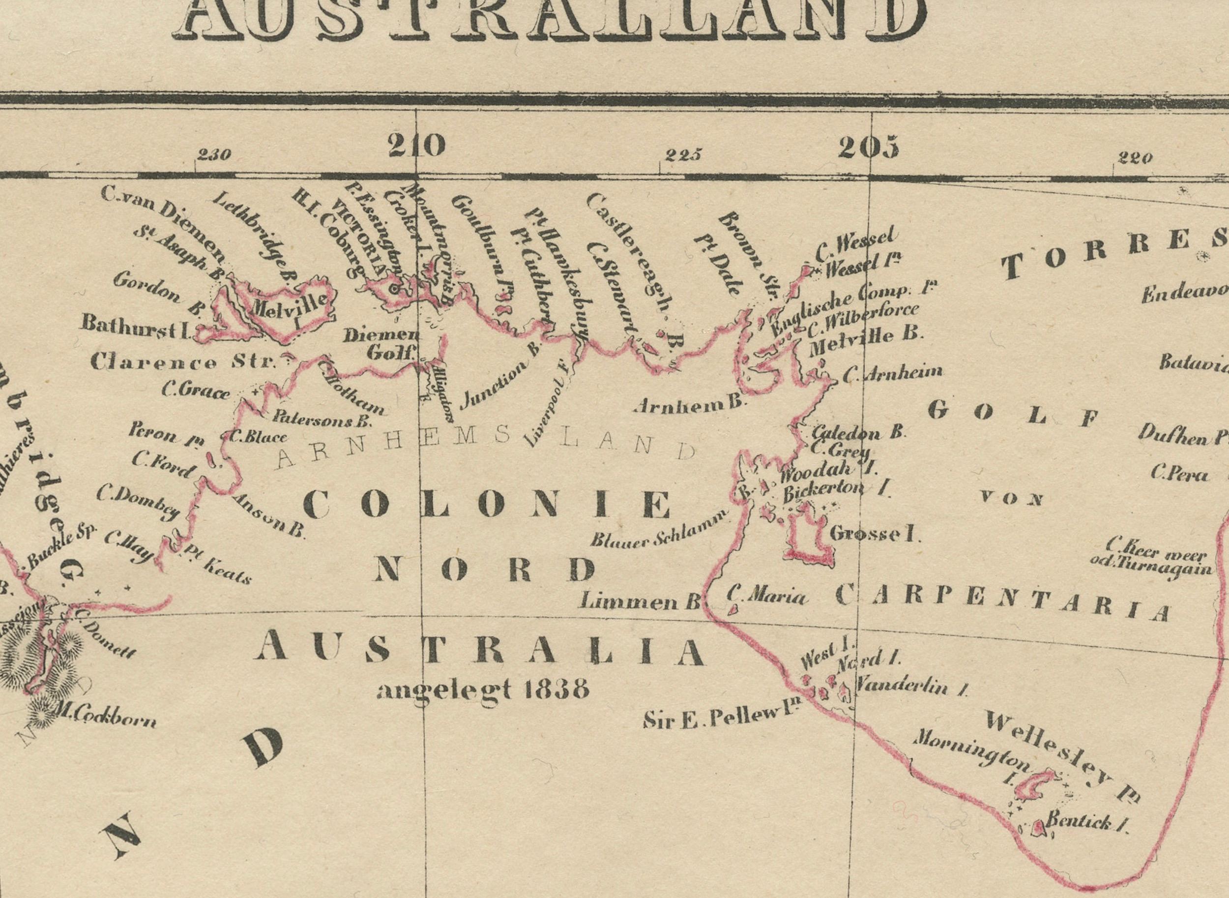
This historic map, titled "Australland," was published in Glogau in 1854 by cartographer Carl Flemming. It's an intricately detailed depiction of Australia, showcasing the division of colonies, which include New South Wales, West Australia, and Van Diemen's Land (now known as Tasmania). Towns, mountain ranges, rivers, and surrounding islands are meticulously marked, providing a comprehensive view of the mid-19th century Australian landscape.
A key feature of this map is the inclusion of a statistical table that gives a snapshot of the population distribution across the colonies as of 1841. This demographic information provides insight into the human geography of the time.
The map also honors the history of exploration and discovery in Australia, with notes referencing significant explorers such as De Witt, Tasman, and Flinders, among others. It acknowledges their contributions to charting the coastline and interior of the continent. The notes "Entdeckt Durch" followed by an explorer's name means "Discovered By," attributing the discovery of particular regions to these figures.
The cartographic style is indicative of the period, with fine engraving and a simple yet effective color scheme that differentiates land from sea, colonies, and borders. This map not only served as a practical reference for those living during the time but now serves as a historical document, offering valuable insights into the state of Australian exploration and colonization in the mid-1800s.