Maps & PrintsBartele Gallery · Langweer
Home / Antique Maps / Europe / South-East Europe

South-East Europe · 19th century

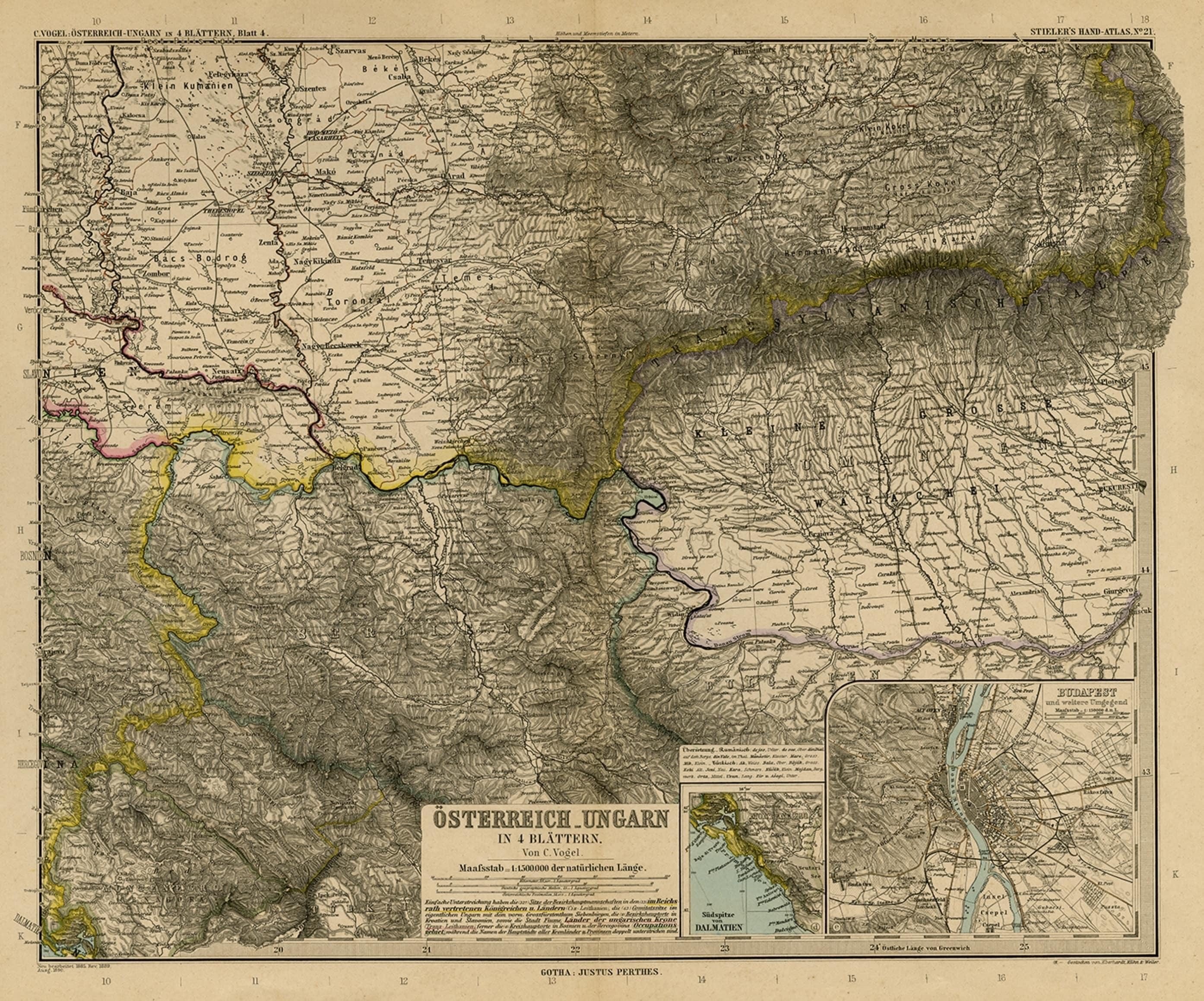
Antique Map of Eastern Europe, Incl Montenegro & Serbia & a Budapest Map, 1890

€ 120

Original antique · The actual sheet photographed · Certificate of authenticity on request · Sold unframed · Worldwide shipping from € 15 (rates)

Date
1890
Sheet size
39.7 × 48.8 cm (15.6 × 19.2 in)
Condition
Good
Reference
PCT-56516

Condition

Given age. Original middle fold, as issued. A few small closed tears in the margin edges (not affecting image). Some creasing in the top right margin corner. General age-related toning and/or occasional minor defects from handling.
About this sheet

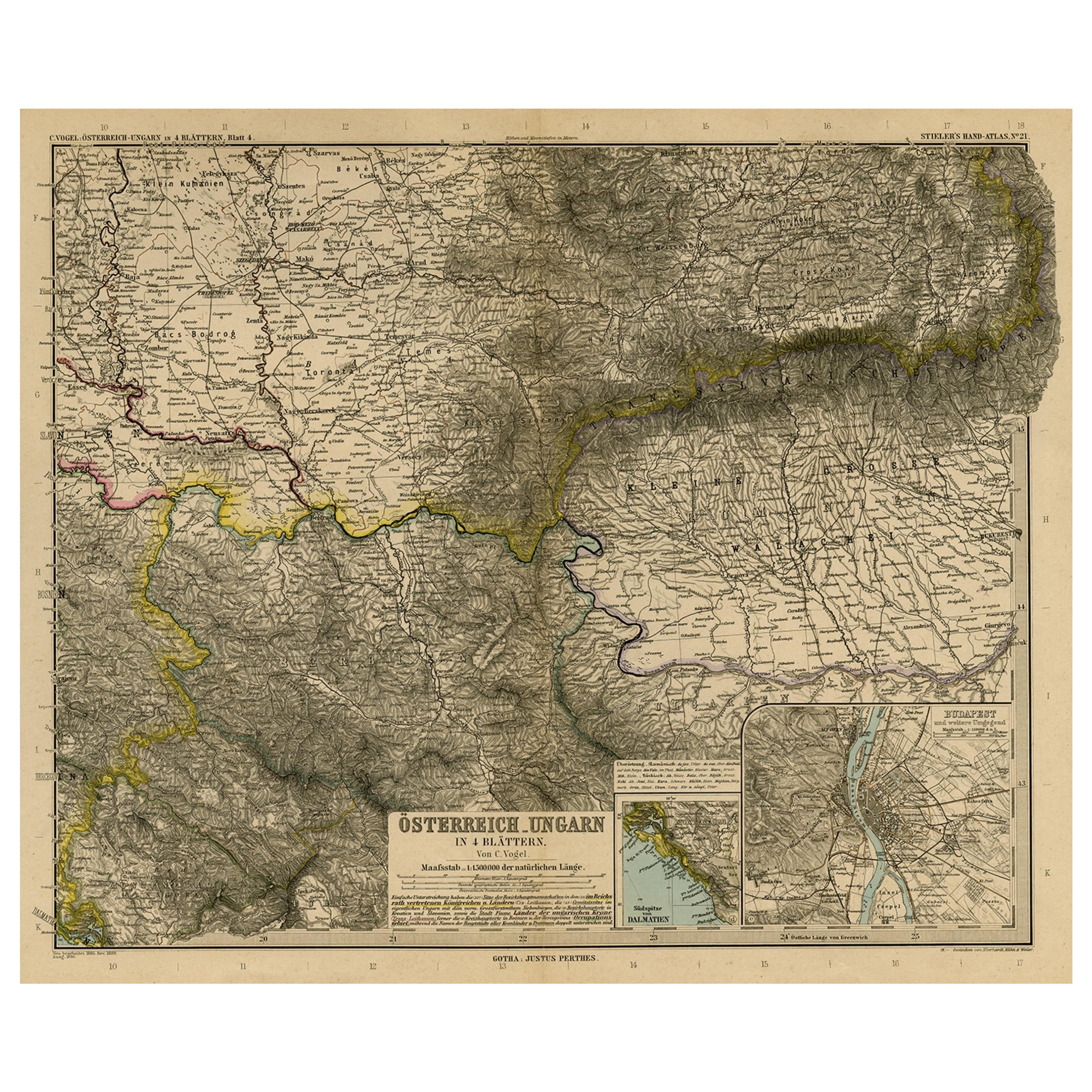
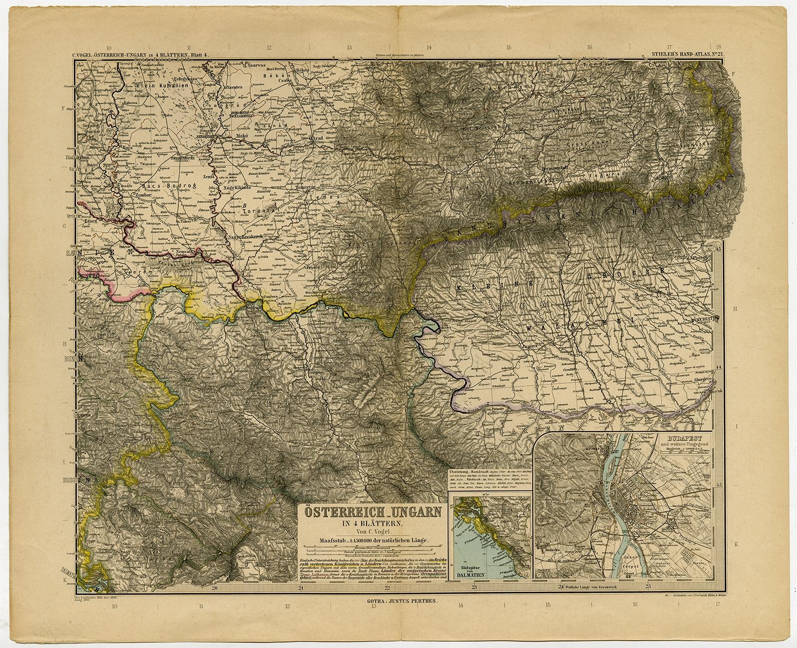
Antique map titled 'Osterreich-Ungarn in 4 Blattern, Blatt 4.'

Map of Eastern Europe, with Montenegro in the lower left corner, the southern edge of Hungary (area Baja and Szeged) and Serbia and Bulgaria. With a small inset map of Budapest and another of the southern tip of Croatia.Sheet 21 from 'Stieler's Hand-Atlas', published in Gotha: Justus Perthes, 1890.

Artists and engravers: Made by 'C. Vogel' after 'Eberhardt, Kuhn & Weiler'.

More from South-East Europe

Ask about this sheet

Antique Map of Eastern Europe, Incl Montenegro & Serbia & a Budapest Map, 1890
1890 · Ref. PCT-56516 · € 120
We reply by email, usually within one working day.