About this sheet
Antique Map of Idaho – Railroads, Mining Camps & Counties, 1888
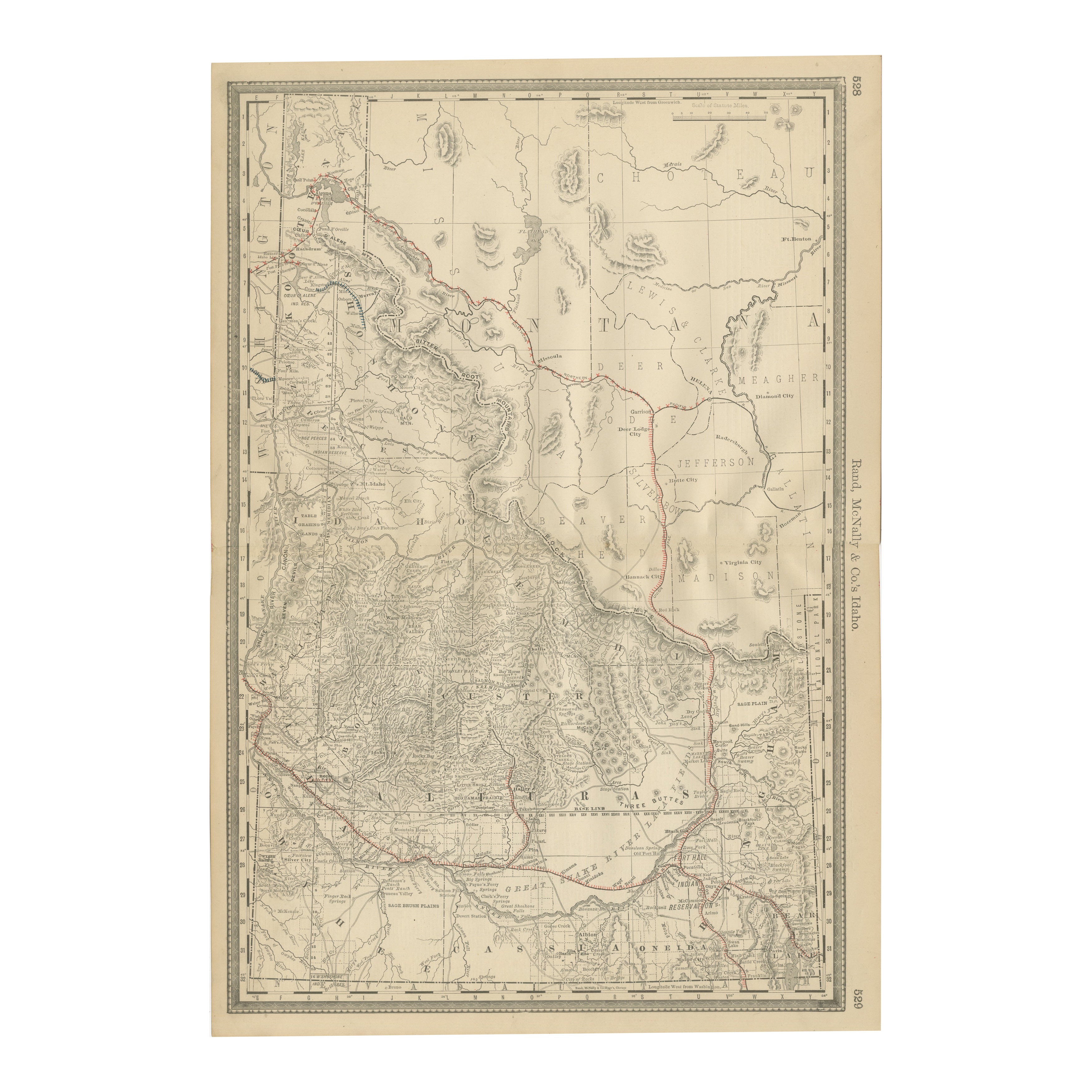
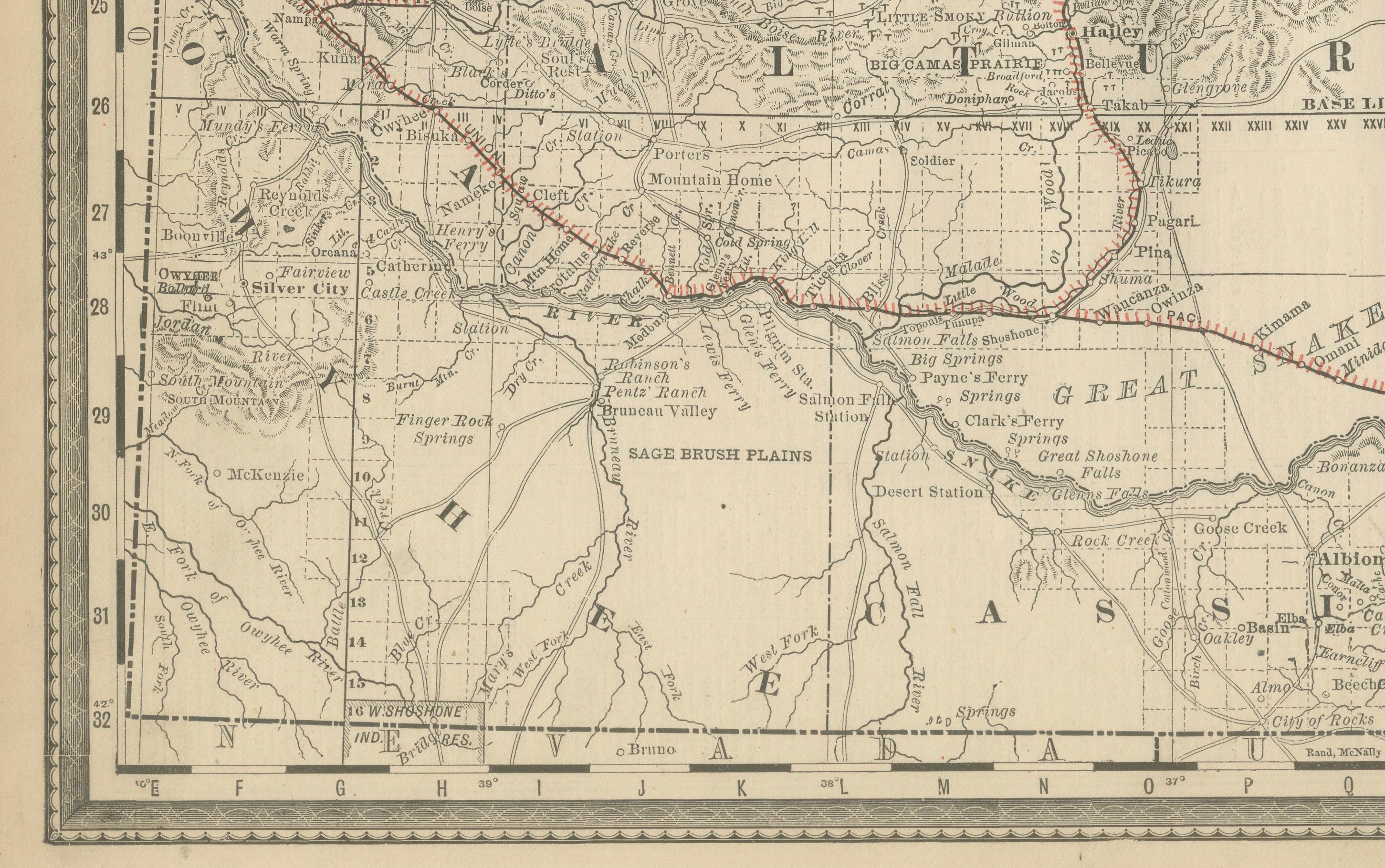
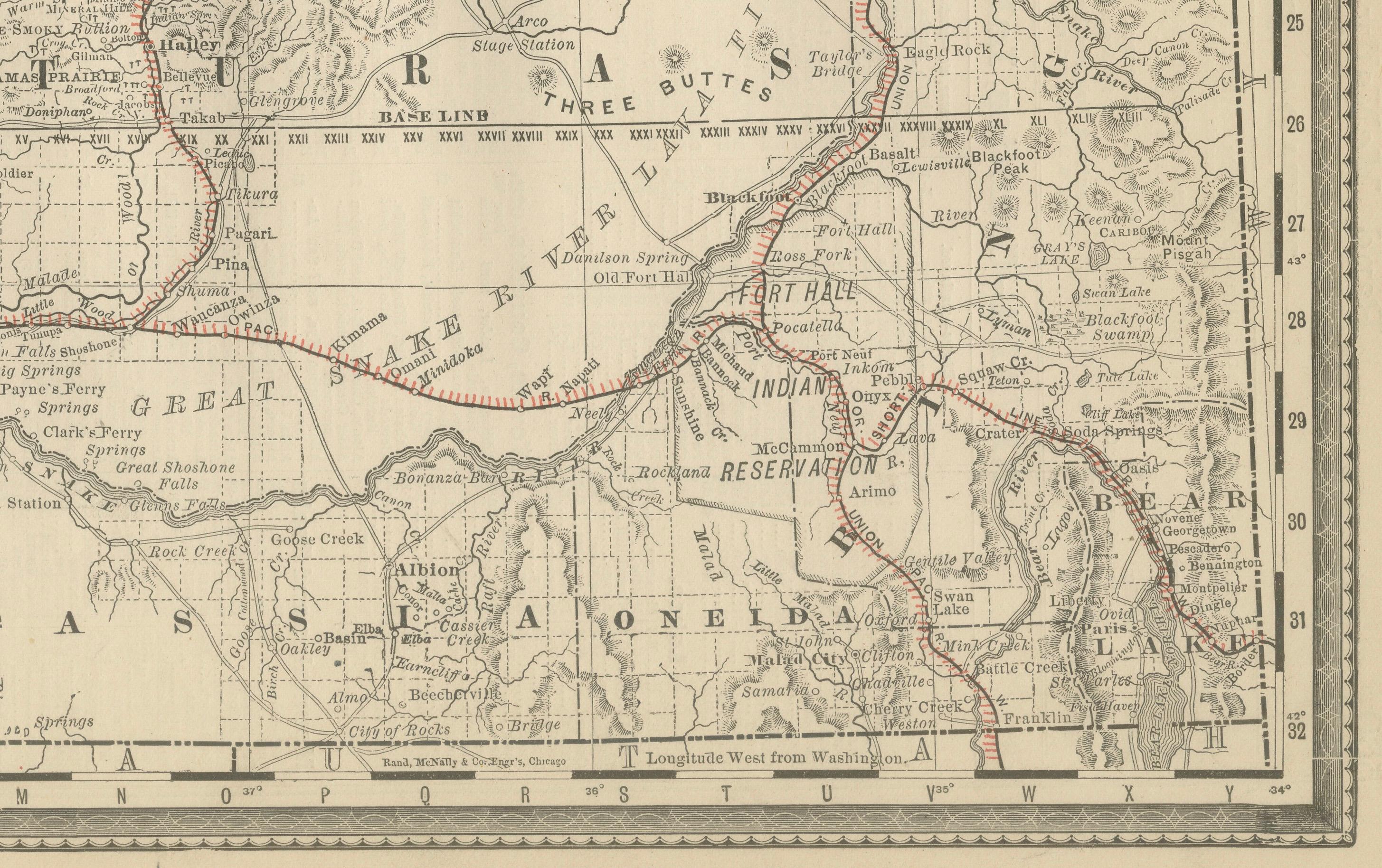
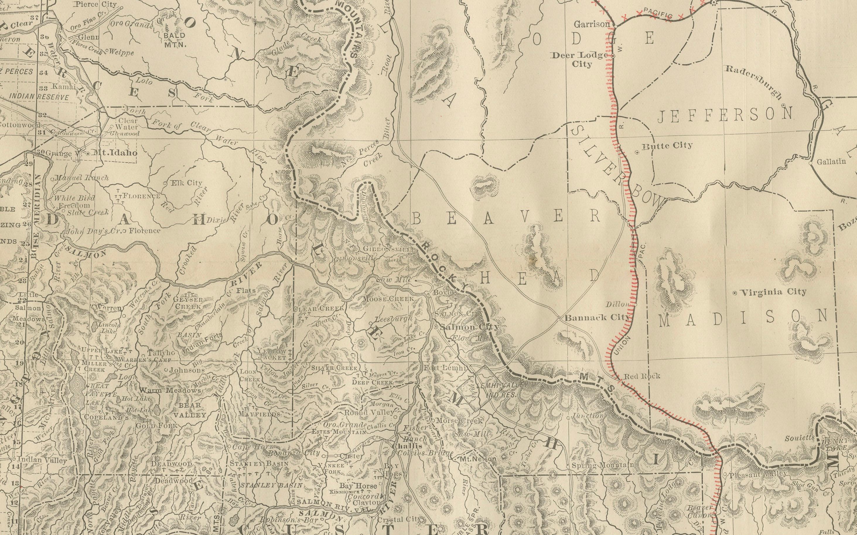
This antique engraved map depicts the Territory of Idaho in 1888, engraved and published by Rand, McNally & Co. in Chicago for their Improved Indexed Business Atlas and Shippers Guide. It captures Idaho in the territorial period—22 years before it gained statehood in 1890—and provides a detailed view of its counties, towns, transportation routes, and rugged natural features.
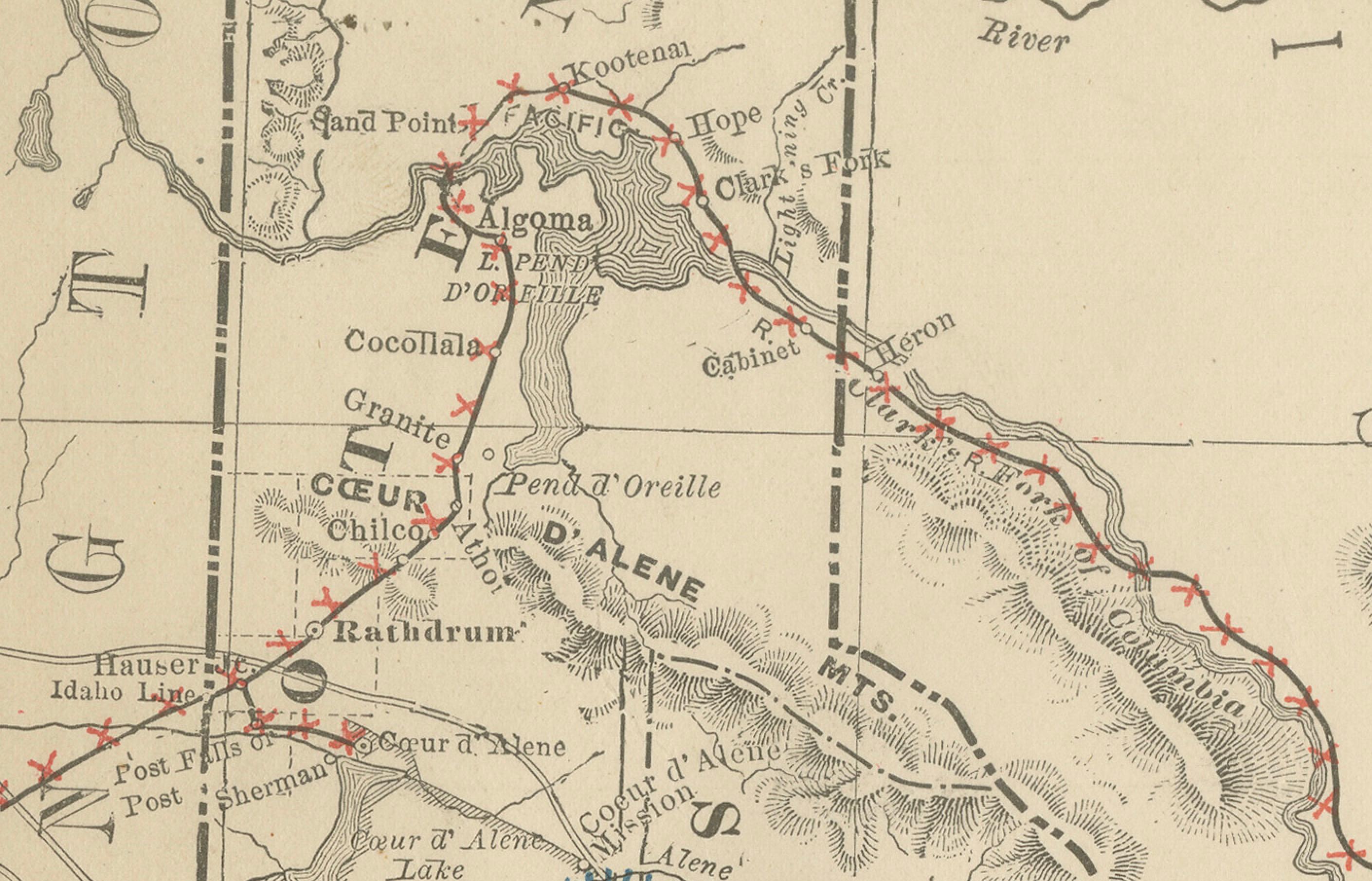
The map shows railroad routes, particularly the Northern Pacific line skirting the northern border through towns such as Rathdrum, Coeur d’Alene, and Lewiston, connecting Idaho to Spokane and Montana. Additional routes extend southward into mining and agricultural districts, including stage roads and trails feeding smaller frontier communities. This transportation network was essential for moving ore, livestock, and agricultural goods out of the territory.
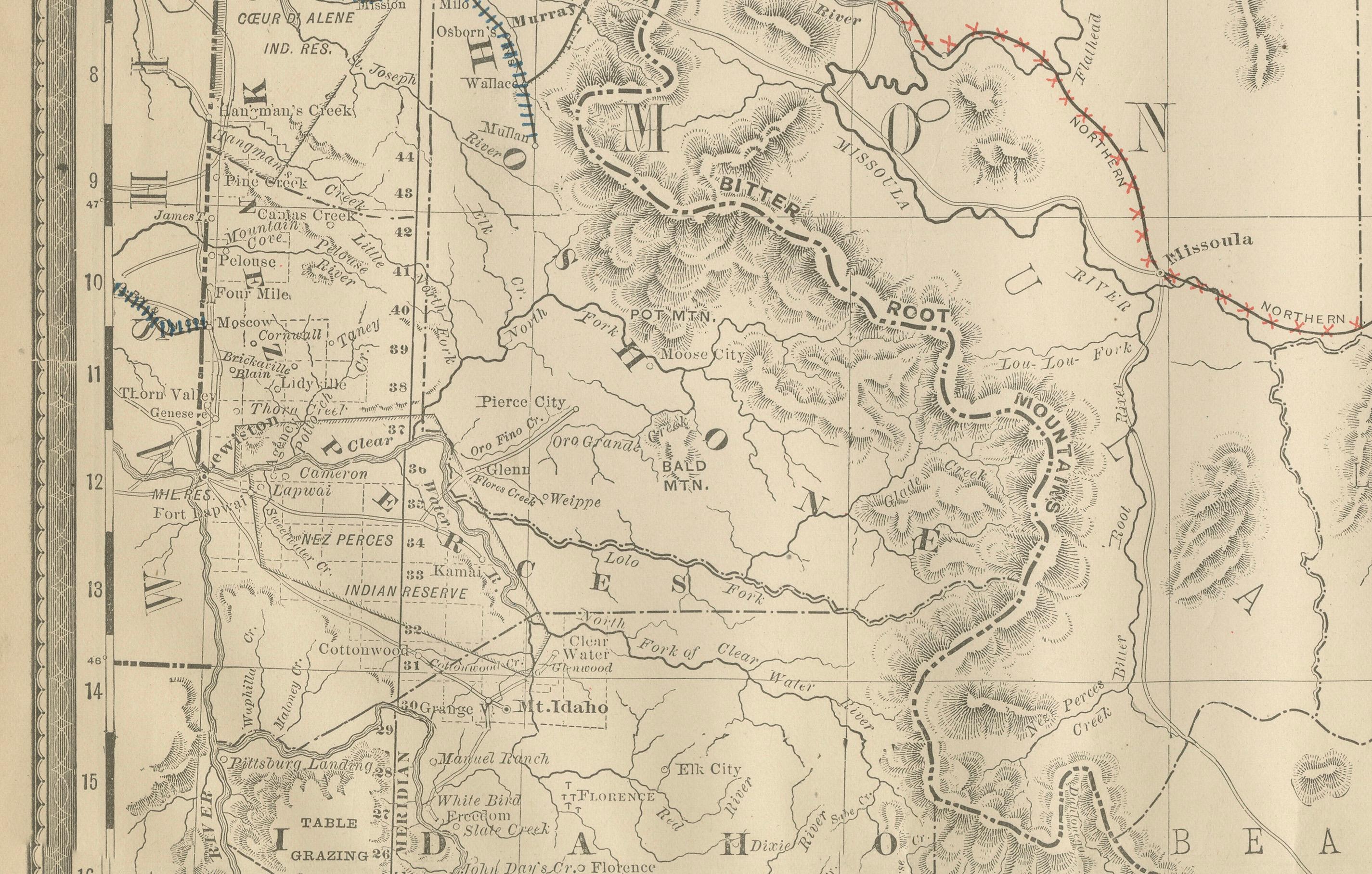
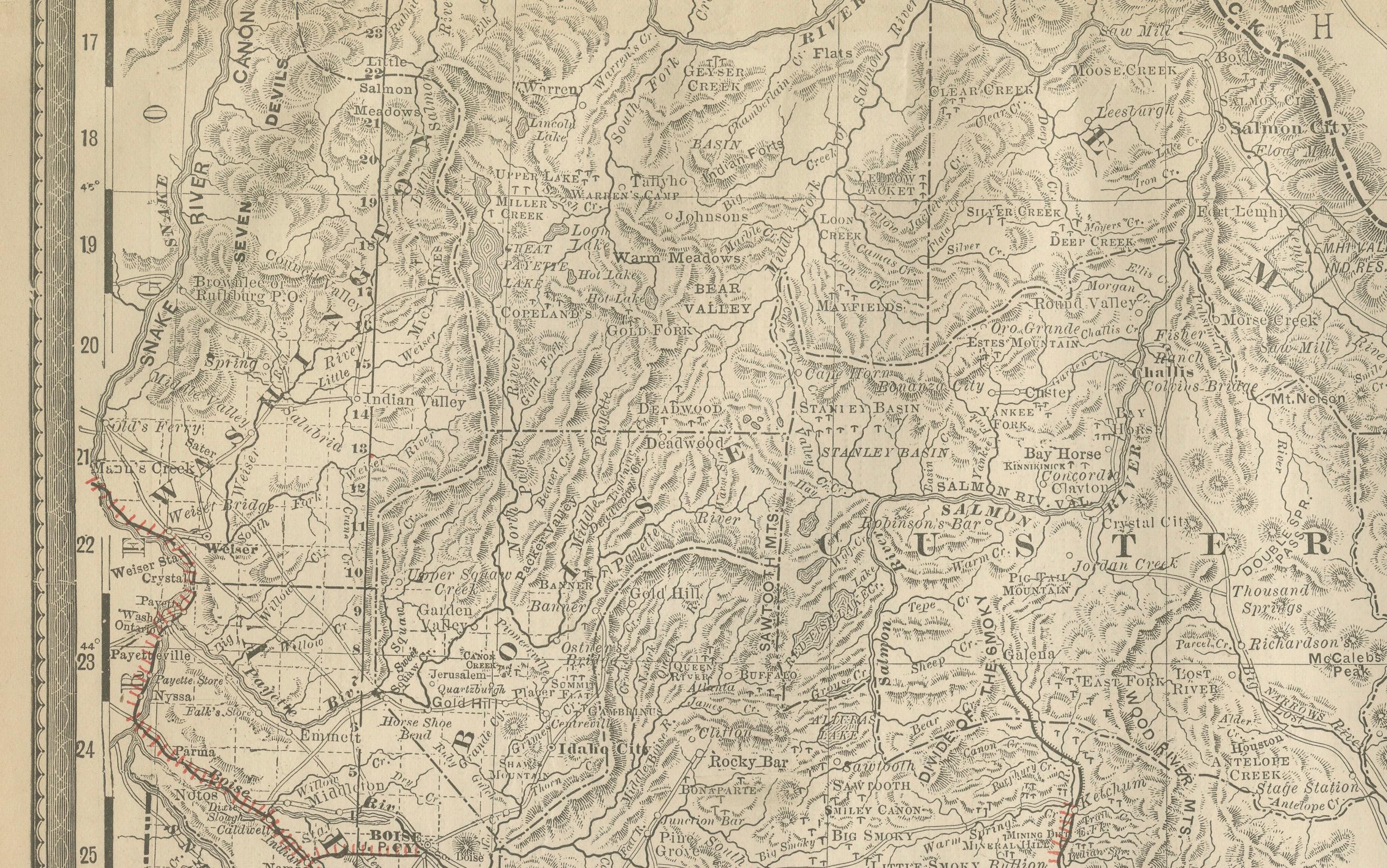
Counties are clearly marked, including Boise, Ada, Lemhi, Idaho, Nez Perce, Alturas, and Shoshone. Mining towns, many of which sprang up during the silver and gold rushes of the 1860s and 1870s, are noted, such as Silver City, Rocky Bar, Warren, and Pierce City. These were central to Idaho’s early economy and population growth. The map also marks military posts and Native American lands, including the Fort Hall Indian Reservation and the Lemhi Reservation, reflecting the tensions between settlers and indigenous peoples in the late 19th century.
Geographic features are well represented, with the Bitterroot Range, Sawtooth Mountains, Salmon River, and Snake River all prominently drawn. The Great Lava Bed and the vast “Sage Brush Plains” in southern Idaho emphasize the challenging terrain that shaped settlement and travel.
This map is significant because it captures Idaho during its transition from a sparsely populated frontier to an organized territory on the verge of statehood. Mining, cattle ranching, and farming were driving its development, while railroads and river transport played an increasingly important role in linking the region to national markets.
Printed as a steel engraving, the map demonstrates the precision for which Rand McNally was renowned. It was intended as a practical reference for shippers, businessmen, and settlers navigating the opportunities of the American West.
Condition summary: Very good condition overall. Paper shows mild toning consistent with age, with faint foxing in the margins. Original fold lines as issued, no major tears or repairs. Plate impression remains clear and paper strong.
Framing tips: A walnut or mahogany frame enhances the historic character of the map, while a black frame with a cream or parchment mount provides a sharp, modern presentation. A double mat in ivory with a muted green accent complements Idaho’s mountainous and forested character.
Technique: Engraving
Maker: Rand, McNally & Co., Chicago, 1888