About this sheet
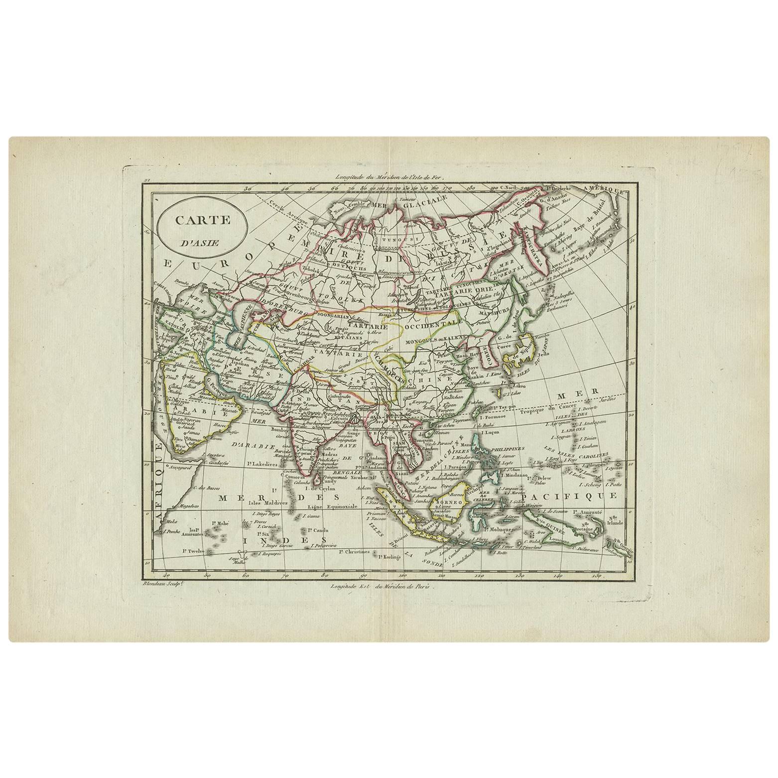
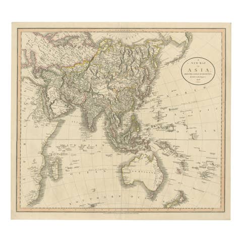
Asia Map, from Mediterranean to Japan – Antique Map by Alexandre Blondeau, c. 1800
This fine circa 1800 map of Asia presents the entire continent in a single, coherent composition, extending from the eastern Mediterranean and parts of northeastern Africa across the Middle East, India, China, and Southeast Asia to the Pacific, reaching as far north as the Bering Sea and south to Java and New Guinea. The map offers a compelling snapshot of European geographical knowledge at the turn of the 19th century, combining relatively well-established regions with areas that remained speculative and imperfectly understood.
The map was produced by Alexandre Blondeau, a French cartographer active around the late 18th and early 19th centuries. Blondeau’s work reflects the transitional phase of cartography during this period, when scientific measurement and exploration were steadily improving accuracy, yet vast regions—particularly in northern and eastern Asia—were still mapped using incomplete reports, travelers’ accounts, and earlier sources.
One of the most interesting features of this map is its depiction of the extreme northeast of Asia. Japan, Hokkaido, Sakhalin Island, Kamchatka, and Korea appear in noticeably distorted and misshapen forms, revealing the limited and often conflicting information available to European mapmakers at the time. Sakhalin, in particular, is ambiguously rendered, reflecting uncertainty over whether it was an island or connected to the mainland. These elements make the map especially appealing to collectors interested in the evolution of geographic knowledge and the history of exploration.
The map is finely engraved with clear political and regional boundaries, enhanced by original outline hand coloring. Major seas, rivers, and mountain ranges are carefully delineated, while the use of a graticule underscores the scientific ambitions of the period. The overall aesthetic is balanced and elegant, with generous margins that frame the image and make it well suited for both scholarly appreciation and decorative display.
Condition:
Good condition. Light, even age-related toning to the paper. Minor scattered spotting and light handling marks, mostly confined to the margins. The engraved image remains clear and well-defined, with visible plate marks.
Framing tips:
This map works beautifully in a classic dark walnut or ebonized frame with a soft ivory or light beige mat to emphasize its historical character. For a more contemporary interior, a simple black frame with a wide neutral mat will give the map a clean, gallery-style presentation while allowing the detail and coloring to stand out.
Technique: Engraving with original outline hand color
Maker: Alexandre Blondeau, France, circa 1800