About this sheet
World War II Pictorial Map of India and Southeast Asia by Jacques Mercier, 1942
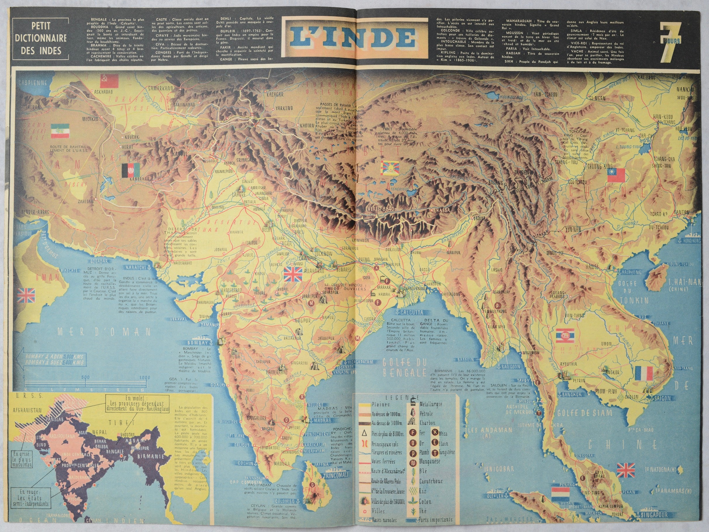
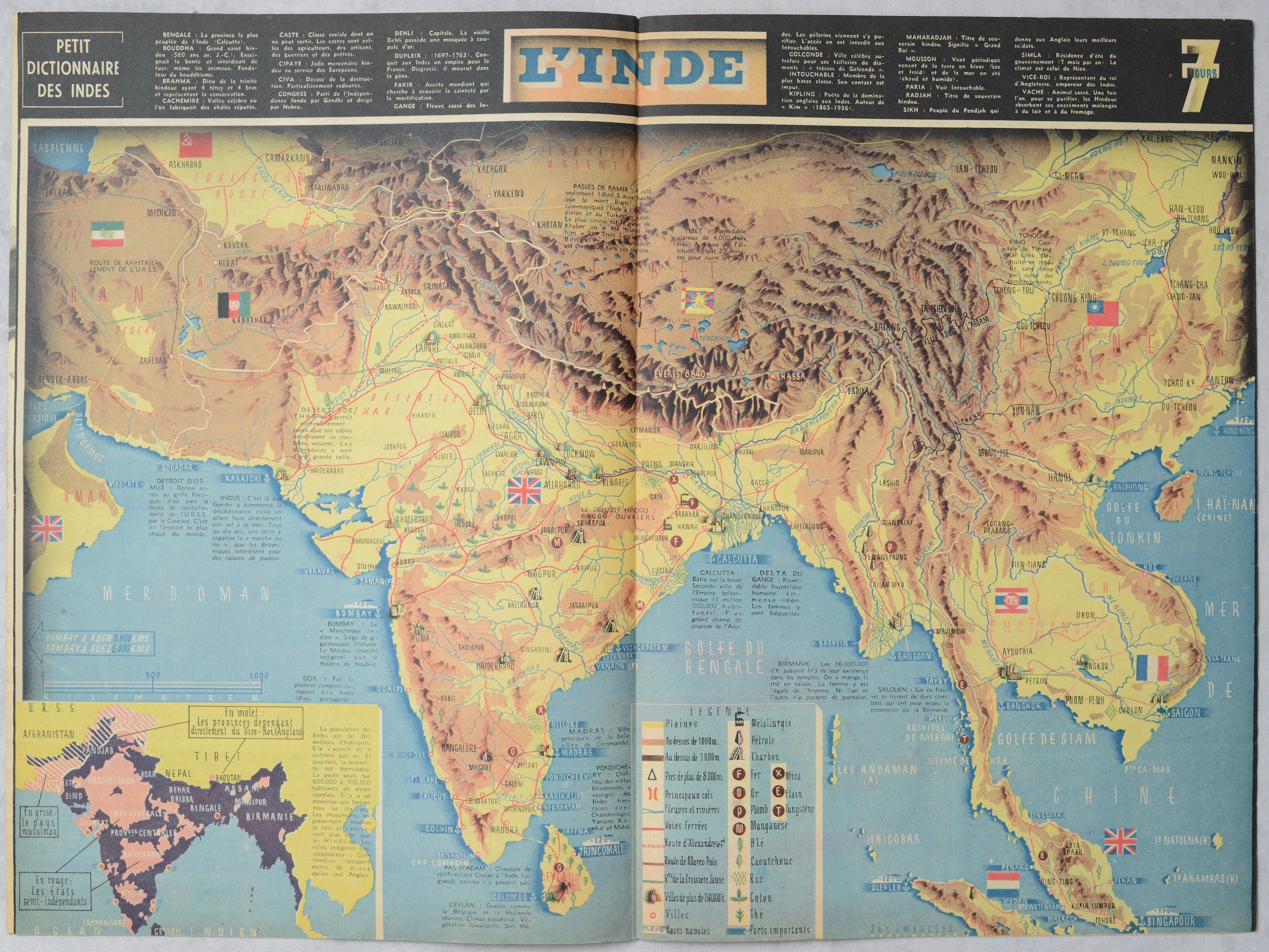
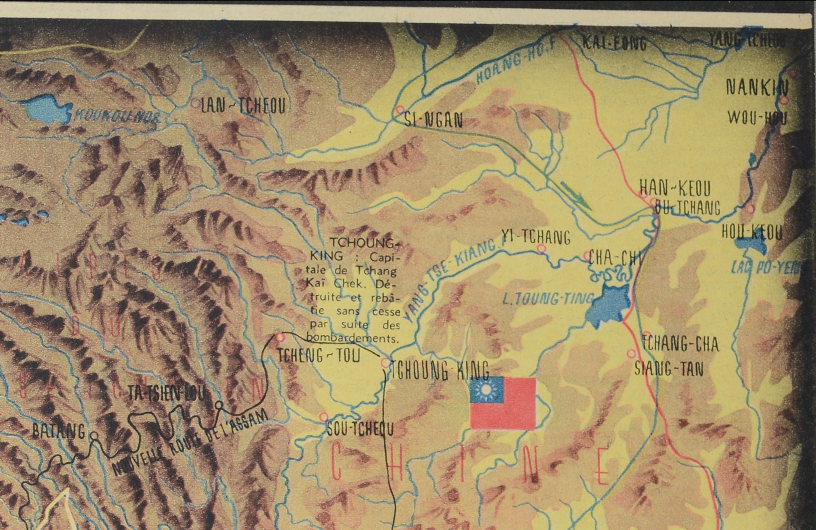
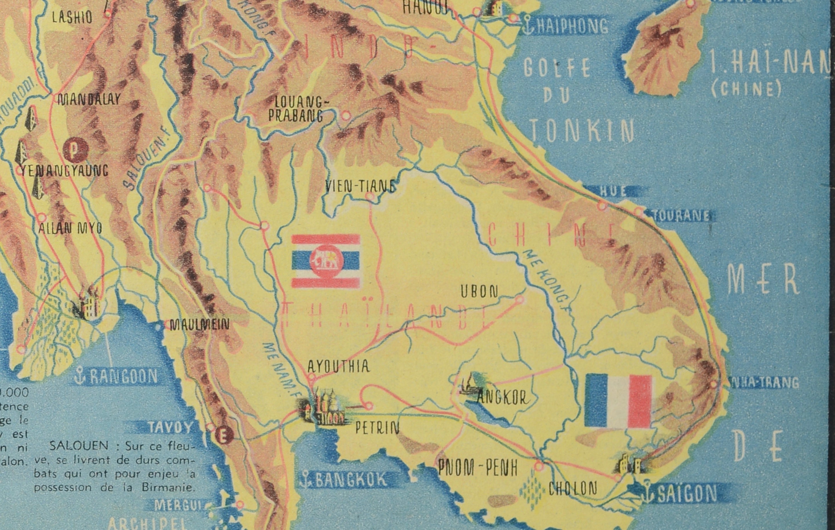
Original World War II-era pictorial map of India and Southeast Asia, designed by French graphic artist Jacques Mercier and published in the March 8, 1942 issue of the French illustrated magazine 7 Jours.
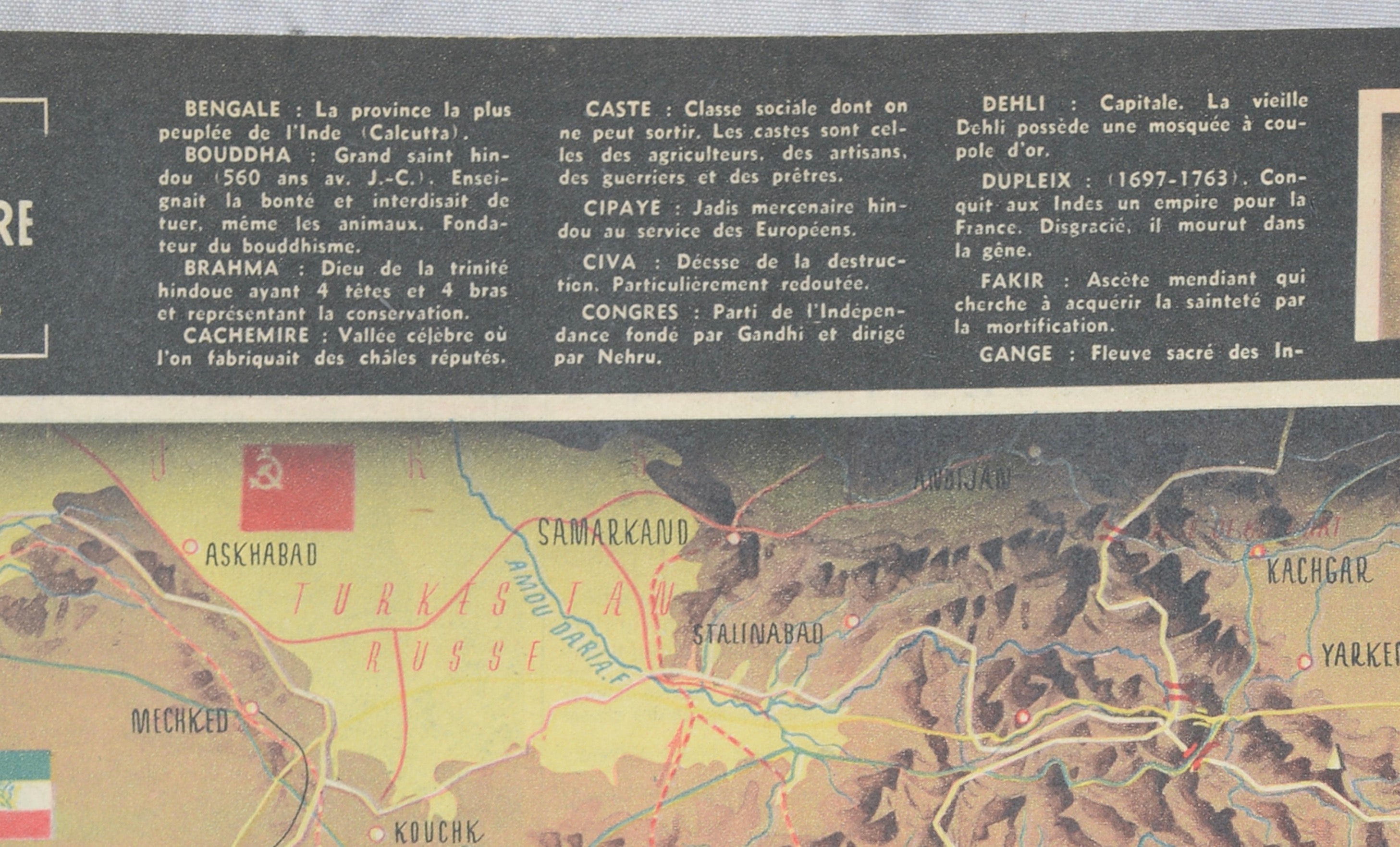
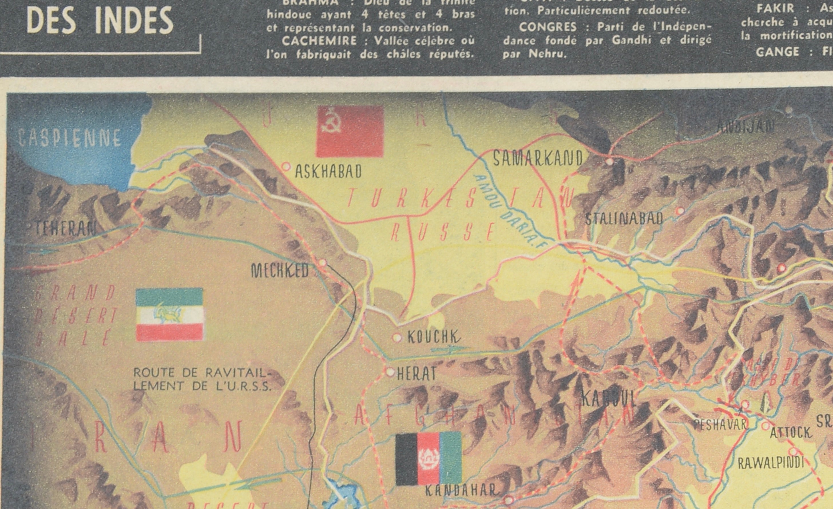
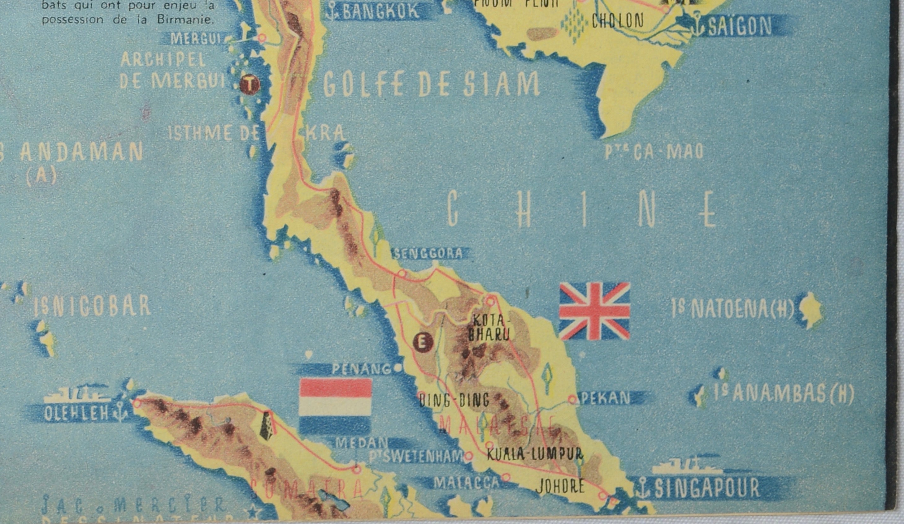
Entitled “L’Inde,” this striking large-format map centers on the Indian subcontinent and extends from Iran and Afghanistan across the Himalayas and Tibet to China, Hong Kong and French Indochina. Burma, Thailand, Malaya, Singapore and Ceylon are also prominently depicted.
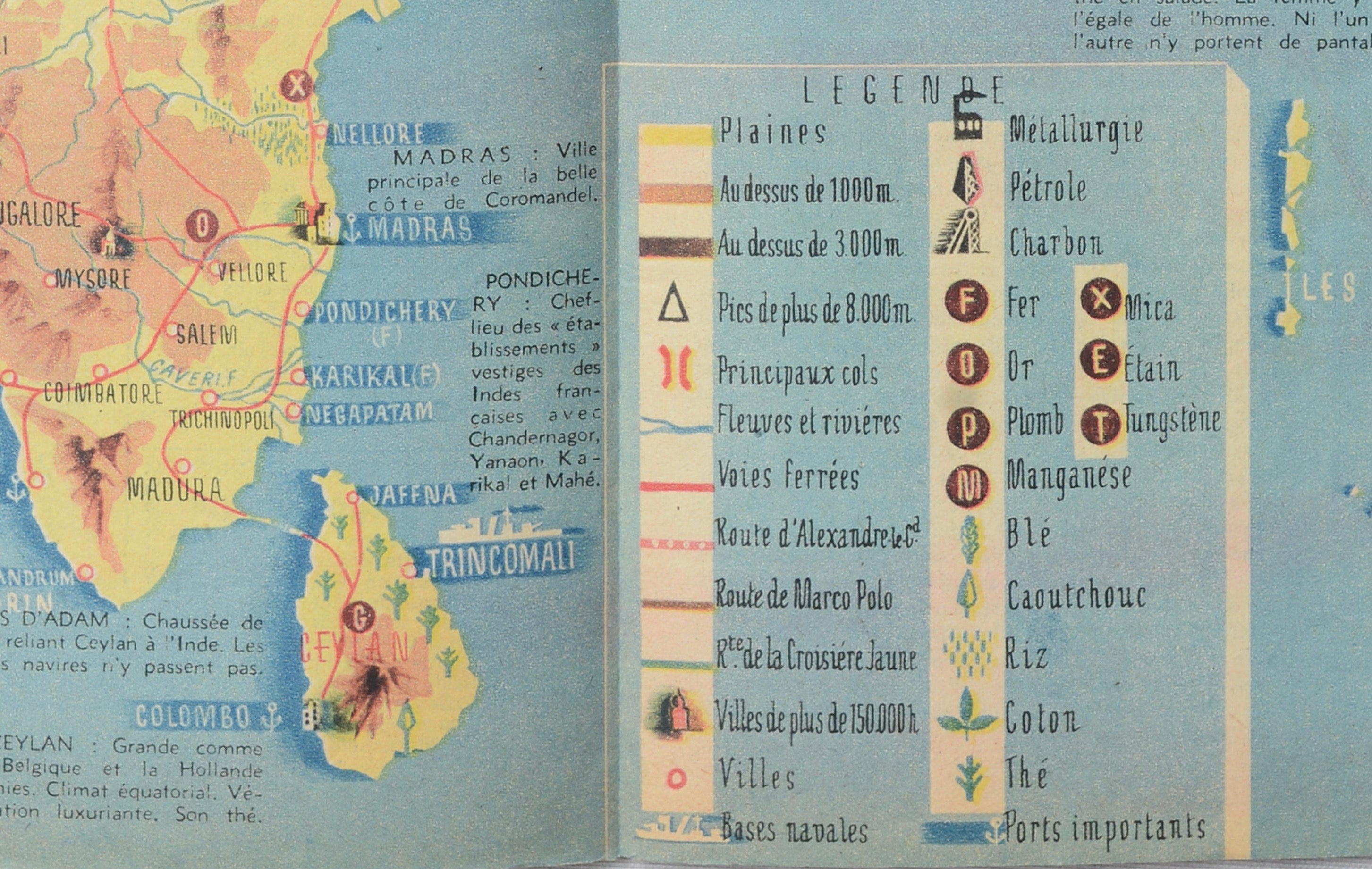
Published at a critical moment during World War II, the map combines dramatic relief-style cartography with political, military and economic information. A detailed legend identifies elevations, mountain passes, naval bases, important ports and natural resources including petroleum, coal, iron, tin, manganese, rubber, rice, cotton and tea.
Historical routes are also indicated, including those associated with Alexander the Great, Marco Polo and the Yellow Expedition. National and colonial flags throughout the map emphasize the complex geopolitical situation in Asia during the war.
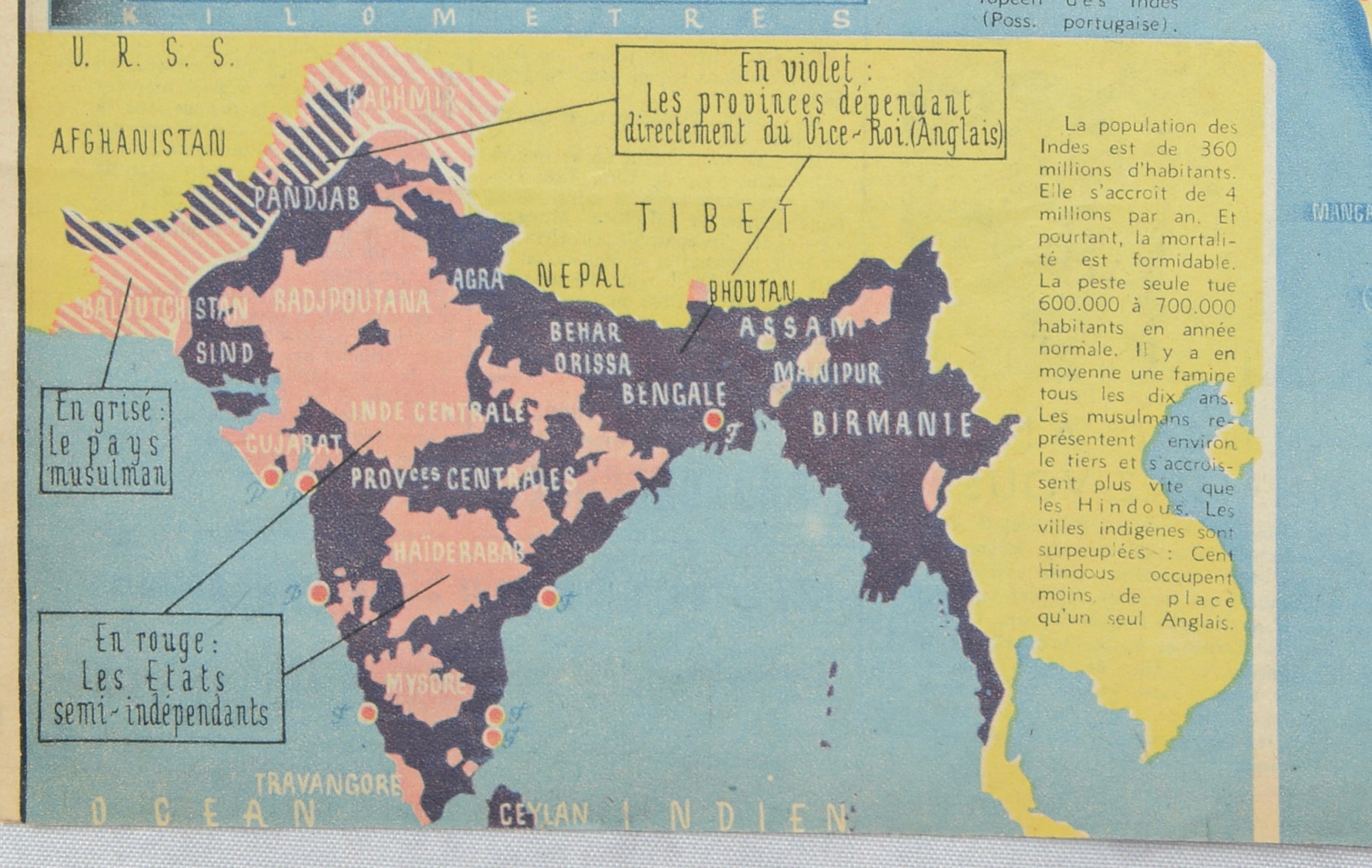
An inset at lower left illustrates the political divisions of British India, distinguishing semi-independent states, Muslim territories and areas under British administration. Across the upper margin, a “Petit Dictionnaire des Indes” provides contemporary explanations of geographical and cultural terms.
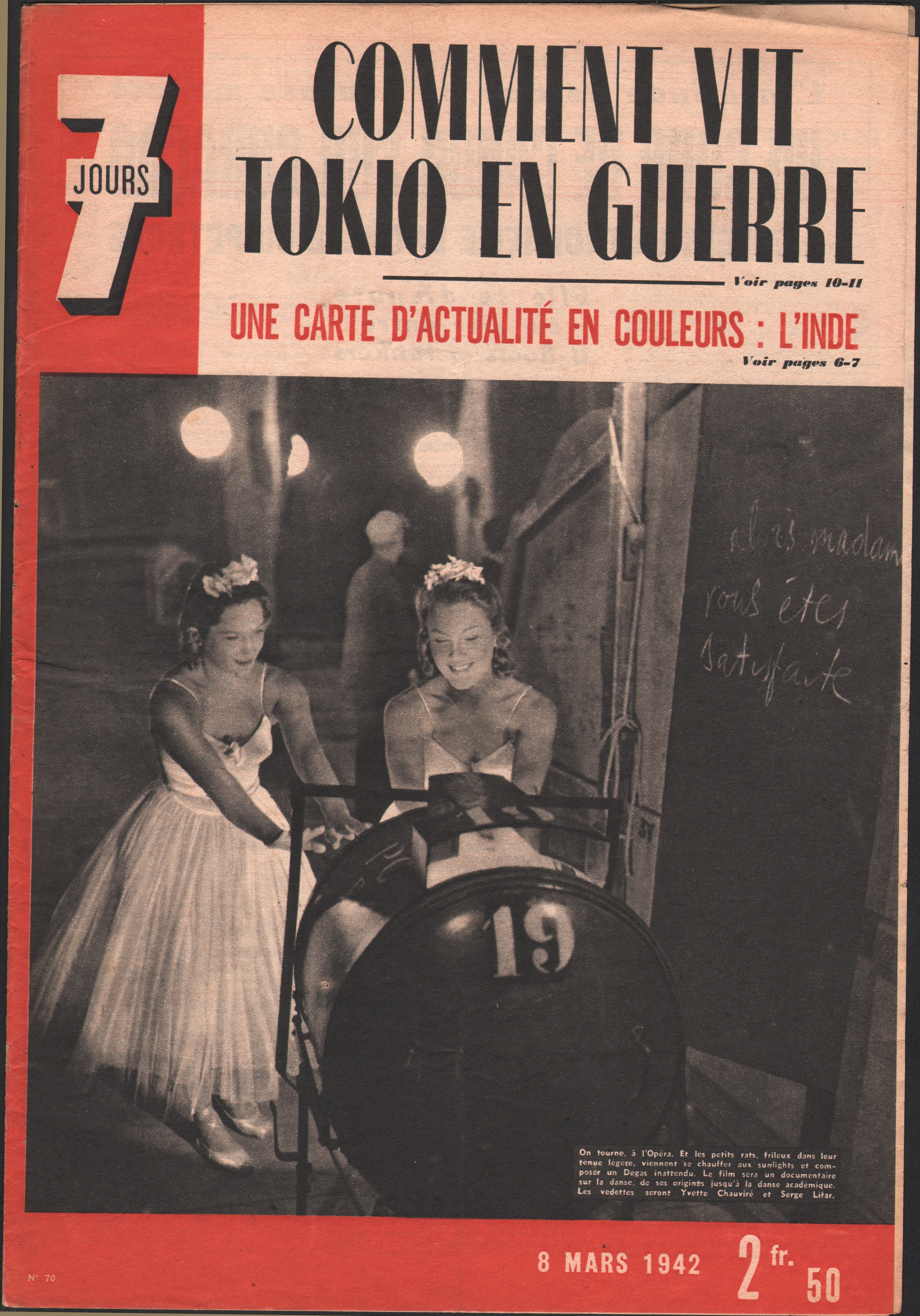
The complete March 8, 1942 issue of 7 Jours accompanies the map, retaining its striking original wartime magazine cover.
An exceptionally decorative piece of wartime graphic design combining cartography, geopolitics, colonial history and French journalism.
ARTIST
Jacques Mercier
PUBLICATION
7 Jours, No. 70
DATE
March 8, 1942
MEDIUM
Printed color map on paper, published as a double-page spread within the original magazine.
DIMENSIONS
Approximately 22.1 × 16.4 inches (56.1 × 41.7 cm).
CONDITION
Very good vintage condition. The map is clean and retains strong, attractive printed color. Original centerfold with staple as issued. Minor age-related wear consistent with a magazine publication of this period. Please examine the photographs carefully for condition.
STYLE
Art Deco / World War II Graphic Design / Pictorial Cartography
SUBJECT
India; Southeast Asia; Iran; Afghanistan; Tibet; China; Burma; Indochina; Thailand; Malaya; Singapore; Ceylon; World War II; British Empire; colonial history.
NOTES
Original 1942 publication, not a modern reproduction. The complete issue of 7 Jours magazine is included. Sold unframed.