About this sheet
Decorative Map of Manchester and Environs, Victorian Industrial Lancashire Map, 1885
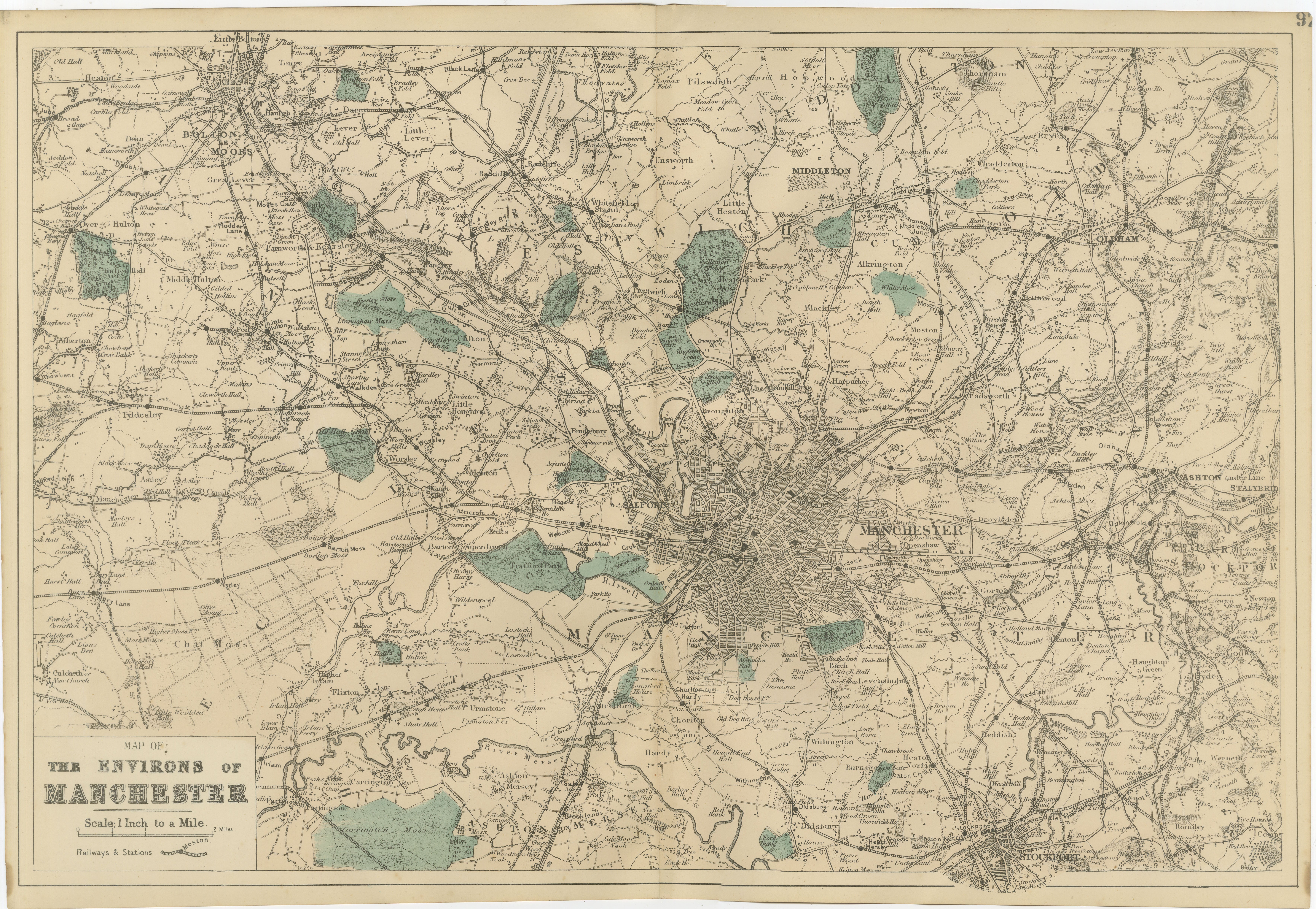
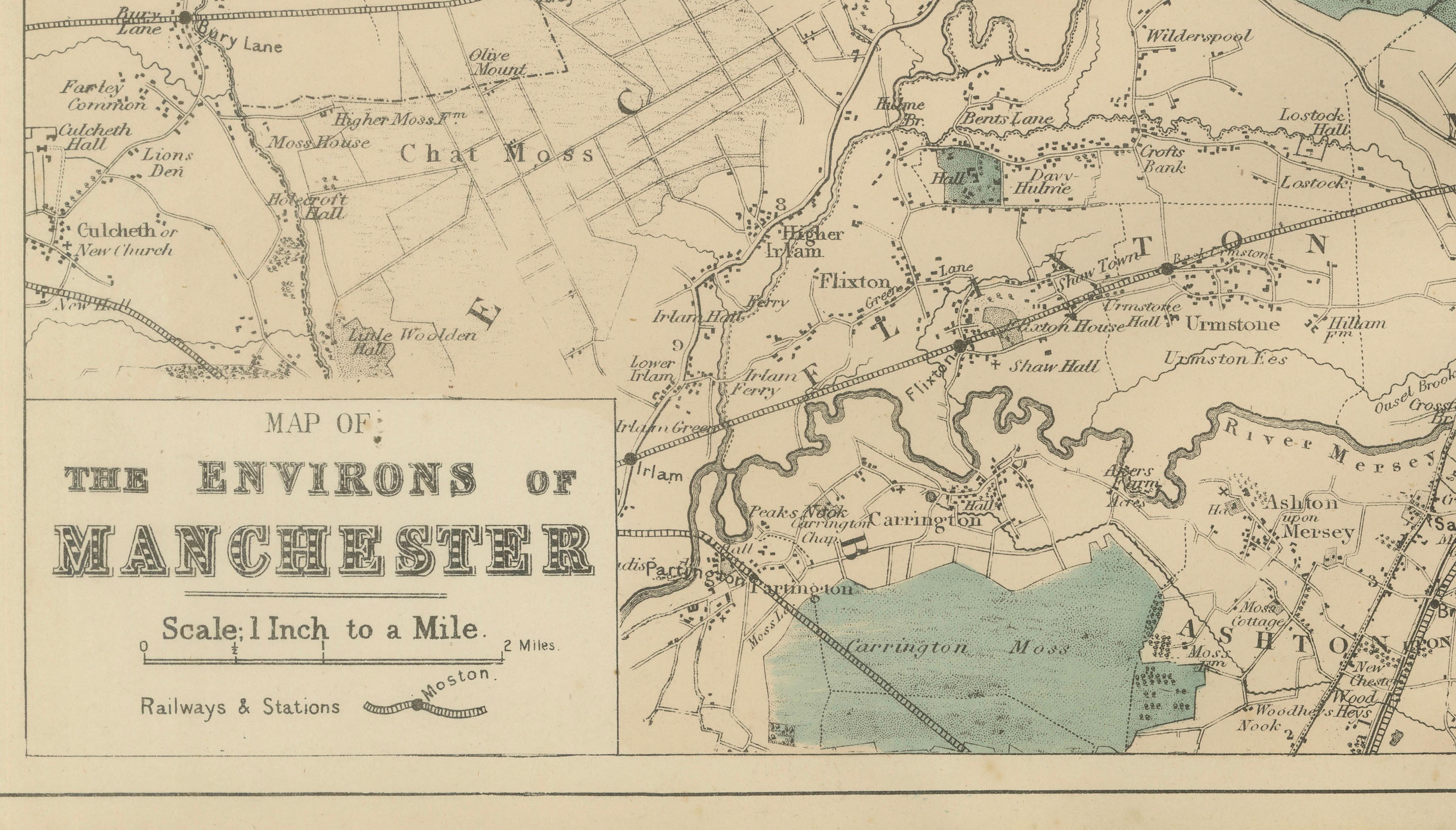
This finely detailed Victorian map titled “Map of the Environs of Manchester” presents the rapidly expanding industrial landscape surrounding Manchester in the late nineteenth century. Published in 1885 as part of a British atlas series, the map captures one of the most dynamic urban regions of the Industrial Revolution, when Manchester was widely regarded as the world’s leading manufacturing city and the symbolic heart of industrial Britain.
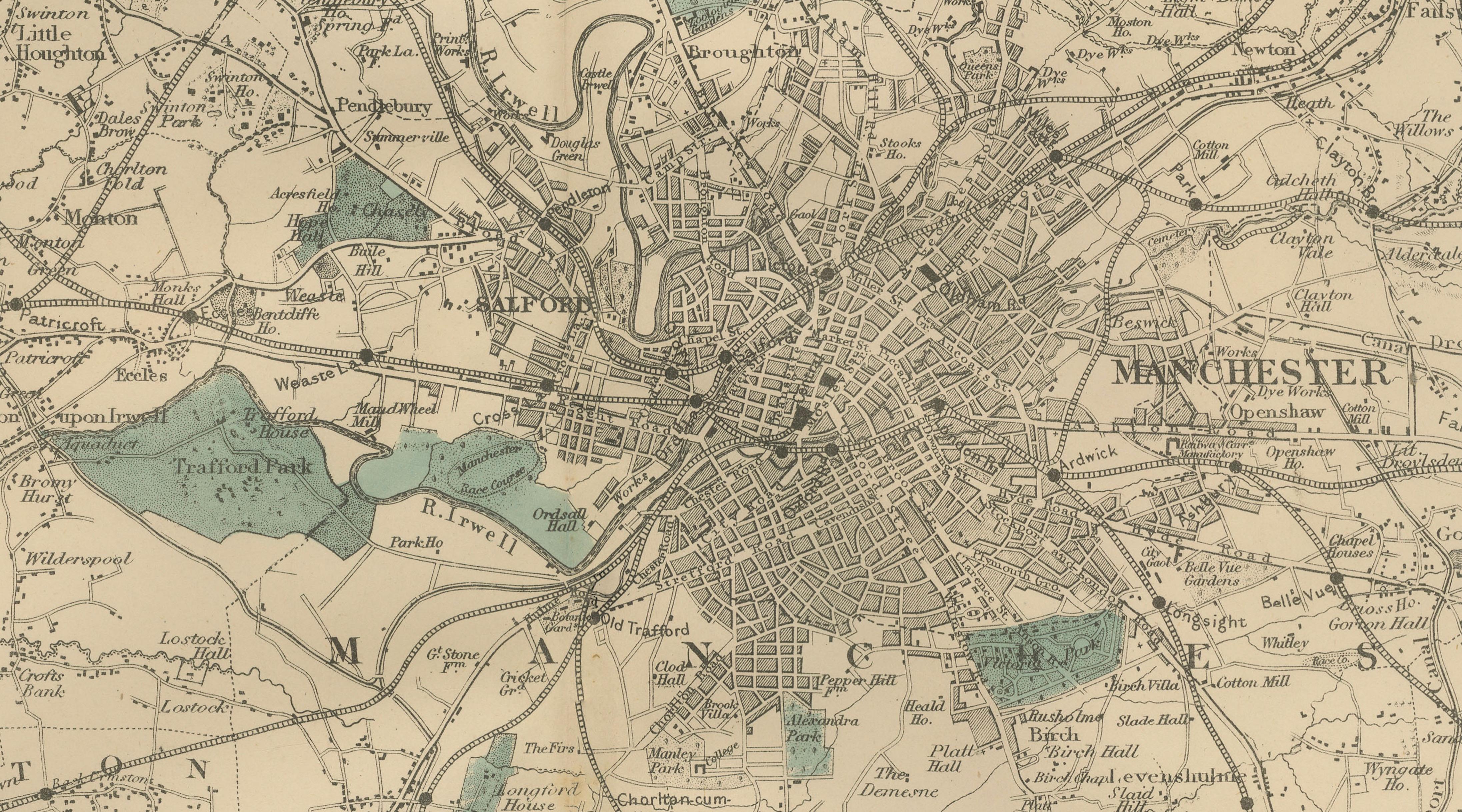
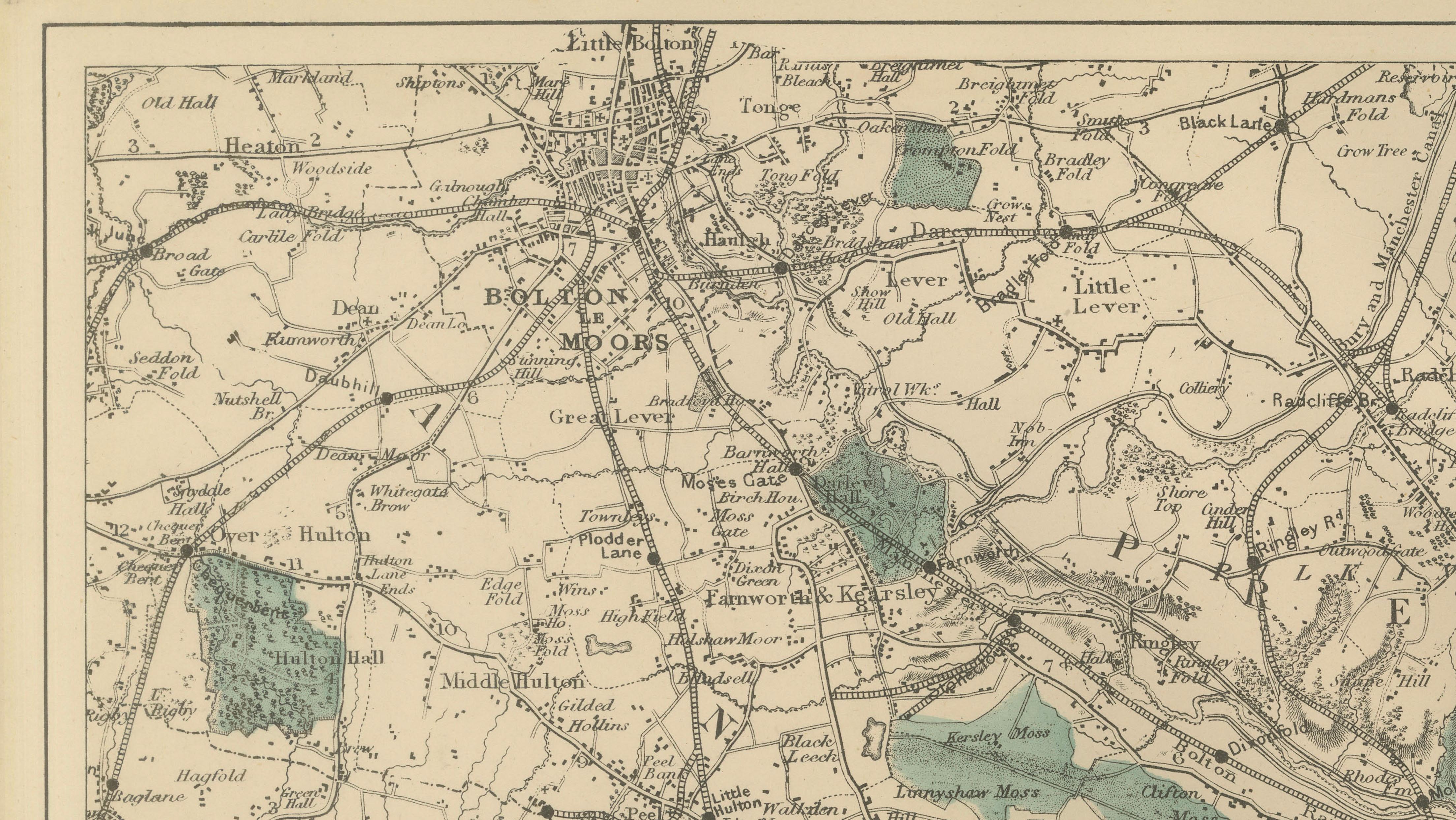
The map shows Manchester at its dense urban core, with the surrounding industrial towns and suburbs radiating outward in all directions. Salford appears immediately to the west across the River Irwell, while important satellite towns such as Bolton, Middleton, Oldham, Ashton-under-Lyne, and Stockport form a network of manufacturing communities connected by roads and railways. These towns were central to the cotton spinning, engineering, and textile industries that made Lancashire one of the most economically powerful regions in the world during the nineteenth century.
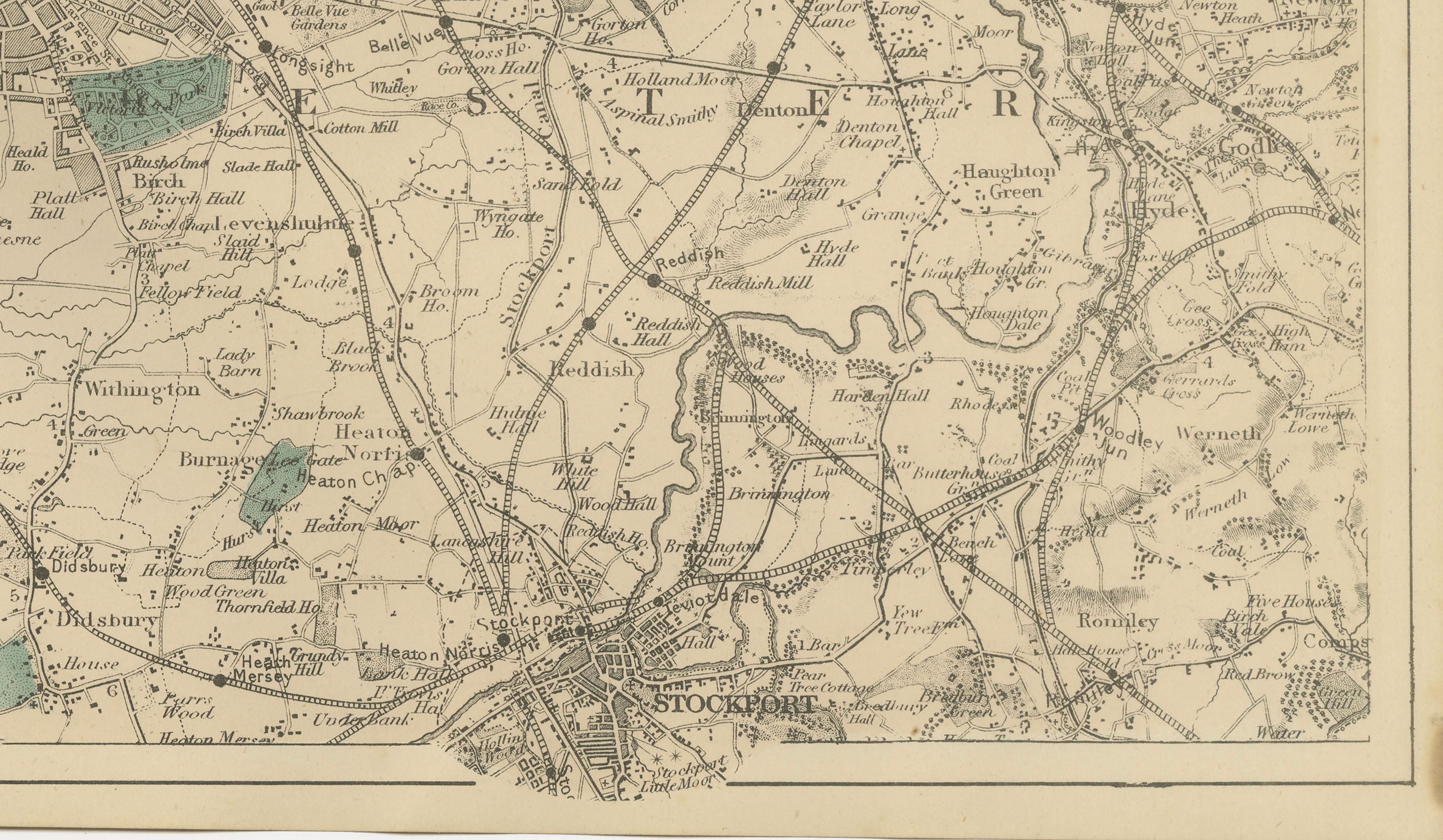
A remarkable feature of the map is the intricate railway network that connects the city to its surrounding towns and industrial districts. Lines radiate outward toward Bolton, Rochdale, Oldham, Ashton, and Stockport, reflecting the rapid growth of rail infrastructure that allowed raw cotton, coal, and manufactured goods to move efficiently between factories, warehouses, and ports. The railways also facilitated the rise of commuter suburbs such as Didsbury, Withington, and Chorlton-on-Medlock, which appear clearly labeled on the map.
Beyond the dense industrial center, the map reveals the rural landscape that still surrounded the city in the 1880s. Areas such as Worsley, Eccles, and Prestwich appear as smaller settlements within agricultural land, while the River Mersey winds through the southern part of the map near Didsbury and Northenden. Green tinted areas indicate parks, reservoirs, or open land, offering a visual contrast between the urbanized core and the countryside beyond.
Important towns and districts visible include Manchester, Salford, Bolton, Middleton, Oldham, Ashton-under-Lyne, Stalybridge, Stockport, Prestwich, Whitefield, Radcliffe, Bury, Chadderton, Droylsden, Openshaw, Gorton, Ardwick, Hulme, Moss Side, Withington, Didsbury, Levenshulme, Newton Heath, Failsworth, Blackley, Cheetham Hill, Eccles, Worsley, Walkden, Pendlebury, Farnworth, Rochdale, Hyde, Marple, Cheadle, and Altrincham.
For collectors and historians, this map provides a remarkable snapshot of Greater Manchester at the height of the Industrial Revolution, showing both the industrial density of the city and the network of surrounding towns that supported its economic power. Today it serves as both an important historical document and a visually appealing decorative map of one of Britain’s most significant industrial regions.
Condition:
Very good antique condition. Light age toning and minor spotting consistent with nineteenth-century atlas maps. Original center fold as issued. Margins complete and well preserved. Plate mark visible.
Framing tips:
This map displays beautifully in a wide horizontal frame. A warm ivory or cream mat with a dark walnut or black frame works particularly well, highlighting the delicate Victorian linework and the subtle hand-colored areas. For interior designers, this piece pairs nicely with other British city maps such as London, Liverpool, or Glasgow to create an impressive gallery wall of historic industrial cities.
Technique: Lithograph
Maker: Edward Weller, London, 1885
Places on the Map: Manchester, Salford, Bolton, Middleton, Oldham, Ashton-under-Lyne, Stalybridge, Stockport, Prestwich, Whitefield, Radcliffe, Bury, Chadderton, Droylsden, Openshaw, Gorton, Ardwick, Hulme, Chorlton-on-Medlock, Moss Side, Whalley Range, Withington, Didsbury, Burnage, Levenshulme, Heaton Norris, Heaton Chapel, Reddish, Denton, Audenshaw, Newton Heath, Failsworth, Blackley, Crumpsall, Cheetham Hill, Higher Broughton, Lower Broughton, Pendleton, Eccles, Patricroft, Monton, Worsley, Walkden, Little Hulton, Swinton, Pendlebury, Clifton, Kearsley, Farnworth, Little Lever, Great Lever, Horwich, Turton, Tottington, Ramsbottom, Heywood, Rochdale, Milnrow, Shaw, Royton, Saddleworth, Lees, Greenfield, Uppermill, Delph, Mossley, Dukinfield, Hyde, Gee Cross, Romiley, Marple, Compstall, Mellor, Woodley, Bredbury, Hazel Grove, Bramhall, Cheadle, Cheadle Hulme, Gatley, Altrincham, Bowdon, Hale, Timperley, Sale, Stretford, Urmston, Flixton, Carrington, Partington, Lymm, Knutsford, Wilmslow, Alderley Edge, Handforth, Poynton, Disley, Bollington, Macclesfield.