Black Friday starts Friday 20 November: up to 30% off, plus free FedEx shipping on qualifying orders →
Orders placed from 15 to 30 November ship from 1 December, in time for Christmas. Our shipping partner: InXpress.
Maps & PrintsBartele Gallery · Langweer
Home / Antique Maps / Europe / Western Europe / The Netherlands & Belgium / Province of Friesland

Province of Friesland · 17th century

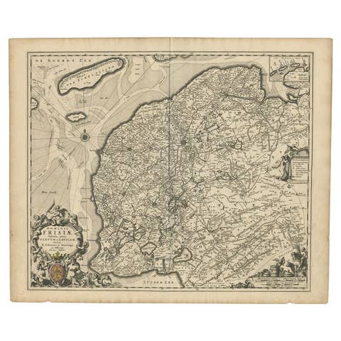
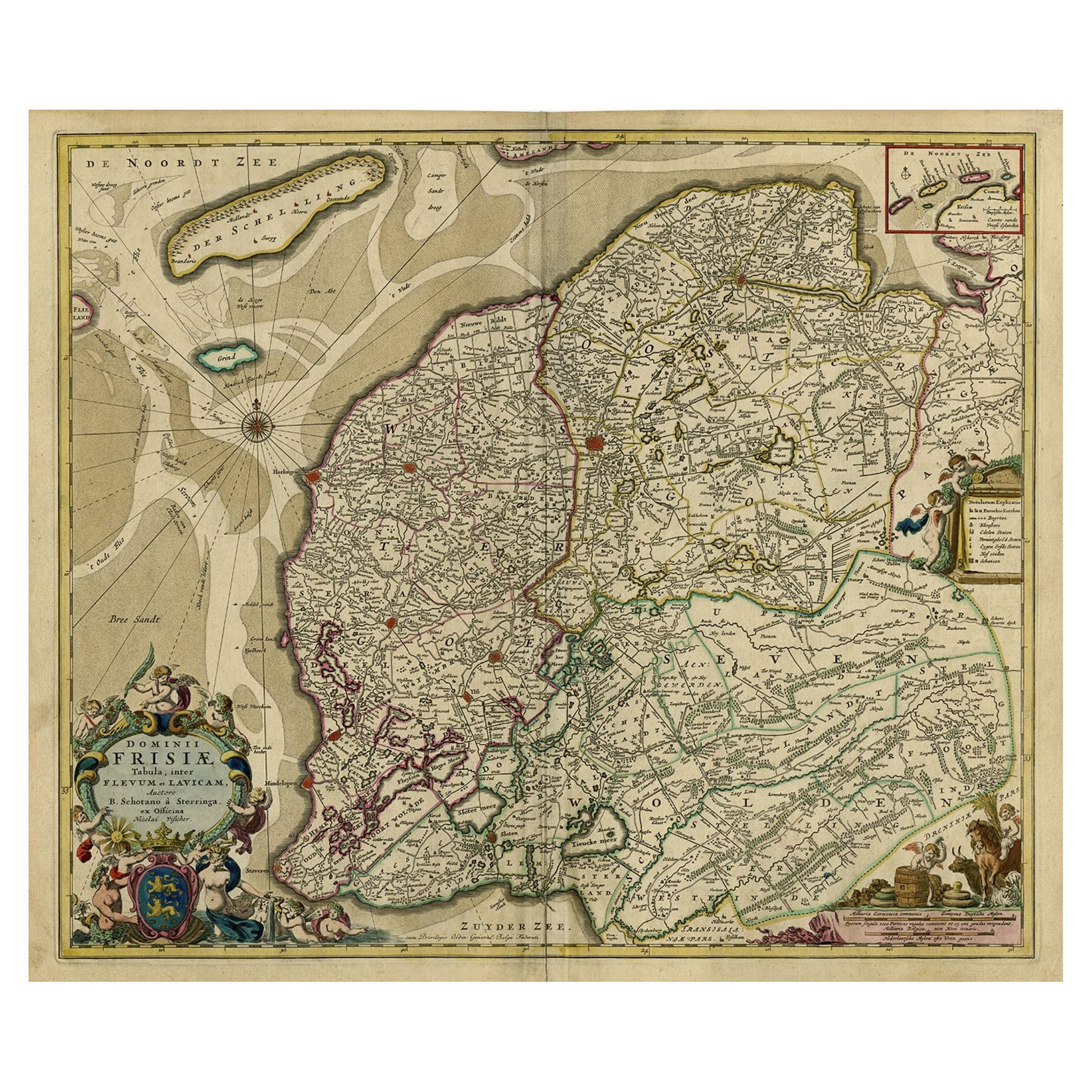
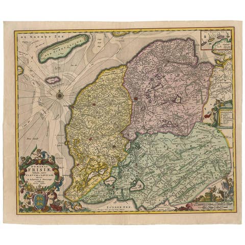
Large Copper Engraved Map of the Coastline of Friesland and Terschelling, c.1670

€ 890

Original antique · The actual sheet photographed · Certificate of authenticity on request · Sold unframed · Worldwide shipping from € 15 (rates)

Date
1670
Sheet size
51.5 × 60.7 cm (20.3 × 23.9 in)
Condition
Good
Reference
PCT-56388
What the condition grades mean
Excellent
Bright and clean, with no faults worth mentioning.
Very good
Only light signs of age, such as faint toning.
Good
Normal signs of age for a sheet of this period: toning, some foxing, small marks or neat old repairs.
Fair
Clear faults such as staining, tears or repairs, priced to match.

Every fault we see is written in the condition note, and the whole sheet is shown uncropped in the photos.

Condition

Given age. Original middle fold, as issued. Slight paper separation at top and lower middle fold, Backed. Remains of paper from previous Atlas attachment at rear middle fold. Paper edges browned. Light soiling. Original coloring.
About this sheet

Antique print, titled: 'Dominii Frisiae Tabula, inter Flevum et Lavicum (…)'

This large copper engraved map details the coastline of Friesland and Terschelling. At east is a part of Groningen. The main cities are colored in red. The very decorative cartouches displays putti and a coat of arms. At the right corner there is an inset with the isles belonging to this province. From: 'Germania Inferiorsive XVII Provinciarum Geographicae Generalis uit et Particulares tabulae.' (Kaert-Boeck van de XVII Nederlandtsche Provincien.), published by Nicolaas Visscher II in Amsterdam. ca. 1670. Exact ed. to be determined. Ref: Koeman III Vis 10 (18).

Artists and Engravers: Publisher: Nicolaes Visscher II. Cartographer: Bernardus Schotanus a Sterringa (1640-1704). Publisher: The Visscher family were art and map dealers in Amsterdam during the 17th century. Funded by C. J. Visscher (1587-1652), the business was continued by his son and grandson both named Nicolas. Nicolas Visscher I was born 1618 in Wenns, Austria. He died 1679 in Linz. After the death of Nicolas II, his widow passed the business to Pieter Schenk.

More from Province of Friesland

Ask about this sheet

Large Copper Engraved Map of the Coastline of Friesland and Terschelling, c.1670
1670 · Ref. PCT-56388 · € 890
We reply by email, usually within one working day.

Your favorites

Saved in this browser. Email the list to yourself to keep it on any device.

We use your email to send this list and, only if you tick the box and confirm, for occasional new arrivals. Every email has an unsubscribe link. Bartele Gallery, the Netherlands.

Powered by SiteKeys