About this sheet
Roman Gaul & Northern Italy – Antique Map of La Gaule by Andriveau-Goujon, 1861
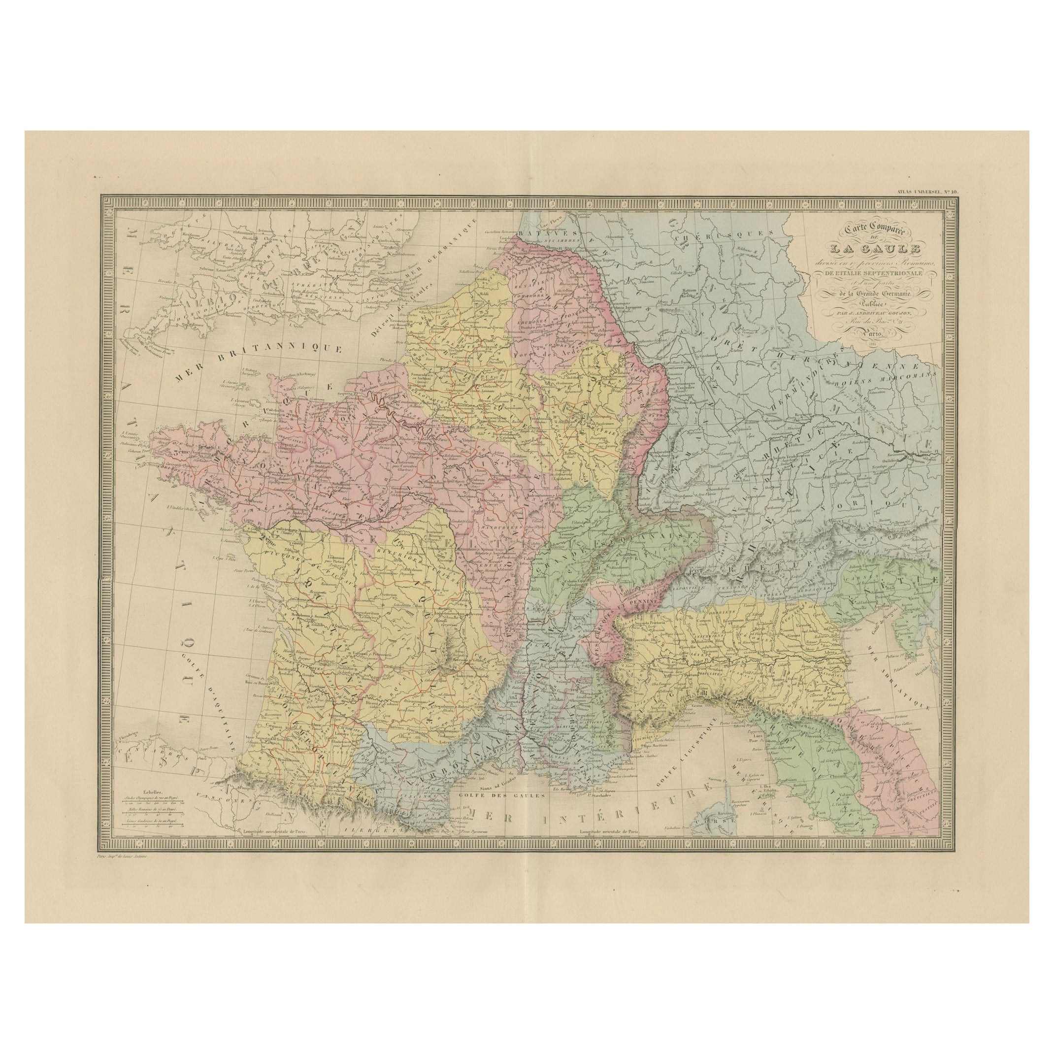
This antique map titled "Carte Comparée de La Gaule" was published in Paris in 1861 by J. Andriveau-Goujon and offers a richly detailed historical representation of ancient Gaul, the Roman provinces of Northern Italy, and part of Germania. Issued as plate 10 in the Atlas Universel, the map provides a comparative cartographic view of Roman territorial divisions overlaid on modern geography, ideal for historians, collectors, and classical scholars.
The map spans a wide swathe of Western Europe, centering on modern-day France but extending into Belgium, Switzerland, Germany, and Northern Italy. Using distinct pastel colors, the map delineates Roman provinces such as Aquitania, Gallia Lugdunensis, Gallia Narbonensis, Belgica, and parts of Germania Superior and Raetia. Many Roman cities are identified with their Latin names — including Lutetia (Paris), Lugdunum (Lyon), Arelate (Arles), Burdigala (Bordeaux), Massilia (Marseille), and Augusta Treverorum (Trier).
The cartouche in the upper right reads:
"Carte Comparée de La Gaule divisée en 17 provinces Romaines, de l’Italie Septentrionale, et d’une partie de la Grande Germanie, publiée par J. Andriveau-Goujon, Rue du Bac No. 4, Paris, 1849", with the date 1861 below, indicating a reissue or updated edition.
The map is surrounded by a bold decorative border and includes longitudinal measurements referenced to Paris. Fine engraving and color printing techniques were used to achieve clear geographic readability, combined with subtle aesthetic appeal.
This map is an exceptional resource for visualizing the Roman Empire’s provincial structure superimposed on the modern layout of Europe. It would be an excellent addition to any collection focused on classical antiquity, Roman cartography, or French historical geography.
Condition: Very good condition. Clean sheet with original hand coloring. Slight toning to edges and minor foxing in blank margins. Centerfold as issued; no tears or repairs. Plate mark visible.
Framing tips: Frame in a dark walnut or black frame with a light cream or off-white mat to enhance the classical appearance. A gold-trimmed inner mat can add a refined historical feel suitable for libraries or academic settings.
Technique: Engraving with original hand coloring
Maker: J. Andriveau-Goujon, Paris, 1861