About this sheet
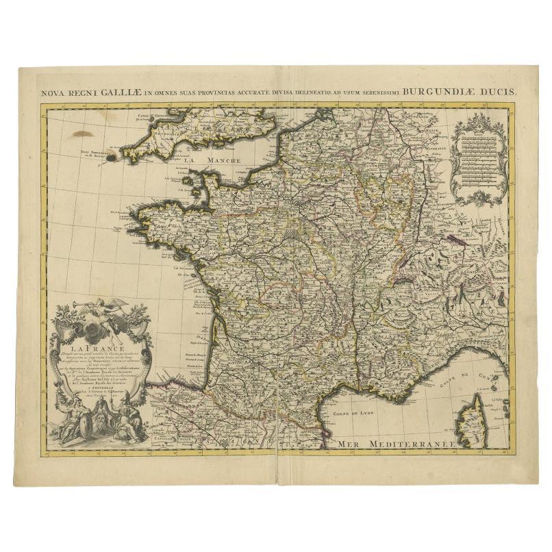
Antique map titled 'Nova regni Galliae (..) La France'. Old map of France with large decorative title cartouche. With great detail.
Artists and Engravers: Pieter und David Mortier were booksellers in Paris and have published a wide range of geographical works. After Pieter's death, his widow continued the business until their son Cornelius took over. Cornelius started a partnership with his brother-in-law Johannes Covens and established the famous publishing house ""Covens and Mortier"" in Amsterdam. They have re-issued Atlases of Sanson, de l'Isle, Visscher and de Wit.
Condition: Good, original/contemporary hand coloring. General age-related toning. Minor wear and small defects (mainly on folding line), blank verso. Please study image carefully.
Date: c.1730
Overall size: 65 x 53 cm.
Image size: 59 x 44.5 cm.