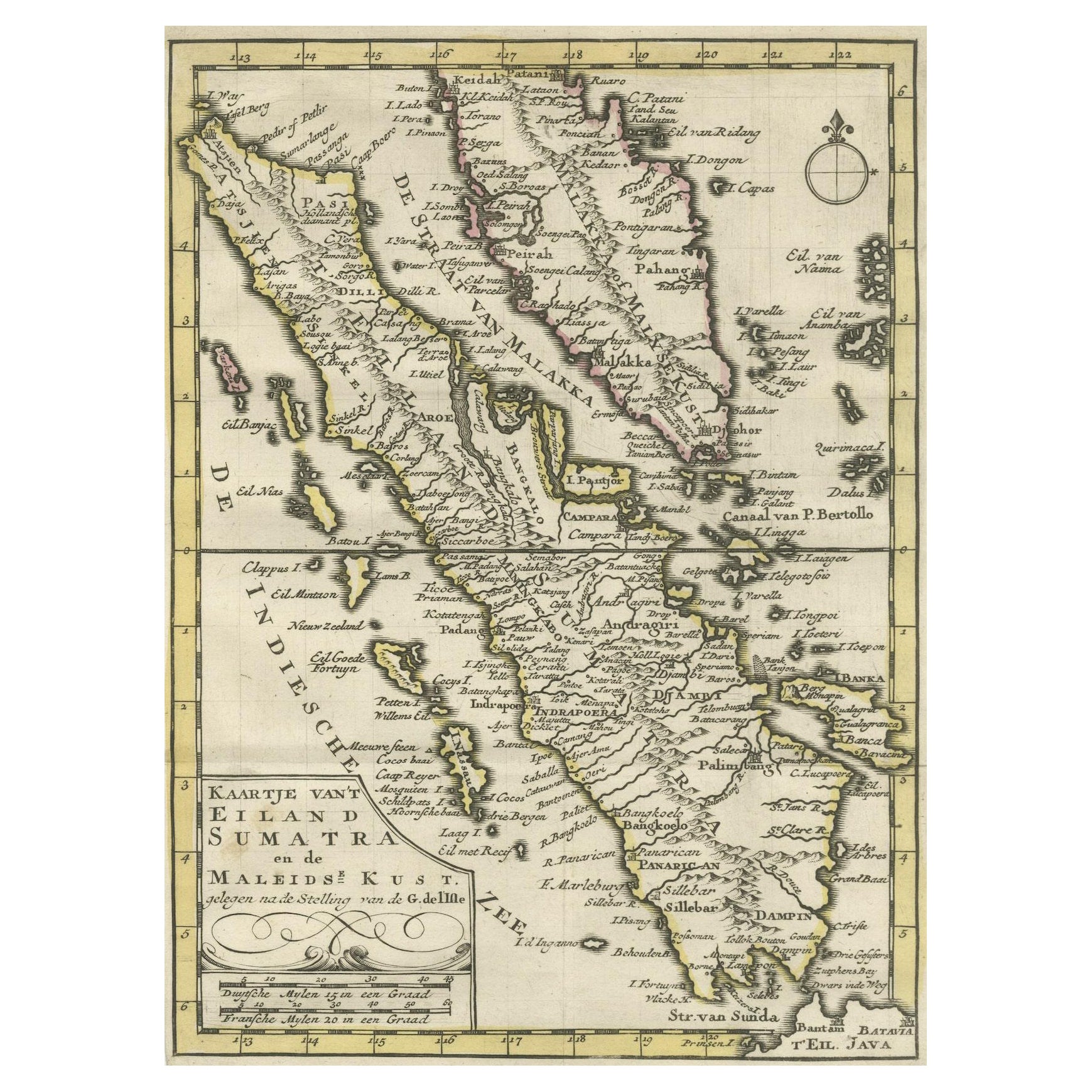
Authentic Old Map of Sumatra, Malaysia and Singapore, 1745
€ 480
Original antique · The actual sheet photographed · Certificate of authenticity on request · Sold unframed · Worldwide shipping from € 15 (rates)
Date
1745
Sheet size
17 × 24 cm (6.7 × 9.4 in)
Condition
Good
Reference
BG-11488-5
What the condition grades mean
Excellent
Bright and clean, with no faults worth mentioning.
Very good
Only light signs of age, such as faint toning.
Good
Normal signs of age for a sheet of this period: toning, some foxing, small marks or neat old repairs.
Fair
Clear faults such as staining, tears or repairs, priced to match.
Every fault we see is written in the condition note, and the whole sheet is shown uncropped in the photos.
Condition
Very Good. Three folding lines. Margin on the lower left is a bit tight, but leaves space for matting or framing. Study the image carefully.
About this sheet
Published by Jacob Keizer and by Jan de Lat Creator: Keizer, Jacob, active 1706-1750
Size: 17.10 x 24.20cm.
The phrase "Kaartje van't Eiland Sumatra en de Maleidse Kust gelegen na de stelling van de G. de L'Isle" translates to "Map of the Island of Sumatra and the Malayan Coast based on the work of G. de L'Isle."
This indicates a map that depicts the Island of Sumatra along with the coastline of the Malay Peninsula and Singapore, based on the cartographic work of the prominent French cartographer, Guillaume de L'Isle.
Sumatra is one of the largest islands in Indonesia, known for its diverse landscapes, including tropical rainforests, volcanic terrain, and rich cultural heritage. The Malay Peninsula is a region comprising part of Malaysia and Thailand, with a long coastline along the western side of the South China Sea and Singapore at the southern tip.
This map lrepresents the geographical features, cities, rivers, and other notable landmarks of Sumatra and the coastal areas of the Malay Peninsula, reflecting the cartographic expertise and accuracy associated with the works of Guillaume de L'Isle. It serves as a historical document, offering insights into the understanding of these regions during the period when the map was created, likely showcasing the advancements in cartography and geographical knowledge of that time.