About this sheet
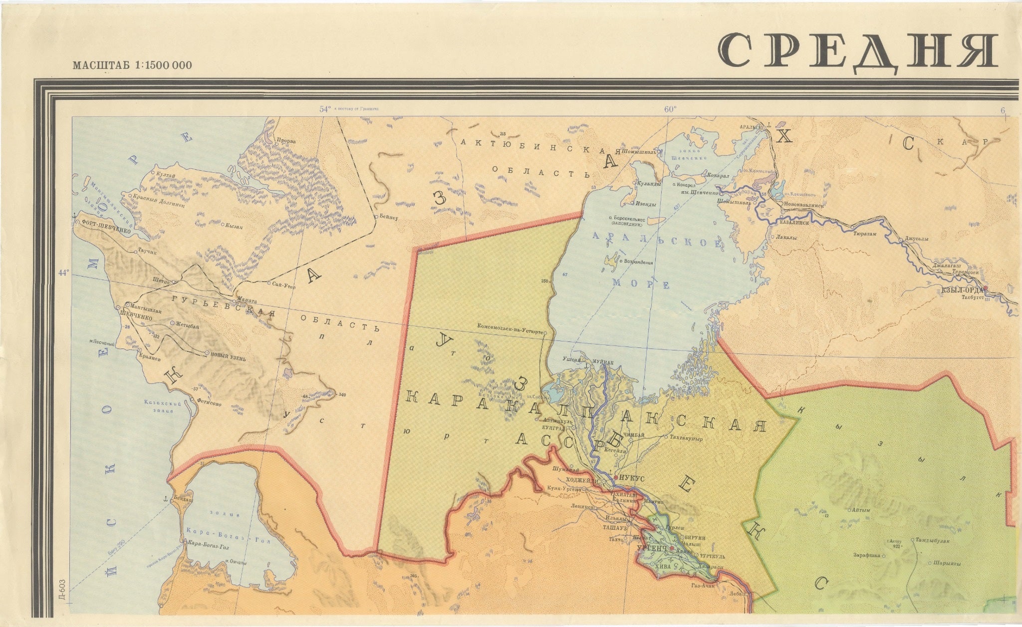
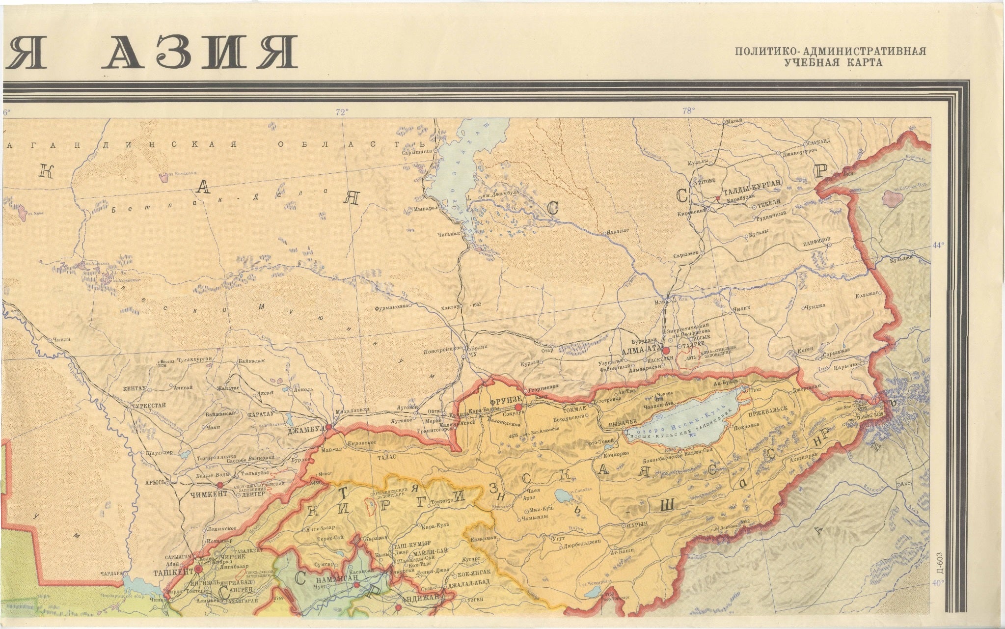
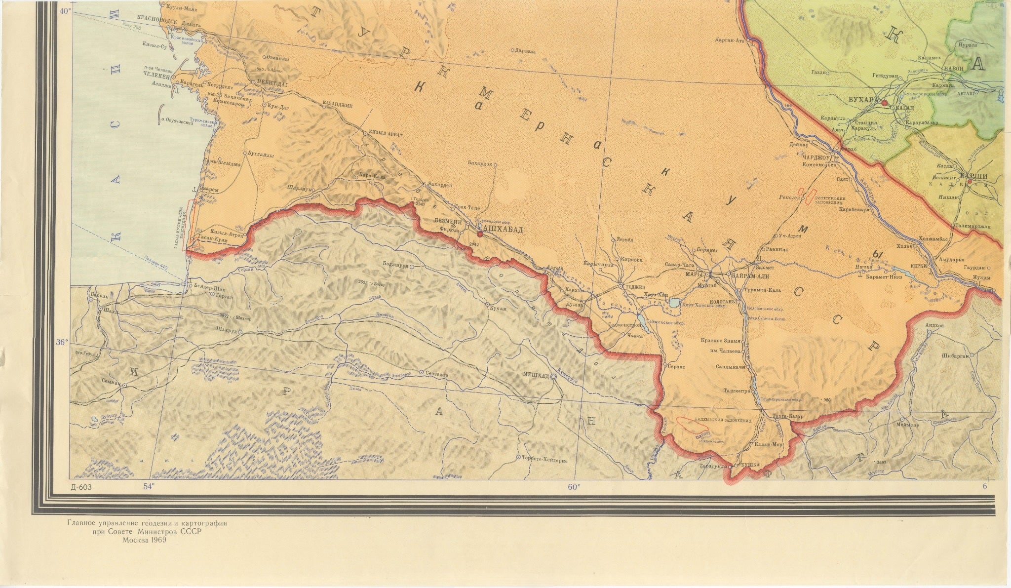
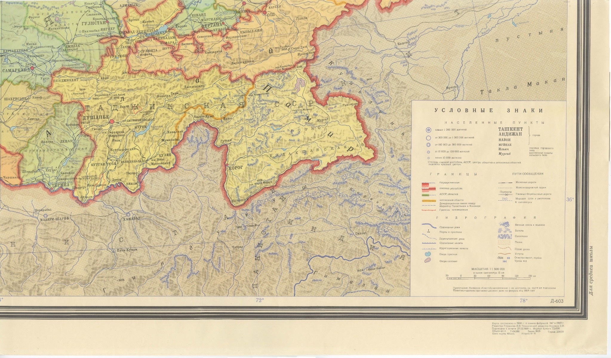
Impressive large-format political and administrative map of Central Asia, designed by L. V. Glushkova and published in Moscow in 1969 by the Main Administration of Geodesy and Cartography under the Council of Ministers of the USSR.
Printed in colour offset across four large adjoining sheets, the map covers an extensive area of Soviet Central Asia and neighbouring territories, including Kazakhstan, Uzbekistan, Turkmenistan, Kyrgyzstan and Tajikistan, together with parts of the Caspian region, Afghanistan, Iran, China and surrounding areas.
The map is richly detailed with political and administrative boundaries, cities and settlements, railways and roads, rivers, lakes, mountain ranges and other topographical information. Different administrative regions are highlighted in contrasting colours, while major borders are strongly delineated in red. A large Cyrillic legend provides symbols for population centres, boundaries, transport routes, hydrography and physical geography.
The bold graphic treatment, large scale and strongly coloured Soviet cartographic design make this an especially decorative example of late-1960s educational wall cartography. When assembled, the four sheets form a monumental wall map measuring approximately 176 cm across.
The upper title reads “Средняя Азия” (“Central Asia”), while the lower inscription identifies the Main Administration of Geodesy and Cartography under the Council of Ministers of the USSR and Moscow as the place of publication.
ARTIST / MAKER: L. V. Glushkova
DATE: 1969
ORIGIN: Moscow, USSR
PUBLISHER: Main Administration of Geodesy and Cartography under the Council of Ministers of the USSR (GUGK)
MEDIUM: Colour offset lithograph on paper, printed in four sheets
DIMENSIONS: Four sheets; approximately 52.5 × 88 cm (20.7 × 34.6 in) for two sheets and 56 × 88 cm (22 × 34.6 in) for two sheets. Complete assembled size approximately 108.5 × 176 cm (42.7 × 69.3 in).
SCALE: 1:1,500,000
STYLE / PERIOD: Mid-Century Modern / Soviet Modernism / 1960s
LANGUAGE: Cyrillic / Russian
CONDITION: Good vintage condition with visible age- and use-related wear, including light toning, minor handling marks, creasing and marginal wear consistent with its original use as a large educational wall map. Please study the photographs carefully for the exact condition.
FRAME / PRESENTATION: Unframed. The four sheets are designed to be displayed together as one monumental map. Framed and interior images, if shown, are for presentation inspiration only.
SUBJECT: Central Asia, Kazakhstan, Uzbekistan, Turkmenistan, Kyrgyzstan, Tajikistan, Soviet Union, USSR
KEYWORDS: Central Asia map, Soviet map, USSR map, Kazakhstan map, Uzbekistan map, Turkmenistan map, Kyrgyzstan map, Tajikistan map, Russian cartography, Soviet cartography, Soviet wall map, educational map, political map, administrative map, Mid-Century Modern map, Soviet Modernism, 1969 map, large wall map, four-sheet map, Cyrillic map
SHIPPING: Sold and shipped unframed. The four original sheets will be carefully packed for secure worldwide delivery.