About this sheet
Antique Hand-Colored Map of Jamaica and the Caribbean, circa 1680
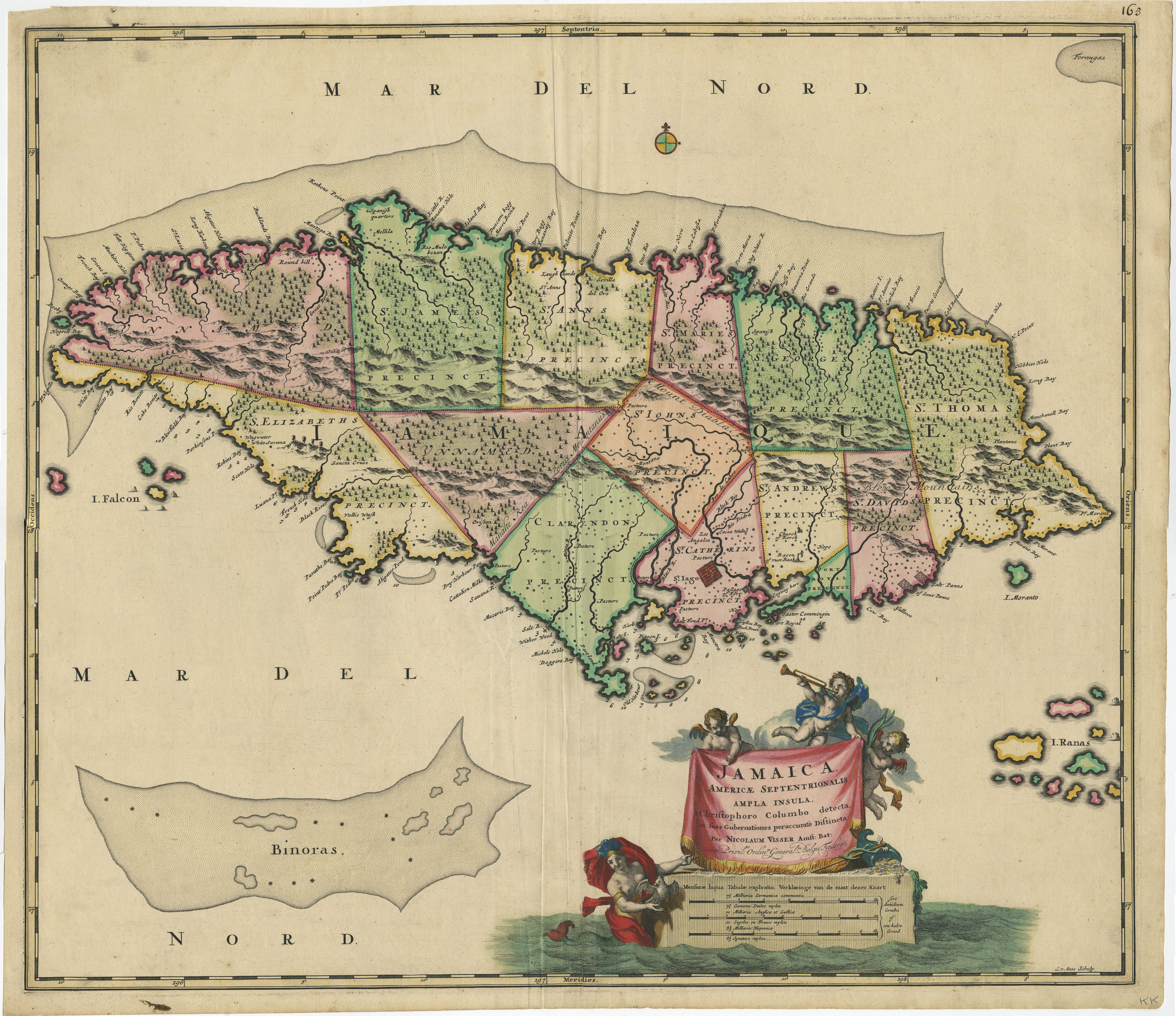
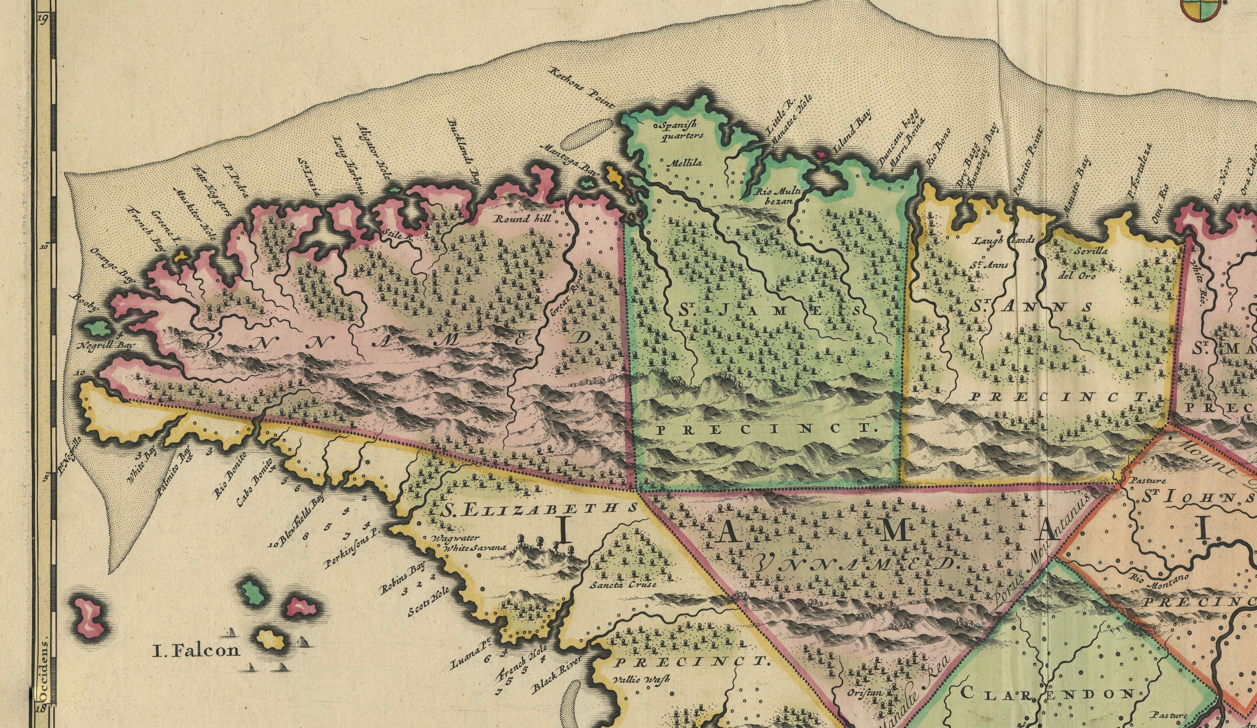
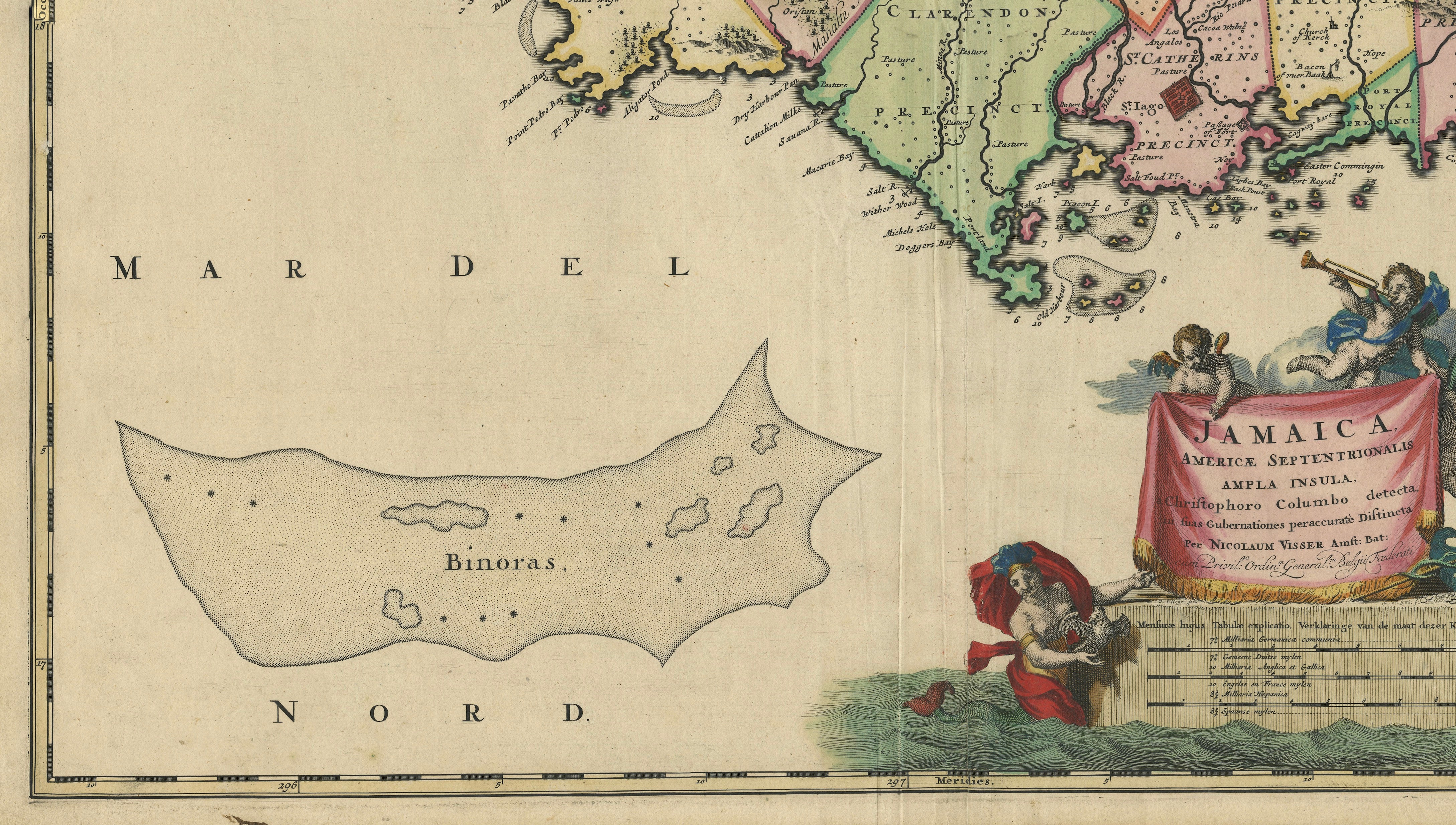
A large and highly decorative 17th-century map of Jamaica by the Dutch cartographer and publisher Nicolaes Visscher, titled “Jamaica, Americae Septentrionalis ampla insula, a Christophoro Columbo detecta, in suas gubernationes peraccurate distincta.”
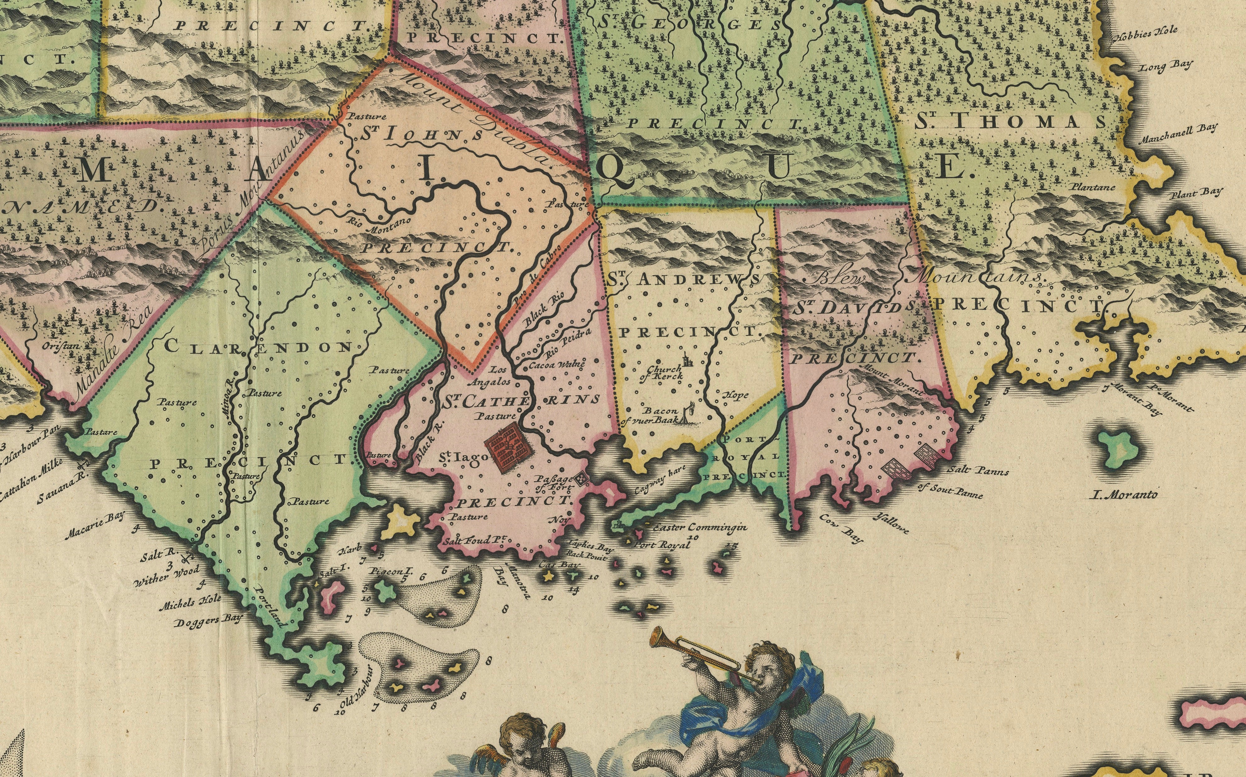
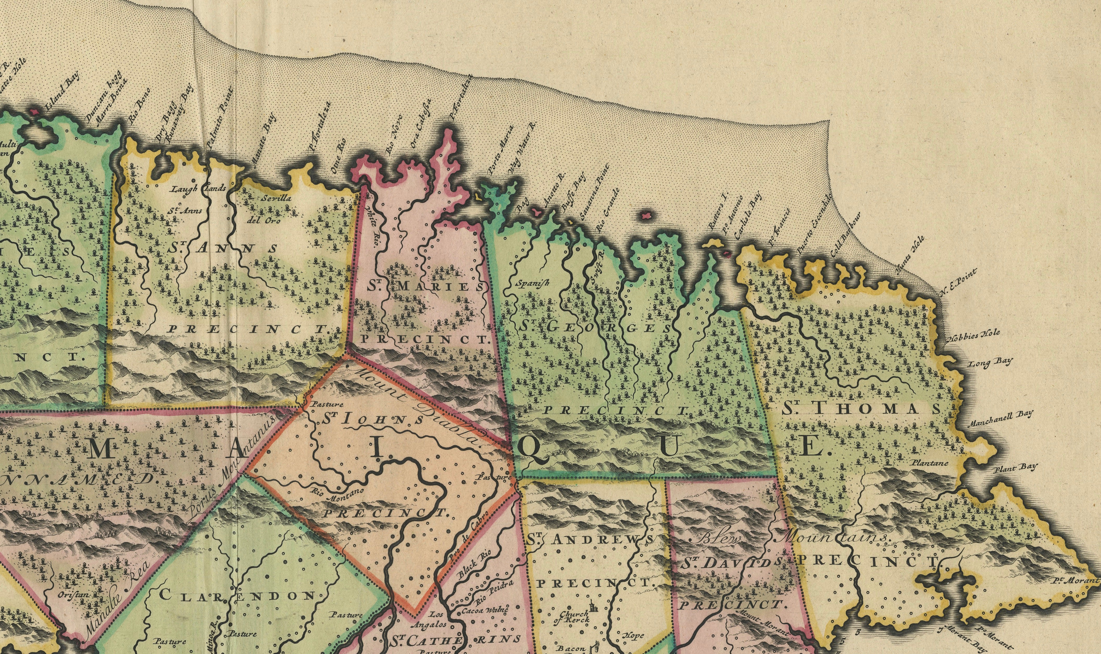
Published in Amsterdam circa 1680, this finely engraved map presents Jamaica in considerable detail, divided into its historic precincts or parishes. Towns, settlements, churches, forts, rivers, mountains, forests, bays and numerous coastal locations are identified throughout the island.
The map is particularly notable for its detailed representation of Jamaica during the period following the English conquest of the island from Spain in 1655. Contemporary cataloguing identifies this map as being derived from earlier English surveys and maps of Jamaica.
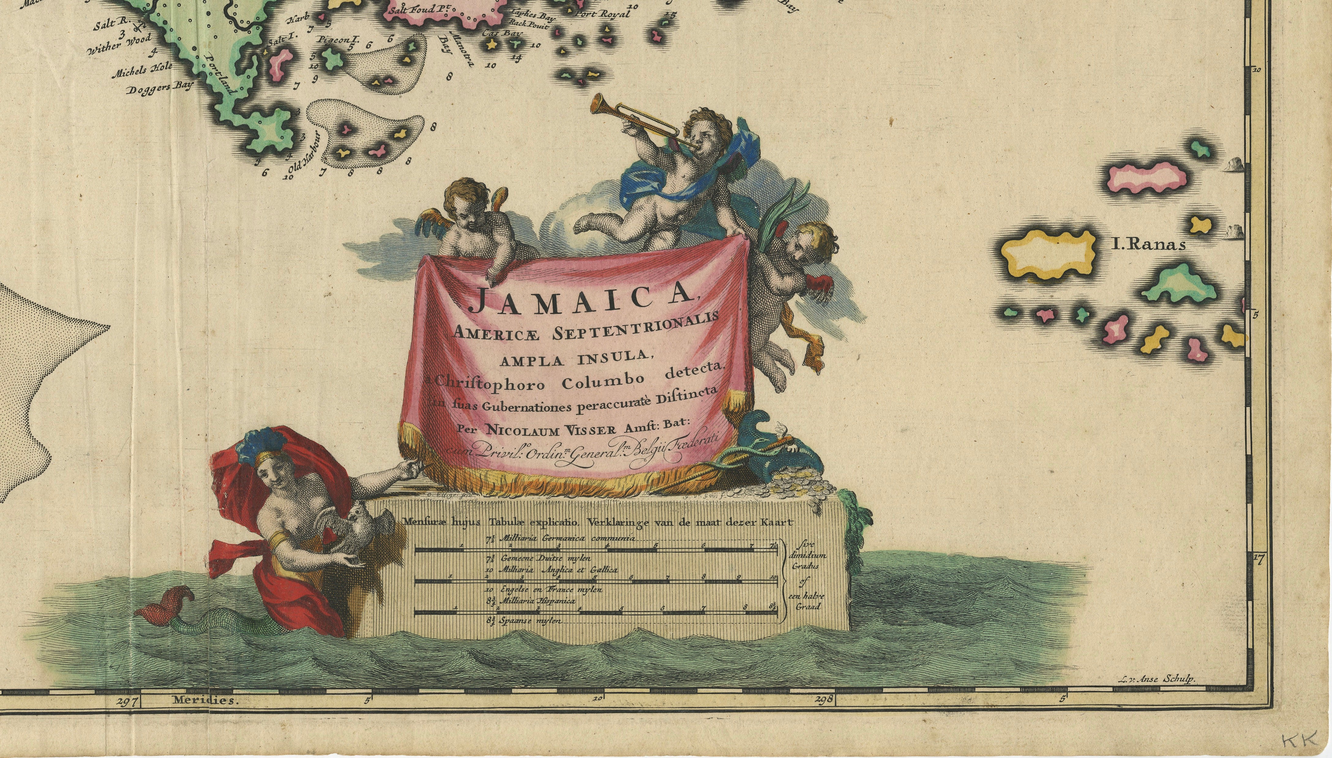
At lower right is an elaborate Baroque title cartouche featuring a mermaid and putti, including a figure blowing a trumpet, surrounding the draped title panel. A mileage scale appears beneath the cartouche. The map is further embellished with a small compass rose in the sea north of Jamaica.
The engraving is signed “L. v. Anse sculp.”, identifying the engraver as L. van Anse.
An important and visually impressive example of late 17th-century Dutch cartography of the Caribbean.
Creator: Nicolaes Visscher
Title: Jamaica, Americae Septentrionalis ampla insula, a Christophoro Columbo detecta, in suas gubernationes peraccurate distincta
Date: circa 1680
Place of publication: Amsterdam, Netherlands
Technique: Copper engraving with hand coloring
Period: Late 17th century
Style: Dutch Baroque
An original antique map from the 17th century. Not a modern reproduction.
Condition:
Good antique condition. Original vertical center fold as issued. General age-related toning with some light discoloration and minor soiling, particularly toward the margins. Minor handling and wear along the sheet edges consistent with age. Strong engraved impression and attractive hand coloring. Please study the photographs carefully as they form an important part of the condition description.
Keywords:
Antique Jamaica Map, Jamaica Map, Caribbean Map, Antique Caribbean Map, West Indies Map, Nicolaes Visscher, Nicholas Visscher, Dutch Map, Dutch Cartography, 17th Century Map, 1680 Map, Antique Map, Hand Colored Map, Hand Coloured Map, Copper Engraving, Baroque Map, Dutch Baroque, Amsterdam Map, Colonial Jamaica, Caribbean History, West Indies, Island Map, Decorative Map, Historical Map, Early Map of Jamaica, Jamaican History, Antique Wall Decor, Cartography, Map Collector, Old Map
Sold unframed.