Antique 1683 Map of Hispaniola and Puerto Rico in the Caribbean by Mallet
€ 380
Original antique · The actual sheet photographed · Certificate of authenticity on request · Sold unframed · Worldwide shipping from € 15 (rates)
Date
1683
Sheet size
20.6 × 14 cm (8.1 × 5.5 in)
Reference
BG-13792
What the condition grades mean
Excellent
Bright and clean, with no faults worth mentioning.
Very good
Only light signs of age, such as faint toning.
Good
Normal signs of age for a sheet of this period: toning, some foxing, small marks or neat old repairs.
Fair
Clear faults such as staining, tears or repairs, priced to match.
Every fault we see is written in the condition note, and the whole sheet is shown uncropped in the photos.
Condition
Good. Minor wear due to handling and age, including an old fold in the lower right corner and small residu of inkt. Study the images carefully.
About this sheet
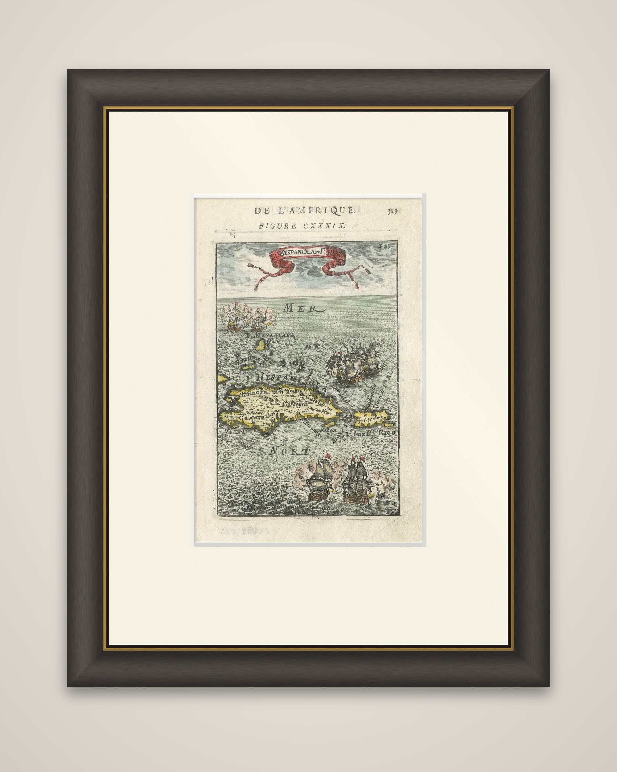
Hispaniola and Puerto Rico, a small copper engraving by Allain Manesson Mallet from his Description de l'Univers, published in Paris in 1683. The sheet is hand colored and lettered "I. d'Hispaniola et P.to Rico" on a ribbon banner at the top, with the running head "De l'Amerique" and "Figure CXXXIX" at the head of the page.
The two islands lie in a sea marked "Mer du Nort", with Hispaniola in yellow on the left and Puerto Rico, labeled "I. de P.to Rico", at the right. Coastal names and a few mountain ranges are engraved on the land, and a scattering of smaller islands lies to the north and east, among them Mayaguana, Saona and Mona. Three groups of sailing ships fill the open water, firing at one another with clouds of gun smoke: one pair at the upper left, another at the right and a third at the bottom.
Mallet, a French military engineer and teacher of mathematics, filled the several volumes of the Description de l'Univers with small, lively maps of this kind, each decorated with ships, figures and sea creatures.