Antique Print of Roseau, Place in Dominica Island in the West-Indies, 1779
€ 180
Original antique · The actual sheet photographed · Certificate of authenticity on request · Sold unframed · Worldwide shipping from € 15 (rates)
Date
1779
Sheet size
21.2 × 33.7 cm (8.3 × 13.3 in)
Condition
Good
Reference
PCT-57927
What the condition grades mean
Excellent
Bright and clean, with no faults worth mentioning.
Very good
Only light signs of age, such as faint toning.
Good
Normal signs of age for a sheet of this period: toning, some foxing, small marks or neat old repairs.
Fair
Clear faults such as staining, tears or repairs, priced to match.
Every fault we see is written in the condition note, and the whole sheet is shown uncropped in the photos.
Condition
Given age. A few small soft creases. Top edge slightly browned. General age-related toning and/or occasional minor defects from handling. Please review the images for further condition details.
About this sheet
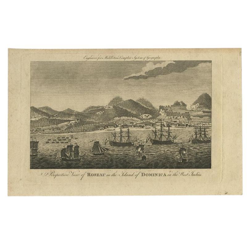
Roseau, the chief town of Dominica in the Lesser Antilles, in an original copper engraving published in 1779 in Middleton's New Complete System of Geography, with the title "Perspective View of Roseau in the Island of Dominica in the West Indies" lettered beneath the image and the book's name engraved across the top.
The view is taken from the sea, with a fleet of sailing ships in the foreground anchored in the roadstead. Behind them the white line of the shore carries the low buildings of the town, and densely wooded hills climb behind it into peaks and volcanic ridges, one of them showing a lighter patch where the slopes have been cleared. A row of small boats or rafts lies near the left shore.
Dominica was a British possession for most of the eighteenth century, and Roseau, on the sheltered western side of the island, was its principal port. The engraving was prepared for Charles Theodore Middleton's general geography, a popular compendium of its day.