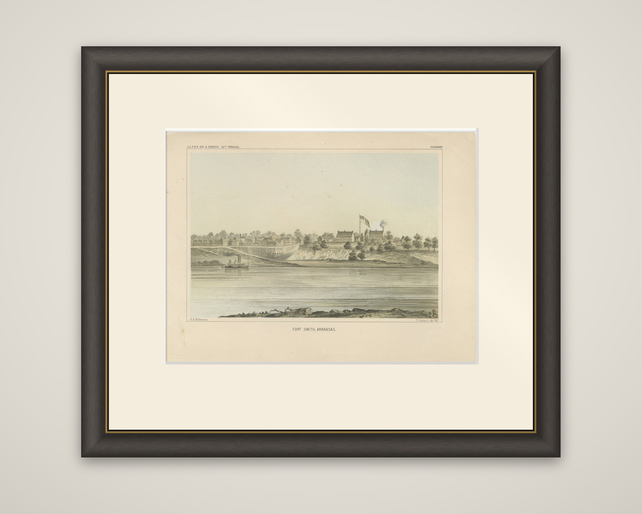
Historic View of Fort Smith, Arkansas, Overlooking the Arkansas River, 1856
€ 220
Original antique · The actual sheet photographed · Certificate of authenticity on request · Sold unframed · Worldwide shipping from € 15 (rates)
Date
1856
Sheet size
20.7 × 28.3 cm (8.1 × 11.1 in)
Reference
BG-14038-69
What the condition grades mean
Excellent
Bright and clean, with no faults worth mentioning.
Very good
Only light signs of age, such as faint toning.
Good
Normal signs of age for a sheet of this period: toning, some foxing, small marks or neat old repairs.
Fair
Clear faults such as staining, tears or repairs, priced to match.
Every fault we see is written in the condition note, and the whole sheet is shown uncropped in the photos.
Condition
Light toning with minimal foxing; overall excellent condition with vibrant colors and well-preserved details.
About this sheet
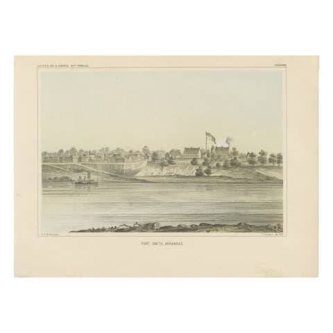
Fort Smith on the Arkansas River, a color-tinted lithograph of 1856 from the Pacific Railroad Surveys reports (heading "U.S.P.R.R. Exp. & Surveys, 35th Parallel", marked "Itinerary"). The plate is lettered "Fort Smith, Arkansas" beneath the image, with the draftsman's credit to Möllhausen at lower left and the lithographer's name at lower right.
The town is seen from the far bank of the river. A line of low buildings runs along the top of a pale clay bluff at the left, and the fort's barracks stand farther right beside a tall flagpole flying the national flag, with a thin column of smoke rising behind them. A side-wheel steamboat lies at the foot of the bluff, and the broad river fills the foreground, edged by rocks and a driftwood-strewn bank.
Fort Smith, on the western edge of Arkansas, was the starting point for the survey along the 35th parallel, and the view shows the town as the surveyors found it.