About this sheet
Antique Map Wiltshire England – John Cary County Map, Detailed Roads & Hundreds, 1805
Description
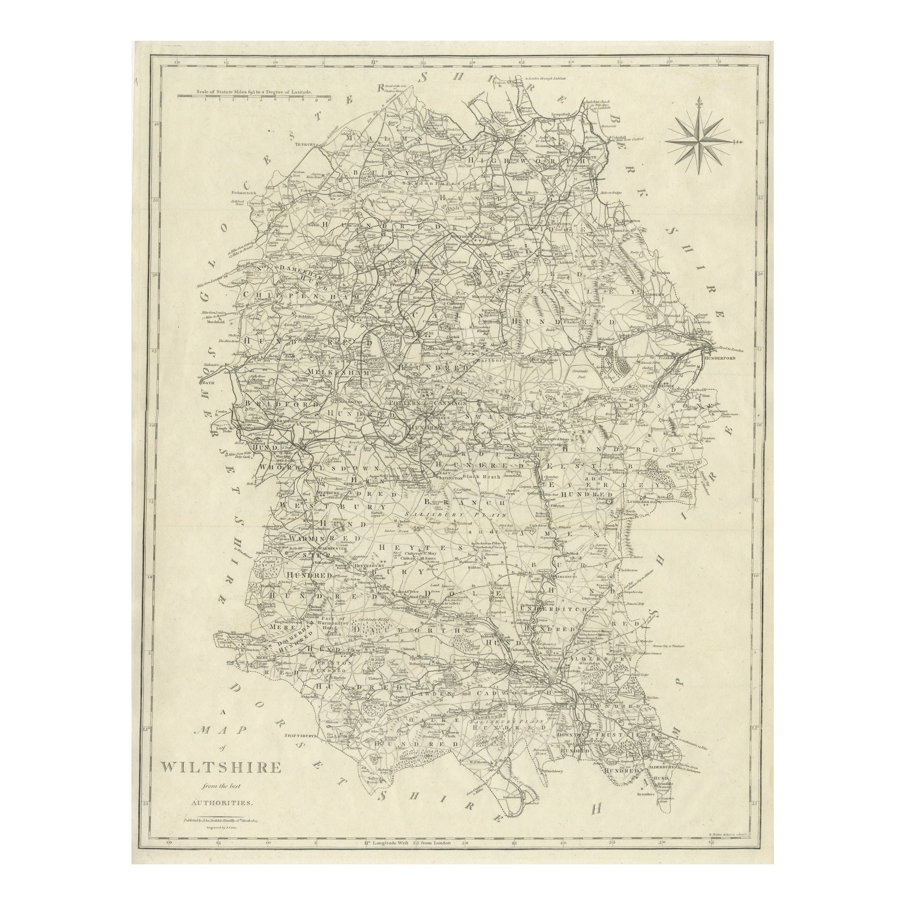

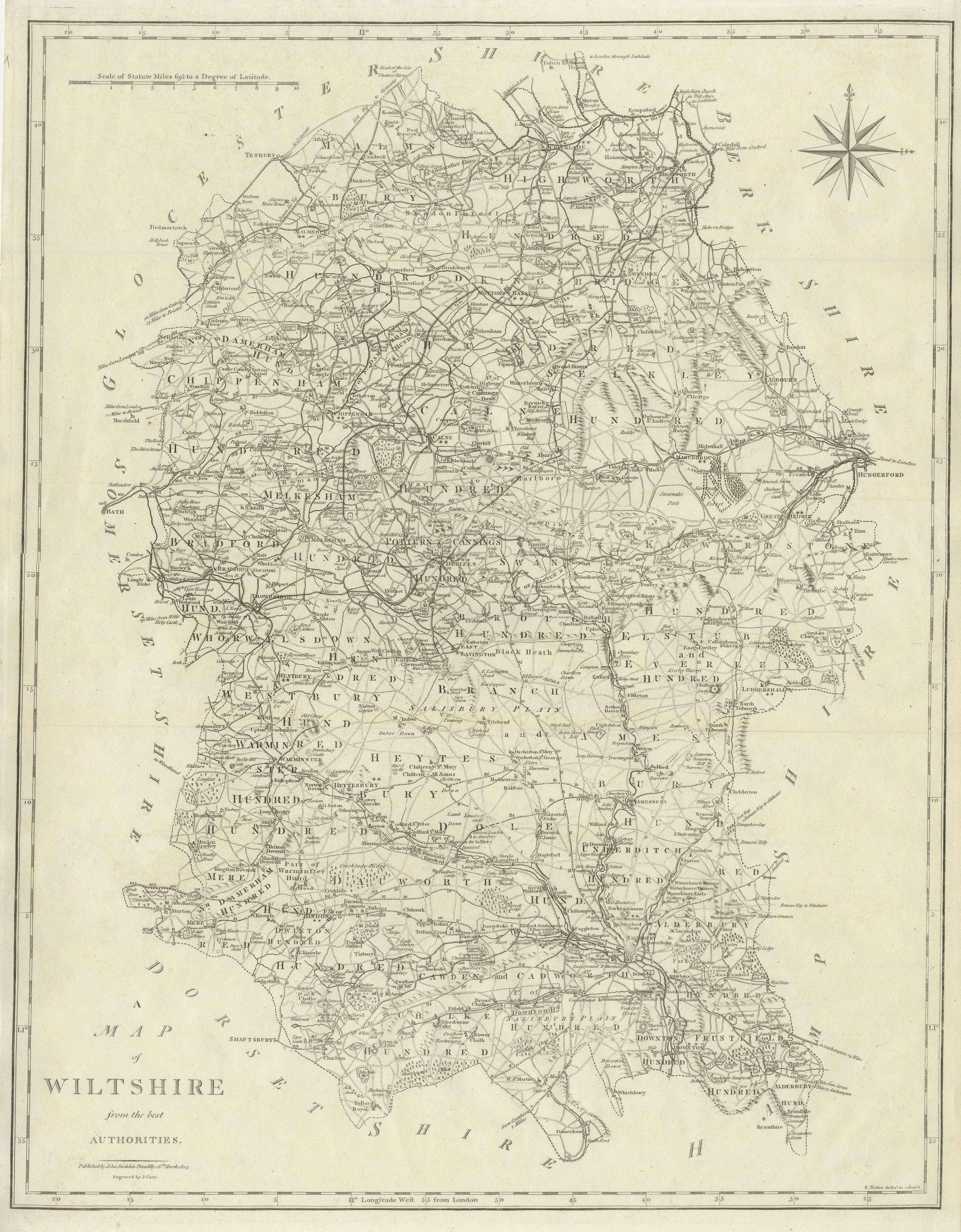
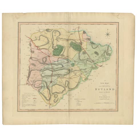
Original antique engraved county map of Wiltshire titled “Map of Wiltshire from the best Authorities,” produced by the renowned English cartographer John Cary and published circa 1805. This finely detailed map represents Wiltshire at the height of the Georgian period, capturing the county’s landscape, settlements, road networks, administrative divisions, and historic geography with exceptional clarity and precision.
John Cary was among the most respected British cartographers of the late eighteenth and early nineteenth centuries, known for his accuracy, clean engraving style, and authoritative surveys. His maps were widely used by travelers, scholars, and administrators, reflecting the growing importance of standardized cartography during Britain’s expansion of infrastructure and scientific mapping. Cary’s work represents a transition toward modern cartographic clarity, emphasizing readable typography, precise road networks, and well-organized geographic information.
The map shows Wiltshire divided into historic “hundreds,” with extensive detail including towns, villages, parish boundaries, rivers, and major transportation routes. The county’s position between the Bristol Channel and the English interior made it historically important as a route network, and Cary carefully illustrates the roads linking market towns, rural settlements, and administrative centers. A compass rose appears in the upper right, adding both decorative and navigational appeal.
Particularly notable is the density of information across the sheet, demonstrating the Georgian era’s increasing emphasis on infrastructure and geographic documentation. The map reflects Wiltshire’s agricultural landscape, historic estates, and important early urban centers, providing both historical context and visual interest for collectors of British county maps.
Highly desirable for collectors of English cartography, Georgian-era maps, and regional British history, this engraving combines scholarly accuracy with elegant simplicity, making it equally suitable for archival collections or refined interior display.
Condition:
Good original condition with age-related toning and light wear consistent with early nineteenth-century engraved maps. Original fold lines as issued. Strong impression with clear engraved detail.
Framing tips:
Frames beautifully in a classic dark wood or ebonized frame with an ivory or warm neutral mat to highlight the delicate engraving lines. Museum glass recommended for preservation.
Technique: Copperplate engraving
Maker: John Cary, England, circa 1805
Keyword block (places, rivers, regions, key points)
Wiltshire, Salisbury, Salisbury Plain, Devizes, Marlborough, Chippenham, Trowbridge, Melksham, Warminster, Westbury, Amesbury, Calne, Bradford-on-Avon, Corsham, Malmesbury, Wootton Bassett, Highworth, Swindon, Cricklade, Pewsey, Ludgershall, Tidworth, Mere, Hindon, Wilton, Downton, Alderbury, Broad Chalke, Chalke Valley, Cranborne Chase, Kennet River, River Avon, River Nadder, River Wylye, River Bourne, River Marden, River Ebble, Savernake Forest, Stonehenge, Avebury, Silbury Hill, Kennet and Avon corridor, Bath Road, London Road, Bristol Road, Salisbury Hundred, Branch and Dole Hundred, Swanborough Hundred, Kinwardstone Hundred, Selkley Hundred, Elstub Hundred, Chippenham Hundred, Malmesbury Hundred, Highworth Hundred, Cricklade Hundred, Marlborough Downs, Pewsey Vale, Salisbury Cathedral (city reference), Old Sarum, Amesbury Abbey, Wilton House, Longleat Estate, Stourhead vicinity, Semington, Seend, Lacock, Lacock Abbey, Castle Combe vicinity, Monkton Farleigh area, Bradford Leigh, Edington, Erlestoke, Market Lavington, West Lavington, Great Bedwyn, Hungerford vicinity, Ramsbury area, Chiseldon, Wanborough, Aldbourne, Collingbourne Kingston, Collingbourne Ducis, Shrewton, Bulford, Durrington, Netheravon, Upavon, Enford, Bishopstone, Figheldean, Codford St Peter, Codford St Mary, Heytesbury, Knook, Norton Bavant, Horningsham, Kilmington, Stourton vicinity, Zeals, East Knoyle, Hindon Downs, Berwick St Leonard, Stratford Tony, Coombe Bissett, Harnham, Britford, Downton Forest area, Whiteparish, Landford, Redlynch, Laverstock, Bemerton, Fisherton, Salisbury Close, Porton Down vicinity, Winterbourne Stoke, Winterbourne Gunner, Winterbourne Earls, Allington, Newton Tony, Broughton Gifford, Holt, Staverton, Hilperton, Southwick, North Bradley, West Ashton, Yarnbrook, Semington Brook, River Till, River Thames headwaters vicinity.