Maps & PrintsBartele Gallery · Langweer
Home / Antique Maps / Europe / Western Europe / The Netherlands & Belgium

The Netherlands & Belgium · 20th century

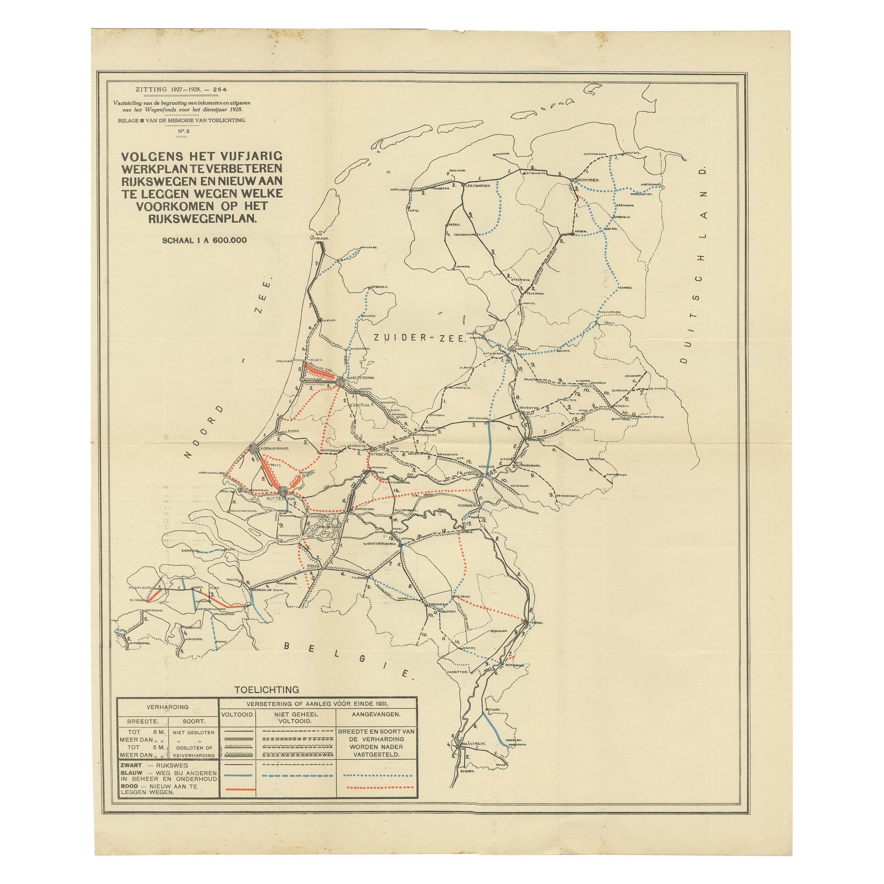
Vintage Road Map of the Netherlands '1928'

€ 250

One of a kind: this is the sheet in the photographs. Ships from Langweer, the Netherlands.

Date
1928
Sheet size
55.9 × 65 cm (22.0 × 25.6 in)
Condition
Good
Reference
BG-0064

Condition

General age-related toning, original folding lines. Some wear, blank verso. Please study image carefully.
About this sheet

Vintage map titled 'Volgens het vijfjarig Werkplan te verbeteren Rijkswegen en nieuw aan te leggen wegen welke voorkomen op het Rijkswegenplan'. Map of the Netherlands, used to illustrate the highways/roads that need improvement or that need to be build. Published 1928.

More from The Netherlands & Belgium

Ask about this sheet

Vintage Road Map of the Netherlands '1928'
1928 · Ref. BG-0064 · € 250
We reply by email, usually within one working day.