Maps & PrintsBartele Gallery · Langweer
Home / Antique Maps / Europe / Southern Europe

Southern Europe · 19th century

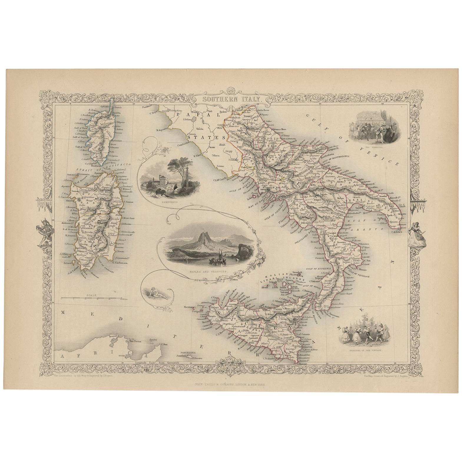
Antique Map of Southern Italy by J. Tallis, circa 1851

€ 270

One of a kind: this is the sheet in the photographs. Ships from Langweer, the Netherlands.

Date
1851
Sheet size
26.7 × 37 cm (10.5 × 14.6 in)
Condition
Good
Reference
BG-03337

Condition

Good with age related toning. Please study image carefully.
About this sheet

Decorative and detailed mid-19th century map of Southern Italy which was drawn and engraved by John Rapkin (vignettes by A. H. Wray and J. Rogers) and published in John Tallis & Co.'s The Illustrated Atlas (London & New York, circa 1851). The Illustrated Atlas, published from 1849-1853, was the last decorative world atlas. The Northern Italy map was typical of the many fine ones that appeared in this work with its ornamental border and attractive vignettes. Illustrated are views of Naples and Vesuvius, Benevento, a carnival and the Festival of the Vintage.

More from Southern Europe

Ask about this sheet

Antique Map of Southern Italy by J. Tallis, circa 1851
1851 · Ref. BG-03337 · € 270
We reply by email, usually within one working day.