About this sheet
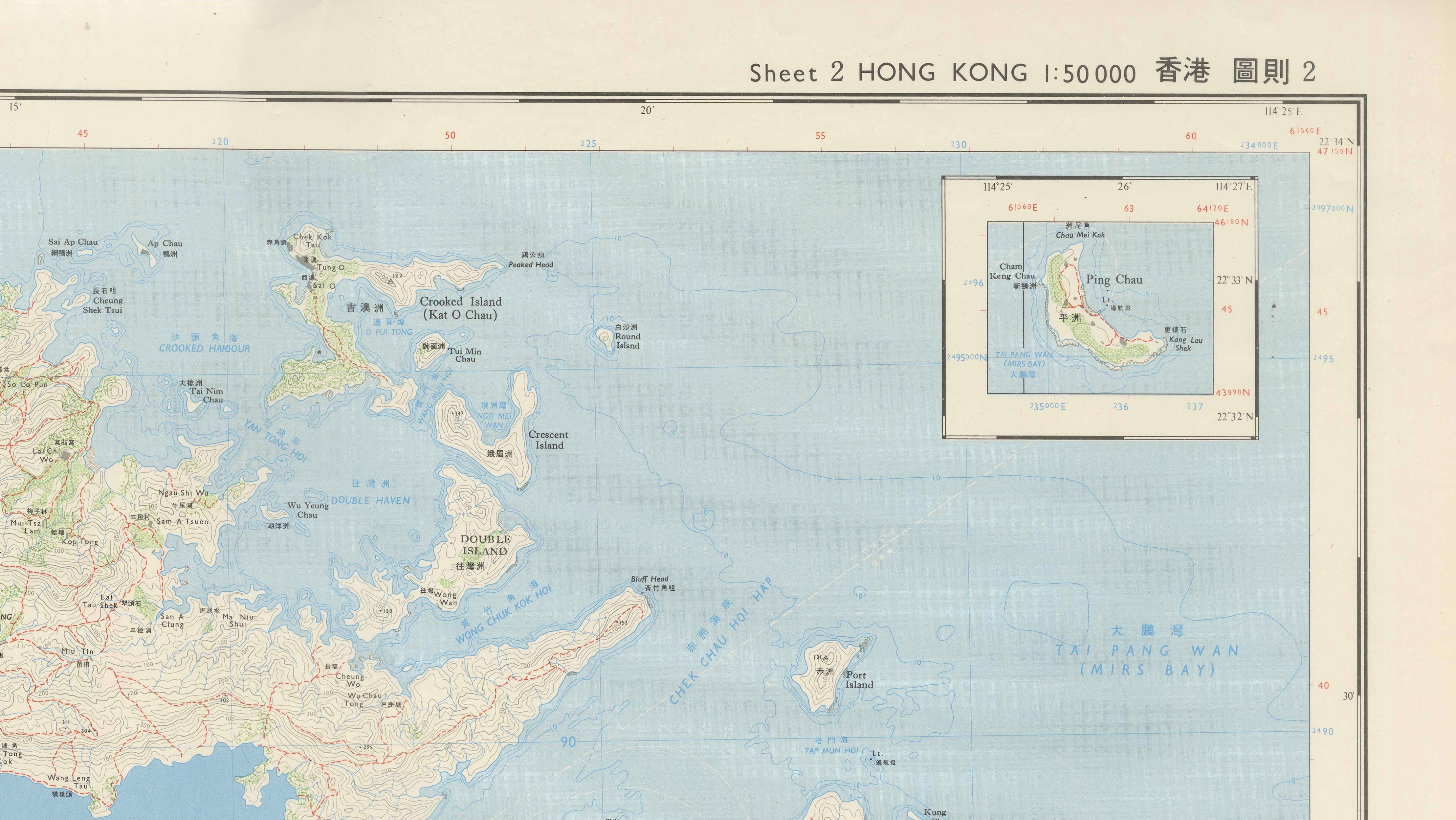
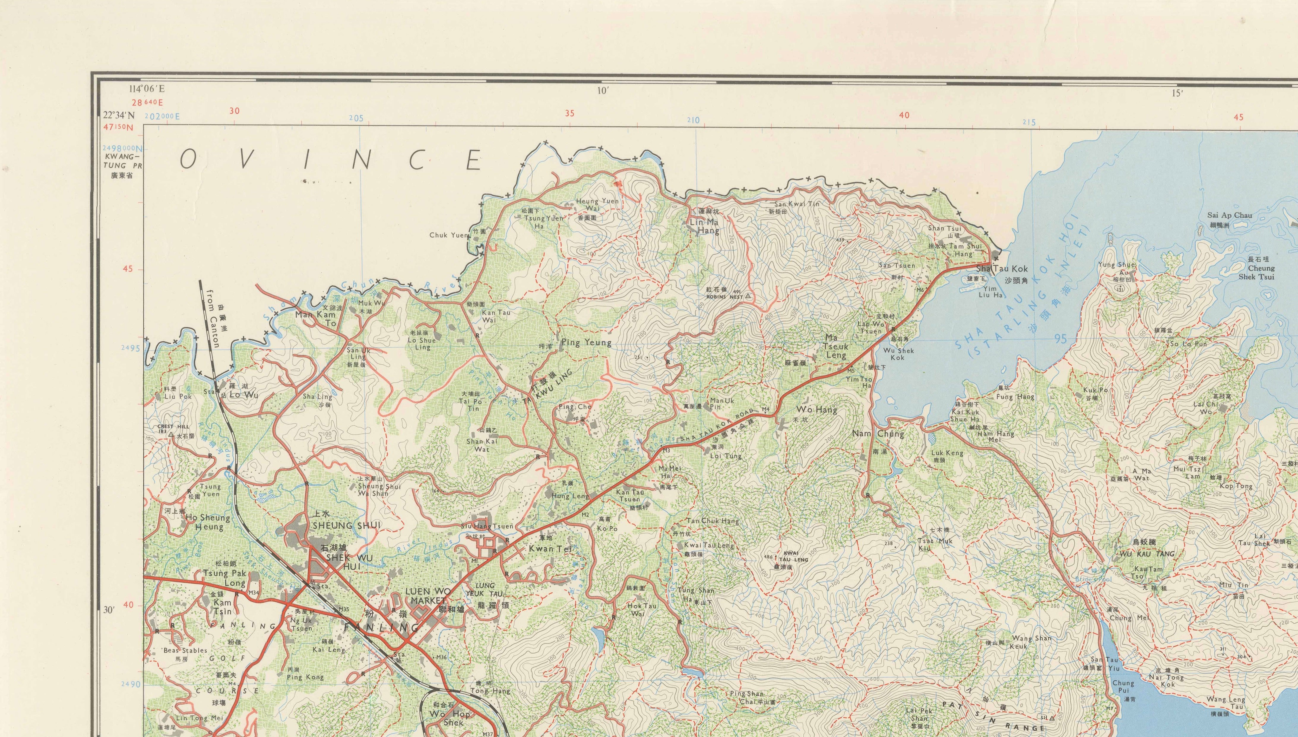
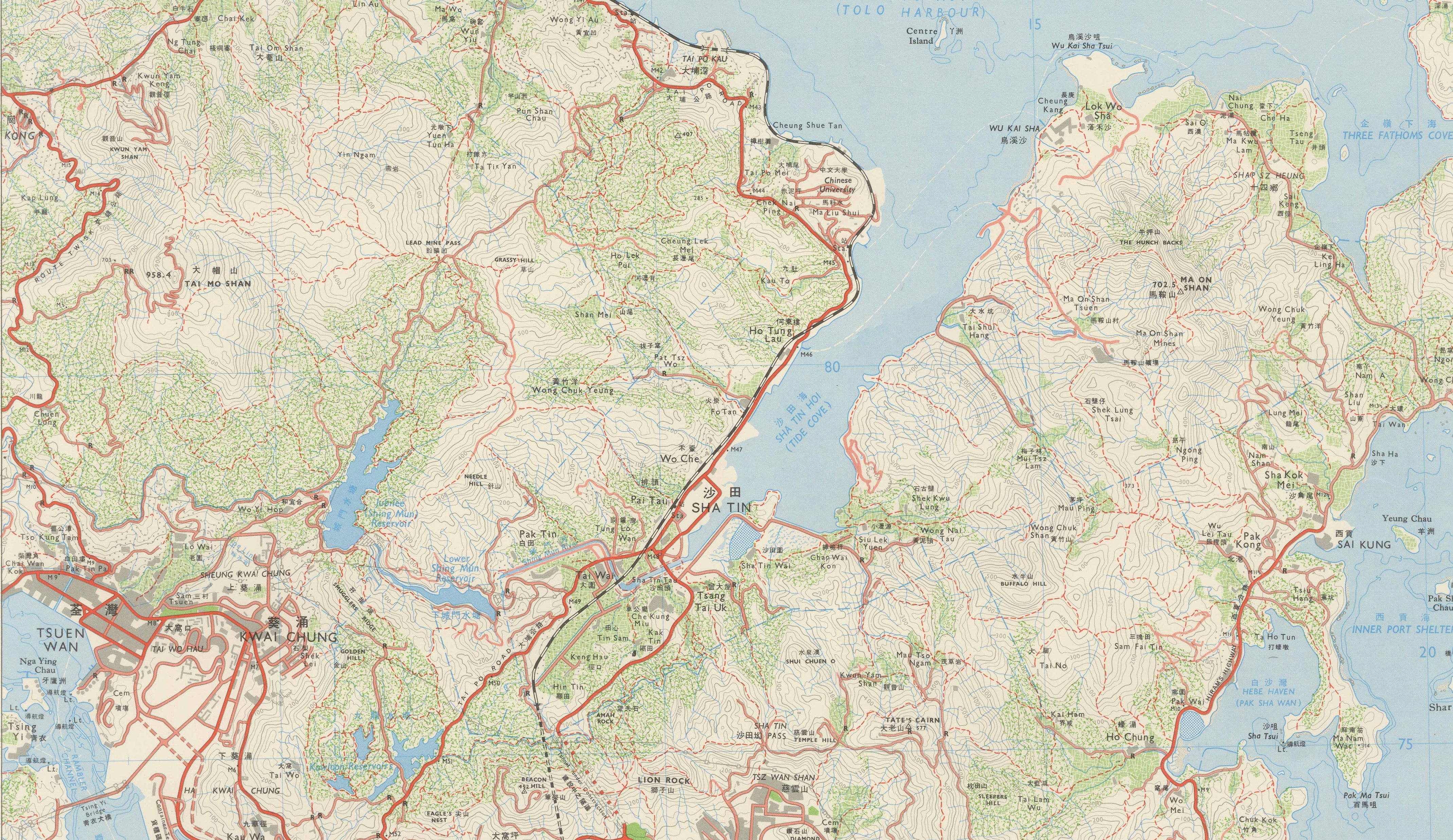
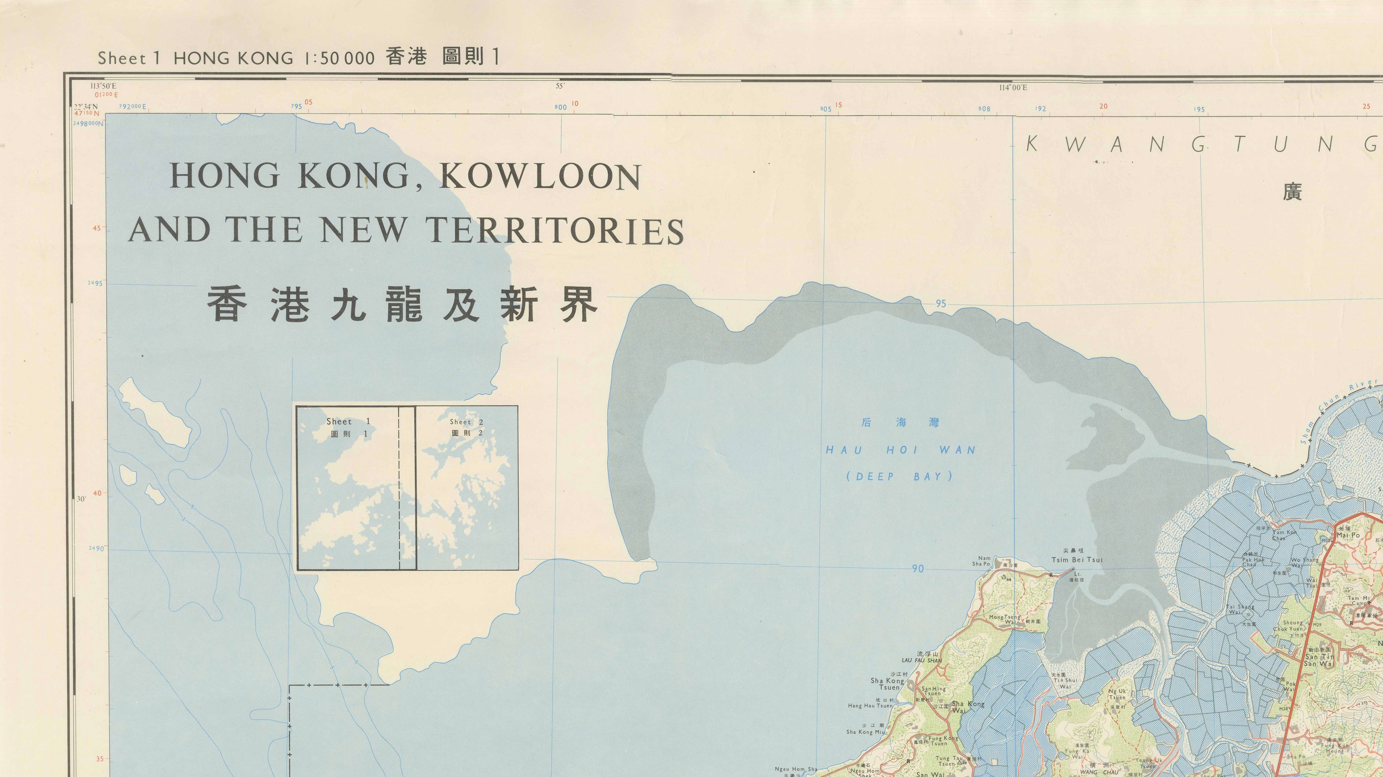
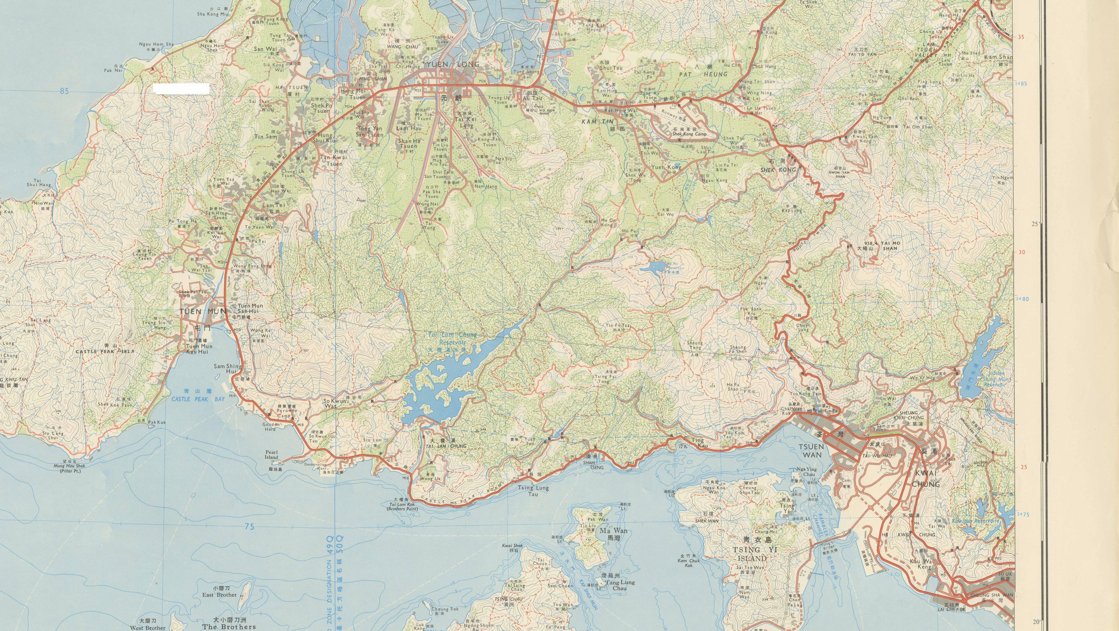
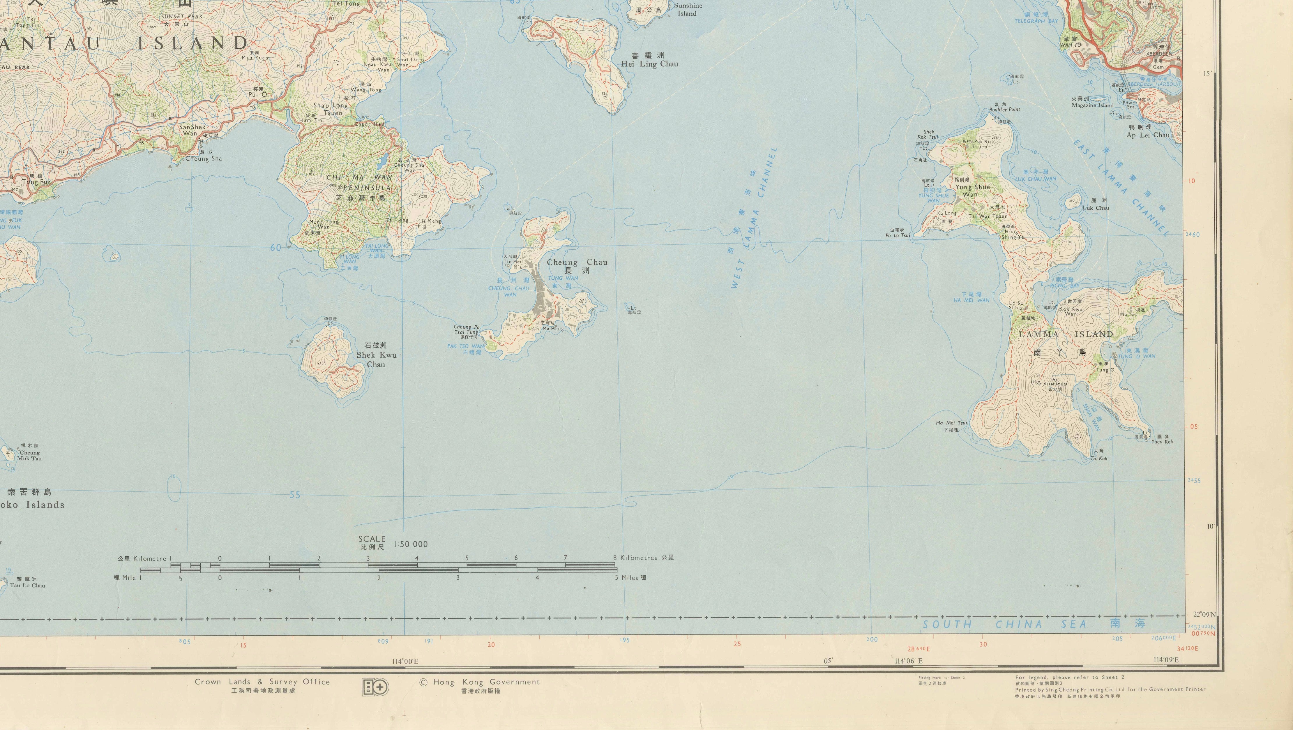
An impressive and highly detailed large-format map of Hong Kong, Kowloon and the New Territories, published by the Hong Kong Government in 1975. Issued as two adjoining sheets at a scale of 1:50,000, the maps together provide an exceptionally comprehensive cartographic record of Hong Kong during the final decades of British colonial administration.
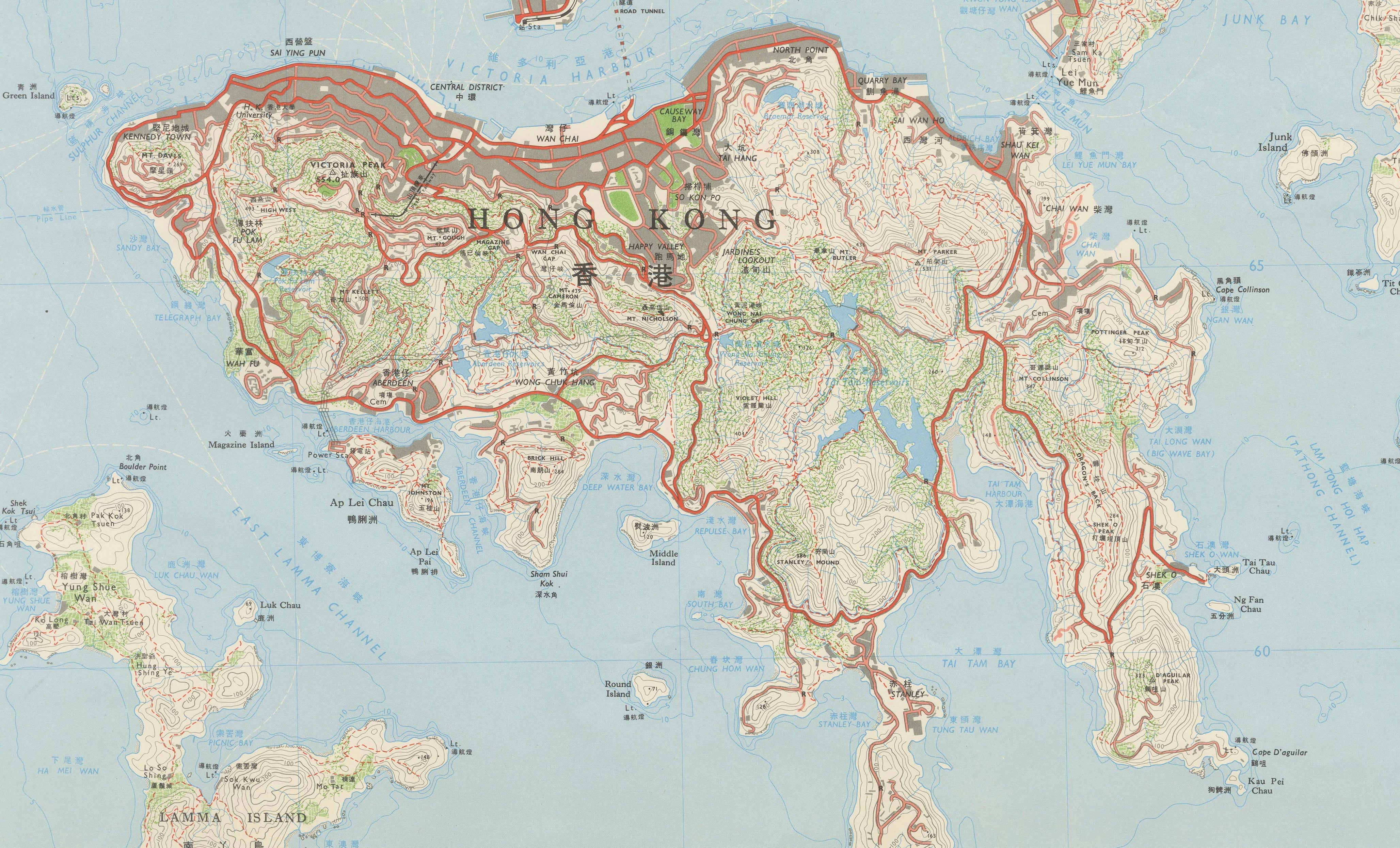
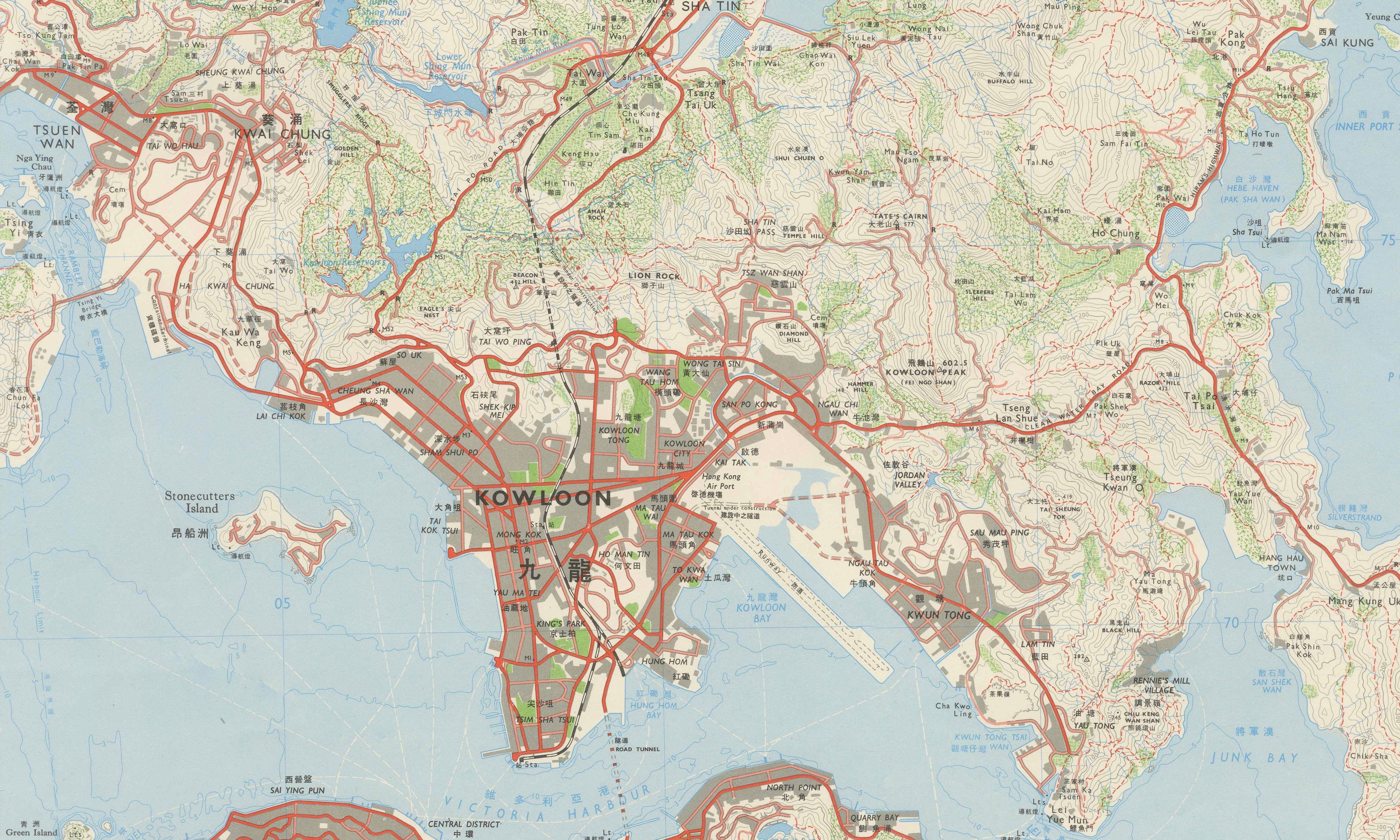
Sheet 1 covers the western New Territories and surrounding islands, including Lantau Island, Deep Bay (Hau Hoi Wan), Castle Peak, Yuen Long and the approaches toward the Pearl River estuary. Sheet 2 continues eastward across Kowloon, Hong Kong Island, the eastern New Territories and numerous offshore islands.
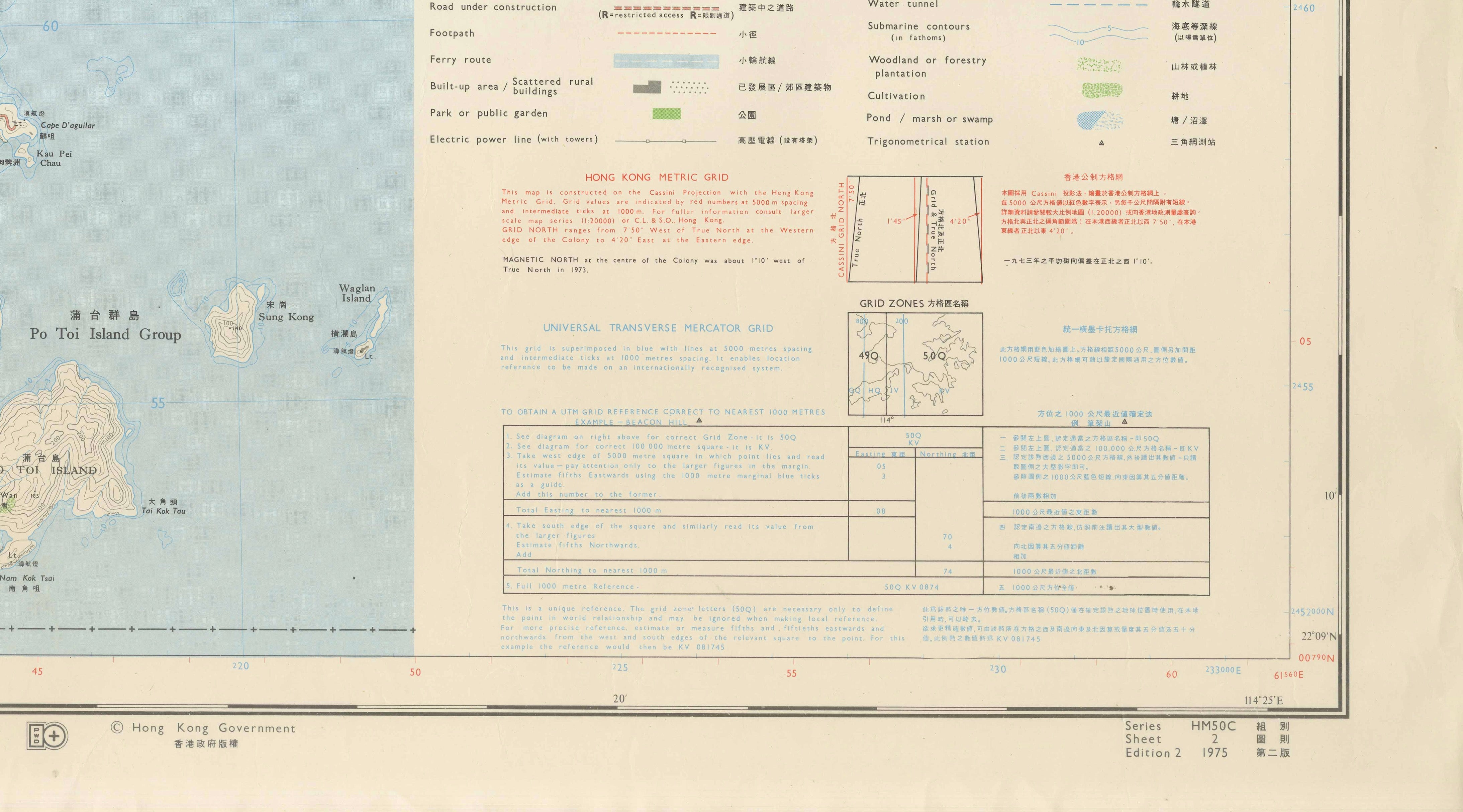
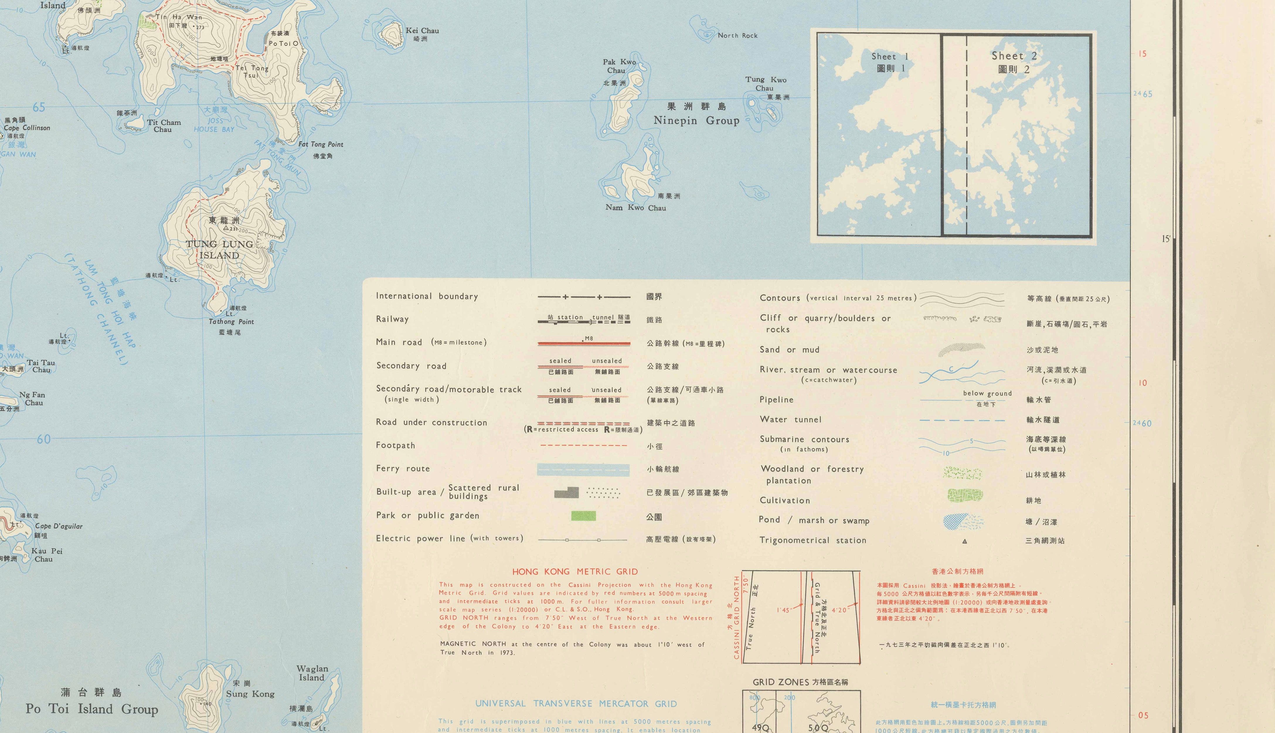
The maps are remarkably detailed, showing roads and roads under construction, railways, ferry routes, footpaths, built-up areas, villages, cultivation, woodland, reservoirs, marshland, power lines and topographical relief. Sheet 2 retains the extensive original bilingual English-Chinese legend and explanatory information for the Hong Kong Metric Grid and Universal Transverse Mercator Grid.
Particularly interesting is the depiction of Hong Kong and Kowloon as they appeared in the mid-1970s, before the enormous urban expansion and infrastructure development of the following decades. The maps therefore have considerable decorative as well as historical and documentary interest, illustrating the territory approximately twenty-two years before the 1997 handover.
Both sheets bear the copyright notice “© Hong Kong Government” and are identified as Series HM50C, Edition 2, 1975.
An attractive pair for display together, particularly suitable for a large wall, office, library or Hong Kong-related collection.
ARTIST / MAKER: Crown Lands & Survey Office, Hong Kong Government
DATE: 1975, Edition 2
ORIGIN: Hong Kong
MEDIUM: Original colour-printed topographical maps on paper
SCALE: 1:50,000
NUMBER OF SHEETS: Two adjoining map sheets (Sheet 1 and Sheet 2)
DIMENSIONS: Please add individual sheet dimensions
STYLE / PERIOD: Mid-Century Modern / British Colonial Hong Kong / 1970s Cartography
CONDITION: Good vintage condition with light age-related toning, handling and minor marginal wear consistent with maps of this age. Please study the photographs carefully for the exact condition.
FRAME / PRESENTATION: Unframed. The two sheets are designed to be displayed together and form an exceptionally large and decorative cartographic presentation.
PUBLISHER: Hong Kong Government
SERIES: HM50C
EDITION: Edition 2
LANGUAGE: English and Chinese
SUBJECT: Hong Kong, Kowloon, New Territories, Lantau Island, Hong Kong Island, British Hong Kong
KEYWORDS: Hong Kong map, Kowloon map, New Territories map, Lantau Island map, Hong Kong Government map, British Hong Kong, colonial Hong Kong, 1970s Hong Kong, vintage Hong Kong map, Asian map, Chinese map, topographical map, survey map, two-sheet map, large wall map, 1975 map, Hong Kong cartography, Crown Lands and Survey Office
SHIPPING: Sold and shipped unframed. The two original sheets will be carefully packed for secure worldwide delivery.